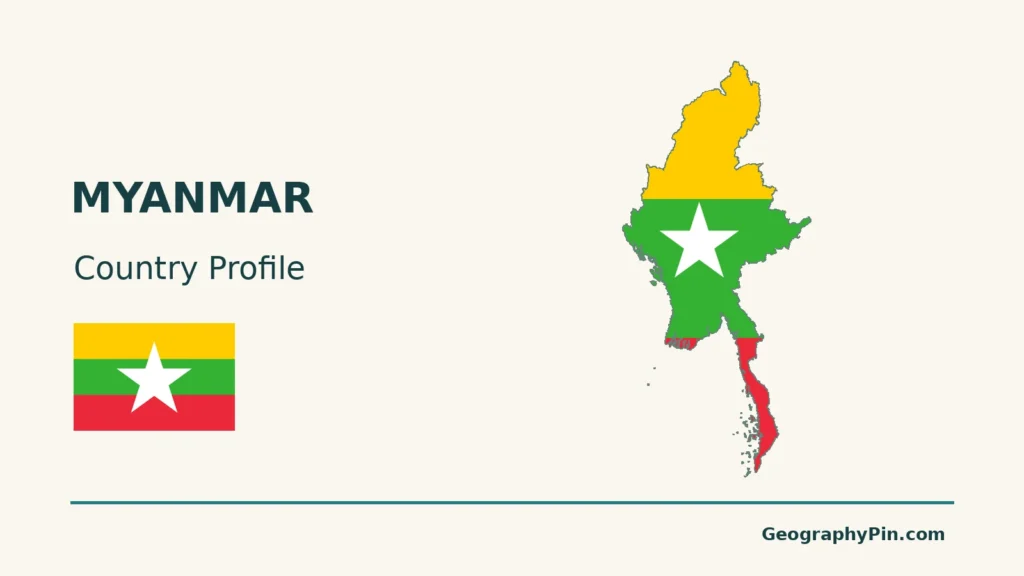
Myanmar’s central river corridors connect landscapes that are far from uniform: a relatively dry interior, uplands on three sides, a broad southern delta and monsoon coasts. Reading those contrasts explains more than treating the country as one tropical lowland.
Myanmar, also known as Burma, lies in mainland Southeast Asia between Bangladesh, India, China, Laos and Thailand, with coasts on the Bay of Bengal and Andaman Sea. Nay Pyi Taw is the capital. The Irrawaddy (Ayeyarwady) links the interior to a southern delta, while western mountains, northern highlands and the eastern Shan Plateau frame the central lowlands.
How to use this article: Compare physical regions, understand water in the Dry Zone, follow river and city connections, or check population coverage.
1. Locate Myanmar and Understand the Map
Five neighbors and two adjoining seas
Bangladesh and India lie on the western and northwestern side of Myanmar, China to the north and northeast, Laos to the east, and Thailand to the southeast. A narrow southern extension continues along the Andaman Sea.

Country names are not maps of political control
Myanmar and Burma refer to the same country. Myanmar is the name used by the United Nations; Burma remains in use by some institutions and in older English-language sources. River names also vary: Irrawaddy and Ayeyarwady identify the same principal river.
These maps show reference geography, not front lines or the areas administered by competing authorities. Armed conflict makes that distinction essential. A national outline and a capital marker do not establish who controls a particular town, road or border crossing.
2. River Plains, Plateaus and Mountain Margins
Read the central corridor against its higher margins
The central lowlands sit between western mountain systems and the eastern Shan Plateau. Higher terrain also closes around the north. Within this broad pattern, the dry interior and the low-lying delta are different environments, not interchangeable parts of a single flat plain.
| Landscape | Position | What distinguishes it |
|---|---|---|
| Central basin and Dry Zone | Interior river corridor | Lower ground between uplands; relatively low rainfall |
| Ayeyarwady delta | Southern end of the main river system | Alluvial lowlands and branching waterways |
| Western and northern mountains | Around the central basin | Rugged relief separating river valleys and coastal districts |
| Shan Plateau | Eastern Myanmar | Upland terrain cut by river valleys |
| Rakhine and southern coasts | Bay of Bengal and Andaman Sea margins | Coastal plains and short rivers beside higher ground |

A large river is not the same as a wide river plain
The IFC’s geomorphic assessment distinguishes low-gradient rivers of the central basin from channels confined by resistant rock. Downstream of Mandalay, the Ayeyarwady and the main Chindwin flow through sediment-filled basins. In the east, the Thanlwin (Salween) follows a more confined course through the Shan uplands before reaching coastal lowlands. Floodplains and delta areas store and rework river sediment.
3. Monsoons, Water Access and Coastal Habitat
One monsoon system produces contrasting local climates
Myanmar’s meteorological adaptation assessment describes a hot, dry season roughly from mid-February to mid-May, a rainy southwest monsoon from mid-May to late October, and a cooler, relatively dry period into February. These are broad seasonal divisions, not fixed onset dates for every location.
The central Dry Zone receives much less rain than the Rakhine and southern coastal regions. Higher ground also differs from the lowlands. A national label such as “monsoon climate” therefore does not mean uniform rainfall across the map.
Why a dry region can contain a major river
The Irrawaddy passes through the Dry Zone, so “dry” does not mean riverless. IWMI’s water-resource research separates the volume of water passing through the region from households’ and farmers’ ability to reach it.
Much rain arrives within a limited season, while settlements away from major channels may rely on ponds, storage or groundwater. Pumping costs, storage capacity and distance from a reliable source matter. A large annual river flow cannot by itself guarantee water at a particular field during a dry spell.
Mottama’s muddy water is an ecological resource
At the Gulf of Mottama, river sediment and strong tides continually reshape mudflats through deposition and erosion. IUCN’s coastal work describes bottom-dwelling organisms such as worms, mussels and crustaceans that feed waterbirds, alongside spawning habitat for fish.
The muddy appearance is not simply an absence of clear water. It is part of a productive estuarine system connecting rivers, coastal habitats and fisheries. This is a different water landscape from both the inland Dry Zone and the upper mountain valleys.
4. Cities, River Connections and Modern Pressures
Waterways help explain the geography of settlement
River corridors combine agricultural water with connections between settlements. The Asian Development Bank’s river-transport study identifies the Yangon–Mandalay corridor as a key relationship within the network. Its historical assessment also explains the limits: shallow dry-season water, shifting navigation channels and inadequate terminals can interrupt the apparent continuity of a blue line on a map.
This supports a geographic explanation for the importance of river-linked cities, not a claim that every large city sits on the Irrawaddy or that present-day routes are open. Nay Pyi Taw’s role as capital is distinct from Yangon’s long-established commercial role.
Bagan shows the river corridor’s historical importance
Bagan occupies a bend of the Ayeyarwady in the central plain. UNESCO describes an archaeological and living Buddhist landscape of temples, stupas and monasteries associated with a regional capital that flourished in the 11th–13th centuries.
Control of river transport helped that civilization extend its influence. The connection places the monuments within a wider landscape of movement and settlement, rather than presenting them as isolated buildings.
The central corridor also crosses active tectonic terrain
The magnitude 7.7 earthquake of March 28, 2025 ruptured the Sagaing Fault near Mandalay. USGS mapped the rupture using satellite observations. The event is a reminder that low-lying, populated corridors are not necessarily geologically quiet; elevation alone is not a measure of earthquake hazard.
Transport potential is not the same as current access
The World Bank’s June 2026 assessment describes an economy constrained by power supply, weak demand and conflict-related disruption to trade and logistics. It also identifies higher fuel costs as a pressure on transport and production.
5. Country Facts with Dates and Coverage
Myanmar: national reference facts
| Item | Reference |
|---|---|
| Capital | Nay Pyi Taw; Yangon is the former capital and a major commercial center |
| Population | About 54.85 million: UN 2025 medium-fertility projection |
| Surface area | About 261,228 square miles (676,577 square kilometers); UN reference year 2023 |
| Official language | Burmese (Myanmar) |
| Currency | Kyat (MMK) |
| Government context | Republic; military-dominated authorities amid armed conflict, reviewed November 2026 |
| Administrative framework | 7 states, 7 regions and Nay Pyi Taw Union territory |
Why the population figure needs a method as well as a year
The UN’s 2025 figure is a demographic projection, not a census count or an observed 2026 total. Myanmar’s 2024 census report used a different approach: roughly 32.2 million people were enumerated and another 19.2 million were estimated for inaccessible or un-enumerated areas.
Those components refer to September 30, 2024. The resulting census total and the UN projection are separate statistical series; they should not be added together or treated as two complete headcounts. The coverage limits are particularly important when using detailed local statistics.
An administrative framework is not effective territorial control
The 2008 Constitution identifies Burmese, termed the Myanmar language in its English text, as the official language. It also provides the framework of seven states, seven regions and the Nay Pyi Taw Union territory. These are reference administrative categories, not a claim of uniform functioning authority.
A June 2026 UN human-rights report describes military-controlled voting in December 2025–January 2026 and military-affiliated parliamentary dominance. The UN’s Independent Investigative Mechanism reported continuing armed conflict in October 2026. The country facts therefore distinguish the formal republic from the contested political and security situation.
Surface area includes more than dry land
The UN figure is surface area, not land-only area. It should not be mixed with a differently defined land total or recalculated from the simplified outline of an illustration.
For wider context, see the Southeast Asia countries map and the Asia countries and capitals list.
What Did We Learn Today?
Myanmar’s river corridors connect a relatively dry center with southern lowlands, while mountains, the Shan Plateau and monsoon coasts create sharp regional contrasts. Water availability depends on access and season as well as river size. Nay Pyi Taw and Yangon have different roles, and population figures and political descriptions need explicit dates and coverage rather than an undated “country facts” label.
Sources & Data Notes
Population uses an explicitly dated UN projection; the 2024 census report includes estimates for areas not enumerated. Surface area is not land-only area. Historical physical, climate and transport studies support enduring landscape relationships, not present service availability, economic totals or political conditions. Governance was reviewed against 2026 UN reports, not inferred from the Constitution alone. Maps show source geography rather than current military control. River-name variants are retained for recognition.
- FAO-hosted Myanmar forestry country report: geographic introduction
- FAO: national land-use paper and natural regions
- Myanmar meteorological department and UNEP: 2012 adaptation programme, climate section
- IFC/ICEM: 2017 geomorphic and sediment baseline assessment
- IWMI: Dry Zone water-resource research and access constraints
- Asian Development Bank: Myanmar River Transport, 2016
- UNESCO World Heritage Centre: Bagan
- USGS: 2025 Mandalay earthquake rupture observations
- World Bank: June 2026 economic assessment
- IUCN: Gulf of Mottama coastal field project
- UN Data: 2025 population projection, surface area and currency
- Department of Population: 2024 census Union Report and coverage
- UK PCGN: Myanmar (Burma) names and capital, 2025
- WIPO Lex: 2008 Constitution, language and administrative framework
- OHCHR: June 2026 human-rights report, political context
- UN Independent Investigative Mechanism: October 2026 bulletin
Map method: Original GeographyPin cartography uses public-domain Natural Earth country geometry (v5.1.1) and river geometry (v5.0.0), actual Mapzen/USGS elevation data and GeoNames points under CC BY 4.0. All 39 source-country components are retained; this is not an exhaustive island inventory. The Irrawaddy mainstem and delta network follow actual source records, without invented connectors or flow arrows. Plateau and coastal markers identify reference locations, not full region boundaries. Source outlines are generalized geography, not current military control, internal front lines or a final delimitation of neighboring disputes. The featured graphic combines the national flag with a generalized country outline.