Morocco is not one continuous desert landscape. Atlantic plains, Mediterranean-facing mountains, high valleys and dry interior plateaus sit close enough together for striking changes in scenery and climate. The most useful way to understand the country is to follow the relationship between mountains, rain and the settlements and farms that depend on water downstream.
Morocco lies in northwestern Africa, with Rabat as its capital. The Rif rises in the north, while the Atlas ranges separate much of the Atlantic-facing country from drier southeastern landscapes. Elevation, exposure to moist air and distance from the sea help explain regional climate contrasts. Western Sahara is shown separately as a disputed territory.
How to use this article: Compare the main landscapes, follow the mountain-to-lowland water connection, or check the Western Sahara distinction before comparing maps and statistics.
1. Locate Morocco and understand the map’s scope
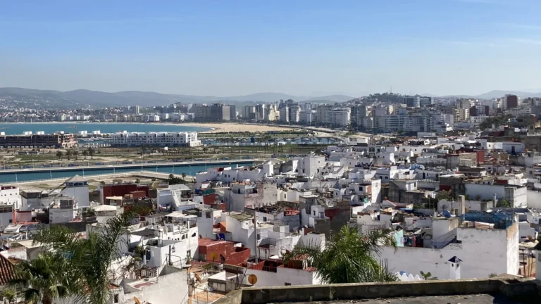
Morocco faces the Atlantic Ocean to the west and the Mediterranean Sea to the north. The Strait of Gibraltar separates its northern coast from Europe. Algeria lies to the east, while Western Sahara lies to the south of the Morocco-only outline used here. Spain administers the coastal enclaves of Ceuta and Melilla on the North African mainland.
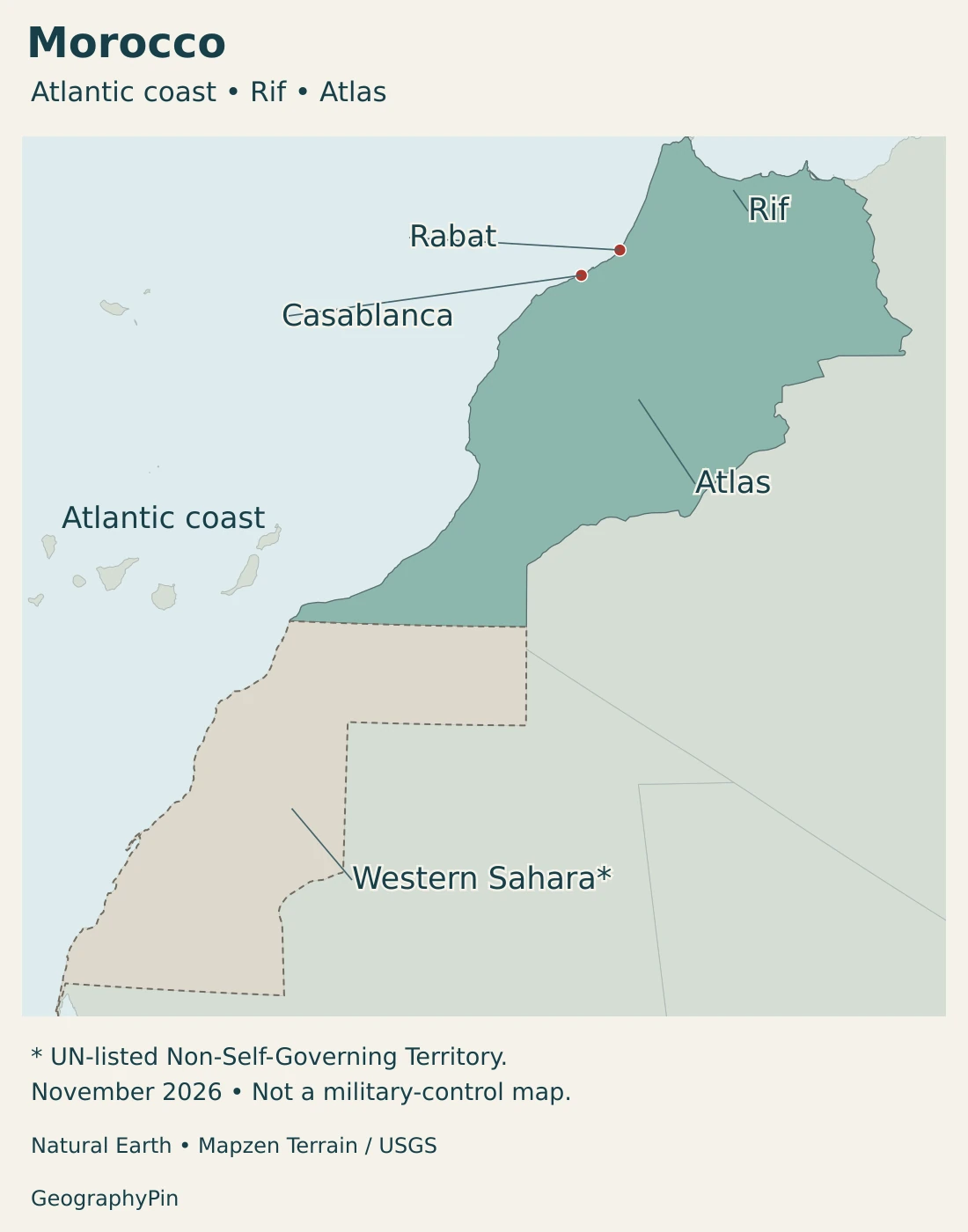
This position gives Morocco both an ocean-facing and a Mediterranean setting. A coastal city near the strait occupies a different geographic situation from a high Atlas valley or a settlement beyond the mountains. Our North Africa countries map places these connections in the wider region.
Western Sahara: status, claims and administration are different
Western Sahara remains a United Nations Non-Self-Governing Territory with an unresolved final status. Morocco claims sovereignty over it and administers most of the territory; the Polisario Front contests that claim and controls territory east of the Berm. Administration on the ground is not the same thing as an internationally settled sovereignty question.
The maps separate Western Sahara from the colored Morocco outline and provide geographic context without drawing a current military-control line. Neither the desert landscape nor a national statistical table resolves the territory’s status. The distinction also matters when comparing country areas, administrative regions and population totals.
2. Country facts with dates and territorial coverage
| Item | Fact | Date or scope |
|---|---|---|
| Capital | Rabat | National capital; distinct from Casablanca’s commercial role |
| Population | 36,828,330 | HCP legal census population at September 1, 2024; includes Moroccan-administered Western Sahara |
| Area | About 172,414 sq mi (446,550 km²) | UN surface-area series, 2023 reference; excludes Western Sahara |
| Official languages | Arabic and Amazigh | Constitution, Article 5 |
| Currency | Moroccan dirham (MAD) | National currency |
| Government | Constitutional monarchy | King, head of government and parliamentary institutions have distinct roles |
| Administrative framework | 12 regions in the HCP census tables | Moroccan administrative framework includes territory in Western Sahara; not a sovereignty determination |
The census and the area figure cover different territories
The 2024 census figure is the legal population published by Morocco’s Haut-Commissariat au Plan, or HCP, for September 1, 2024. It includes Moroccan and foreign residents within the census’s administrative coverage, including Moroccan-administered Western Sahara. It is not a count restricted to the Morocco-only outline above, and it is not a 2026 population estimate.
The area figure uses the UN series that excludes Western Sahara. Dividing the broader census population by that area would mix territorial definitions, so no population density is calculated here. Nor can an alternative census total be obtained reliably by subtracting whole administrative regions whose boundaries do not necessarily match the disputed territory.
Within Morocco’s census tables, a region, prefecture, province and commune are different units. The population of Casablanca-Settat region, for example, is not the population of Casablanca city. Keeping the unit attached to the number prevents a regional total from becoming an inflated city figure.
3. Atlas, Rif, plains and desert margins
Compare the broad physical settings
| Setting | Where to look | Geographic character |
|---|---|---|
| Rif | Northern Morocco, near the Mediterranean | Mountain terrain with short distances between coast, slopes and inland valleys |
| Middle and High Atlas | Central mountain belts | Higher terrain, river headwaters and strong local contrasts in temperature and precipitation |
| Anti-Atlas and southeastern margins | South of the High Atlas and toward the dry interior | Rugged terrain, plateaus and increasingly arid landscapes |
| Atlantic plains and basins | Western side of the country | Broader lowlands, river corridors, farming areas and major urban connections |
| Mediterranean coastal strip | Northern edge | Generally narrower coastal plains beside nearby relief |
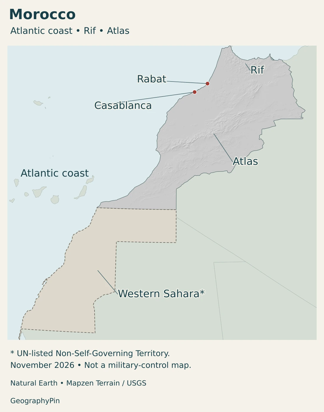
The Atlas is a mountain system rather than a single uniform ridge. Its named ranges help locate different landscapes, but valleys and passes interrupt the high ground. The Rif is a separate northern mountain belt, not simply another name for the High Atlas.
Plains are connected to surrounding mountains
The Gharb plain offers a concrete example. Rivers draining the Rif and Middle Atlas enter this lower basin and continue toward the Atlantic. The plain is therefore part of a larger catchment, receiving water and sediment from terrain far beyond its own flat surface.
Its low relief supports a different pattern of cultivation and transport from a steep mountain valley. Yet lowland farming is not automatically free from water constraints: the timing of rainfall, river flows, irrigation supply and drainage all matter.
Dry country is more varied than a field of dunes
South and southeast of the Atlas, semi-arid and arid plateaus and plains become more prominent. “Desert margin” describes a climatic and ecological transition, not a straight political boundary or one continuous belt of sand.
Mountain settlements, grazing areas and cultivated pockets can exist within this wider dry setting. An oasis is a place where accessible water supports life and cultivation; it need not resemble the isolated palm grove of a postcard. In the High Atlas, cold-oasis farming systems combine crops, trees and livestock in a mountain environment.
4. Mountains, rainfall and river systems
Why the mountains matter to water downstream
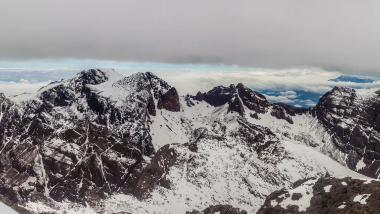
Higher ground is generally cooler than neighboring lowlands, and mountain slopes influence where moist air rises and precipitation falls. In the High Atlas, some winter precipitation is stored as snow. Melting snow then contributes to river flow, particularly in spring, linking a seasonal mountain process to water availability on lower ground.
This is not a fixed annual supply. Snow cover and precipitation vary between years, and water reaching a downstream field depends on more than how white a distant summit looks. Evaporation, catchment conditions, reservoir management and withdrawals affect the eventual flow.
A wetter season does not mean equal rain everywhere
Much of Morocco’s rain falls between October and April, with generally drier summers. Rainfall tends to decrease toward the south, while mountain exposure modifies the broad pattern. The Atlantic-facing northwest, high mountain areas and southeastern drylands do not share a single climate.
The southern side of the High Atlas includes rain-shadow environments. A rain shadow does not mean that rain never falls: it describes a tendency toward lower precipitation on the sheltered side of a mountain barrier. Elevation and exposure can create large differences over comparatively short distances.
The Sebou connects northern mountains with the Atlantic
The Sebou system links upland catchments with the Gharb plain and the Atlantic Ocean. Its tributaries include the Ouergha, Beht and Rdom. Thinking in terms of the full basin makes the connection between hillslope land use, river conditions and downstream farms clearer than looking at the main river alone.
Other catchments have their own water balances. Water stored behind a dam is not a new source of rainfall, and groundwater pumping can exceed aquifer replenishment. FAO identifies agricultural demand and over-abstraction of groundwater among Morocco’s important water-management pressures.
Drought and flooding can both affect a dry region. A long period of low rainfall can reduce supplies, while an intense storm can produce damaging runoff. Seasonal dryness should not be interpreted as protection against floods.
5. Cities, languages and regional livelihoods
Rabat and Casablanca have different national roles
Rabat is the capital and a center of national government on the Atlantic coast. Its urban landscape combines older quarters and monuments with a planned modern city containing administrative, residential and commercial districts. The Bou Regreg valley is part of that setting.
Casablanca is also Atlantic-facing, but its prominence is strongly commercial and industrial. It hosts major financial institutions and business headquarters. Calling it Morocco’s “economic capital” describes that role; it does not replace Rabat as the political capital.
A map that marks only the capital misses these complementary functions. The country’s administrative center, business centers, ports, farming basins and mountain communities form a network rather than a single dominant landscape. For the wider regional comparison, see our African countries and capitals guide.
Official languages and cultural diversity
Arabic and Amazigh are official languages under Article 5 of Morocco’s Constitution. The Constitution also provides for safeguarding Hassani and the country’s cultural and linguistic expressions. These protections should not be confused with a claim that every protected language has the same official status.
Language, citizenship and place of residence are not interchangeable categories. A mountainous region is not culturally uniform, and a city’s economic role does not define the language used by every household. Constitutional language status describes public institutions, not the full range of everyday speech.
Mountain farming depends on shared water and land
The High Atlas cold-oasis systems recognized by FAO combine vegetables, cereals and fruit with animal husbandry and seasonal pasture use. Small cultivated plots and grazing areas complement one another, while coordinated water management makes agriculture possible in a difficult environment.
Crop rotation and agroforestry are part of these systems, not just the presence of a spring or stream. Their geography includes social arrangements for distributing water as well as the slopes, soils and channels that carry it.
6. Government and the geography of economic connections
Morocco is a constitutional monarchy. Under the Constitution, the king appoints the head of government from the political party that leads the elections to the House of Representatives. The king also chairs the Council of Ministers. These provisions give the monarchy a substantive constitutional role rather than a purely ceremonial one.
Regions and local authorities form another layer of administration. Their boundaries organize public responsibilities and statistical reporting; they are not equivalent to physical regions such as the Rif or a river basin. Morocco’s administrative framework in Western Sahara also remains distinct from the territory’s unresolved international status.
Ports connect manufacturing regions with overseas markets
Tanger Med illustrates how infrastructure builds on geographic position. Its port complex handles containers, vehicles, passengers and other cargo, with rail connections serving industrial and logistics activities. Vehicle exports link factories around Melloussa, Casablanca and Kenitra with maritime routes.
The port is more than a point on a coastline. Terminals, rail access, industrial sites and border-processing facilities turn a favorable location into a working transport system. The broad relationship is durable even though cargo totals and shipping services change from year to year.
Agriculture links economic conditions to rainfall
Rainfed farming depends directly on seasonal rainfall. Irrigation can reduce that immediate dependence, but transfers pressure to rivers, reservoirs or aquifers. A productive irrigated plain may still face a water deficit if withdrawals are greater than replenishment.
The contrast between mountain water sources and lowland demand makes water management a national economic issue as well as a local agricultural one. It connects rural livelihoods, urban supplies and the environmental condition of river basins.
A country of connected contrasts
Morocco’s geography is clearest when the coasts, plains and mountains are considered together. Rivers carry the influence of upland weather downstream; roads and ports connect inland production to markets; and different cities specialize in government, finance, industry and maritime activity.
These connections explain more than a simple division into “green north” and “desert south.” Local terrain, rainfall exposure and access to water matter throughout the country, while the separate status of Western Sahara requires its own territorial explanation rather than a climatic shortcut.
Frequently Asked Questions
Is Casablanca the capital of Morocco?
No. Rabat is the capital. Casablanca is a major business and financial center, which explains the descriptive phrase “economic capital.”
How do Morocco’s mountains affect regional climates?
Elevation lowers temperatures, slopes influence precipitation, and the High Atlas separates wetter exposed areas from drier rain-shadow settings. Seasonal mountain snow also contributes to downstream river flow.
Do all Morocco population and area figures include Western Sahara?
No. Coverage depends on the source. The HCP 2024 census total used here includes Moroccan-administered Western Sahara, while the UN area figure excludes it. They should not be combined to calculate density.
What Did We Learn Today?
Morocco combines Atlantic and Mediterranean coasts, northern Rif mountains, the Atlas ranges, broad plains and dry interior margins. Mountains influence climate and feed water systems that support lower-lying settlements and agriculture. Rabat’s capital role differs from Casablanca’s commercial importance, while Western Sahara’s disputed status and the territorial coverage of statistics must remain explicit.
Sources & Data Notes
Population and area retain their different territorial coverage. Western Sahara’s final status remains unresolved; administration, national claims and the UN territorial classification are not interchangeable. Status context was reviewed in November 2026; the maps are not current control surveys.
- Haut-Commissariat au Plan: 2024 legal population: 36,828,330 legal residents at September 1, 2024; includes Moroccan and foreign residents.
- HCP: detailed regional census tables: The 12-region framework includes Laâyoune-Sakia El Hamra and Dakhla-Oued Ed-Dahab. Census coverage includes Moroccan-administered Western Sahara and differs from the area/map scope.
- UN Statistics Division: Morocco profile: Published surface area 446,550 km², reference 2023; Rabat and Moroccan dirham. No separate dry-land or inland-water definition is inferred.
- FAO: AQUASTAT Morocco profile, 2015: Page 1 explicitly excludes Western Sahara from the 446,550 km² figure under UN practice and describes the principal mountain and coastal-plain settings. Historical economic and population values are not current figures.
- Moroccan High Authority for Audiovisual Communication: Constitution: Articles 1, 5, 47 and 48: monarchy, official languages and institutional roles.
- UK government: Western Sahara parliamentary answer: June 11, 2026: UN Non-Self-Governing Territory with no defined Administering Power, distinct from de facto administration.
- UK Foreign, Commonwealth and Development Office: Western Sahara: Disputed status and the distinction between Moroccan-controlled territory and Polisario-controlled territory east of the Berm. This article is not a live security or travel advisory.
- World Bank: Climate Risk Country Profile, Morocco, 2025: Pages 3–4: mountain/coastal geography, rainfall seasonality and regional climate contrasts. Long-term climate descriptions are not a weather forecast.
- Tuel and colleagues: High Atlas snowpack and runoff: Original 2022 research on seasonal snow and downstream water. Scenario projections are not presented as observed present-day losses.
- Schulz and de Jong: High Atlas field experiments: Field research in a rain-shadow setting south of the High Atlas; snowmelt, sublimation and seasonal water connections.
- Moroccan agriculture ministry and JICA: Gharb project environmental assessment: Section 3.1, topography and geology: Sebou tributaries descend from the Rif and Middle Atlas through the Gharb plain toward the Atlantic.
- FAO: Morocco water-scarcity programme: Rainfall variability, agricultural water demand and groundwater pressure; the old per-capita water statistic is not used.
- FAO: High Atlas oasis agricultural heritage: Cold-oasis farming, crops, livestock, pasture and community water management.
- UNESCO: Rabat, Modern Capital and Historic City: Atlantic setting, administrative city planning and older urban heritage.
- Casablanca municipality: economic functions: Business and financial functions. The 2020 page’s historical population and economic percentages are not used as current statistics.
- Tanger Med: port and logistics activities: Port terminals, rail links and vehicle-export connections. Capacity figures and annual traffic rankings are not treated as timeless facts.
Map sources and territorial scope: Original GeographyPin maps use Natural Earth country and disputed-area geometry. Natural Earth data are public domain. The source polygon for Moroccan-administered Western Sahara is removed from the default Morocco geometry and combined with the source Western Sahara polygon to show the territory separately. This is a transparent territorial display convention, not a military-control boundary or a determination of sovereignty.
Western Sahara is outside the colored Morocco outline and receives no relief treatment. The dashed source-defined outline does not show the Berm. November 2026 dates the presentation and status review, not a new boundary survey. Broad Atlas and Rif labels locate mountain ranges without inventing measured regional boundaries. Rabat and Casablanca use Natural Earth city-coordinate attributes. Small coastal territorial details may be indistinct at this generalized national scale.
Hillshade is calculated from genuine elevations accessed through Mapzen Terrain Tiles, without vertical exaggeration. Global elevation data courtesy of the U.S. Geological Survey. Elevation-source attribution and terms apply. Historical terrain is not a current surface survey, and relief shading is not bathymetry or numerical elevation bands.
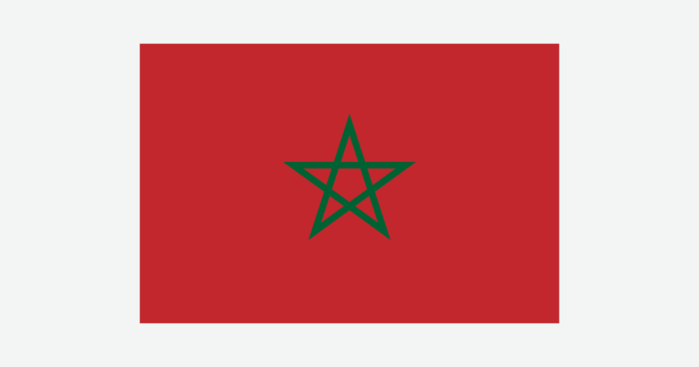
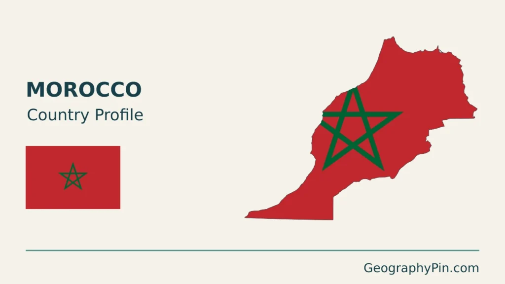
The cover uses Morocco flag artwork by Denelson83 and Zscout370. The intact 3:2 flag appears separately from the decorative outline motif. Western Sahara is excluded from the flag-filled outline; that does not represent the full area under Moroccan administration.