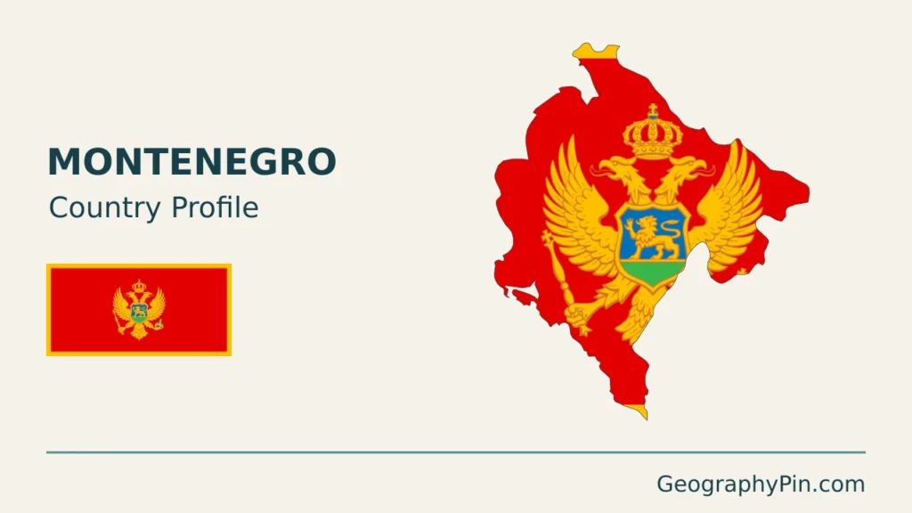
Montenegro’s coast and mountains stand close together, but they do not form one uniform landscape. The Bay of Kotor, the lower Skadar basin and the high country around Durmitor have different origins and water connections. Two prominent city names also need separating: Podgorica is the capital, while Cetinje holds the constitutional title of Old Royal Capital.
Montenegro is a southeastern European country on the Adriatic Sea. Its landscape combines a coastal belt, limestone uplands, the Lake Skadar basin and northern Dinaric mountains. Podgorica is the capital and Cetinje is the Old Royal Capital. Lake Skadar is shared with Albania, while northern rivers connect to the wider Black Sea drainage system rather than flowing directly to the nearby Adriatic.
How to use this article: Clarify the two capital roles, compare the main landscapes, or follow the Lake Skadar water system.
1. Locate Montenegro on the Adriatic
Montenegro lies on the eastern side of the Adriatic, in the western Balkans. Its neighbors are Croatia, Bosnia and Herzegovina, Serbia, Kosovo and Albania. The coastline faces the sea, while the interior rises into a much more rugged mountain setting.
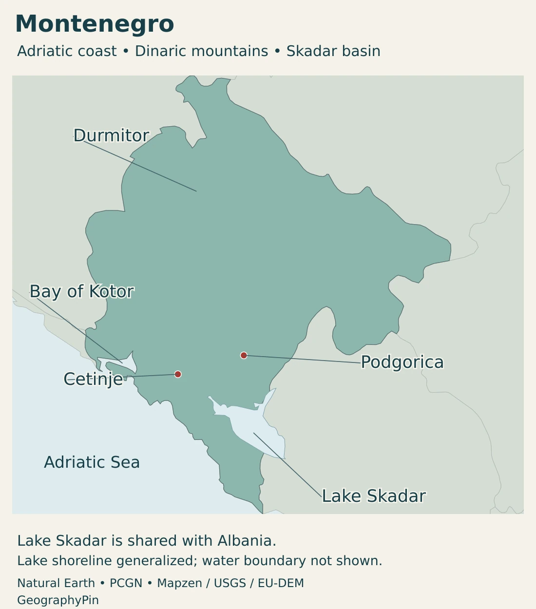
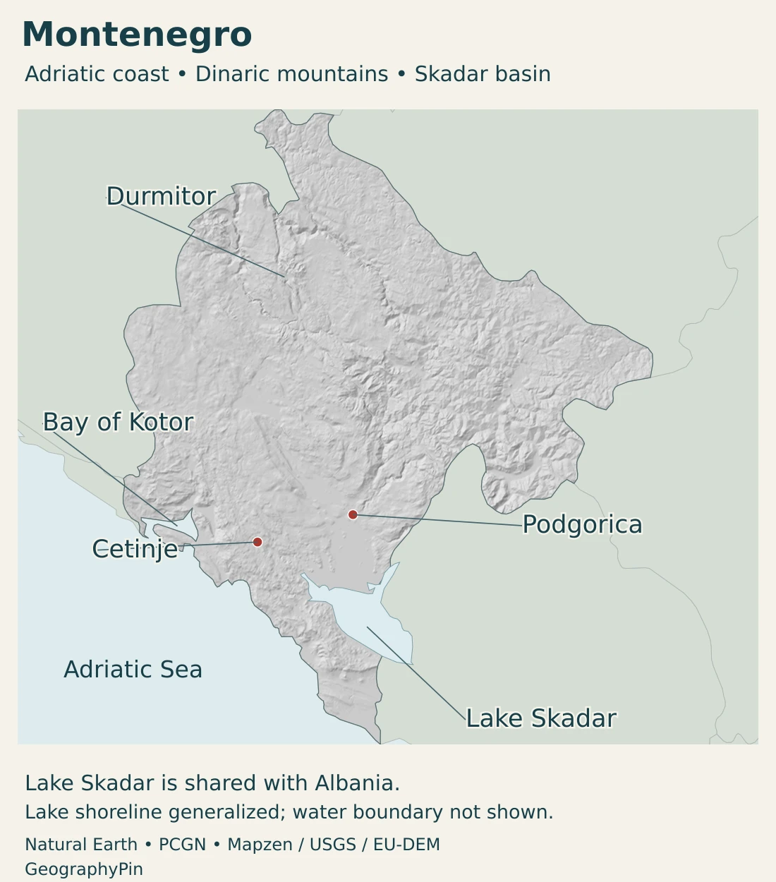
The Bay of Kotor is in the western coastal area. Podgorica is inland, near the lower basin north of Lake Skadar, while Cetinje lies in the uplands between the capital and the coastal zone. Durmitor represents the high northern landscape, not a coastal mountain immediately beside Kotor.
Our Adriatic Sea guide explains the wider marine setting, and the Balkan countries map places Montenegro among its regional neighbors.
2. Country facts and two capital roles
| Fact | Value | Date or meaning |
|---|---|---|
| Capital | Podgorica | Cetinje is the constitutionally designated Old Royal Capital. |
| Population | 622,902 | MONSTAT estimate at December 31, 2025; released May 2026. |
| Published area | About 5,360 square miles (13,883 km²) | MONSTAT 2025 yearbook; includes Montenegro’s share of Lake Skadar. |
| Language framework | Montenegrin; Serbian, Bosnian, Albanian and Croatian also in official use | Constitutional Article 13; Latin and Cyrillic alphabets are equal. |
| Currency | Euro (EUR) | Montenegro is outside the EU and euro area. |
| Local administration | 25 municipalities | Yearbook reference: December 2024, including the Capital and Old Royal Capital. |
| Government | Republic with parliamentary government | Parliament legislates, the Government exercises executive power, and the President represents the state. |
Podgorica and Cetinje have different constitutional titles
Article 5 of the Constitution names Podgorica as the capital and Cetinje as the Old Royal Capital. Cetinje’s title is therefore more than an informal historical nickname, but it does not displace Podgorica as the national capital.
The distinction is worth keeping in a country profile because maps, museums and historical accounts often give Cetinje special prominence. A reference to the royal capital need not mean that the modern capital has moved.
Using the euro is not the same as euro-area membership
Montenegro uses the euro, but it is not a member of the European Union or the euro area. The Council of the European Union identifies it as a non-EU euro user without a domestic currency. Currency use and membership of the institutions behind that currency are separate facts.
3. Coast, karst uplands and northern mountains
Compare four broad settings
| Setting | Landscape | Useful distinction |
|---|---|---|
| Adriatic coast and bays | Marine inlets and coastal settlements below steep surrounding uplands. | A coastal bay is seawater, not an inland lake. |
| Karst uplands | Limestone terrain with fissures, depressions and underground water movement. | Visible surface channels do not reveal every drainage connection. |
| Podgorica–Skadar basin | Lower terrain associated with the Morača and shared Lake Skadar. | The lake and its catchment extend across an international boundary. |
| Northern mountains | Dinaric highlands, glacial landforms and deep river valleys. | Some waters ultimately reach the Black Sea rather than the Adriatic. |
The Bay of Kotor is not a glacial fjord
Kotor’s steep mountain walls and branching inlets can resemble a fjord. That visual resemblance does not establish the same origin. NASA’s Earth Observatory explains that the bay occupies an old river-canyon system submerged as sea level rose, rather than valleys excavated by glaciers.
It is better understood as a drowned-valley coastal system. The town of Kotor, the wider bay and the UNESCO-listed Natural and Culturo-Historical Region are also different extents. The World Heritage property covers an inner portion of the bay and its associated landscape, not all of Montenegro’s coast.
Durmitor does preserve a glacial landscape
In the north, Durmitor provides a genuine example of terrain shaped by ice as well as rivers. UNESCO describes a limestone massif with glacial lakes, plateaus, meadows, forests and deeply cut river canyons.
These processes coexist: glaciers shaped parts of the high ground, rivers cut through it, and water also moves underground through carbonate rocks. The landscape cannot be explained by a single process operating everywhere.
Durmitor National Park and the wider Tara River Basin Biosphere Reserve are distinct protected-area extents. Neither designation means that every northern mountain is part of the same park.
4. Lake Skadar, river basins and climate
Lake Skadar links Montenegro and Albania
Lake Skadar, also known as Lake Shkodra, straddles Montenegro and Albania. The Morača is a major inflow, and the Bojana, called Buna in Albanian, carries water toward the Adriatic. Rivers and underground springs both contribute to the lake system.
The lake’s surface changes with water levels. Its wetland fringe is therefore not a fixed shoreline that can be represented perfectly by a single undated outline. Reeds, shallow-water vegetation and surrounding habitats make this more than a simple open-water basin.
Ramsar’s site assessment describes the importance of the lake for waterbirds, fisheries and the surrounding communities. The national border crosses one connected ecosystem, so upstream water quality and management have implications beyond one jurisdiction.
Northern rivers take a different route
The Tara, Piva, Lim and Ćehotina belong to the drainage network leading toward the Drina and ultimately the Danube and Black Sea. The Ibar connects through the Morava system. These routes contrast with the Morača–Skadar–Bojana connection to the Adriatic.
A river’s destination depends on the catchment and its outlets, not simply on which sea looks closest on the map. Montenegro’s mountains divide drainage, while valleys and underground pathways provide connections through the terrain.
Short distances can bring large climatic contrasts
The coastal zone has Mediterranean conditions, with generally hot, dry summers and milder, wetter winters. Inland and higher areas have stronger continental and mountain influences, including colder winters and snow at elevation.
Mountains alter the movement of air and the distribution of rainfall. A coastal temperature or seasonal description should not be applied directly to a northern upland. Karst depressions and river plains can also experience flooding even where nearby slopes appear dry.
5. Cities, population and languages
Podgorica’s lower inland setting differs from Cetinje’s upland location and from the marine settlements around Kotor. These are useful geographic contrasts even before considering their different administrative and historical roles.
The national population figure is an estimate for the end of 2025, not a new census count or a 2026 enumeration. MONSTAT updates census-based totals with vital statistics and a statistical migration adjustment. City, municipality and national figures describe different geographic populations.
Official language and additional official use
The Constitution identifies Montenegrin as the official language and also provides for Serbian, Bosnian, Albanian and Croatian in official use. Latin and Cyrillic alphabets have equal status. This legal framework is more precise than describing Montenegro as a country with only one language.
Language use, citizenship and self-identification are related but different topics. A national language provision does not mean that every resident has the same mother tongue, and a city’s location does not determine the identity of everyone living there.
Historic coastal towns are part of a working landscape
The Kotor World Heritage property combines historic settlements with their mountainous maritime setting. Its significance lies in that relationship, rather than in isolated buildings detached from the bay around them.
The area also illustrates the importance of earthquake resilience and conservation. UNESCO records damage from the 1979 earthquake and subsequent restoration. That historical event is part of the built landscape’s story, not a prediction of an imminent earthquake.
6. Government, tourism and maritime connections
Montenegro is a republic with parliamentary government. Legislative power belongs to Parliament, executive power to the Government, and the President represents the state. Municipalities organize local administration; they are not equivalent to physical regions such as the Skadar basin or Durmitor.
Bar connects the coast with freight activity
The coast supports more than seaside tourism. The Port of Bar’s facilities include specialized cargo handling and a free-zone area associated with trade, storage and business activity. Its operator distinguishes existing port space from areas planned for development.
This is an important geographic contrast with the historic inner Bay of Kotor. Both are coastal settings, but they do not have identical functions. A port’s cargo facilities and its surrounding urban area are also different units.
Tourism and mountain livelihoods
Durmitor combines protected landscapes with recreation and longstanding pastoral use. UNESCO notes the traditional use of high meadows by farmers and shepherds. A protected mountain landscape is therefore not necessarily an uninhabited space without a history of work.
Coastal heritage, lake environments and mountain recreation create different demands on transport, water and land. Their coexistence helps explain why Montenegro should not be reduced to either a beach destination or a single mountain panorama.
The clearest country-wide picture brings these settings together: an Adriatic frontage, a shared lake basin, limestone uplands and northern river systems, with cities that perform different constitutional, economic and cultural roles.
Frequently Asked Questions
Is Podgorica or Cetinje the capital of Montenegro?
Podgorica is the capital. Cetinje has the separate constitutional title of Old Royal Capital.
Is the Bay of Kotor a fjord?
It resembles one, but its drowned river-valley origin differs from a glacially excavated fjord. Steep sides alone do not make a bay a fjord.
Is Lake Skadar entirely in Montenegro?
No. It is shared with Albania, where it is also known as Lake Shkodra. Its waters flow toward the Adriatic through the Bojana/Buna.
What Did We Learn Today?
Montenegro’s coastal bays, Skadar basin and northern mountains have different origins and water connections. Kotor is not a glacial fjord, while Durmitor preserves glacial landforms. Podgorica and Cetinje have distinct constitutional roles, and using the euro does not make Montenegro a euro-area member.
Sources & Data Notes
Population refers to December 31, 2025. It is a census-based estimate with a statistical migration adjustment, not a newly enumerated population. Area follows MONSTAT’s 2025 geographical table and includes the Montenegrin part of Lake Skadar. The source warns that cadastral updates can change the published area; no dry-land-only or maritime-total interpretation is added. Conversions are rounded, and environmental sources describe geography rather than current lake levels.
- MONSTAT, population estimates and demographic indicators, 2025: Table 2 gives the December 31, 2025 estimate, released May 13, 2026. Census-based annual estimates incorporate vital statistics and a statistical international-migration adjustment.
- MONSTAT, Statistical Yearbook 2025: Geography: 13,883 km² published area, including Montenegro’s portion of Lake Skadar; cadastral records remain subject to updating. Twenty-five municipalities as of December 2024, including the Capital and Old Royal Capital.
- Parliament of Montenegro, Constitution: Articles 5, 11 and 13: capital titles, institutional responsibilities, language provisions and equal status of the two alphabets.
- Council of the European Union, the euro outside the euro area: Montenegro uses the euro without being a member of the EU or euro area.
- NASA Earth Observatory, Bay of Kotor: Drowned river-canyon origin, distinct from a glacial fjord. The 2017 image and visitor figures are not current observations or counts.
- UNESCO, Natural and Culturo-Historical Region of Kotor: Inner-bay World Heritage property, historic settlements and restoration following the 1979 earthquake.
- UNESCO, Durmitor National Park: Limestone massif, glacial landforms, river canyons and traditional pastoral use; distinction from the wider Tara biosphere reserve.
- Ramsar Advisory Mission 56, Lake Skadar, 2005: Shared lake, major inflow and outlet, fluctuating water levels and wetland ecology. Historical country naming, species counts and water levels are not presented as current.
- Montenegro, Second National Communication on Climate Change: Stable Adriatic and Black Sea drainage connections and karst water systems. Older area, population and catchment percentages are not used as current statistics.
- Government of Montenegro, fisheries and agrifood environmental framework, November 2025: Qualitative coastal–inland climate contrasts, terrain and flooding in karst depressions; demographic statements follow MONSTAT instead.
- Government of Montenegro, Preliminary Flood Risk Assessment for the Danube River Basin, June 2021 final draft: Section 3.1 identifies the Ibar connection to the Western Morava and the Tara, Piva, Lim and Ćehotina connections to the Drina within the Danube–Black Sea drainage system.
- Port of Bar, free-zone and port facilities: Cargo, storage, trade and business functions; distinction between existing facilities and development areas.
Map sources and scope: Original GeographyPin maps use public-domain Natural Earth country outlines, city coordinates and lake polygons. The complete source Montenegro outline is retained. Generalized country and coastal outlines are not an official boundary survey. Context boundaries follow the source convention; Kosovo’s status is disputed and its depiction does not imply a position on sovereignty.
Podgorica uses Natural Earth city-coordinate attributes. Cetinje, Bay of Kotor, Durmitor and Lake Skadar use geographic reference points from the PCGN Montenegro Toponymic Factfile, 2025. These are feature locators, not surveyed extents. No national-park, physiographic or administrative subdivision boundaries are drawn.
Lake Skadar is shown as a shared lake. Its international water boundary is omitted because the generalized source geometry is unsuitable for measuring or depicting the precise division. Full source lake shapes are not current shoreline or water-level observations, and the map does not measure either country’s share.
Hillshade is calculated from genuine elevations accessed through Mapzen Terrain Tiles, with no vertical exaggeration. Global elevation data courtesy of the U.S. Geological Survey. Produced using Copernicus data and information funded by the European Union – EU-DEM layers. Elevation-source attribution and terms apply. Shading is not bathymetry or numerical elevation bands.
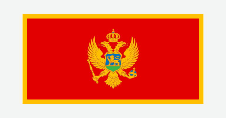
The cover uses national flag artwork from Commons. The intact flag retains its 2:1 proportions and is shown separately from the decorative outline motif.