Mongolia combines open steppe, mountain ranges, northern lakes and the Gobi. Its dry landscapes do not imply a warm climate: distance from oceans and high terrain help produce a strongly continental pattern. The maps below separate those physical contrasts from the country’s borders and administrative facts.
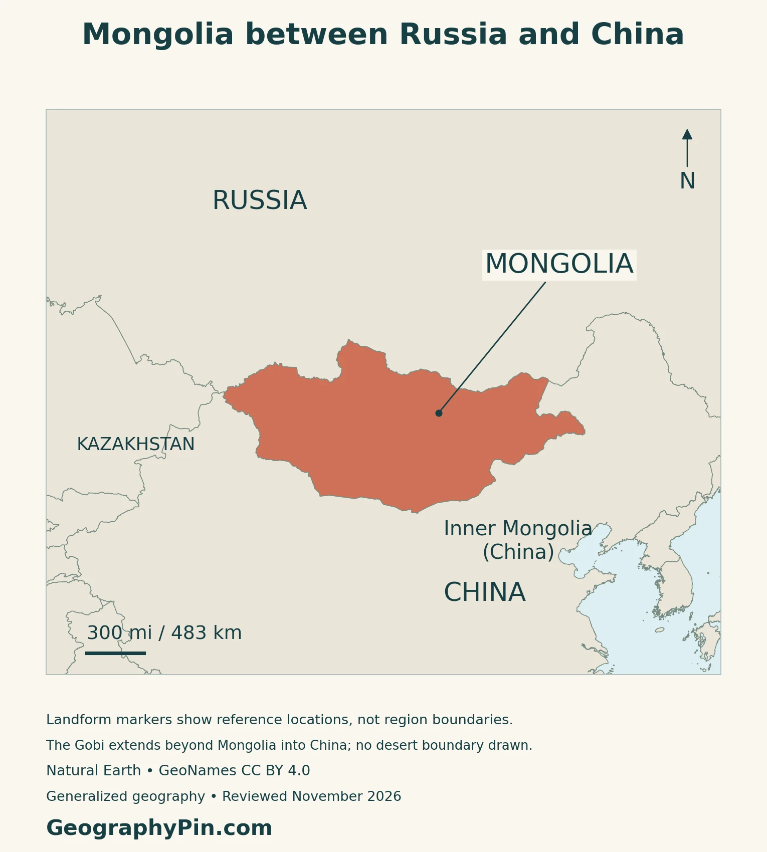
Mongolia is a landlocked country between Russia and China, with Ulaanbaatar as its capital. The Altai and Khangai mountains contrast with steppe and the southern Gobi. Severe winters can coexist with desert because dryness and temperature describe different conditions. Independent Mongolia is not Inner Mongolia, an autonomous region within China.
How to use this article: Compare physical regions, understand continental climate, follow northern lake landscape, or check population coverage.
1. Locate Mongolia and Distinguish Its Neighbors
One independent country, two land neighbors
Russia lies to the north and China around the southern side. Mongolia has no coastline and no direct border with Kazakhstan. The locator map highlights the sovereign state rather than a wider cultural or historical region.
Mongolia and Inner Mongolia are not interchangeable
Inner Mongolia is an autonomous region of China. The similarity of the names does not make it a second name for the independent country, nor does the national boundary divide every physical landscape into separate units.
This distinction matters when reading a map of the Gobi: the desert extends into China, while Mongolia includes environments beyond desert. A country map answers a political-location question; a landform map answers a different question about terrain.
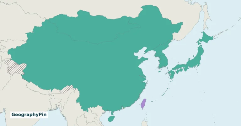
For the wider regional setting, use the East Asia countries map.
2. Mountains, Steppe and the Gobi
Read the mountain margins before the open spaces
The Altai occupy the west, the Khangai rise in the central part of the country, and the Khuvsgul region lies in the north. These uplands help explain why Mongolia should not be pictured as one uninterrupted flat grassland.
| Feature | Map position | Reading cue |
|---|---|---|
| Altai | Western Mongolia | Mountain terrain rather than a flat western margin |
| Khangai | Central Mongolia | An interior upland reference |
| Lake Khovsgol | Northern Mongolia | A lake within a mountain and forest landscape |
| Steppe | Extensive interior and eastern landscapes | Grassland distinct from both forest and desert |
| Gobi | Southern Mongolia and beyond the border | An arid region, not the outline of the country |
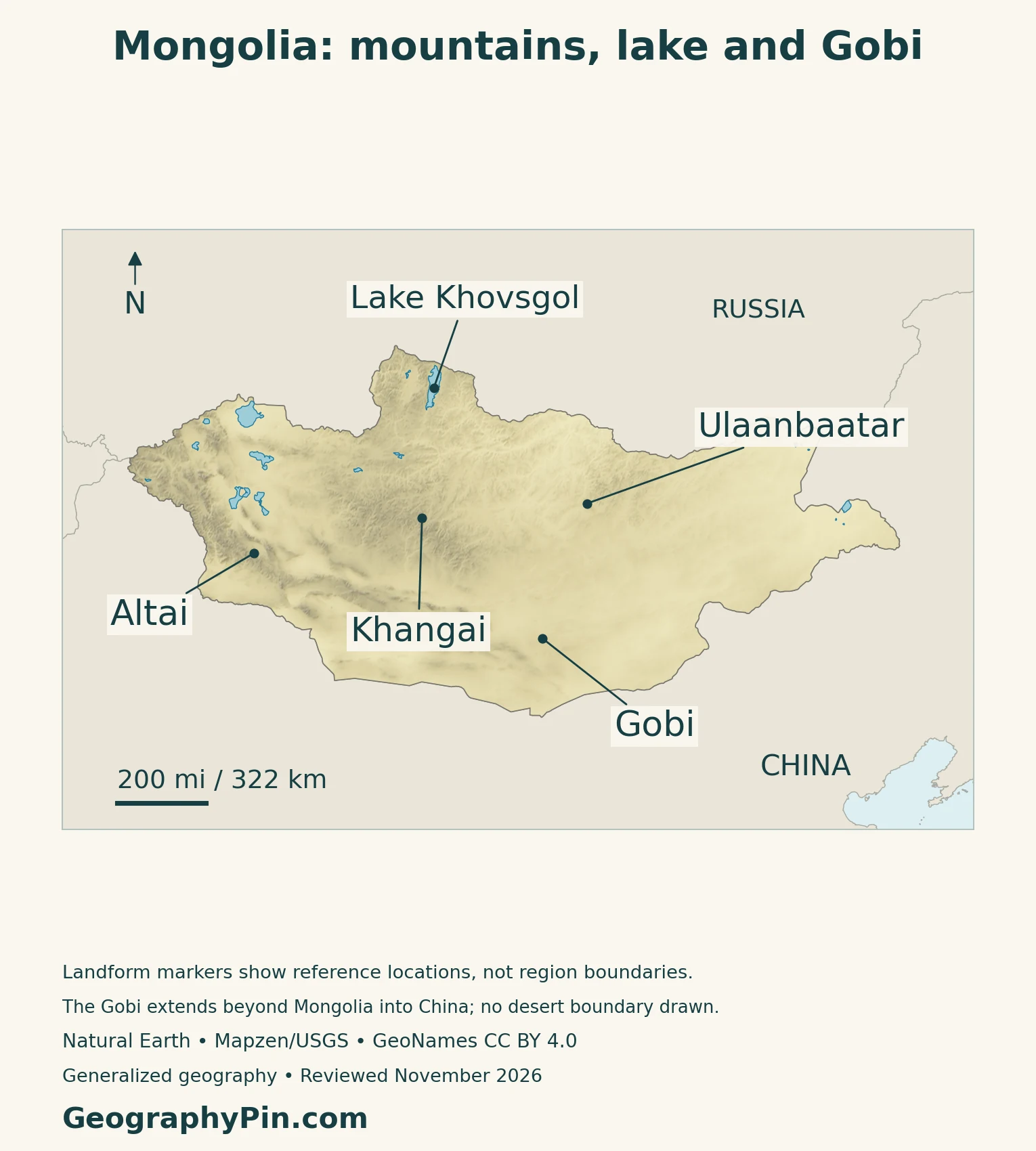
The Gobi is not simply a sea of sand
ESA’s satellite interpretation describes rocky surfaces, gravel-covered ground and basins separated by higher terrain within the Gobi. Sand dunes are only one possible desert surface, not a complete description of this region.
3. Why a Dry Country Can Have Severe Winters
Dryness does not mean year-round heat
Mongolia’s national climate communication links its severe continental climate to distance from oceans, surrounding mountain barriers and high elevation. Large seasonal temperature changes are therefore compatible with low precipitation.
“Desert” describes an arid environment, not a promise of hot winters. Treating the Gobi like a uniformly hot tropical desert confuses moisture conditions with temperature. The same country can have dry ground, intensely cold winter weather and much warmer summer conditions.
Season and location both matter
The World Bank–Asian Development Bank climate profile shows precipitation concentrated in the warmer part of the year, with drier conditions toward the central and southern regions. Its historical climate summaries also show pronounced differences between winter and summer.
A national average can hide these contrasts. Mountain districts, northern forest landscapes and southern drylands do not have identical conditions. Historical climatology describes a pattern over many years, not the weather on a particular travel date or a forecast for the next winter.
Dzud is a compound livestock hazard
The disaster term dzud refers to cold-season conditions that severely restrict livestock access to, or availability of, forage. Snow and ice can obstruct grazing, while drought before winter can leave too little fodder.
Not every dzud is simply a heavy snowstorm. Different combinations of weather, pasture conditions and vulnerability can produce severe livestock losses. The UN disaster-risk definition therefore treats the hazard as a compound problem rather than a synonym for an ordinary cold winter.
4. Lakes, Pastures and Economic Connections
Khovsgol is a freshwater landscape
Lake Khovsgol, also written Khuvsgul or Khövsgöl, lies within a northern landscape of mountains, taiga, forest-steppe and wetlands. UNESCO’s biosphere-reserve account identifies the Eg River as its single outlet.
The surrounding landscape supports water supply, livestock and hay production, as well as distinctive local ways of life. UNESCO designated the Khuvsgul Lake Biosphere Reserve in 2022. A biosphere reserve designation is not the same as inscription on the World Heritage List.
Uvs Nuur shows a different kind of lake system
Uvs Nuur is a shallow, highly saline lake in an enclosed basin shared by Mongolia and Russia. Unlike a freshwater lake with an outward-flowing river, an enclosed basin retains its drainage rather than continuing along a river route toward the sea.
The Uvs Nuur Basin World Heritage property protects selected components of a much larger landscape. UNESCO describes cold desert, steppe, forests, wetlands and high mountain habitats there. The lake’s importance for migrating waterbirds is another reason not to equate dry regional conditions with an absence of valuable aquatic habitat.
Mobile herding follows forage, not empty space
FAO’s grazing-management study explains seasonal movement between pastures as a response to changing forage and conditions. The combination of sheep, goats, horses, cattle, yaks and camels varies with the environment and production system; it is not an identical herd everywhere.
Portable gers and seasonal movement belong within that practical landscape relationship. They should not be used to imply that every Mongolian lives as a mobile herder.
The contemporary economy is more than pastoralism
In its October 2026 mission findings, the IMF identified higher copper production and prices as drivers of mining exports and government revenue. That dated assessment connects Mongolia to international commodity markets as well as local land-based livelihoods.
It also points to exposure to commodity-price changes and fuel-supply pressures.
5. Country Facts with Dates and Population Scope
Dated national reference facts
| Item | Reference |
|---|---|
| Capital | Ulaanbaatar |
| Resident population | About 3.424 million; 2025 register-based intercensal census |
| Surface area | About 603,909 square miles (1,564,116 square kilometers); UN reference year 2023 |
| Official language | Mongolian |
| Currency | Tugrik (tögrög), MNT |
| Government | Unitary republic with a parliamentary system |
| First-order administration | 21 aimags (provinces) and the capital municipality |
Residents are not the same as citizens worldwide
The National Statistics Office’s 2025 intercensal census reports 3,423,940 residents. That includes resident Mongolian citizens, foreign citizens and stateless residents. The larger total of 3,589,826 Mongolian citizens includes citizens living abroad and is not a domestic resident count.
The register-based exercise combined administrative records with verification and follow-up. Its report was published in 2026, but the population observation remains labeled 2025. The capital municipality contained 1,672,689 residents, about 49 percent of the national resident total; this is an administrative-area count, not a separately measured continuous urban footprint.
Keep administrative and statistical definitions separate
The Constitution identifies Mongolia as a unitary republic, names Ulaanbaatar as the capital and specifies Mongolian as the official language. The parliamentary system and the division into 21 aimags plus the capital are corroborated by the current Australian diplomatic country brief.
The Bank of Mongolia identifies the national currency as the tugrik, also transliterated tögrög. The area in the table is UN surface area, not a separately verified land-only measurement.
For a comparison of capitals rather than physical regions, see the Asia countries and capitals list.
What Did We Learn Today?
Mongolia is not interchangeable with Inner Mongolia, and its physical geography is not reducible to the Gobi. Mountain, steppe and lake environments require different map cues. Strong continental seasonality explains why dryness and severe cold can coexist. The country facts also need clear definitions: a resident population differs from a worldwide citizenship count, just as surface area differs from land-only area.
Sources & Data Notes
Population uses the National Statistics Office’s 2025 register-based intercensal census, published in 2026; resident and worldwide citizenship totals are not interchangeable. Surface area follows the dated UN series. Older national climate and pastoral studies support enduring processes, not current population or economic shares. IMF context is dated October 2026 preliminary mission findings.
- National Digital Atlas of Mongolia: general geography
- State Council: Inner Mongolia autonomous region context, April 2026
- ESA: Gobi surface interpretation
- Mongolia Second National Communication (2010): climate background
- World Bank and ADB: Mongolia Climate Risk Country Profile (2021)
- UNDRR and WMO: dzud hazard definition
- UNESCO: Khuvsgul Lake Biosphere Reserve
- UNESCO World Heritage Centre: Uvs Nuur Basin
- FAO: Grazing Management in Mongolia, J. M. Suttie
- IMF staff mission findings, October 8, 2026
- National Statistics Office: 2025 Population and Housing Intercensal Census, published 2026; printed pages 26 and 42–43
- UNData: Mongolia, dated surface-area reference
- Constitutional Court: Constitution, stable capital, language and state-form clauses
- Australian DFAT: Mongolia country brief
- Bank of Mongolia: national-currency history, August 2024
Map method: Original GeographyPin maps use public-domain Natural Earth countries v5.1.1 and lakes v5.0.0, real Mapzen/USGS elevation data and GeoNames reference points under CC BY 4.0. All source-country geometry is retained. Lake Khovsgol follows an actual lake polygon; lake outlines are generalized, not current water levels. Landform markers identify reference locations, not region boundaries. Elevation colors are not desert classifications. Inner Mongolia is labeled within China without inventing an internal boundary. The cover combines the national flag with a generalized country outline; the separate intact flag preserves its proportions.