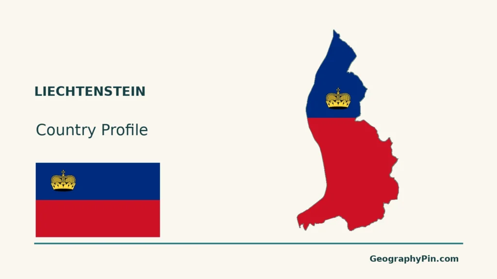
Liechtenstein fits between Switzerland and Austria, but its small outline contains more than one kind of Alpine landscape. A view across the Rhine Valley and a view from the mountain interior show different settings within the same country. The useful starting point is that valley-to-mountain contrast, rather than the country’s size alone.
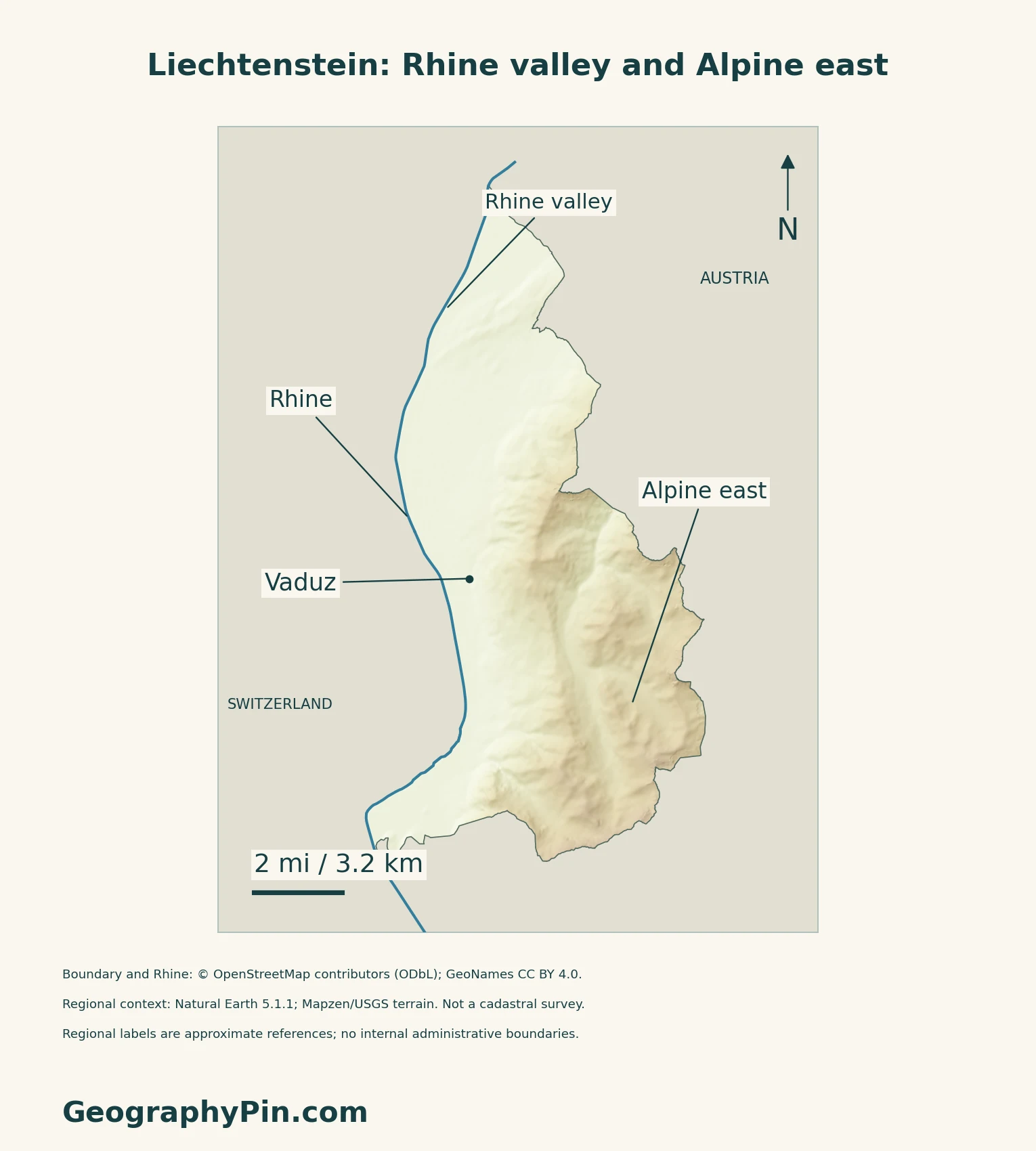
Liechtenstein combines the Rhine Valley floor, the slopes facing that valley and an Alpine interior. These are different landscape settings within a small national territory. The relatively concentrated settlement along the valley does not mean the country is uniformly flat, and a mountain image alone leaves out an important part of its geography.
How to use this article: Locate the country, compare the physical settings, or follow the Alpine Rhine.
1. Locate Liechtenstein Between Its Two Neighbors
A sovereign country, not a Swiss canton
Switzerland adjoins Liechtenstein to the west and south; Austria lies to the north and east. Vaduz is the national capital. The country is in the Alps, but it is neither part of Switzerland nor part of Austria.
Because both neighbors are themselves landlocked, Liechtenstein is doubly landlocked. That describes coastlines and borders, not economic isolation. The separate double-landlocked countries explainer works through the full classification and comparison.

Valley, slopes and Alpine interior
| Setting | What the map helps distinguish |
|---|---|
| Rhine Valley | The lowland corridor and concentrated settlement. |
| Valley-facing slopes | The transition upward from the plain. |
| Alpine interior | Mountain terrain beyond the valley-facing slopes. |
2. Separate Valley Climate From Mountain Weather
The influence of the Föhn
Liechtenstein’s February 2025 climate report links local climate to the Rhine Valley’s topography and warm downslope winds. The Föhn is a familiar example: air crossing mountains can become warmer and drier on the sheltered, or lee, side. It is a weather process, not a guarantee of mild conditions every day.
The report gives Vaduz’s mean annual temperature as about 51.1°F (10.6°C) for the 1991–2020 reference period. That is a station-based, multi-decade average, not today’s temperature or a single value describing every mountain elevation.
3. Follow the Alpine Rhine Beyond the National Border
A river shared across borders
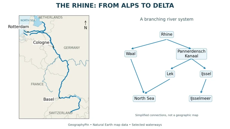
The Alpine Rhine forms part of the boundary with Switzerland and continues downstream toward Lake Constance. Upstream, the Vorderrhein and Hinterrhein join at Reichenau to form this reach. Liechtenstein therefore occupies one part of a much larger river system.
Water management also crosses national borders. A July 3, 2026 government statement describes cooperation through the International Governmental Commission for the Alpine Rhine on flood protection, ecology, river development and land use.
This is why a country outline and a river catchment answer different questions. The outline identifies national territory; the river connects upstream and downstream places that require coordinated management.
4. Check Dated Country Facts
| Item | Reference |
|---|---|
| Capital | Vaduz; constitutional seat of parliament and government |
| Population reference | 41,228 permanent residents on December 31, 2025; final release September 25, 2026 |
| Area reference | About 62 sq mi (160 km²), as presented by Liechtenstein’s Council of Europe Presidency |
| National and official language | German, under Article 6 of the Constitution |
| Currency | Swiss franc (CHF) |
| Municipalities | 11, grouped into Oberland and Unterland |
| Government form | Constitutional hereditary monarchy on a democratic and parliamentary basis |
Residents, not just citizens
The final permanent-resident figure replaces the preliminary total of 41,237. It includes resident citizens and foreign nationals, not Liechtenstein citizens living worldwide. The same release gives 41,712 people when 484 non-permanent residents are included.
This is register-based population statistics, not a new door-to-door census. The Office of Statistics draws on municipal, immigration and civil-status administrative records. A definition change from 2024 assigns some permit categories according to length of residence, so comparisons with earlier permanent-resident totals require care.
Close Swiss ties, separate state
Sharing a currency and customs area does not make Liechtenstein part of Switzerland. The customs treaty entered into force in 1924; a separate currency treaty signed in 1980 governs the monetary relationship. These agreements connect two states rather than abolishing the national border.
The Constitution names Vaduz as the seat of parliament and government. Its 11 municipalities belong to two historical regions: six in Oberland and five in Unterland. These administrative groupings are distinct from the mountain slopes, valleys and other physical features shown on a terrain map.
For a broader comparison, see the European countries and capitals reference.
What Did We Learn Today?
Liechtenstein’s Rhine Valley, valley-facing slopes and Alpine interior form distinct landscapes. Settlement is concentrated along the valley, while the Alpine Rhine connects the country with a wider river system and cross-border water management.
Sources & Data Notes
Sources, dates and map conventions
Population uses the final December 2025 permanent-resident series, not the earlier provisional release; the methodology changed from reporting year 2024. The rounded national area is an official country-description figure, not a separately asserted land-only measurement. Legal references use the official Constitution consolidated January 1, 2026. Customs and currency integration are distinguished from sovereignty. The landscape comparison uses the government’s country brochure; climate figures retain the February 2025 report’s 1991–2020 station reference. The river section distinguishes geographic course from a dated description of cross-border cooperation, without asserting that planned works are complete.
- Office of Statistics: final population reference for December31,2025, released September25,2026
- Office of Statistics:2025 population methodology and quality
- Official Constitution, consolidated January1,2026: Articles1,2 and6
- Liechtenstein Council of Europe Presidency: national area and currency
- Liechtenstein Embassy in Bern: customs and currency relations with Switzerland
- Original currency treaty: signed June 19, 1980; effective November 25, 1981
- Government of Liechtenstein: Encounter with a Small State, landscape section
- Office of Environment: First Biennial Transparency Report, February 2025
- Met Office: the Foehn effect
- ICPR: Alpine Rhine and Lake Constance
- Government statement, July 3, 2026: Alpine Rhine cooperation
- Liechtenstein embassy: geography and two neighboring countries
Original maps use OpenStreetMap relation 1155955 (version 104, edited November 15, 2026) for Liechtenstein and five unchanged Rhine ways from Geofabrik’s OSM extract. © OpenStreetMap contributors, ODbL. Edit dates are not survey dates. The river is a selected reach, not its complete course. Neighboring context uses public-domain Natural Earth countries 5.1.1; adjoining background polygons are dissolved to avoid a duplicate generalized Liechtenstein outline, not to imply shared sovereignty. Vaduz coordinates use GeoNames, CC BY 4.0. Mapzen/USGS terrain is qualitative shaded relief, not a cadastral or elevation survey. All country-masked samples are nonnegative; no national terrain samples were removed. Regional labels do not delineate administrative zones. The cover uses the same national outline and the Flagpedia reusable flag rendition; the National Administration corroborates the blue-red bands and gold prince’s hat.