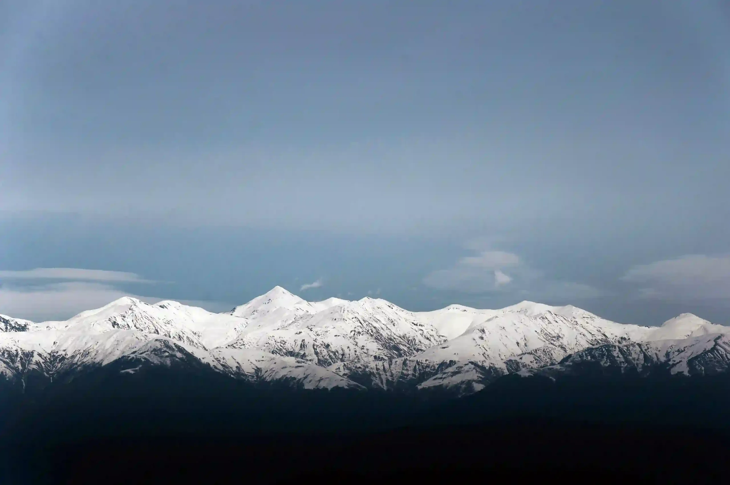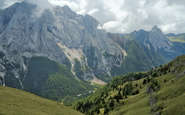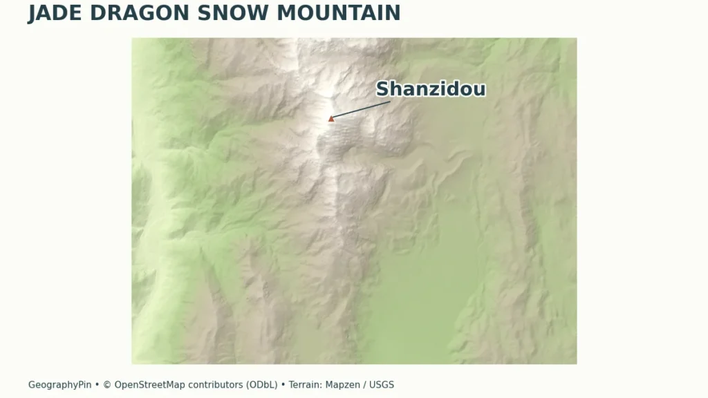
A snowy skyline, a cable-car terminal and a high viewing platform can all belong to the same mountain landscape without sharing the same elevation. Understanding those differences is the starting point for reading Jade Dragon Snow Mountain’s maps, glacier descriptions and visitor information.
Jade Dragon Snow Mountain’s highest summit, Shanzidou, has an officially adopted elevation of 18,341 feet (5,590.2 meters), announced in 2025. The range lies north of Lijiang in Yunnan, China. Its Glacier Park cable car reaches a much lower station; the visitor platform is not the mountain’s summit.
How to use this article: Locate Yulong and Shanzidou, compare summit and visitor heights, or understand the glacier measurements.
1. Where Is Jade Dragon Snow Mountain?
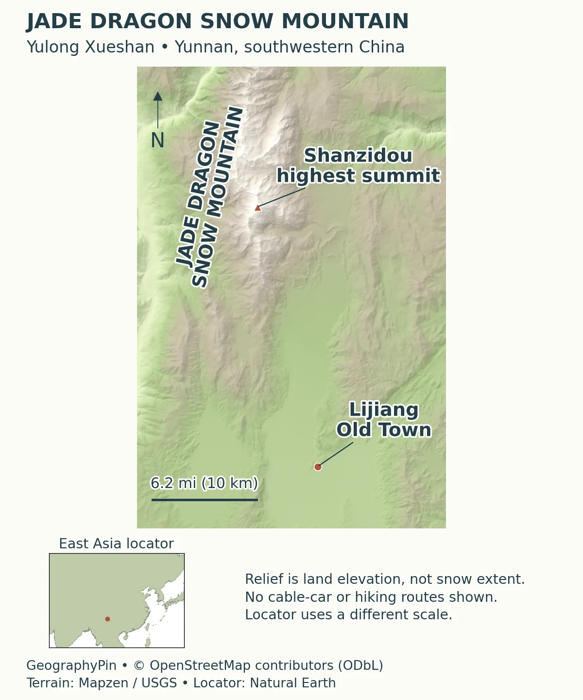
Jade Dragon Snow Mountain is the English name commonly used for Yulong Xueshan, the mountain range north of Lijiang in Yunnan, southwestern China. It lies in Yulong Naxi Autonomous County. The name can refer to the mountain landscape as a whole, while Shanzidou identifies its highest summit.
This distinction explains why searching for the mountain’s height produces several different numbers. A mountain summit, a cable-car terminal and a sightseeing platform are separate places. Reaching a visitor facility high on the slope does not mean reaching the highest point of the range.
Yulong, Shanzidou and Lijiang are different kinds of names
Think of Lijiang as the nearby city, Yulong Xueshan as the mountain range and Shanzidou as the summit within it. “Glacier Park” instead refers to a visitor area on the mountain. Keeping those categories separate makes a map, tour description or photograph caption much easier to interpret.
The mountain also has cultural meaning beyond its dramatic skyline. China’s Ministry of Culture and Tourism identifies it as a sacred mountain of the Naxi people. Its landscape is therefore not simply an outdoor backdrop: respectful behavior and local site rules are part of understanding the place.
2. Summit, Cable-Car Station and Viewpoint Heights
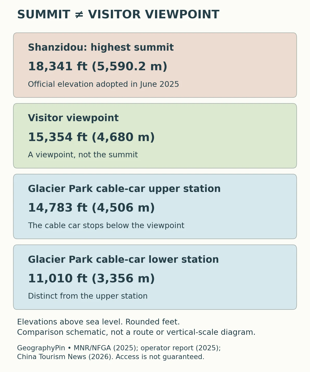
The current officially adopted elevation of Shanzidou is 18,341 feet (5,590.2 meters). The Ministry of Natural Resources and National Forestry and Grassland Administration announced the figure in 2025. It is a summit elevation, not an advertised visitor access height.
| Place | Elevation above sea level | Source context |
|---|---|---|
| Shanzidou summit | About 18,341 feet (5,590.2 meters) | Official elevation adopted in 2025 |
| Glacier Park cable-car upper station | About 14,783 feet (4,506 meters) | Operator’s 2025 annual report |
| Visitor viewing platform | About 15,354 feet (4,680 meters) | China Tourism News reporting, September 2026 |
| Glacier Park cable-car lower station | About 11,010 feet (3,356 meters) | Operator’s 2025 annual report |
Why the cable car does not reach the summit
The upper station and the viewing platform are also not interchangeable. Their published elevations differ by about 571 feet (174 meters). That is a vertical difference, not the length of a walkway. The platform remains about 2,986 feet (910.2 meters) below the officially adopted summit elevation.
Why older summit heights still appear
The older figure of about 18,360 feet (5,596 meters) remains in tourism descriptions and earlier mountaineering references. The newer official announcement takes precedence for the summit height in this profile. The difference is not evidence that the mountain physically shrank, and the announcement alone does not justify an explanation involving snow depth or a changed surveying datum.
3. A Mountain Ridge Shaped by Rock and Ice
A range, not one isolated tourist viewpoint
The American Alpine Journal describes the peaks along a roughly north–south ridge about 22 miles (35 kilometers) long. The silhouette seen from one viewpoint is only a view of that larger mountain system, not its complete outline. Shanzidou is the highest point, but the name Yulong Xueshan encompasses more than that summit.
A 2025 glacier study describes Yulong as a limestone mountain affected by folding and fault-block structure. These are processes and structures in the rock mass; they should not be confused with the later carving and redistribution of material by glaciers. A mountain can owe its broad relief to tectonic development while ice modifies its slopes and valleys.
Glaciers erode rock, carry debris and reshape terrain, but a visible glacier is not the whole explanation for the existence of a high range. Likewise, a relief map represents the land surface. It does not by itself reveal the age of the rocks, a buried fault or the thickness of glacier ice.
This separation is useful when reading mountain photographs: the ridge is a landform, snow is a changing surface cover, and a glacier is a body of ice with its own history and movement. Our introduction to physical geography explains how landforms, water and climate fit together.
4. What Glacier Measurements Actually Show
A dated change in area, not a promise of today’s view
Baishui River Glacier No. 1 is closely associated with the Glacier Park side of the mountain. Scientific research distinguishes this individual glacier from the glacierized area of the whole range. A measurement for one must not be relabeled as a measurement for the other.
A 2026 study by Yan and colleagues compared Yulong’s glacierized area between 1987 and 2024. It reported a decline from about 3.03 square miles (7.85 square kilometers) to 1.66 square miles (4.29 square kilometers), approximately 45%. These are dated, range-wide area estimates, not the area of Baishui River Glacier No. 1 alone or a measurement made in 2026.
The study also explains why counting glaciers can be misleading: fragmentation can temporarily increase the number of smaller ice bodies even while the total glacierized area decreases. More separate outlines on a map would not necessarily mean more ice.
For a visitor, the practical distinction is between long-term glacier change and the appearance on a particular day. Snow cover, exposed ice and cloud can change what a photograph shows. Neither the name “Snow Mountain” nor an older image guarantees the same visible snow conditions during a later visit.
5. Forests, Meadows and Changing Elevation
Vegetation changes with altitude, but not in perfect stripes
Research on Jade Dragon Snow Mountain and its surrounding region describes a broad progression from lower-elevation forests toward alpine meadows and tundra. Temperature, precipitation, terrain and the amount of land available at different heights all influence plant distributions. Elevation is an organizing factor, not the only control.
A 2016 plant-diversity study analyzed the mountain and surrounding region together. Its study area and elevation bands were chosen for ecological analysis. The upper limit of that dataset should not be mistaken for the height of Shanzidou, and its regional species totals should not be assigned to one tourist platform.
A simple elevation diagram therefore helps compare places but cannot accurately divide every slope into identical vegetation belts. Aspect and local terrain matter, while forest edges and meadow boundaries are more irregular than neat horizontal bands. The same caution applies to snowlines: a fixed line in a diagram would imply more certainty than a general geographic profile can provide.
6. Reading the Heights Before a Visit
High access does not remove the effects of altitude
The cable car provides mechanical access to high terrain, not a gradual acclimatization schedule. The upper station and platform are both well above 14,000 feet (4,267 meters). The CDC’s high-altitude travel guidance advises gradual ascent and warns that altitude illness can occur at much lower elevations. Discuss a high-altitude itinerary with a clinician when appropriate, particularly if rapid ascent is unavoidable or you have a relevant health condition.
Do not treat the platform as a target that must be reached regardless of how you feel. CDC guidance says not to ascend farther with symptoms of altitude illness, and to descend if symptoms worsen while resting. Follow site staff instructions and seek medical assistance when needed.
Before booking, confirm which cableway your ticket covers and check current operating notices. Glacier Park, Spruce Meadow and Yak Meadow are different products, not different names for one ride. September 2026 reporting described Yak Meadow’s cableway as closed for redevelopment; that dated report should not be treated as a live operating notice.
Weather and operational restrictions can change access. This profile explains where the facilities sit in the landscape, rather than guaranteeing a timetable, a clear view or entry to the platform on a particular day. The key geographic fact remains the same: visiting the high sightseeing area is not summiting Shanzidou.
What Did We Learn Today?
Yulong is a mountain range, Shanzidou is its highest summit, and Glacier Park is a visitor area below it. The 2025 official summit elevation replaces the older reference used in many descriptions. A station height, a platform height and a dated glacier-area estimate each answer a different question about the landscape.
Sources & Data Notes
US customary equivalents are rounded; the official summit value is retained to its published metric precision. Differences between elevations are vertical separations, not route distances. Glacier-area estimates retain their observation period.
- Yunnan Department of Natural Resources, June 23, 2025. Official report of the adopted Shanzidou elevation of 5,590.2 meters.
- Ministry of Natural Resources and National Forestry and Grassland Administration: Announcement No. 34 of 2025. Summit elevation announcement dated June 4, 2025; no physical elevation change is inferred here.
- Lijiang Yulong Tourism: 2025 annual report. Glacier Park cableway lower and upper elevations and its eastern-slope setting.
- China Tourism News, September 1, 2026. Reported visitor platform height and dated operating context. Its older summit figure is superseded by the official 2025 announcement.
- Ministry of Culture and Tourism: Yulong Snow Mountain. County location and Naxi cultural context; not used for the updated summit height.
- American Alpine Journal (2021): Yulong Xueshan overview. Range identity, orientation and approximate length; historical mountaineering reference, not current visitor permissions.
- Yan and colleagues (2025): Baishui River Glacier No. 1. Study-area geology and the distinction between one glacier and the wider range.
- Yan and colleagues (2026): glacier changes on Yulong, 1987–2024. Range-wide glacier area estimates; publication year is not the final observation year.
- Xu and colleagues (2016): altitudinal plant-diversity patterns. Mountain and surrounding-region study; broad vegetation and environmental context.
- CDC: Travel to High Altitudes. General altitude precautions, not an assessment of an individual visitor.
Map sources and method: Original GeographyPin cartography uses the actual Shanzidou summit point and Lijiang Old Town polygon from © OpenStreetMap contributors (ODbL). Historical Mapzen elevation tiles represent land relief; global GMTED2010/SRTM terrain data courtesy of the U.S. Geological Survey. Exact per-tile source composition was not independently resolved; see Mapzen source attribution. The East Asia coastal outline uses Natural Earth public-domain data. The main map uses a latitude-adjusted geographic aspect and an approximate scale bar; the inset has a separate scale. No current glacier boundaries, station positions or routes are reconstructed from the elevation data.