Rainforest does not always mean the Amazon. Along the eastern Black Sea, Georgia has rain-soaked forests with broad-leaved trees, evergreen shrubs and a long ecological history. Nearby peatlands belong to the same UNESCO property, but they work differently from the forests.
Georgia’s Colchic rainforests grow outside the tropics because abundant moisture from the Black Sea, mountain barriers and a relatively mild climate support persistently humid conditions. They are generally described as temperate rainforests. The UNESCO-listed Colchic Rainforests and Wetlands protects seven separate components, not every forest in the broader Colchic region.
How to use this article: Locate the seven UNESCO components, understand the climate terminology, or compare a rain-fed bog with a forest.
1. Where the Colchic Rainforests Are
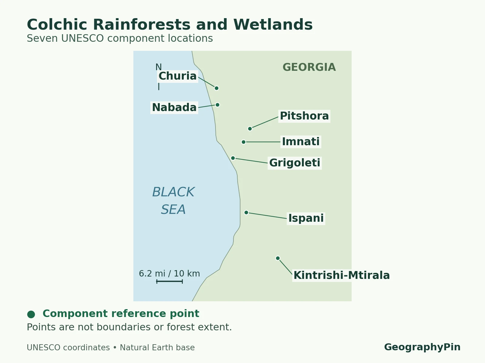
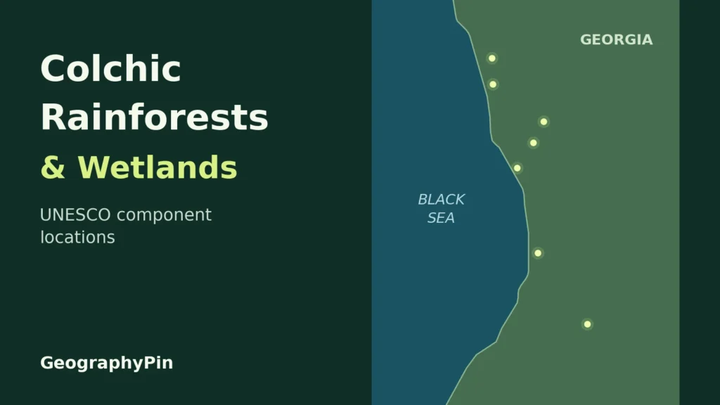
The forests are in Georgia, the South Caucasus country, rather than the U.S. state. The UNESCO components lie in western Georgia, in Adjara, Guria and Samegrelo–Zemo Svaneti. They are distributed along a coastal corridor about 50 miles (80 kilometers) long, with the mountainous Kintrishi-Mtirala component extending inland.
“Colchic” describes a wider biogeographic setting associated with the Black Sea. It is not an alternative name for one national park. Research on Colchic forests includes northeastern Türkiye as well as Georgia; the UNESCO property discussed here is entirely in Georgia.

The seven components, not seven national parks
- Kintrishi-Mtirala: the mountainous component in Adjara, dominated by forests.
- Ispani: the lowland component in Adjara, associated with the Kobuleti peatlands.
- Grigoleti: a coastal-lowland component in Guria.
- Imnati: a lowland component in Guria.
- Pitshora: a lowland component in Samegrelo–Zemo Svaneti.
- Nabada: a lowland component in Samegrelo–Zemo Svaneti.
- Churia: the northernmost component reference point, in Samegrelo–Zemo Svaneti.
The component order follows UNESCO’s component table. These are parts of a serial property: several distinct places recognized together. The property intersects protected areas administered through Kintrishi, Mtirala, Kobuleti and Kolkheti; those park and reserve names are not interchangeable with the seven component names.
UNESCO inscribed the property in 2021 and approved a minor boundary modification in 2023. The wider ecological region, the World Heritage property and its buffer zones are three different things. For an exact legal boundary, use UNESCO’s documents rather than drawing a line around all seven map markers.
2. Why This Coast Can Support Rainforest
The combination of sea and mountains matters more than a tropical latitude. Moist air arriving from the Black Sea meets the mountain relief of western Georgia. As air is forced upward, it cools, helping clouds and precipitation form. The Greater Caucasus, Lesser Caucasus and intervening Likhi ridge shape this regional setting.
The sea also moderates the coastal climate. That does not eliminate seasons or make a high mountain as warm as the coast. Elevation and exposure change conditions over short distances, so one rainfall figure cannot describe every part of the property.
ETH Zurich’s Colchic forest research reports that some places, including Mtirala National Park, receive up to about 157 inches (4,000 millimeters) of precipitation annually. This is a location-specific illustration of the region’s wetness, not a UNESCO-wide average or a promise for any particular year.
The distribution of water through the year also matters. A large annual total concentrated into a short wet season is not equivalent to sustained moisture. Colchic forests and bogs developed in a highly humid setting, but their response still depends on soils, drainage and the timing of dry periods.
3. Temperate, Subtropical or Tropical?
Use the label that matches the question
UNESCO describes the setting as warm-temperate and the forests as temperate deciduous rainforests. “Deciduous” means that trees shed their leaves seasonally; “rainforest” describes a wet forest environment, not a requirement that all trees remain leafy year-round.
In their 2015 comparison of Colchic and Hyrcanian forests, Nakhutsrishvili and colleagues argue for temperate rather than subtropical rainforest. Their reasoning includes winter temperatures and forest structure: an evergreen shrub layer beneath a largely deciduous broad-leaved canopy is not the same as a broad-leaved evergreen forest.
This is why “subtropical coast” and “temperate rainforest” can appear in descriptions of the same general area. One may refer loosely to mild coastal conditions or cultivated plants; the other describes forest ecology. Rather than force every climate and vegetation scheme into one label, state what is being classified.
A palm on a waterfront or a tea plantation is not evidence that the native forest is tropical. Nor does a dense evergreen understory turn the entire canopy evergreen. Rainfall, winter temperature, vegetation structure and elevation each answer a different part of the question.
For the distinction between a broad ecological grouping and a functioning local system, see biome, ecosystem and habitat. A useful description of Colchis must leave room for several ecosystems rather than treating the whole region as one uniform forest.
4. Forests and Wetlands Are Not the Same Habitat
The title “Colchic Rainforests and Wetlands” deliberately includes more than trees. IUCN’s technical evaluation distinguishes the mountainous Kintrishi-Mtirala component from the six lowland components, which contain combinations of lowland forests and freshwater wetlands. A wetland can be wooded, so forest and wetland are not always mutually exclusive categories.
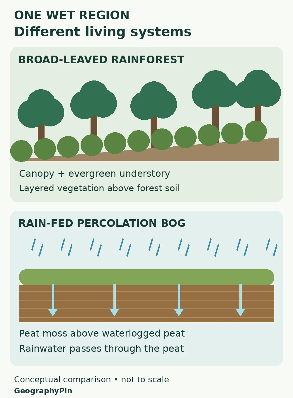
In the forests, canopy trees, an understory and the forest floor create different living conditions. Evergreen shrubs such as rhododendrons are a conspicuous part of many Colchic forest communities. Forest streams and the surrounding slopes add further habitat variation.
What makes a percolation bog different?
A bog is a peatland supplied by precipitation rather than primarily by mineral-rich groundwater. Peat consists of partly decomposed plant material. At Ispani, the Ramsar information sheet describes a rain-fed, peat-moss-dominated system whose highly permeable peat allows water to pass through its depth.
That movement explains “percolation.” The image to keep in mind is water moving through a deep, porous peat body, not simply standing in a shallow pond. Persistent wetness and the properties of the peat are central to how the system works.
The Ramsar description concerns the Ispani wetland complex; its designation should not be assumed to have exactly the same boundary as the UNESCO Ispani component. Likewise, the properties of a rain-fed bog should not be assigned automatically to nearby fens, rivers or swamp forests. The broad word “wetland” contains different water sources and processes.
5. What an Ancient Forest Refugium Means
A refugium is an area where organisms persist when conditions elsewhere become unfavorable. For Colchis, the idea concerns the survival and evolution of forest communities through major climatic changes. It does not mean that today’s individual trees are millions of years old.
The forest’s historical importance also does not imply an unchanging landscape. Trees establish, die and are replaced; gaps open; species respond differently to temperature and water availability. “Ancient” describes ecological continuity and evolutionary history, not the absence of change.
The European Commission’s account of the CLIMADYST-RAINFOR project describes how researchers combined tree rings, forest inventories and vegetation modeling to investigate that history. Their work found that even these wet forests can be sensitive to drought, with effects varying among species and locations.
Two other terms need separating. A relict is a survivor from a formerly wider distribution or older ecological setting. An endemic species has a restricted geographic distribution. A species can fit both descriptions, but the words are not synonyms. The significance of Colchis lies partly in the combination, not simply in a high count of trees.
6. Why Protecting the Water Matters
Protecting a forest is not only a matter of preventing tree cutting. Protecting a bog is not only a matter of leaving its visible moss untouched. Water supply, drainage and activities around the protected area can affect the living system.
UNESCO’s conservation account recognizes past losses across the wider Colchic region and stresses the need to assess nearby development for effects on the property. The broader lesson is that a designation protects selected places; it does not make their surroundings ecologically irrelevant.
For readers, the safest way to interpret a map is therefore to ask three separate questions: where is the component, what ecosystem is present, and what area is legally protected? A locator answers the first. Ecological descriptions help with the second. Official boundary documents answer the third.
For a visit based around the southern coast, the Batumi travel guide supplies the urban and trip-planning context. This ecology map is not a trail map: a reference point is not necessarily an entrance, and World Heritage status does not itself mean unrestricted access.
Frequently Asked Questions
Are Colchic and Hyrcanian forests the same place?
No. Colchic forests are associated with the Black Sea region; Hyrcanian forests are associated with the southern Caspian region. They share an important history as forest refugia, but their geography, climate and plant communities differ.
Does the UNESCO property include the Black Sea itself?
IUCN’s evaluation describes the property’s wetlands as freshwater and states that the nominated property contained no marine area. Being beside a sea does not make a peatland or swamp forest a saltwater ecosystem.
What Did We Learn Today?
Colchis shows why rainforest is not a synonym for tropical forest. Black Sea moisture, relief and mild conditions support forests with a long ecological history, while coastal peatlands depend on a different set of water and soil processes. Reading the seven-component map correctly means separating reference points from boundaries, and the UNESCO property from the much larger ecological region.
Sources & Data Notes
The locator uses UNESCO’s published component reference coordinates on a Natural Earth basemap; markers are not surveyed boundaries or forest-cover polygons. The 2023 boundary decision is distinguished from the earlier nomination and evaluation documents. Rainfall is a reported local example, not a uniform regional average. The forest–bog drawing is an original conceptual illustration, not a field photograph. Geographic facts are summarized independently; no UNESCO emblem or third-party map has been reproduced.
- UNESCO: Colchic Rainforests and Wetlands
- UNESCO: component names and reference coordinates
- UNESCO: 2023 minor boundary modification decision
- IUCN technical evaluation, May 2020
- Nakhutsrishvili and colleagues (2015): Colchic and Hyrcanian forests
- ETH Zurich: Colchic temperate rainforest research
- European Commission CORDIS: forest climate-history research
- Ramsar: Ispani Mire information sheet
- Natural Earth: public-domain cartographic data