Burkina Faso is often reduced to a dryland label, but its geography combines gently rolling plains, southwestern rock formations and rivers belonging to several international basins. The useful distinction is between terrain, seasonal climate and state boundaries, not between one uniform desert and everything outside it.
No. Burkina Faso is a landlocked West African country spanning a northern Sahelian zone and wetter savanna settings farther south. Much of its relief is gentle, with more rugged sandstone landscapes in the southwest. The Mouhoun and Nakambé connect it to the Volta system, while other areas drain toward the Niger or Comoé.
How to use this article: Locate the landlocked country, distinguish the Sahel transition, or follow the Volta tributaries.
1. Locate a Landlocked West African Country
Six neighbours, but no national coastline
Burkina Faso lies inland in West Africa. Mali borders it to the north and west, Niger to the east, and Benin, Togo, Ghana and Côte d’Ivoire along its southern side. None of its national boundary is an ocean shore.
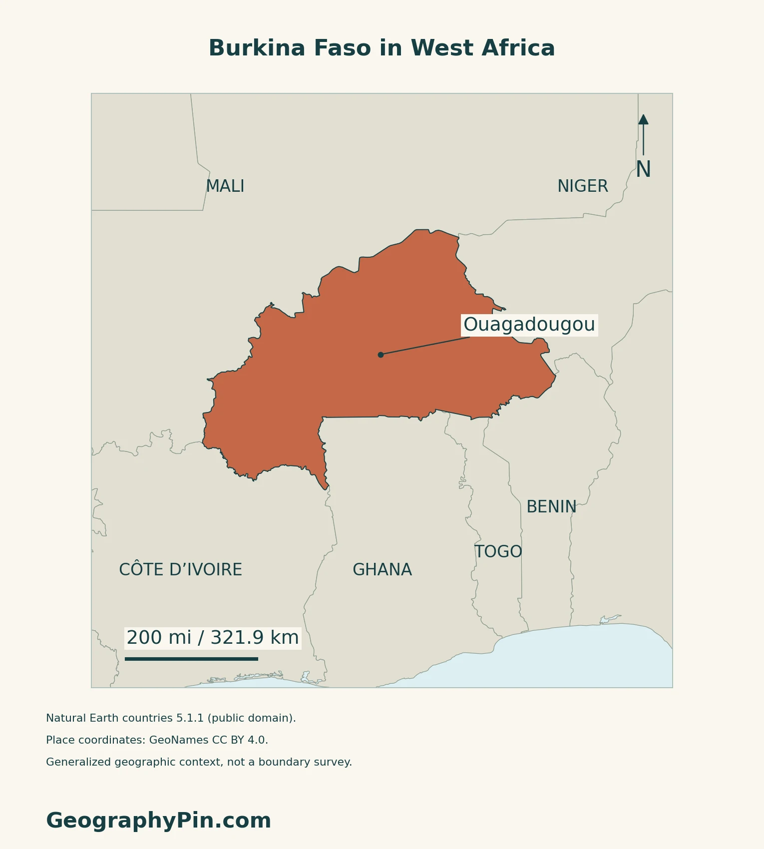
Ouagadougou is the capital in the central part of the country. Bobo-Dioulasso lies farther southwest.
The country’s updated National Adaptation Plan notes its dependence on neighbouring coastal countries for port traffic. Landlocked does not mean disconnected: it means routes to seaports cross another country’s territory.
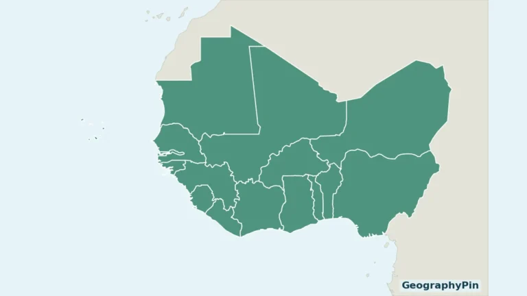
For the wider regional setting, see the West Africa country map.
2. Compare Low-Relief Plains and Southwestern Uplands
Mostly gentle relief does not mean a featureless surface
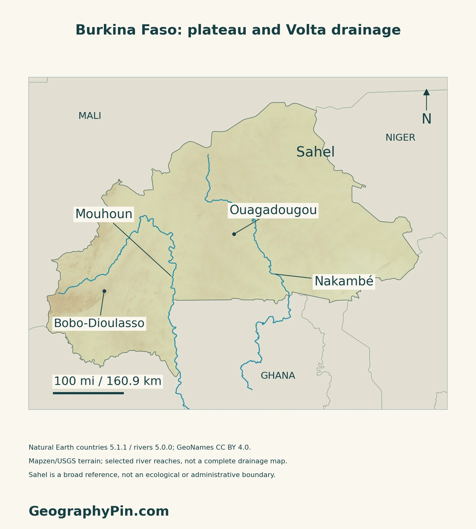
The national education portal describes a broad peneplain: an extensive, gently relieved surface interrupted by isolated hills, domes, granite outcrops and shallow valleys. These smaller landforms matter even where a country-scale map appears relatively flat.
The updated adaptation plan contrasts this widespread low-relief setting with sandstone terrain in the southwest, including the Banfora escarpments and Sindou rock formations.
| Setting | What to look for |
|---|---|
| Broad interior plains | Gently rolling terrain with isolated hills and shallow valleys. |
| Southwestern sandstone country | More conspicuous escarpments and rocky uplands. |
| River valleys | Drainage corridors crossing the wider plateau landscape. |
3. Separate the Sahel From the Sahara
The northern dryland belt is not the whole country
Burkina Faso is not entirely in the Sahara. The Sahel is a semiarid transition belt south of the desert, with grassland, scattered woody vegetation and seasonal water availability. The Sudanian savanna belt lies farther south. These geographical terms do not refer to the modern country of Sudan.
USGS emphasizes that the boundaries between these bioclimatic regions are gradual transitions, not sharp lines.
Rainfall seasons generally lengthen toward the south
Burkina Faso’s embassy describes a shorter rainy period in the northern Sahelian zone and longer rainy periods in central and southern zones. The whole country has a pronounced dry season, but that does not make its climate uniform.
The updated adaptation plan addresses drought, floods and strong heat as distinct risks affecting water resources, agriculture, livestock and other sectors. A dry climate label does not rule out damaging floods when intense rain arrives.
4. Follow the Mouhoun and Nakambé Across Borders
Two named rivers belong to a larger system
The Mouhoun is also known as the Black Volta, and the Nakambé as the White Volta. The Volta Basin Authority identifies both as major tributaries entering Lake Volta. Downstream of that lake, the Volta reaches the Atlantic in Ghana.
Three international basins and four national drainage units
The national basin agency distinguishes three international systems: Volta, Niger and Comoé. Its national classification uses four drainage units: Mouhoun, Nakanbé, Niger and Comoé. The two counts are not contradictory; they describe different levels of the drainage network.
The agency also describes most watercourses as seasonal, with some permanent flows.
5. Check Dated Country Facts
| Item | Reference |
|---|---|
| Capital | Ouagadougou |
| Population reference | 24,736,828 for 2026; INSD medium-scenario projection |
| Surface area | About 105,870 sq mi (274,200 km²); UNData’s 2023 reference |
| Currency | West African CFA franc (XOF) |
| Languages in law | National languages officialized by law are official; English and French are working languages |
| Administrative framework | 17 regions and 47 provinces under the July 2025 reorganization |
A projection built from the 2019 census
The 2026 figure comes from INSD’s November 2022 projection report, not a new headcount. Its medium scenario models fertility, mortality and migration from the 2019 census baseline. The final census reported 20,505,155 residents, including residents temporarily absent, rather than visitors. Security-related gaps required estimates for nine unenumerated and 28 partly enumerated communes.
Read current legal labels carefully
The December 2023 constitutional revision changed the language provision. Article 35 distinguishes national languages granted official status by law from English and French as working languages; an older table calling French the sole official language is outdated.
Administrative regions are not ecological zones. The July 2025 reorganization replaced the former 13-region, 45-province arrangement. Separately, the legislature’s July 2026 report confirms institutions operating under the Charter of the Revolution, rather than the earlier transition framework. These legal descriptions do not map territorial control.
For continental comparisons, use the African countries and capitals reference.
What Did We Learn Today?
Burkina Faso’s dry northern landscapes do not describe the whole country. Its plains, southwestern uplands and cross-border river systems make more sense when climate zones, drainage basins and administrative divisions are kept separate.
Sources & Data Notes
Sources, dates and map conventions
Population is INSD’s 2026 medium-scenario projection from its November 2022 report; it is not a 2026 census. The 2019 census included estimated populations in areas affected by incomplete enumeration. Language wording follows Article 35 in the government’s 2024 consolidation, incorporating the December 2023 revision. Administrative and institutional references are dated July 2025 and July 2026 respectively; no current-control boundaries are inferred. Older embassy and adaptation-plan material is used only for stable physical context, not its superseded administrative counts or government descriptions. No exact summit height, present river discharge or current security-control boundary is asserted. The Sahel label is ecological context, not an administrative polygon.
- INSD: November 2022 demographic projections 2020–2035, medium scenario
- INSD: June 2022 final synthesis of the 2019 census, methodology and resident population
- UNData: capital, 2023 surface area and XOF currency
- Government: Constitution consolidated after the October 2024 revision, Article 35
- Presidency: July 2, 2025 territorial reorganization
- National legislature: July 31, 2026 institutional framework under the Charter of the Revolution
- Burkina Faso embassy: stable location and broad seasonal contrast
- National education portal: peneplain and local relief
- Burkina Faso: updated National Adaptation Plan 2024–2028, published by UNFCCC in March 2025
- USGS: West African bioclimatic regions and gradual boundaries
- Volta Basin Authority: tributary names and downstream connections
- National basin agency: international and national drainage classifications
Map method: Original maps use public-domain Natural Earth countries 5.1.1 and rivers 5.0.0. Mouhoun and Nakambé are supplied line geometries, without invented joins; the latter record is named Nakanbé in the source. They are selected reaches, not a complete drainage inventory. City coordinates come from GeoNames under CC BY 4.0. Mapzen terrain retains Mapzen/USGS upstream credits; heights are unchanged, with no negative samples inside the country mask. Sahel is a broad northern reference, not a fixed ecological boundary or an administrative region. No current-control areas are mapped. Scales use local WGS84 distances. The cover uses Flagpedia’s explicitly reusable flag rendition; the Presidency’s flag description corroborates equal red and green bands and a central yellow five-pointed star. The separate complete flag retains the source’s 3:2 proportions.