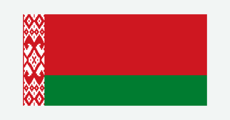
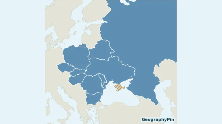
Belarus is predominantly lowland, but its northern lake country, central ridges and southern floodplains are not one uniform landscape.
Belarus is a landlocked country in Eastern Europe, with Minsk as its capital. Its landscape combines glacial hills and plains, northern lakes and the Pripyat wetlands of Polesie. The Belarusian Ridge is elevated country rather than a high mountain chain, while rivers connect the country to both Baltic and Black Sea drainage systems.
How to use this article: Locate the country on the map, read the physical map, explore seasonal climate, or check the population reference.
1. Locate Belarus and Its Neighbors
A landlocked country in Eastern Europe
Belarus lies in Eastern Europe, with Latvia to the north, Russia to the east and northeast, Ukraine to the south, Poland to the west and Lithuania to the northwest. It has no coastline.
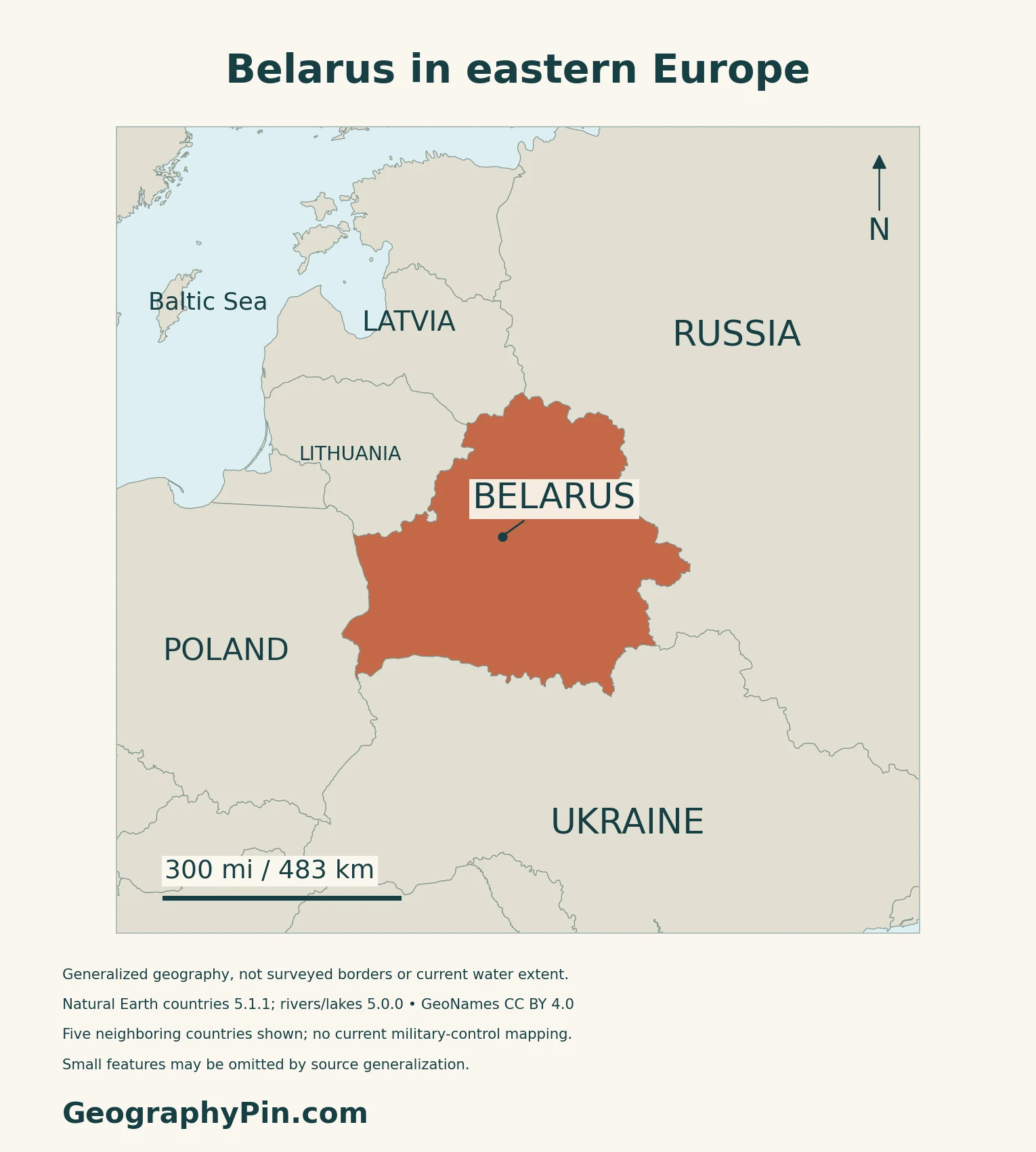
Minsk city is separate from Minsk Oblast
Minsk is the national capital under Article 20 of the Constitution. Administratively, the city is separate from the surrounding Minsk Oblast, rather than being included in that region’s population total.
2. Compare Lake Country, Ridges and Lowlands
Lowland does not mean perfectly flat
| Setting | Physical character | Map interpretation |
|---|---|---|
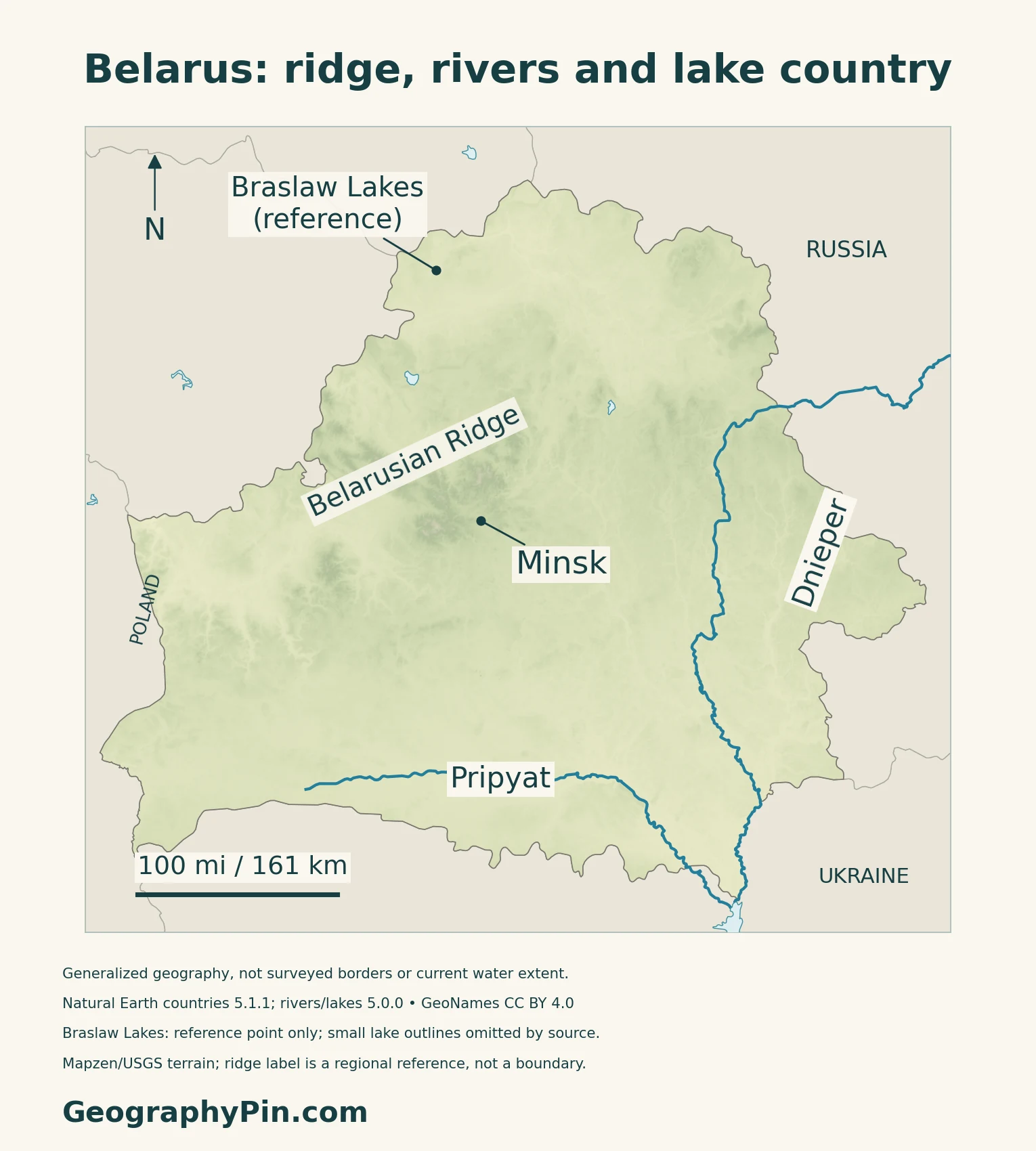
| Northern lake country | Lakes among glacial hills and plains | Braslaw is a reference to a lake district, not one lake |
| Belarusian Ridge | A belt of uplands and adjoining plains | A broad relief label, not a mountain-chain boundary |
| Southern Polesie | Lowland with river floodplains and wetlands | A physical region, not an administrative province |
Past ice sheets shaped more than the hills
Belarus’s national environmental communication describes a landscape strongly influenced by Quaternary glaciations. Northern Poozerie retains younger glacial landforms, while the central ridge and southern lowlands have different combinations of deposits and relief.
Research by geologist Irina Pavlovskaya on the ancient Polotsk lake basin used shorelines, terraces and sediment sequences to reconstruct changes around the last ice sheet. It shows why lake country reflects both glacial deposition and changing drainage, rather than simply water collecting on an otherwise flat surface.
The Polotsk lake in that study is a reconstructed glacial lake, not a present-day lake to look for on this map.
3. Follow Rivers Across the Watershed
Landlocked Belarus drains toward two seas
The Dnieper and Pripyat belong to the Black Sea drainage system. The Western Dvina or Daugava, Neman and Western Bug systems drain toward the Baltic.
The physical map selects the Dnieper and Pripyat to make the eastern and southern water routes legible. It does not show every tributary, canal or catchment boundary. Dnieper and Dnipro are different name forms for the same major river.
The Pripyat is a river within a wider wetland landscape
The 2016 Ramsar information sheet for Mid-Pripyat describes a floodplain landscape of meadows, alluvial forests and wetlands between Pinsk and Turov. Its account links spring flooding and groundwater conditions to the river and its tributaries.
That site-level description helps explain southern Belarus without turning all of Polesie into one protected area. A channel line cannot represent the full floodplain, and neither the map nor the historical site report is a live flood-extent assessment.
4. Connect Water, Land Use and Seasonal Climate
Atlantic influence meets a continental setting
The national environmental communication describes a temperate continental climate shaped by mid-latitude location, Atlantic influence and prevailing westerly air movement. The relatively subdued relief does not create the strong mountain barriers found in many other European countries.
Water abundance and local demand are different questions
OECD’s 2021 water-security assessment uses Minsk to illustrate that distinction. It describes the Vileysko-Minsk system, built in 1968–1976, carrying water from the Viliya reservoir in the Neman basin to the Svisloch in the Dnieper basin.
Floodplain meadows also reflect human activity
The Mid-Pripyat report records haymaking and grazing in floodplain meadows. It also describes shrub growth where those activities declined or stopped. The distinction matters: conserving an open meadow is not necessarily the same management task as leaving a forest untouched.
5. Dated Country Facts and Definitions
| Item | Reference | Date or scope |
|---|---|---|
| Capital | Minsk | Constitution, Article 20 |
| Population | About 9.06 million | Official population figure for January 1, 2026 |
| Surface area | About 80,155 sq mi (207,600 km²) | UNData reference year 2023; not land-only |
| Languages | Belarusian and Russian | State languages under Constitution Article 17 |
| Currency | Belarusian ruble (BYN) | Distinct from the Russian ruble |
| Government | Unitary republic | Constitutional state structure |
| Administration | Six oblasts plus separately administered Minsk city | Minsk city is not part of Minsk Oblast |
A year-start figure, not a new census
The official President’s portal attributes a January 1, 2026 population of 9,056,080 to Belstat. A June 2026 presentation by the head of demographic statistics independently reports the same national figure rounded to 9,056.1 thousand.
The annual figure should not be confused with a fresh enumeration. Belarus’s population-estimate metadata submitted to the UN identifies the October 4, 2019 census as the base for its January 2020 estimate, updated with registered births, deaths and migration. That document describes the earlier estimate’s method, not a new 2026 census.
The six oblasts
The six oblasts are Brest, Vitebsk, Gomel, Grodno, Minsk and Mogilev.
What Did We Learn Today?
Belarus is mostly lowland, with important differences between its northern lake country, central ridge and southern Polesie. Its rivers cross borders and link two sea basins. The Pripyat floodplain and Minsk’s water infrastructure illustrate how physical geography and land use interact, while population figures require a date and method.
Sources & Data Notes
Population references retain their dates and methods. Historical physical-geography sources are not used for current demographic or economic totals. The Polotsk lake study reconstructs an ancient glacial basin, not a modern water body. The 2016 Ramsar site sheet describes Mid-Pripyat rather than all of Polesie; its ecological observations are not a new survey or live flood map. The 2021 OECD account supports the historical water-transfer example, not a current drinking-water supply share.
- Official President portal: Belarus key facts; Belstat January 1, 2026 population and administrative framework
- Irina Bichan, demographic statistics department: June 8, 2026 population presentation, original hosted by CIS-Stat
- Belarus national metadata submitted to UNSD: 2019 census base and method for January 2020 population estimate
- Official current constitutional text in Russian: Articles 1, 17 and 20
- UNData: Belarus, 2023 surface area and national currency
- Belarus Ministry of Natural Resources: 2006 national environmental communication, physical geography and historical climate context
- FAO AQUASTAT historical Belarus profile: lowland, ridge and Polesie background; old statistics not used
- Irina Pavlovskaya, Geological Quarterly 43(2), 1999: original Polotsk glacial-lake research
- OECD, Towards Water Security in Belarus, 2021: drainage systems and historical Minsk water infrastructure
- Mid-Pripyat Ramsar Information Sheet, November 8, 2016: site-level floodplain and land-use description
Map method: Original GeographyPin maps use public-domain Natural Earth countries 5.1.1 and rivers/lakes 5.0.0. The source Dnipro course is labeled Dnieper; supplied Pripyat geometry is retained. Water polygons are generalized, not present water extent. Braslaw Lakes is a reference point because the source omits its small lake outlines. The Belarusian Ridge label is not a surveyed divide or regional boundary. GeoNames supplies Minsk and the Braslaw park reference under CC BY 4.0. Real Mapzen Terrain Tiles provide relief with Mapzen/USGS and upstream credits. WGS84 scales apply locally. The cover uses the generalized country outline and the Commons flag rendition, released into the public domain by its copyright holder, with a complete separate flag.