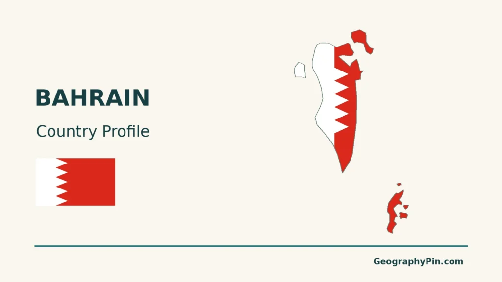
Bahrain is an island country whose geography brings together a limestone interior, shallow Gulf waters and a shoreline reshaped by construction. Manama is its capital, but the country is larger than the capital city and includes islands separated from the main urban cluster.
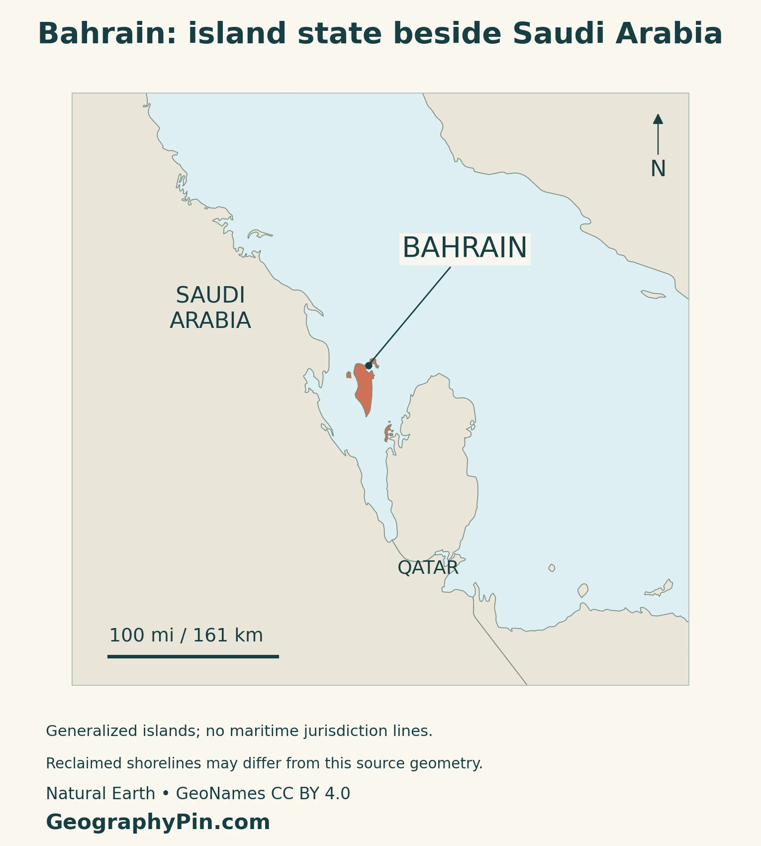
Bahrain is an independent archipelago in the Persian Gulf, east of Saudi Arabia and west of Qatar. The King Fahd Causeway connects it to Saudi Arabia by road, not by a natural land border. Its geographic story is the relationship between island terrain, marine habitats, urban development and reclaimed land.
How to use this article: Locate Hawar, distinguish the causeway from a natural border, compare area definitions, or check population scope.
1. Reading Bahrain’s Island Map
Bahrain Island, Muharraq and the wider archipelago
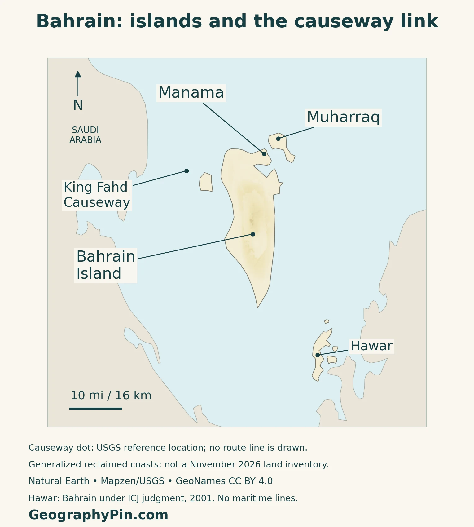
Start with Bahrain Island, the main landmass. Manama lies in its northern part, with Muharraq to the northeast. These names describe different things: Bahrain is the country, Bahrain Island is its principal island, and Manama is the capital city. Treating them as interchangeable hides much of the country’s geography.
Saudi Arabia lies across the water to the west, while Qatar’s peninsula lies to the southeast. On the locator map, follow the water channels before following the roads. An island linked by a bridge remains geographically distinct from the mainland.
Why Hawar appears close to Qatar
The Hawar Islands lie away from the main Bahrain–Muharraq cluster, close to Qatar’s west coast. Geographic proximity alone does not determine sovereignty. In its March 16, 2001 judgment, the International Court of Justice concluded that Bahrain has sovereignty over Hawar, while Janan Island, including Hadd Janan, belongs to Qatar.
That distinction matters when reading a small-scale map. Do not assign every nearby island to the closest mainland or color all islands in the southern group as Bahraini. The map is a geographic overview, not a maritime boundary chart.
A road connection, not a natural land border
Inaugurated in 1986, the King Fahd Causeway links Bahrain with Saudi Arabia across Gulf waters. It is an engineered transport connection between two countries, not evidence that Bahrain is part of Saudi Arabia or a peninsula projecting from it.
2. Low Relief and a Changing Coastline
The interior is more than a flat coastal plain
Bahrain’s national biodiversity strategy describes a central limestone plateau with residual hills, an interior basin and surrounding escarpments. Lower surfaces extend toward the coastal fringe. Jabal Al Dukhan is a prominent feature of this interior, distinct from the low northern urban shoreline.
The terrain map uses elevation data rather than an illustrated mountain pattern. Read its subtle shading as relative relief: a small country can contain meaningful differences between an inland rise, a basin and coastal lowland without having a high mountain range.
Reclamation changes the outline, not just the buildings
NASA’s comparison of Landsat images from August 1987 and August 2022 shows substantial shoreline change, especially in the north. Development enlarged existing islands and created new land. Muharraq’s surroundings illustrate why an older atlas and a modern image may have different outlines even when both label the same island.
NASA’s separate 2022 account of Durrat Al Bahrain describes dredging begun in 2004 and about 2 square miles (5 square kilometers) of new land visible by 2007. Dredging and filling also affect the shallow seabed and its habitats. Added land is not simply a cartographic change.
Land area and territorial water are different measurements
The Survey and Land Registration Bureau’s 2024 series records about 304.2 square miles (787.79 square kilometers) of land. Its separate territorial-water entry is about 2,888.5 square miles (7,481.21 square kilometers). The combined figure, about 3,192.7 square miles (8,269 square kilometers), must not be presented as the size of Bahrain’s landmass.
For this island country, an area value needs both a category and a reference year. A generalized map outline is not a substitute for the official area table, especially where reclamation has altered the shore.
3. Sea Resources and Island Settlement
Muharraq’s heritage connects buildings with oyster beds
The UNESCO property Pearling, Testimony of an Island Economy links seventeen buildings in Muharraq with offshore oyster beds, a stretch of shore and Qal’at Bu Mahir fort. Merchant houses, shops and storehouses record the urban side of a marine economy.
This is a useful geographic connection: the resource was offshore, boats departed from the shore, and trade shaped spaces within the city. The listed property is a defined collection of places, not a designation covering every building on Muharraq Island.
Qal’at al-Bahrain records an older maritime center
Qal’at al-Bahrain, another World Heritage property, preserves the ancient harbor and capital of Dilmun. Its archaeological mound contains layers of occupation accumulated over a long period. The site’s relationship with a sea channel and surrounding landscape helps explain its role as a trading center.
An arid island can still have wetlands
The national biodiversity strategy identifies mangroves around Ras Sanad and Tubli Bay, intertidal mudflats, salt marshes and highly saline coastal flats. These settings are not interchangeable: a mudflat is a tidal surface, while a mangrove habitat includes salt-tolerant trees. Their presence does not imply a rainy national climate.
4. Dry Climate and Managed Water
Low rainfall and humidity can coexist
Bahrain’s climate is arid, with high temperatures and low rainfall; humidity can nevertheless be high. Aridity concerns the water balance, not the absence of moisture in the air. Surrounding seawater and humid air should not be read as signs of an abundant freshwater supply.
Aquifers connect the island to a less visible geography
The National Initiative for Agricultural Development’s AgroBH resource identifies two principal groundwater systems: Dammam and Rus–Umm Er Radhuma. These are geological water-bearing systems beneath the surface, not lakes visible on a country map.
Groundwater is particularly relevant to agriculture.
Desalination needs storage and distribution as well as plants
The Electricity and Water Authority describes a supply chain of production, transmission and distribution. Its water production uses both reverse osmosis and thermal desalination. Produced water moves through pipelines and storage facilities before reaching users.
That network is part of Bahrain’s human geography: settlement depends on infrastructure as well as the island’s natural resources.
5. Country Facts and Population Scope
A compact national reference
| Item | Reference |
|---|---|
| Capital | Manama |
| Population | 1,603,260 in June 2025, iGA nationality-and-sex series |
| Land area | About 304.2 square miles (787.79 square kilometers), 2024 |
| Official language | Arabic |
| Currency | Bahraini dinar (BHD), divided into 1,000 fils |
| Government | Hereditary constitutional monarchy |
| Governorates | Capital, Muharraq, Northern and Southern |
Residents and citizens are not the same total
The Information & eGovernment Authority’s June 2025 nationality-and-sex dataset totals 1,603,260 people: 746,097 Bahrainis and 857,163 non-Bahrainis. The national figure includes both groups. It should not be presented as the number of Bahraini citizens or the population of Manama.
Governorate boundaries provide another statistical frame. The Capital Governorate is not simply a different name for the entire island or the country. A city total, a governorate total and a national total answer different questions even when their labels include the word “capital.”
For broader reference, use the Middle East countries guide and the Asia countries and capitals list.
What Did We Learn Today?
Bahrain is an independent archipelago with a road link to Saudi Arabia, not a natural land connection. Its limestone interior, marine habitats and maritime settlement history sit alongside a changing engineered shoreline. Read maps with their scale and date in mind, keep land area separate from territorial water, and distinguish the whole country’s population from its citizens or capital-city residents.
Sources & Data Notes
Population refers to June 2025, not an undated current estimate. Land and territorial-water areas use the 2024 Survey and Land Registration Bureau series; conversions to square miles are rounded. Historical satellite comparisons explain reclamation, not the exact present-day shoreline. The biodiversity strategy supports broad landscape descriptions, not current habitat-area totals. No fixed island count or precise summit height is asserted. The causeway description is geographic, not a statement about current operating or travel conditions.
- King Fahd Causeway Authority: bilateral connection, 1986 inauguration and Manama
- International Court of Justice: March 16, 2001 judgment summary on Hawar and Janan
- Supreme Council for Environment: National Biodiversity Strategy 2016–2021, terrain, broad climate and habitats
- NASA: Building Bahrain, comparison of August 1987 and August 2022 imagery
- NASA: Making Pearls in the Persian Gulf, historical Durrat reclamation and seabed effects
- UNESCO: Pearling, Testimony of an Island Economy
- UNESCO: Qal’at al-Bahrain, Ancient Harbour and Capital of Dilmun
- AgroBH: groundwater systems, updated January 2026
- Electricity and Water Authority: desalination, transmission and distribution, updated June 2026
- Information & eGovernment Authority: June 2025 population by nationality and sex
- Survey and Land Registration Bureau: 2024 land and territorial-water areas
- Information & eGovernment Authority: four governorates in the June 2025 series
- WIPO Lex constitutional record: hereditary monarchy and Arabic; English translation is not a latest-law certification
- Central Bank of Bahrain law, Article 13: dinar and fils
Map method: Original GeographyPin maps use public-domain Natural Earth geometry and GeoNames locations under CC BY 4.0. Continuous relief shading comes from Mapzen Terrain Tiles and USGS elevation data; it is not a classified elevation map. All seven Bahrain source components are retained, but small islands and recent reclamation are generalized or omitted. This is not the geometry behind the official 2024 area statistic or a current land inventory. The causeway dot uses a USGS reference location, not a road route. No maritime jurisdiction lines are drawn. The feature uses a decorative flag-filled outline with a separate intact flag. Map source components are not a national island count.
