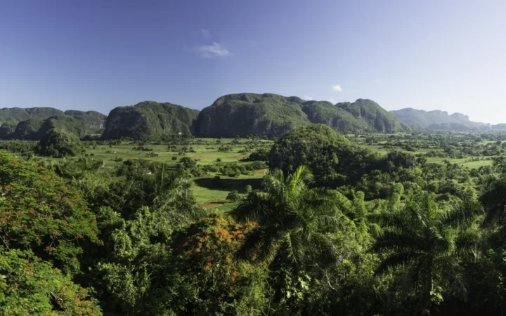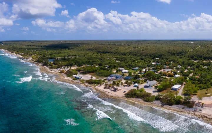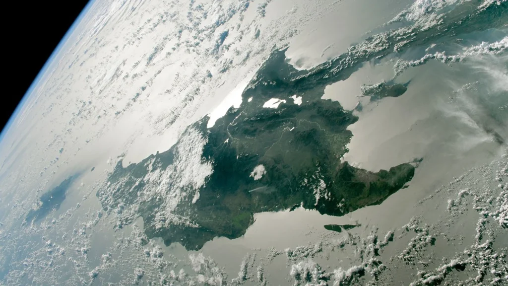
The largest islands of the northern Caribbean are easy to recognize by their coastlines. Their political labels are trickier: one island contains two countries, and another shares its name with a territory that includes several islands.
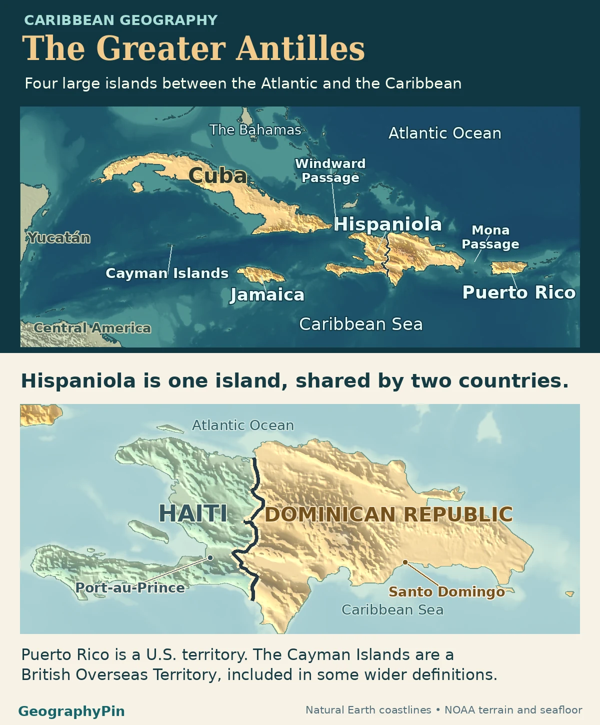
Cuba, Hispaniola, Jamaica and Puerto Rico are the four largest islands of the Greater Antilles. Haiti and the Dominican Republic share Hispaniola, while Puerto Rico is a U.S. territory. Some definitions also include the Cayman Islands, but those smaller islands are not part of the four-largest-islands comparison.
How to use this article: Compare island and jurisdiction counts, locate Haiti and the Dominican Republic or check which islands belong to Puerto Rico.
The four largest islands and what the map counts
The familiar Greater Antilles core consists of Cuba, Hispaniola, Jamaica and Puerto Rico, the four largest islands in this Caribbean group. Caribbean marine research names the four large islands separately while including the much smaller Cayman Islands in its broader geographic grouping. That distinction matters: “the four largest” is not a claim that only four islands belong.
Four islands, five political labels
Follow the coastline to count the main islands, then find the land border on Hispaniola to count jurisdictions. Across these four main islands there are five entries: four sovereign Caribbean countries on the UN member roster and one U.S. territory. Both island and sovereign-country totals happen to be four, but the lists are different. Haiti and the Dominican Republic share one island, while Puerto Rico is an island without being a sovereign country.
Cuba: the western anchor of the largest-island group
Cuba is the long island at the western end of the four. To its west, the Yucatán Channel separates it from Mexico’s Yucatán Peninsula. At the other end of Cuba, the Windward Passage lies between eastern Cuba and Haiti’s side of Hispaniola. The Dominican Republic’s 2026 marine sanctuary plan places both passages in their regional context.
Cuba is also the name of a country. Its island geography includes Isla de la Juventud southwest of the main island, in the Canarreos archipelago. If you are comparing the size of the four main islands, you are comparing Cuba’s big outline, not adding all the smaller islands that belong to the country.
Hispaniola: one island, two countries
Find Haiti on the west and the Dominican Republic on the east
A relief or satellite map shows a single landmass; a political map places an international border across it. The southern part supplies a concrete example. UNESCO’s transboundary biosphere reserve brings together La Selle on the Haitian side and Jaragua–Bahoruco–Enriquillo on the Dominican side. Conservation areas on each side retain their country affiliations even where the landscape crosses the border.
| Physical island | Political labels on that land |
|---|---|
| Cuba | Cuba, a sovereign country |
| Hispaniola | Haiti and the Dominican Republic, two sovereign countries |
| Jamaica | Jamaica, a sovereign country |
| Puerto Rico | Puerto Rico, a U.S. territory |
Jamaica and Puerto Rico are not the same kind of map label
Look south of Cuba and west of Haiti for Jamaica. The main island is the third-largest in the Caribbean, as the University of the West Indies notes. Jamaica is also the name of a sovereign country that includes offshore features; its National Land Agency distinguishes the separate Morant and Pedro Cays from the main landmass.
Puerto Rico includes more than the main island
Puerto Rico lies east of Hispaniola across the Mona Passage. The territorial name includes the main island and smaller islands: the U.S. Geological Survey shoreline study maps Vieques and Culebra separately, both east of the main island. Counting islands requires separating those shapes. Counting territories treats them as parts of Puerto Rico, not as additional countries.
Where the Cayman Islands fit
The Cayman Islands sit south of Cuba and northwest of Jamaica. The United Nations country office describes Grand Cayman, Cayman Brac and Little Cayman as the three main islands of a single British Overseas Territory. They are much smaller than the four core islands, but that does not put them outside every definition of the Greater Antilles.
Scope depends on what the source is mapping. The Smithsonian’s West Indian flora project includes the Caymans and also groups the Virgin Islands with the Greater Antilles under a broader convention. The USGS 2025 geological synthesis maps those areas together under a title that names the Virgin Islands separately. A map of the four largest physical islands can leave these smaller groups as context without making a universal claim that they are outside the region.
Frequently Asked Questions
Is Isla de Mona part of Hispaniola or Puerto Rico?
It is part of Puerto Rico. The USGS geology report places Mona west of the main Puerto Rican island, in the passage between Puerto Rico and Hispaniola. The island and the passage share a name, but one is land and the other is the water gap.
Why do some maps show a bank rather than an island south of Jamaica?
A bank is a raised area of the seabed, not necessarily land above the water. The Jamaica National Land Agency distinguishes offshore cays from the banks they sit on. A bathymetric grid such as GEBCO 2026 shows underwater relief, which is different from a coastline layer.
Are the Bahamas part of the Greater Antilles?
They are usually shown separately to the north. The Smithsonian’s Caribbean geography treats the Bahamas and Turks and Caicos as the Bahamian archipelago, a separate island group. Both can be visible on a map of the northern Caribbean without being part of the same island group.
What Did We Learn Today?
Cuba, Hispaniola, Jamaica and Puerto Rico are four large physical islands. The four sovereign countries are Cuba, Haiti, the Dominican Republic and Jamaica; Puerto Rico is a territory. The Caymans can belong to a wider geographic grouping without changing either list in the four-island comparison.
Sources & Data Notes
The main-island scope follows published geographic and marine sources. The UN and U.S. Department of the Interior supply political status, UNESCO documents the shared Hispaniola landscape, and national and USGS maps distinguish offshore islands and passages. The Greater Antilles label is a geographic convention, not a sovereign roster or maritime boundary.
Photo: Hispaniola astronaut photograph ISS068-E-36387, January 2, 2023. Image courtesy of the Earth Science and Remote Sensing Unit, NASA Johnson Space Center (cropped). Public-domain NASA image; see https://eol.jsc.nasa.gov/FAQ/. Map data: Natural Earth, NOAA ETOPO 2022.