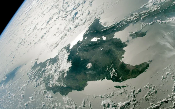
Cuba and Hispaniola take up much of the land in a comparison of the largest Caribbean islands. But an island’s area is not the same as a country’s area, and a wider definition of the Caribbean can change what belongs on the list.
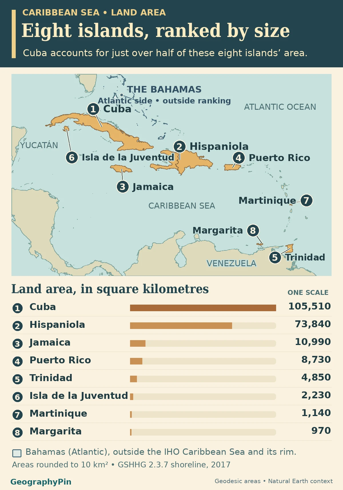
Cuba is the largest island in this Caribbean Sea comparison, followed by Hispaniola, Jamaica and Puerto Rico. Cuba measures about 40,738 square miles (105,510 km²) on the common coastline source. Hispaniola is counted once even though Haiti and the Dominican Republic share it. The ranking measures individual islands within the sea or along its rim.
How to use this article: See how Cuba compares with the other seven, why Hispaniola is one row or which islands count at the sea’s edge.
The eight largest islands within the Caribbean Sea or on its rim
Each row below is one naturally separate landmass. The scope follows the named Caribbean Sea or islands on its rim, using the International Hydrographic Organization’s published sea limits for geographic orientation. That is narrower than a Caribbean culture or country list. The 2017 GSHHG coastline release is the common area source for every ranked row.
| Rank and island | Approx. land area (km²) | Approx. land area (sq mi) | Country or territory |
|---|---|---|---|
| 1. Cuba | 105,510 | 40,740 | Cuba |
| 2. Hispaniola | 73,840 | 28,510 | Haiti and the Dominican Republic |
| 3. Jamaica | 10,990 | 4,240 | Jamaica |
| 4. Puerto Rico | 8,730 | 3,370 | U.S. territory |
| 5. Trinidad | 4,850 | 1,870 | Trinidad and Tobago |
| 6. Isla de la Juventud | 2,230 | 860 | Cuba |
| 7. Martinique | 1,140 | 440 | France (overseas territorial collectivity) |
| 8. Margarita | 970 | 380 | Venezuela |
At Guadeloupe, the source geometry joins two neighboring landmasses rather than separating them across the Rivière Salée. The French National Assembly’s geography report describes Basse-Terre and Grande-Terre as separate islands of about 848 and 588 km² respectively. Both are smaller than Margarita, the eighth ranked island, but their independent figures are not substituted into the coastline-based table. The published ranking stops at eight rather than assigning lower ranks from mixed data.
Island area is not country or territory area
Cuba accounts for just over half of these eight islands’ area
Cuba has about 105,510 km² of mapped land in its main island. Divide its unrounded area by the sum for all eight ranked islands and the resulting share is about 50.7%. This is not a share of all Caribbean land. Cuba’s Isla de la Juventud has its own shoreline, so its land area is not added to the large island.
A political label in the table tells you whose island or territory it is. It does not decide eligibility. Puerto Rico is a U.S. territory, and Martinique is an overseas territorial collectivity of France. Both have their own rows because each is one physical island under this comparison.
Hispaniola is one landmass shared by two countries
Measure the shoreline once, not either side of the border
Haiti lies to the west and the Dominican Republic to the east. The land border divides jurisdictions. It does not separate one body of land from another, so there is one table row for Hispaniola. Using either country’s area would measure a different unit, and summing every island administered by both would add land beyond Hispaniola’s shoreline.
The calculation can be repeated from the full-resolution source: Hispaniola’s outer polygon, ID 29, encloses about 74,316 km²; subtract about 474 km² of separately mapped inland water. The result is about 73,842 km² before display rounding, or 73,840 km² in the table. The border adds context but does not enter the arithmetic.
Why Trinidad is in scope and the Bahamas are not
Use the named sea’s edge rather than the wider region
The chosen hydrographic reference treats islands along the boundary as part of the rim. The IHO’s section on the Caribbean Sea runs a portion of the boundary through Trinidad, from Galera Point to Galeota Point. The comparison includes the whole island rather than cutting its land area at that line.
The Bahamas lie in the Atlantic beyond that named sea. They can be part of the wider Caribbean in cultural or regional usage, but they are not candidates for this particular table. The same narrower rule leaves Turks and Caicos outside. The map shows general geographic context, not a claim about political waters.
What the method can verify and where the ranking stops
The full-resolution GSHHG 2.3.7 release represents a 2017 compilation, not a common field survey of every coast on that date. The calculation follows the full outer shoreline on the WGS 84 ellipsoid and subtracts its separately mapped inland-water polygons. The unrounded values determine the order; the table rounds both units to the nearest 10.
There are no ties among the eight measured values. Exact ties would share a rank. Unmeasured or misjoined outlines are neither assigned zero nor ranked as if they were separate measured islands.
Frequently Asked Questions
Why is Tobago not in Trinidad’s row?
Trinidad and Tobago is the name of the country, not one island. The country’s health ministry describes Tobago as a separate landmass of about 300 km². It is neither added to Trinidad nor large enough for these eight rows.
Does the Puerto Rico row include Vieques or Culebra?
No. A U.S. Fish and Wildlife Service coastal atlas distinguishes Vieques and Culebra from the main island. The ranking includes the main island only, even though those smaller islands are part of the same territory.
How much rounding would make Martinique and Margarita look tied?
At the nearest 1,000 km², both would display as about 1,000 km². They differ by about 164 km² in the underlying calculation, so rounding cannot be used to decide their rank.
What Did We Learn Today?
Cuba ranks first by mapped land area in the Caribbean Sea and rim comparison. Hispaniola is one island despite its land border, and the area of a multi-island country does not go into a single row. The chart compares eight islands from one coastline release rather than extending the list with differently measured areas.
Sources & Data Notes
Areas are original calculations from the full-resolution GSHHG 2.3.7 coastline release of 2017. Geographic scope follows the named sea and its rim using the IHO’s published reference, not the wider cultural Caribbean. The French National Assembly independently identifies the two Guadeloupe landmasses and resolves their relation to the cutoff without replacing the original source.
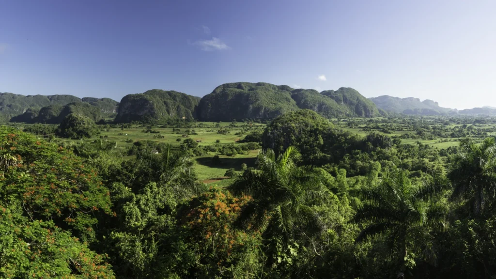
Photo: Viñales Valley in Cuba by Baldo Simone, June 6, 2015, CC BY-SA 4.0 (cropped and resized, same terms). Map data: Natural Earth, GSHHG shoreline database v2.3.7, Pål Wessel and Walter H. F. Smith (GNU LGPLv3 or later; rendered geographic shorelines; area and ranking derived by GeographyPin).