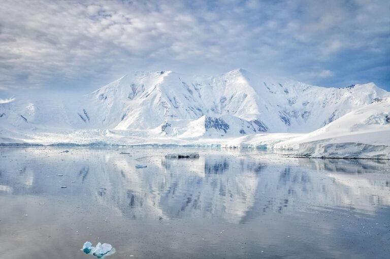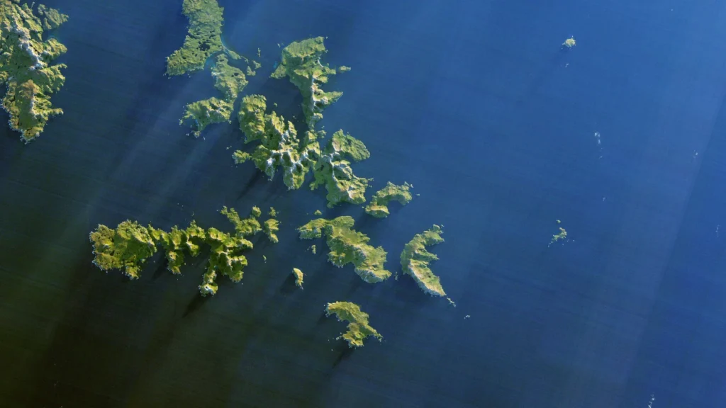
Between South America and Antarctica, the islands give the Drake Passage its shape on a map. Below the surface, a ridge and deep channels help explain why the currents do not spread evenly across it.
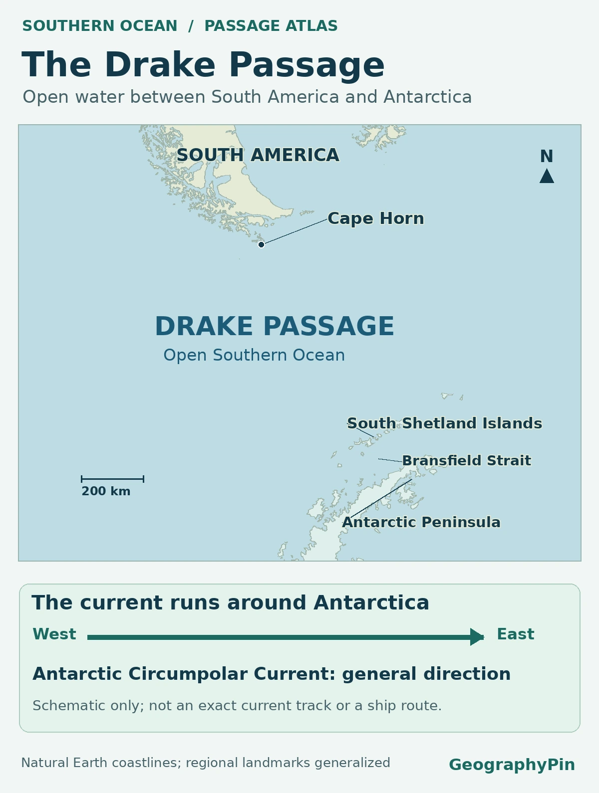
The Drake Passage is the broad stretch of ocean between Cape Horn at the southern end of the Tierra del Fuego archipelago and the South Shetland Islands off the Antarctic Peninsula. It is roughly 500 miles (800 km) across on a regional map and links the Pacific and Atlantic sectors of the Southern Ocean.
How to use this article: Find Cape Horn on the north side, separate the islands from the Antarctic mainland, or read what instruments measured across the passage.
The gap between South America and Antarctica
On a regional map, the passage lies south of the Tierra del Fuego archipelago and north of the outer islands of the Antarctic Peninsula. An ocean sediment study describes this gap as roughly 500 miles (800 km) wide, using Cape Horn and the western Antarctic Peninsula region as the broad reference. That is a scale for the ocean gap, not a precise minimum between two surveyed points.
A ship’s distance depends on its start, destination and route. The length of an offshore line of research instruments is a third convention, not a replacement for either a headland-to-island distance or a sailing itinerary.
Cape Horn is on an island, not the mainland
Find Isla Hornos before reading south
The Chilean Navy’s Cape Horn geography locates Cabo de Hornos on the southern tip of Isla Hornos. This is the northern landmark for Drake Passage, not the southern tip of mainland South America. Cape Froward marks that mainland point farther north on the Strait of Magellan.
The Strait of Magellan winds inside the archipelago’s northern edge. Drake Passage is in open ocean outside the islands. A route rounding Cape Horn does not pass through the Strait of Magellan simply by entering the wider region.
The South Shetland Islands and Bransfield Strait
The island chain comes before the peninsula
Across the passage, the South Shetland Islands lie off the Antarctic Peninsula. Livingston Island and King George Island belong to this chain. British Antarctic Survey research identifies Bransfield Strait as the separate basin between those offshore islands and the peninsula. A point on an island and a point on the Antarctic mainland consequently give different distances from Cape Horn.
The Antarctic Circumpolar Current and the submerged ridge
The current is a broad system of moving fronts
The Antarctic Circumpolar Current generally flows eastward around Antarctica and is squeezed between the continents here. It includes narrower bands of fast flow and sharp transitions in water properties, called fronts. They move and meander; lines on an ocean atlas typically represent an observed or averaged position, not borders.
The cDrake researchers identified the Shackleton Fracture Zone as a raised seafloor feature crossing their roughly 500-mile (800-km) instrument line. It is submerged, not an island chain. Its influence is different from that of a coast: it can steer deep flow without blocking the sea surface.
In the southern passage, one bathymetric study describes the ridge rising from about 13,100 feet (4,000 m) below the surface to about 4,900 feet (1,500 m). Those depths describe one part of the ridge, not its whole length or the waves on a particular crossing.
A study of the cDrake instruments estimated a mean of 173.3 million cubic meters per second across the passage for 2007–2011. That measures water volume through the whole observed section, not its surface speed. A comparison of the observing programs reports a lower estimate of 141 million cubic meters per second from the separate DRAKE program and tests how differences in sampling and analysis can affect the results. Neither value is a new prediction for a specific time or place.
Why one crossing can feel different from another
Weather systems and the long stretch of open sea allow wind waves and swell to develop and travel. Different combinations of local wind and swell arriving from a distant storm can make conditions change without any change in the passage’s width. A Southern Ocean wave-climate study tracks those patterns across the region; it does not supply a forecast for one ship.
During the 2016–2017 austral-summer Antarctic Circumnavigation Expedition, researchers encountered two unusually windy storms while approaching and crossing the passage, yet their Drake crossing recorded significant wave heights of at most about 13 feet (4 m). Significant wave height describes the sea state statistically, not the height of the single largest wave. One observed crossing is not a limit or a typical value for all voyages.
Frequently Asked Questions
Do Pasaje de Drake and Mar de Hoces mark different water?
No. The Spanish Antarctic place-name account discusses both names for this passage. The Chilean Navy uses Paso Drake, and Drake Passage is the usual English name. The name variation does not resolve historical claims about who first reached these waters.
What is one sverdrup on an ocean map?
One sverdrup (Sv) is a million cubic meters per second. The cDrake study uses it to report the volume passing through an entire section, including flow far below the surface. A forceful narrow jet can carry less water than a much wider current.
Does a line for the Polar Front also mark the edge of sea ice?
No. The Polar Front describes a transition between water masses. Ice extent is a different observation that changes with time. The Antarctic Circumnavigation Expedition identifies its front and its satellite-based sea-ice observations separately. Give any mapped ice edge its observation dates.
Can you look up older maps of the passage?
Yes. The Australian Antarctic Data Centre catalog includes a Drake Passage chart published by Argentina’s naval hydrographic service. Its vintage matters if you are comparing coast depiction or names, rather than just locating the passage.
What Did We Learn Today?
Cape Horn and the South Shetland Islands locate a broad ocean passage, while Bransfield Strait is the separate waterway behind those islands. The Antarctic Circumpolar Current moves through the gap over a complex seafloor. Width, current transport and wave height answer three different questions, and observations of ocean conditions need a date.
Sources & Data Notes
Geographic references include the Chilean Navy and the British Antarctic Survey. The ocean transport values are from separate research programs, and the wave figure describes the named expedition’s crossing only. Relief and orientation are not a chart or sea-state forecast. AI tools assisted in preparation.
Map: GeographyPin. The generalized coast is Natural Earth 1:10m, public domain. Geographic naming and frame follow the NOAA Ocean Archive System's Drake Passage entry and the British Antarctic Survey circumpolar-current overview. The direction diagram is original; it does not reproduce BAS’s map. Neither ocean boundaries, a sampled transect, seabed ridges nor sea ice are shown. Local scale applies around the bar’s latitude.
Cape Horn: A Mariner’s Nightmare, NASA Earth Observatory image by Jesse Allen using USGS Landsat 8 OLI data acquired July 12, 2014. NASA imagery policy and USGS EROS public-domain data citation. Federal image; cropped, resized and converted to WebP. No agency endorsement implied.