Liberia is a West African country with its capital, Monrovia, on the Atlantic coast. The Saint Paul River links the Guinean interior with this coastal setting. Following that connection puts the capital in a wider geographic context than the shoreline alone.
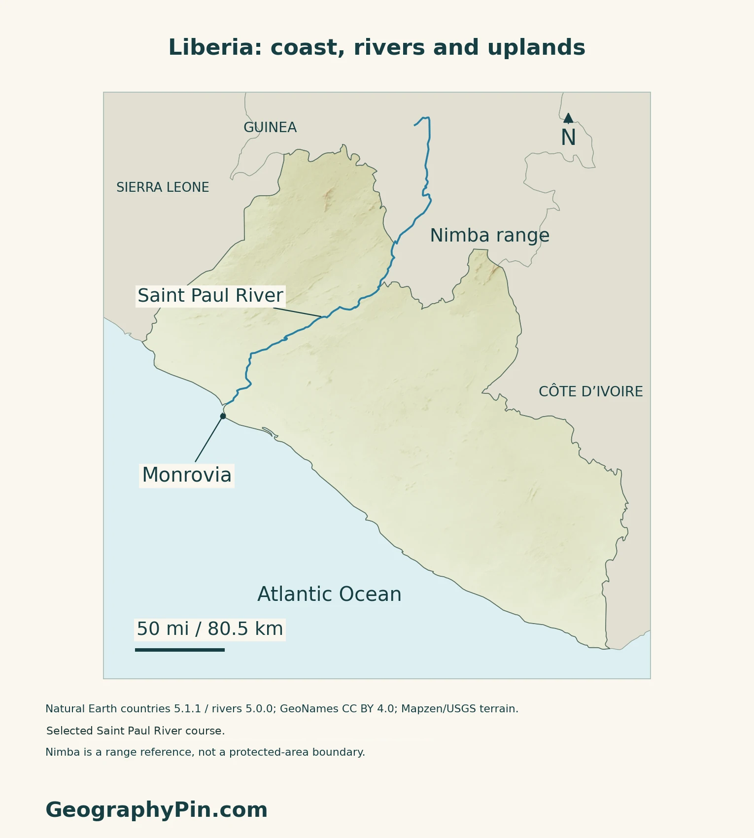
Liberia’s coast is low, with lagoons, creeks and mangrove wetlands. Inland, rolling hills give way to plateaus and northern highlands, including the Liberian part of the Nimba range. These are broad terrain settings, not rigid belts: forests and river valleys cross them, and the coast-to-interior transition is not equally steep everywhere.
How to use this article: Locate the country, compare the physical settings, or follow the Saint Paul River.
1. Locate Liberia and Its Atlantic Capital
Three land neighbors and an ocean frontage
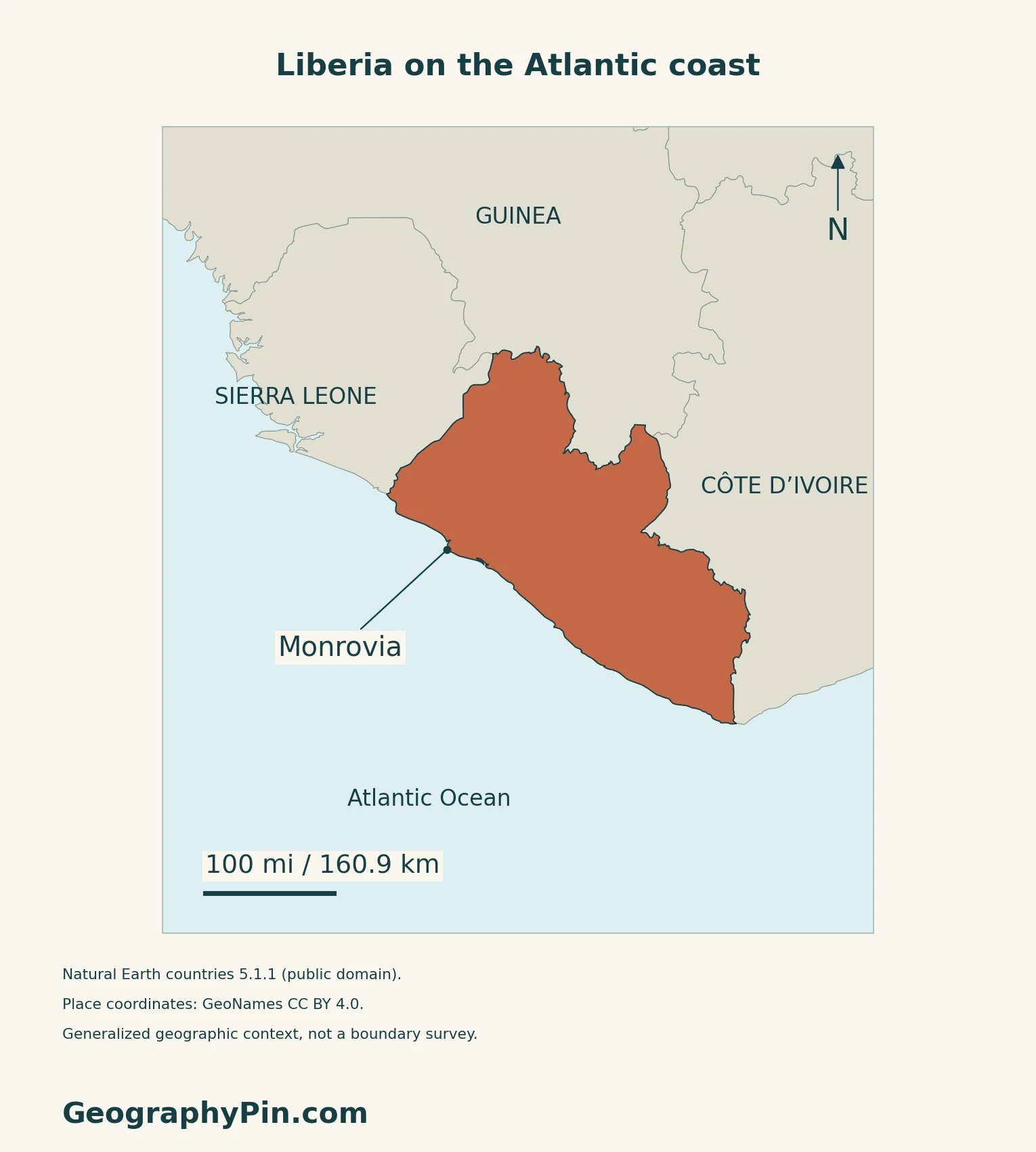
Liberia lies in West Africa, between Sierra Leone to the northwest and Côte d’Ivoire to the east, with Guinea along its northern side. The Atlantic Ocean lies to the southwest. Monrovia, the capital, is on the coast rather than in the northern highlands.
Wetlands are part of the coastal setting
The Environmental Protection Agency’s February 2025 wetlands account identifies Mesurado Wetland in Montserrado County, as well as Lake Piso in Grand Cape Mount and Marshall Wetland in Margibi. The agency links wetland conservation with coastal protection, flood mitigation, biodiversity and livelihoods such as fishing.
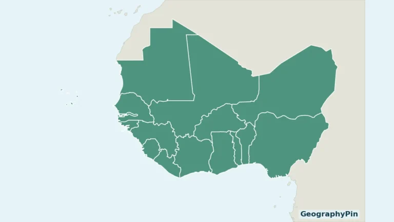
For the surrounding countries and capitals, see the West Africa map.
2. Compare the Coast, Plateaus and Northern Highlands
Read the relief from coast toward interior
The government’s September 2025 climate contribution distinguishes coastal plains, rolling hills, interior plateaus and northern highlands.
| Setting | Geographic character |
|---|---|
| Atlantic coastal plain | Low land with tidal creeks, lagoons and mangrove environments. |
| Rolling hills | A transition of hills, valleys and waterways behind the coast. |
| Interior plateaus | Higher, undulating country occupying much of the interior. |
| Northern highlands | Ridges near Guinea, including the Nimba area in the northeast. |
The Nimba range crosses national boundaries
Nimba is a borderland mountain system associated with Liberia, Guinea and Côte d’Ivoire. Its physical extent should not be confused with the UNESCO World Heritage property called Mount Nimba Strict Nature Reserve: the listed property is in Guinea and Côte d’Ivoire, not Liberia. UNESCO describes forested lower slopes and high mountain grasslands within the reserve, illustrating the landscape’s vertical contrasts.
3. Follow the Saint Paul River and Forest Landscapes
A river connection with Guinea
The Saint Paul begins as the Diani in southeastern Guinea and flows southwest through Liberia toward the Atlantic near Monrovia. The January 2026 environmental assessment for the Mount Coffee extension describes this cross-border course.
Mount Coffee provides a concrete link between river geography and energy. The same assessment describes marked seasonal flow variation in the basin. Its extension designs are project proposals and modeled operating arrangements, not evidence that all planned equipment is already operating.
A forest estimate needs a date and definition
Liberia’s 2018–2019 National Forest Inventory estimated that forest covered about 69% of its assessed land area under the national definition used in that survey. That definition required at least 30% canopy cover and a minimum area of about 2.47 acres (1 hectare), with trees at least 16 feet (5 meters) high or capable of reaching that height.
Qualifying fallow land could count as forest, while predominantly agricultural land such as rubber and oil-palm cultivation did not. This is a dated inventory result, not a current percentage or a claim that every forest is untouched. The survey did not plan to enumerate mangrove forests, so it should not be treated as a dedicated mangrove assessment.
4. Connect Rainfall With the Coast and Interior
Warm conditions, seasonal rain and regional differences
Liberia’s national communication submitted in July 2026 describes a warm, humid country influenced by the African monsoon, with a rainy season and a drier part of the year. Its broad comparison places higher rainfall along the coast than in northern inland areas. Monrovia is therefore not a reliable rainfall average for the whole country.
The report draws on earlier observations and studies; its submission date does not mean every climate figure represents conditions measured in 2026.
5. Check Dated Country Facts
| Item | Reference |
|---|---|
| Capital | Monrovia |
| Census reference | 5,250,187 people; 2022 census, as reported in LISGIS’s June 2024 thematic analysis |
| Surface area | About 43,000 sq mi (111,369 km²); UNData’s 2023 reference |
| Official language | English, as identified by the Ministry of Local Government |
| Currencies | Liberian dollar (LRD); the US dollar is also legal tender |
| Administrative divisions | 15 counties |
A census count and a later projection
The 2022 census total above comes from LISGIS’s later thematic report, rather than the provisional total of 5,248,621 announced in February 2023. It describes the census population, not today’s population or a count of citizens abroad. UNData separately gives a 2025 medium-fertility projected estimate of 5.731 million. A projection and a census count should not be presented as interchangeable observations.
Language, counties and two currencies
The Ministry of Local Government identifies English as the official language and describes a country of fifteen counties with indigenous linguistic diversity. Monrovia is in Montserrado County; the county and the capital city are not identical statistical units.
The Central Bank distinguishes the Liberian dollar as the official currency while confirming that US dollars are also legal tender.
For a broader comparison, see the African countries and capitals reference.
What Did We Learn Today?
The Saint Paul crosses a national boundary, while forest statistics and Nimba’s protected-area status need their own definitions.
Sources & Data Notes
Sources, dates and map conventions
The census figure is read from the original LISGIS June 2024 thematic report hosted by UNFPA. No exact census-night date or usual-resident methodology is asserted. The separate UNData 2025 figure is a medium-fertility projection, and its surface-area reference is 2023. English is attributed to the ministry’s description, not an independently verified statutory language clause. The September 2025 climate contribution supports broad terrain classes, not a surveyed boundary between them. Nimba’s physical range is distinct from the UNESCO property in Guinea and Côte d’Ivoire. The January 2026 Mount Coffee assessment supports the river’s geographic course and seasonal behavior; proposed extensions are not asserted to be completed. The 2018–2019 forest inventory uses its own national definition and assessed land denominator, not today’s forest cover. Climate context comes from the national communication submitted July 7, 2026, which incorporates older studies; conflicting precise monthly summaries are not reproduced. The February 2025 EPA wetlands account is used for named sites and functions, not current site counts or legal enforcement status.
- LISGIS: June 2024 census thematic report, national total on printed page 5
- UNFPA: final-results publication listing, August 2025
- UN Liberia: February 23, 2023 provisional census announcement
- UNData: 2025 projected estimate and 2023 surface area
- Ministry of Local Government: capital, counties and language
- Central Bank of Liberia: official currency and dual legal tender
- Government: September 2025 NDC 3.0, geographic terrain framework
- EPA: February 2025 wetlands account
- UNESCO: Mount Nimba Strict Nature Reserve and country scope
- Republic of Liberia: January 2026 Mount Coffee extension environmental assessment
- Forestry Development Authority: 2018–2019 National Forest Inventory
- Government: national communication submitted July 2026, climate context
Original maps and artwork: Natural Earth countries 5.1.1 and rivers 5.0.0 (public domain) supply generalized outlines and the selected Saint Paul course. The river is not extended to fill source gaps or portray a complete drainage network. GeoNames (CC BY 4.0) supplies Monrovia. Nimba is a broad transboundary range label, not a World Heritage property boundary. Small coastal features are generalized.
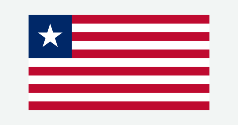
Mapzen/USGS Terrarium elevation supplies qualitative relief, not forest cover. Some elevation values in coastal and river lowlands are omitted; gaps in the shading do not represent flat ground, and no surveyed summit heights are claimed. The cover uses a Flagpedia rendition licensed for free website reuse. Its 19:10 proportions are rendition-specific; the Foreign Ministry’s 2021 description corroborates eleven stripes, a blue canton and one white star.