Guinea is a West African country whose capital is Conakry, distinct from neighboring Guinea-Bissau and its capital, Bissau. Its highlands feed regional river systems, while its Atlantic lowlands and southeastern forest region give the country several different geographic settings.
Guinea is important to several West African river systems because its highlands contain headwaters and upper catchments of rivers that cross national borders. The Fouta Djallon and wider Guinean uplands feed the Gambia, Senegal and Niger systems. Their value lies in this upstream position, not in all three named rivers following the same course through Guinea.
How to use this article: Locate the country, compare the natural regions, or follow headwater connections.
1. Locate Guinea Between the Atlantic and the Interior
Conakry faces the Atlantic coast
Guinea is a West African country with an Atlantic coastline. Guinea-Bissau and Senegal lie to its northwest and north, Mali to the northeast, Côte d’Ivoire to the east, and Liberia and Sierra Leone to the south. Conakry is the national capital on the coast.
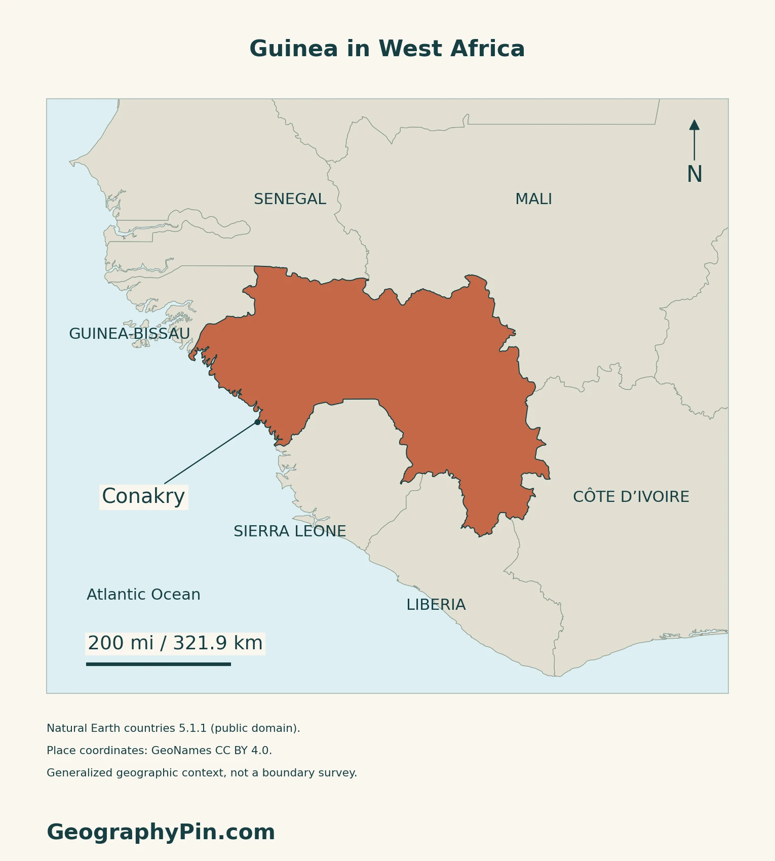
Guinea is not Guinea-Bissau
The neighboring Republic of Guinea-Bissau is a separate state whose capital is Bissau.
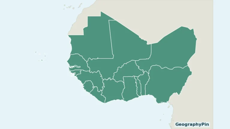
The West Africa countries map puts these neighbors in their wider regional setting.
2. Compare Four Natural Regions
A landscape framework, not an administrative map
Guinea’s national adaptation programme distinguishes four natural regions. Their names describe broad differences in terrain and environment; they should not be substituted for current administrative regions or prefectures.
| Natural region | Geographical character |
|---|---|
| Maritime or Lower Guinea | Atlantic coastal lowlands, estuaries and the transition toward the interior. |
| Middle Guinea | The Fouta Djallon highlands, with plateaus and deeply cut valleys. |
| Upper Guinea | Inland plateaus and plains associated with the upper Niger system. |
| Forest Guinea | The southeastern uplands and forest landscapes near Liberia and Côte d’Ivoire. |
3. Trace Headwaters Across National Borders
Several river systems, not one national river
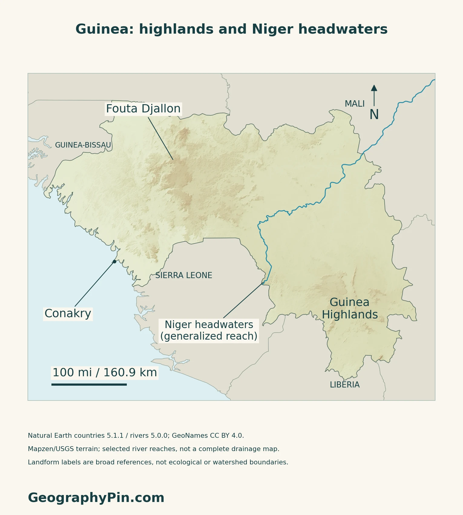
The Guinean highlands contain headwaters and upper catchments feeding the Gambia, Senegal and Niger systems. FAO’s 2024 account emphasizes that their importance extends to countries downstream.
The Bafing connects Guinea with the Senegal River
OMVS places the Bafing’s source near Mamou in the Fouta Djallon. It flows north from Guinea and joins the Bakoye at Bafoulabé in Mali, where the Senegal River takes that name. The distinction matters: a map labeled “Senegal River” may discuss a basin that includes Guinean headwaters without showing that named main stem inside Guinea.
The Niger initially heads toward the interior
The Niger and several important tributaries drain northeast from the Guinean highlands, while other rivers drain toward the southern or western coasts. The national climate communication describes this drainage divide.
Follow the full course and its two delta settings in the Niger River map guide.
4. Connect Rainfall, Highlands and Forest Landscapes
The coast and interior do not share one climate
The 2018 national climate communication describes a wetter coast, cooler highland nights, a drier Upper Guinea interior and a longer rainy period in the forested southeast. It gives May–October as the broad wet season for much of the country, with regional variation. Those are climatic patterns, not a forecast or a fixed timetable for every place.
Mount Nimba is a border landscape
The Nimba massif lies in the border area of Guinea, Liberia and Côte d’Ivoire. UNESCO describes dense forest on lower slopes and montane grasslands higher up. The inscribed Mount Nimba Strict Nature Reserve is a transboundary property in Guinea and Côte d’Ivoire; the massif’s extension into Liberia does not make Liberia part of that listed property.
Highland conservation also has a water dimension. FAO’s June 2024 mission reported pressures from ecosystem degradation and unsustainable land use around Fouta Djallon headwaters.
5. Check Dated Country Facts
| Item | Reference |
|---|---|
| Capital | Conakry |
| Population reference | 17,521,167 residents; preliminary 2025 census |
| Surface area | About 94,918 sq mi (245,836 km²); UNData’s 2023 reference |
| Currency | Guinean franc (GNF) |
| Official languages | National languages and French; French is also the working language |
| Constitutional form | Unitary republic under the Constitution promulgated in September 2025 |
A preliminary resident count
Guinea’s National Institute of Statistics reports 17,521,167 residents from the fourth general population and housing census. Enumeration took place nationwide from July 1 to 31, 2025, and the total includes foreign residents. The February 2026 release and subsequent March decree identify these results as preliminary. Official publication does not turn them into a final census result or a population projection for November 2026.
National languages and French have distinct legal roles
Article 5 of the Constitution promulgated on September 26, 2025, makes the national languages and French official languages, while designating French as the working language. It provides for an organic law to determine implementation. This distinction should not be replaced by the older shorthand that French alone is official.
For a broader comparison, see the African countries and capitals reference.
What Did We Learn Today?
Guinea’s coastal capital and its upland headwaters tell different parts of the same country’s geography. Natural regions, national borders and river basins are distinct ways to read the map.
Sources & Data Notes
Sources, dates and map conventions
Population is the INS preliminary 2025 resident census total, including foreigners, not a current estimate. The census reference uses the INS release and decree explanation. Surface area uses UNData’s dated surface convention, not land area alone. Legal wording follows the promulgated September 2025 Constitution, not its draft. Administrative counts are omitted following recent reorganization; the four natural regions are not administrative units. The 2007 adaptation programme is used for stable physical-region descriptions, not current population or forest-cover totals. The 2018 climate communication supports broad climatic and drainage contrasts, not a current seasonal forecast. FAO’s conservation account is explicitly dated June 2024. The Nimba massif and UNESCO property have different geographic scopes; no protected-area boundaries are inferred from the relief map.
- INS: preliminary RGPH-4 results released February 25, 2026
- INS: March 2026 decree explanation, enumeration dates and resident coverage
- UNData: Guinea capital, currency and 2023 surface-area reference
- Official Gazette: Constitution promulgated September 26, 2025, Articles 4–5 and promulgation decree
- Government of Guinea: July 2007 National Adaptation Programme, natural regions
- Government of Guinea: July 2018 Second National Communication, climate and drainage
- FAO: June 2024 field mission on the Fouta Djallon highlands
- OMVS: Bafing headwaters and formation of the Senegal River
- UNESCO: Mount Nimba Strict Nature Reserve and its two-state property
Original maps use Natural Earth countries 5.1.1 and rivers 5.0.0 (public domain), GeoNames coordinates (CC BY 4.0), and Mapzen/USGS terrain. The Niger is plotted from supplied geometry without invented upstream extensions or tributary joins. Its headwaters label identifies a generalized reach rather than the exact source. Fouta Djallon and Guinea Highlands labels do not delineate formal regions.
Terrain is qualitative, not forest cover or a flood map. Uncertain lowland elevation values are omitted; blank areas should not be read as flat ground. Generalized coastlines omit some minor offshore detail. The cover uses the national outline and the reusable Flagpedia flag rendition. Its red-yellow-green order agrees with Article 4 of the 2025 Constitution; the 3:2 ratio comes from the rendition, not that provision.