Benin is more than its narrow Atlantic frontage. Its southern lagoons, inland plateaus and northwestern uplands form a country whose water systems and rainy seasons change from place to place. Porto-Novo and Cotonou provide a useful starting point, but their national roles are different.
Porto-Novo is Benin’s constitutional capital, while Cotonou is the seat of government and a major economic centre. Both are in the south, near a connected coastal lagoon landscape. Farther inland, plateaus, the Atakora uplands and river plains accompany a transition from two southern rainy periods toward one main rainy season farther north.
How to use this article: Separate the capital roles, compare physical regions, or follow the lagoon system.
1. Locate the Country and Its Two Government Centres
Porto-Novo and Cotonou have different roles
Porto-Novo is Benin’s constitutional capital. Cotonou is the seat of government and the principal economic centre identified by the national portal.
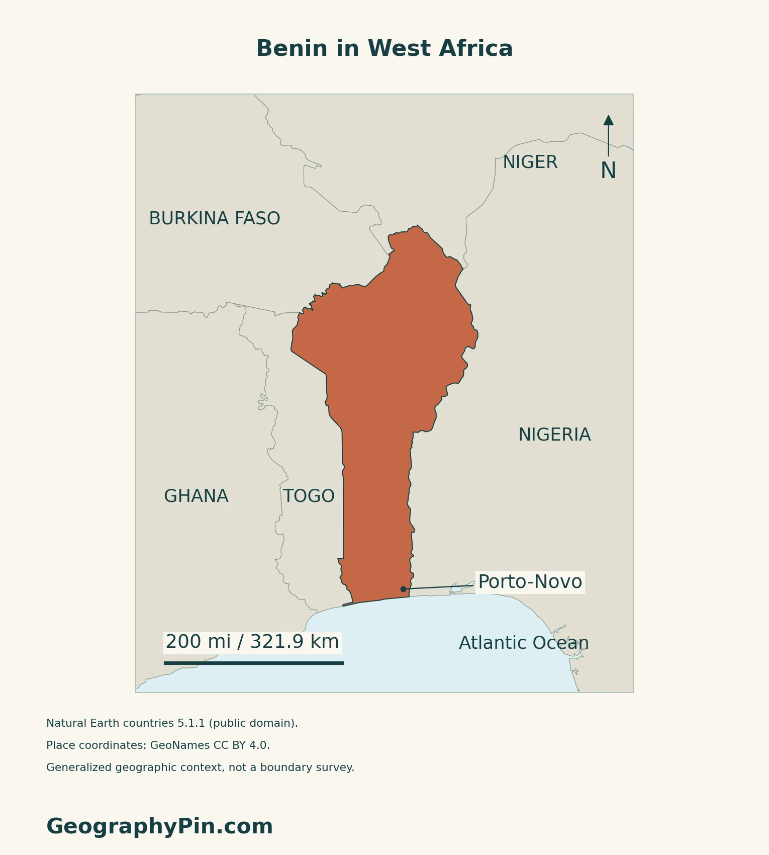
Both are in the south. Cotonou lies on the coast beside Lake Nokoué; Porto-Novo is farther east near its namesake lagoon.
Benin borders Togo to the west, Nigeria to the east, and Burkina Faso and Niger to the north. Its southern coast faces the Atlantic. Nigeria and Niger are different neighbouring countries, while the Niger is also the name of a river.
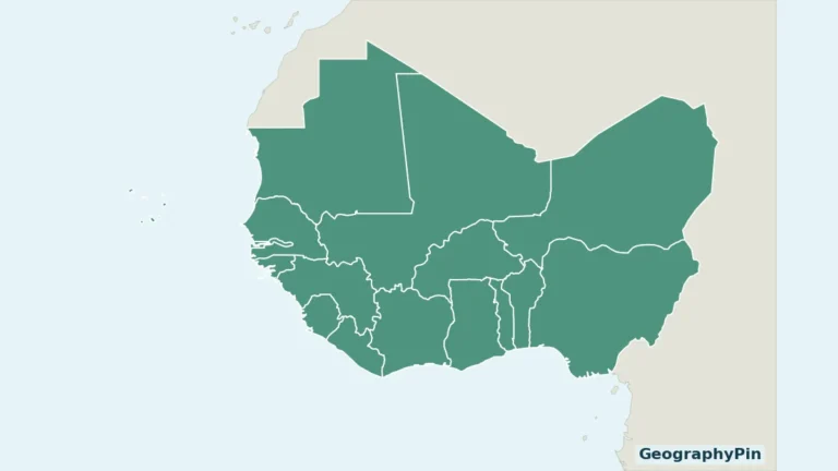
For the wider setting and regional counting rule, use the West Africa country map.
2. Compare the Coast, Interior and Atakora
A coastal country with a substantial inland landscape
| Setting | Main geographical distinction |
|---|---|
| Southern coastal strip | Low sandy terrain with lagoons and wetlands. |
| Central interior | Rolling plateaus and river valleys between the coast and north. |
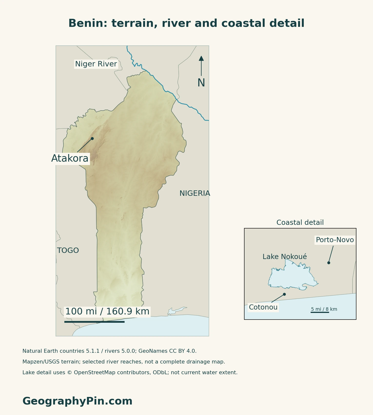
| Atakora uplands | Higher relief concentrated in the northwest. |
| Northern river plains | Lower settings associated with the Niger and Pendjari drainage. |
Not all rivers flow toward Benin’s coast
The FAO’s historical hydrological reference distinguishes north-flowing Alibori, Sota and Mékrou tributaries of the Niger from the south-flowing Ouémé, Mono and Couffo systems. The Pendjari belongs to the Volta drainage. A national boundary therefore contains portions of several river systems rather than a single basin.
3. Understand the Southern Lagoon Landscape
Lake Nokoué is part of a wider wetland system
The official 2019 Ramsar information sheet groups Lake Nokoué, Porto-Novo Lagoon and the lower Ouémé valley within a larger wetland complex. Open water, floodplains, marshes and rivers are different parts of that system, not alternative names for one lake.
The assessment describes permanent waters with seasonal hydrological variation. Floodplain inundation supports fish habitat and agriculture as water recedes; waterways also connect settlements and carry people and goods. A fixed lake outline on a reference map does not represent the full seasonal flood area.
Water shapes settlement as well as scenery
Benin’s 2020 UNESCO Tentative List submission describes Tofin and Ouémè communities living in lake and semi-lake settings, including houses on stilts. It links these settlements to historical refuge and to livelihoods adapted to changing water levels.
This is a national Tentative List submission, not World Heritage inscription.
4. Read the Seasonal Transition and Coastal Pressures
Two southern rainy periods give way to one farther north
The government’s geographical overview describes two rainy periods in the humid south and one main rainy season in the centre and north. This is a broad seasonal pattern, not a guarantee of identical onset dates or rainfall in every locality.
FEWS NET’s June 2026 livelihood assessment connects this contrast with farming: southern livelihoods are relatively diversified, while central and northern areas rely more on a single rainfall cycle and mixed cropping or agropastoral systems. Rainfed agriculture, fishing, livestock and trade matter in different combinations across the country.
Flooding and shoreline erosion are different processes
Benin’s May 2022 National Adaptation Plan identifies coastal erosion, damage to homes and infrastructure, and deterioration of coastal ecosystems among the shoreline’s major pressures. It also treats floods and dry spells as problems affecting agriculture and water-dependent livelihoods.
5. Check Dated Country Facts
| Item | Reference |
|---|---|
| Constitutional capital | Porto-Novo |
| Population reference | About 14.814 million in 2025; UN medium-fertility projection |
| Surface area | About 44,310 sq mi (114,763 km²); UNData’s 2023 reference |
| Official language | French; the Constitution also protects communities’ languages |
| Currency | West African CFA franc (XOF) |
| Government | Republic |
| Territorial administration | 12 departments and 77 communes, corroborated by government reports in September–October 2026 |
A projection is not a new census
The population figure is the UN’s explicitly dated 2025 projection, not a newly counted national total. The original national projection file could not be retrieved during this review, and a completed new national census result was not verified.
Language and administrative scope
Constitution Article 1 identifies French as official. Article 11 protects communities’ use of their spoken and written languages and calls for promotion of national languages of communication. French’s legal role does not imply that everyone speaks only French.
Government reports in autumn 2026 still identify the departments and communes while describing preparations for territorial-development poles. The new structures should not be substituted for those existing units or confused with the physical regions on a terrain map.
For comparisons across the continent, use the African countries and capitals reference.
What Did We Learn Today?
Benin’s capital designation, government location and physical landscape answer different questions. Coastal wetlands connect settlement and water use, while the inland terrain and seasonal transition explain why the whole country cannot be understood from Cotonou alone.
Sources & Data Notes
Sources, dates and map conventions
Population is UNData’s medium-fertility projection for 2025, not a current census count. The original INStaD national-projection PDF returned service errors and RGPH5 results were not verified. Constitutional capital and language provisions were checked against the original text and the 2019 and December 2025 amendments. Administration follows dated September–October 2026 government reports. The historical FAO reference supplies drainage relationships, not current fisheries or reservoir inventories. The 2019 wetland assessment is not a current flood-extent survey. The national adaptation plan is a dated risk assessment, not a forecast. No precise summit elevation, current lake area or shoreline erosion rate is asserted.
- UNData: 2025 medium-fertility population projection, 2023 surface area and XOF currency
- WIPO Lex: original Constitution, Articles 1 and 11
- Government Secretariat: constitutional amendment of November 7, 2019
- Government Secretariat: constitutional amendment promulgated December 17, 2025
- Government institutional catalogue: Presidency at Palais de la Marina, Cotonou
- Government: territorial-development preparations, October 14, 2026
- Government: 77 communes, September 29, 2026
- National portal: Porto-Novo and Cotonou roles
- Government: national physical geography and broad seasonal pattern
- FAO: historical inland-water reference, stable drainage relationships only
- Benin Environment Agency: original 2019 Ramsar information sheet for site 1018
- Benin’s 2020 UNESCO Tentative List submission: Lower Ouémé Valley
- FEWS NET: original livelihood context assessment, June 11, 2026
- Benin: May 2022 National Adaptation Plan
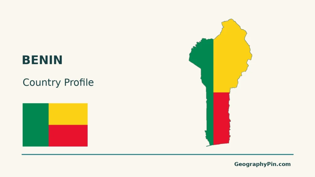
Map method: Original maps use public-domain Natural Earth countries 5.1.1 and rivers 5.0.0. Niger linework shows supplied reaches, not its complete basin. Lake Nokoué uses OpenStreetMap relation 3971451, retrieved 17 November 2026, with © OpenStreetMap contributors, ODbL attribution. Its supplied outer and inner rings are retained; no connection channels or present-day water extent are inferred. Place and Atakora reference coordinates are from GeoNames, CC BY 4.0. Mapzen terrain retains Mapzen/USGS upstream credits. Negative samples in the southern coastal/lagoon corridor are withheld rather than replaced; remaining heights are unchanged. No climate, forest or administrative boundaries are drawn. Each scale uses local WGS84 distances. The cover uses Flagpedia’s explicitly reusable flag rendition; Article 1 of the original Constitution corroborates the green hoist and yellow-over-red field. The separate full flag retains the source’s 3:2 proportions.