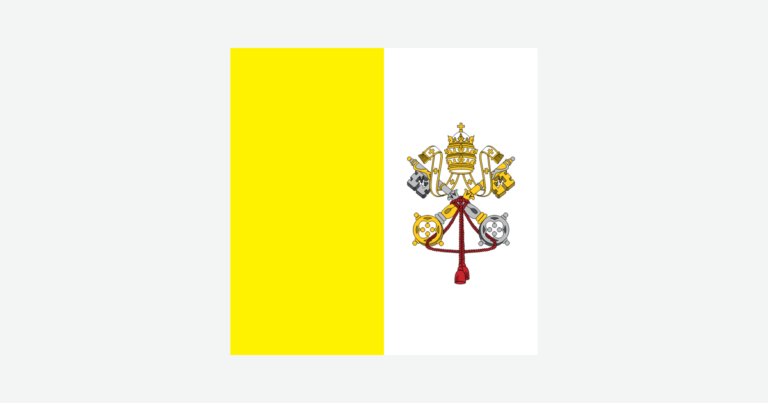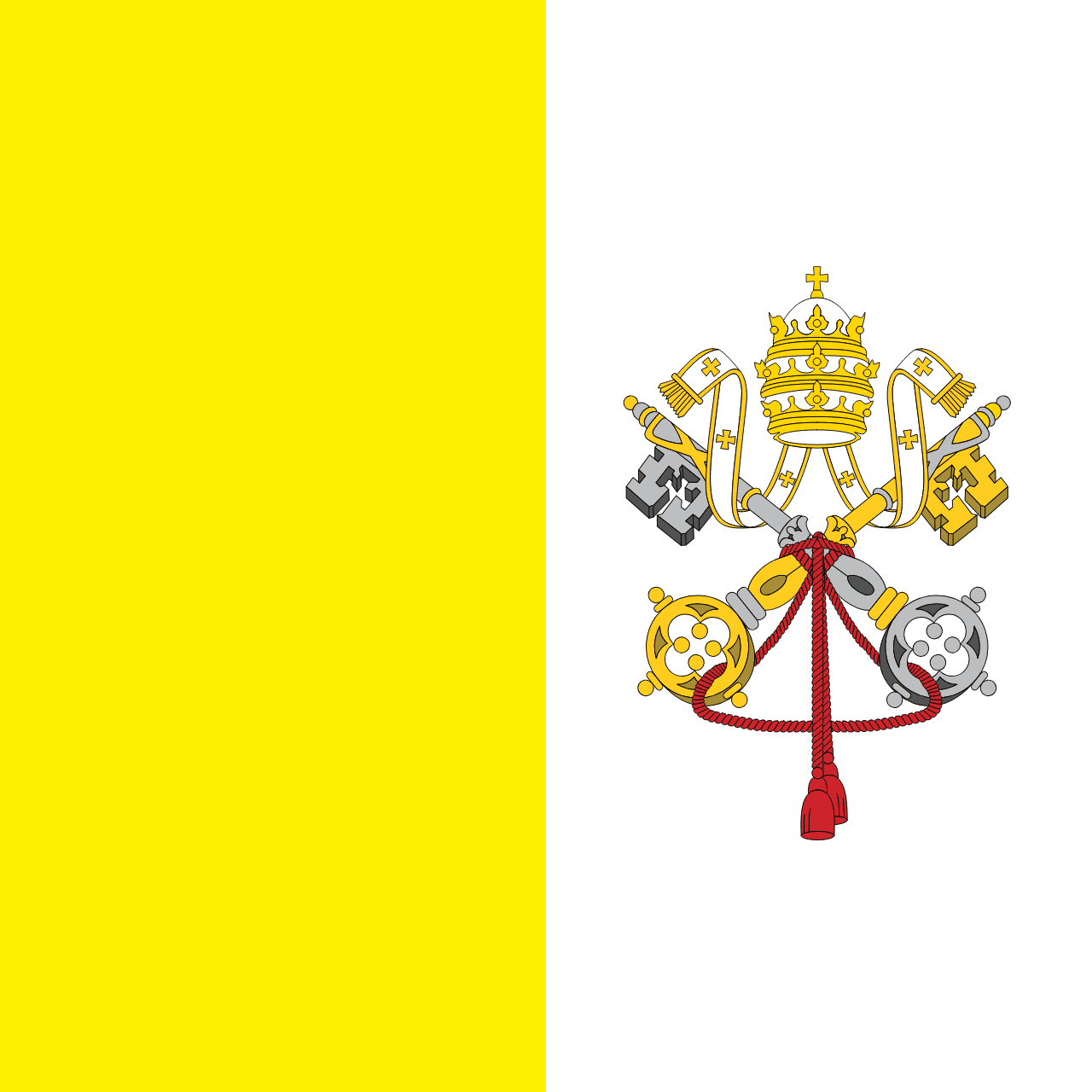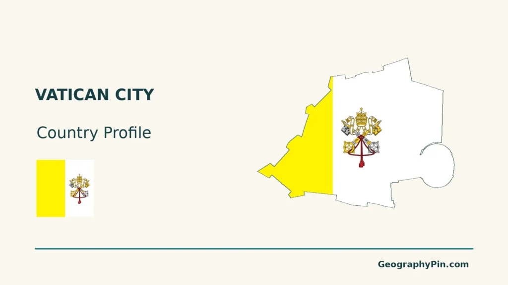
A map of Vatican City answers a different question from a map of Catholic institutions in Rome. The small territorial state has a defined boundary, public spaces, gardens and working buildings. Understanding which places lie inside that boundary makes its unusual relationship with the Holy See much easier to follow.
Vatican City is an independent city-state enclosed by Rome, Italy. Its official reference area is about 109 acres (44 hectares), containing St Peter’s Basilica and Square, the Vatican Museums, palaces and gardens. The Holy See is a distinct institution with an international diplomatic role. Some Holy See properties stand outside the state, on Italian territory.
How to use this article: Distinguish the Holy See, read the cityscape map, locate extraterritorial properties, or check resident figures.
1. Locate Vatican City and Distinguish the Holy See
A territorial state inside Rome
Vatican City is an independent city-state enclosed by Rome, Italy. Its name identifies a defined territory, while the Holy See is the central governing authority of the Catholic Church. The two are closely connected through the Pope, but they are not interchangeable geographic units.
The Lateran settlement of 1929 established Vatican City to secure the Holy See’s independence. The Holy See already maintained diplomatic relations before the territorial state existed. Today, a map of Vatican City shows the small state inside Rome, not the worldwide reach of Catholic institutions.
Which name appears at the United Nations?
The Holy See is a non-member observer state of the United Nations General Assembly. It has held permanent-observer status since April 6, 1964. Vatican City is not a separate UN member alongside it.
For this profile, territory and resident figures refer to Vatican City State. References to diplomacy and the UN observer role concern the Holy See. This distinction also explains why a Holy See institution can operate from a building outside the state’s boundary.
2. Read the Cityscape and Its Boundary
Landmarks organize a very small territory
Vatican City occupies part of Vatican Hill near the right bank of the Tiber. The river is a useful reference in Rome, not a river running through the state. Walls define much of the perimeter, while the open approach at St Peter’s Square creates a different impression from a continuously enclosed compound.
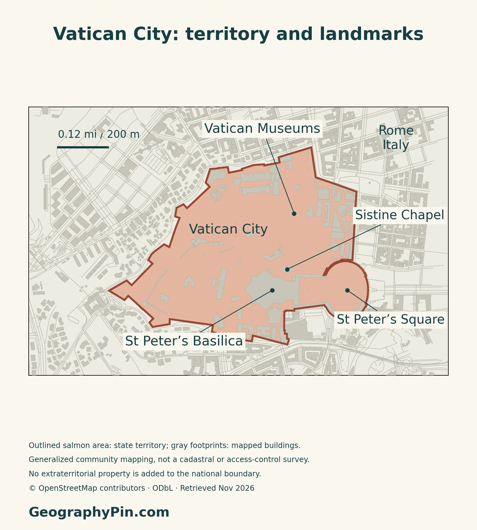
| Area to find | Main features | Geographic relationship |
|---|---|---|
| Eastern approach | St Peter’s Basilica and Square | A monumental open space faces into Rome |
| North and northeast | Museums and palace complex | Dense interconnected buildings occupy much of this sector |
| Western interior | Vatican Gardens | Managed green space contrasts with the larger built complexes |
| Southern and southwestern edge | Station and service areas | The railway connects through the perimeter toward Rome |
These are reading aids for the map, not provinces, municipal districts or official administrative zones.
An open square still belongs to the state
St Peter’s Square lies within Vatican City, extending to the marble strip at the outer edge of the colonnade. Public access and the Italian police arrangements provided for by the Lateran Treaty do not place the square outside the state. A boundary on a map and a barrier to pedestrian movement are not the same thing.
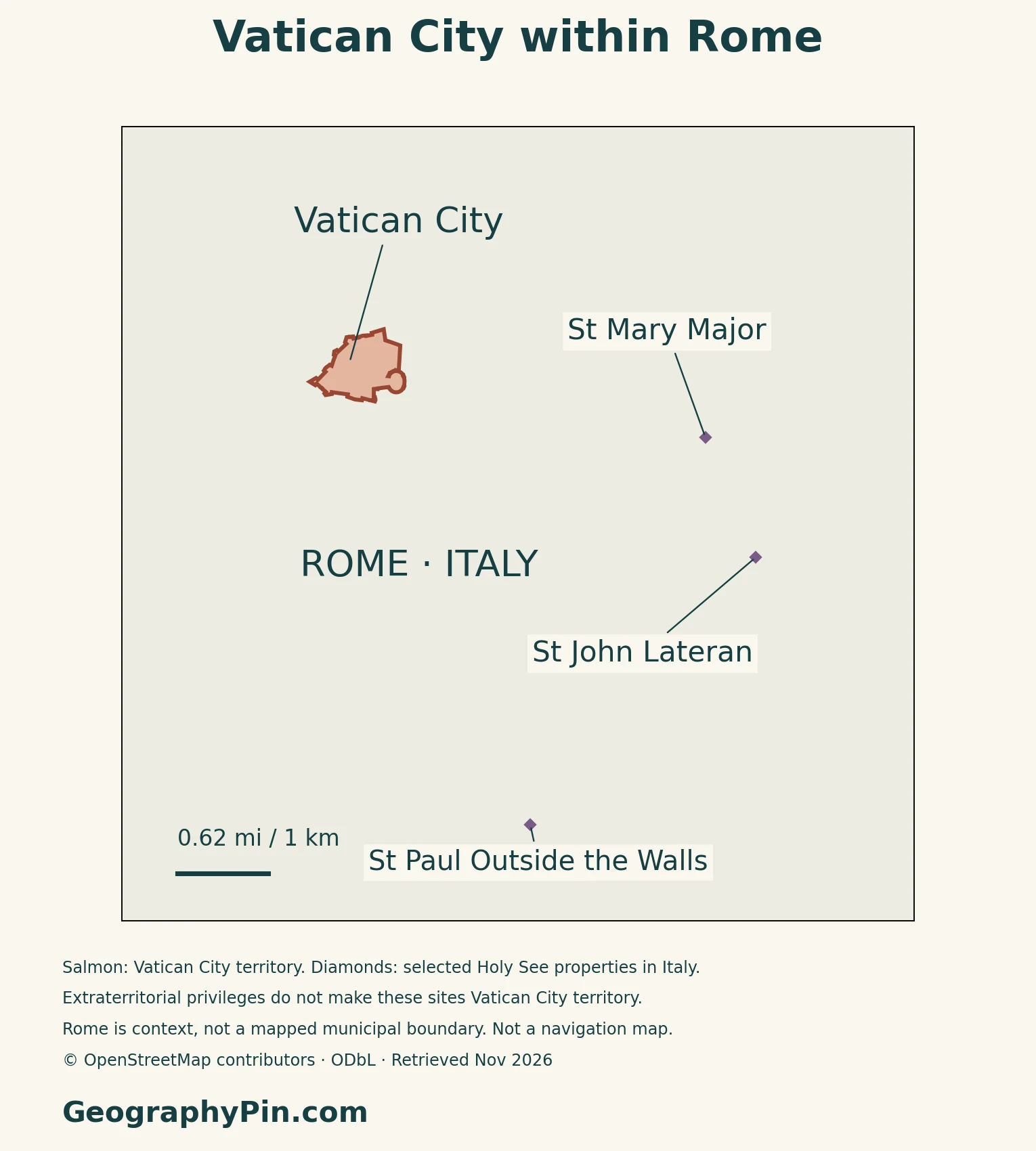
Holy See properties in Rome are not extra pieces of Vatican City
The Lateran Treaty identifies Holy See properties outside the state, including the basilicas of St John Lateran, St Mary Major and St Paul Outside the Walls. Specified properties enjoy immunities while remaining on Italian territory. Their locator-map markers therefore identify related sites, not additional Vatican City land.
For a wider geographic frame, use the Europe map and country guide. The close-up here is deliberately concerned with the territorial state and its immediate Roman setting.
3. Gardens, Seasonal Climate and Water
Green space is designed and maintained
The Vatican Gardens combine lawns, wooded areas, paths, courtyards and fountains. They are a managed landscape inside a densely developed urban setting, rather than an untouched natural reserve. Their layout gives the western interior a different character from the basilica, square and museum complexes.
The Vatican Museums’ account describes successive changes to this landscape, including major reorganization after the creation of the state in 1929. The map shows the relationship between green and built areas; it does not classify every planted courtyard or provide a surveyed garden-area total.
Roman seasons shape the outdoor environment
The Holy See’s 2025 National Communication describes mild, rainy winters and hot, dry summers. This central Italian seasonal pattern matters for garden maintenance and outdoor public spaces.
Water supply connects the enclave to its region
The Governorate’s October 2026 account distinguishes potable water from water used for irrigation and other technical purposes. Drinking water supplied by ACEA ATO 2 comes principally through the Peschiera–Capore aqueduct system. Technical supply uses the Grotta Rossa connection, supplemented by internal wells for non-potable purposes.
The same account states that direct supply from Lake Bracciano ceased in July 2017. Separate circuits, storage and careful irrigation allow water to be managed for different uses. The state’s water geography thus extends well beyond the small territory visible on its own map.
4. A Working State Within Rome
Residents and daily users are different populations
The number of people living in Vatican City is not a measure of the activity taking place there during the day. The 2025 National Communication describes a much larger flow of workers and other users, alongside visitors. Offices, religious functions, museums and maintenance all create demand for services within a very limited area.
Conservation is part of everyday management
Vatican City is a UNESCO World Heritage property whose listed area is 44 hectares. Its significance involves architecture, art and layers of earlier construction, not simply the size of the state. The physical setting combines monumental spaces with buildings that continue to serve institutional purposes.
The Governorate’s Directorate of Museums and Cultural Heritage lists conservation, restoration, research and management of access among its responsibilities. Looking after collections and historic fabric is therefore an ongoing function, not just a description of what a visitor sees. A country map can locate these complexes, but it cannot represent the interiors or the full range of work conducted within them.
The railway crosses an international boundary over a short distance
The Vatican railway connects with Roma San Pietro station on the Italian network and enters through a gateway in the state’s perimeter. The Holy See’s railway history records the handover of the works in October 1934. Its geography illustrates the enclave’s close physical connections with Rome, even where the legal boundary remains distinct.
For the broader distinction between countries and their capitals, see the European countries and capitals guide.
5. Dated Country Facts and State Institutions
| Item | Reference | Date or scope |
|---|---|---|
| Capital | Vatican City | City-state enclosed by Rome |
| Resident population | 882 | Citizens and non-citizens; December 31, 2024 |
| Territorial area | About 109 acres (44 hectares; 0.44 km²) | Governorate reference, accessed November 2026 |
| Language | Italian | Official and main working language of the state |
| Currency | Euro (EUR) | EU–Vatican monetary agreement |
| Government | Monarchy headed by the Pope | Fundamental Law of July 31, 2026 |
| Administrative divisions | No subnational divisions | PCGN reference, January 2026 |
Residents are not the same as citizens
The Governorate’s dated count records 882 residents at the end of 2024, including both citizens and non-citizens. Citizenship is a different category: some Vatican citizens live abroad because of their duties, particularly diplomatic work. The resident figure does not measure everyone who works in, visits or has an institutional connection with the Vatican.
State government and language
The 2026 Fundamental Law gives the Pope legislative, executive and judicial authority. State functions are exercised through the Governorate and other institutions established by law; the state’s legal order is distinct from the Roman Curia and other Holy See institutions. This law replaced the 2023 Fundamental Law with immediate effect.
Italian is the state’s official and principal working language. Latin has an official role in Holy See functions, a different context from everyday administration of the territorial state. The distinction is reflected in the January 2026 PCGN geographic reference.
What Did We Learn Today?
Vatican City is a territorial state within Rome, while the Holy See has a distinct institutional and diplomatic identity. Its geography is unusually compact: a monumental eastern approach, densely built complexes, managed gardens and connections to Italian infrastructure. Extraterritorial properties should not be added to the state’s outline, and residents should not be confused with citizens or daily users. Those distinctions make both the maps and the dated country facts more useful.
Sources & Data Notes
Resident population refers to December 31, 2024, not a current census or a citizen total. Area follows the Governorate’s 0.44 km² reference; it is not calculated from the illustrative map. Language and administrative references use PCGN January 2026, while government wording follows the later Fundamental Law of July 31, 2026. Climate descriptions are seasonal, not a weather forecast or a numerical long-term normal. Water infrastructure follows the October 2026 account; railway history is not a service schedule. Treaty references concern territorial status and immunities, not a claim that its entire original text describes current Italian law.
- Vatican City Governorate: Geography and official area
- Secretariat of State: Holy See and Vatican City distinction
- UN Dag Hammarskjöld Library: Non-member observers
- Lateran Treaty: territory, square and extraterritorial properties
- Vatican Museums: Vatican Gardens
- Holy See: First National Communication, 2025
- Governorate: Water infrastructure, October 13, 2026
- UNESCO: Vatican City World Heritage property
- Governorate: Directorate of Museums and Cultural Heritage
- Holy See: Vatican railway history
- Governorate: Resident population at December 31, 2024
- Fundamental Law of Vatican City State, July 31, 2026, including flag Annex A
- UK PCGN: European Microstates Toponymic Factfile, January 2026
- EUR-Lex: EU–Vatican monetary agreement, consolidated March 24, 2026
Map method: Original GeographyPin maps use © OpenStreetMap contributors, with data under the Open Database License. The state outline uses the direct outer boundary ways of relation 36989, version 120, November 11, 2026. Its nested extraterritorial-properties relation is excluded. Selected Roman basilicas are separate point markers, not additional state territory. Actual OSM building footprints and street lines support the detailed map. This community geometry is not a cadastral survey and its computed footprint differs from the official 0.44 km² reference; neither the map nor its decorative outline replaces that reference. Maps use UTM zone 33N and do not show legal access conditions, property extents outside the state or invented relief. The clean featured graphic uses the state outline and FlagCDN national-symbol artwork. The intact flag and complete keys-and-tiara design were visually checked against Annex A of the current 2026 Fundamental Law. Editorial use does not imply endorsement.