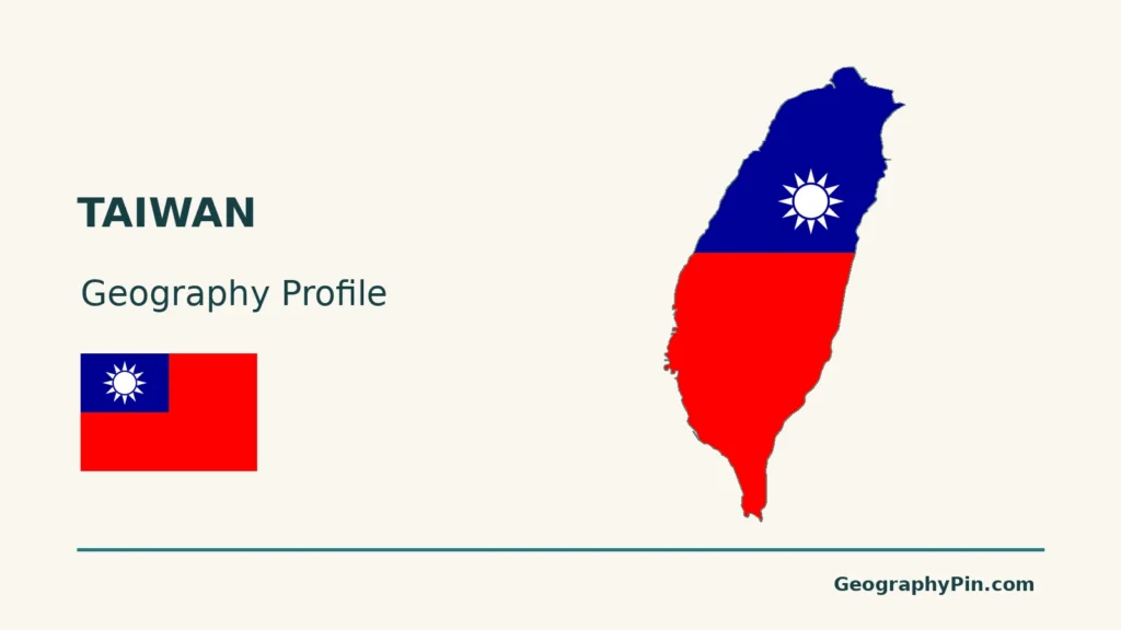
Taiwan’s mountain spine divides river catchments and changes how seasonal winds deliver rain. Western lowlands support a dense mixture of farms, cities and transport links, while northern basins and eastern mountain landscapes have different conditions. A useful profile must also distinguish the main island from administered offshore islands and political claims.
Taiwan is a self-governed island society in East Asia, with its government based in Taipei; the People’s Republic of China claims it. On the main island, mountains contrast with western plains and northern basins. Terrain redirects monsoon winds and rainfall, while lower ground provides space for settlement, farming and transport. Administered offshore islands require separate map coverage.
How to use this article: Compare physical regions, understand seasonal winds, follow western lowland farms, or check population coverage.
1. Location, Island Coverage and Political Status
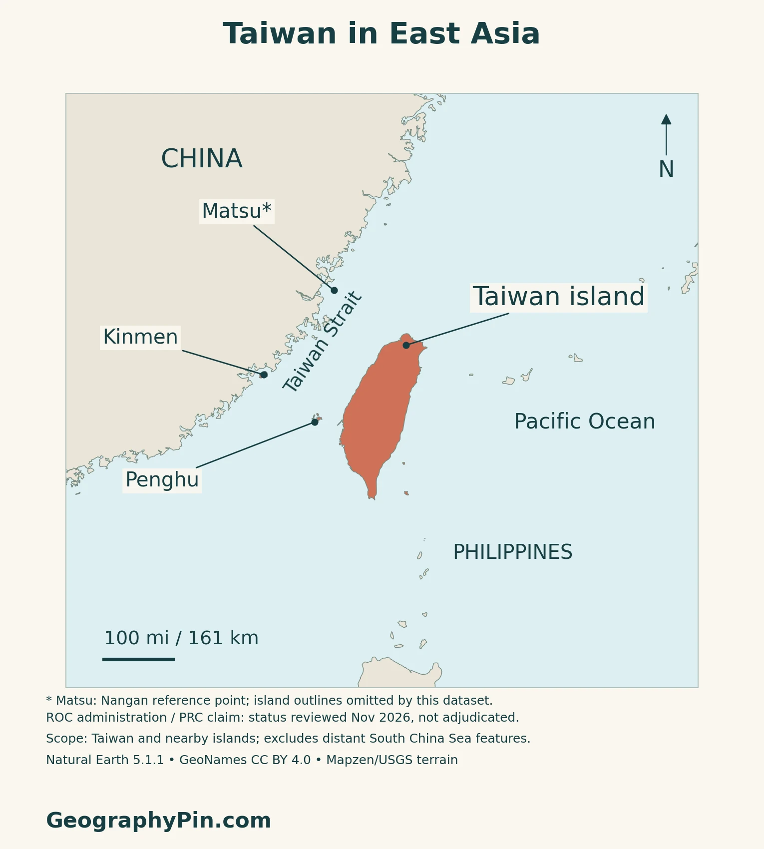
Taiwan island and the Taiwan Strait
Taiwan island lies off the southeastern coast of mainland China, between Japan’s southwestern islands and the Philippines. The Taiwan Strait separates its western shore from the mainland. The physical map concentrates on the main island; separate insets locate selected offshore groups.
Self-government, claims and recognition are different questions
Taiwan is self-governing under the Republic of China, or ROC, government. The People’s Republic of China, or PRC, claims Taiwan, while Taiwan’s government rejects PRC sovereignty over it.
Many governments maintain unofficial ties with Taiwan rather than formal diplomatic relations. Taiwan has no separate United Nations membership; the PRC holds China’s representation there. The 1971 resolution addressed China’s representation at the UN without mentioning Taiwan’s territorial status.
Offshore islands are not extensions of the main island
Penghu lies in the Taiwan Strait. Kinmen and Matsu are much closer to the mainland Chinese coast, although administered by the ROC government.
These maps show selected administered islands, not every offshore feature or the full extent of territorial claims. Distant South China Sea features are outside the displayed coverage. For regional context, see the East Asia countries map.
2. Mountain Spine, Lowlands and Offshore Contrasts
The main island is not one uniform landscape
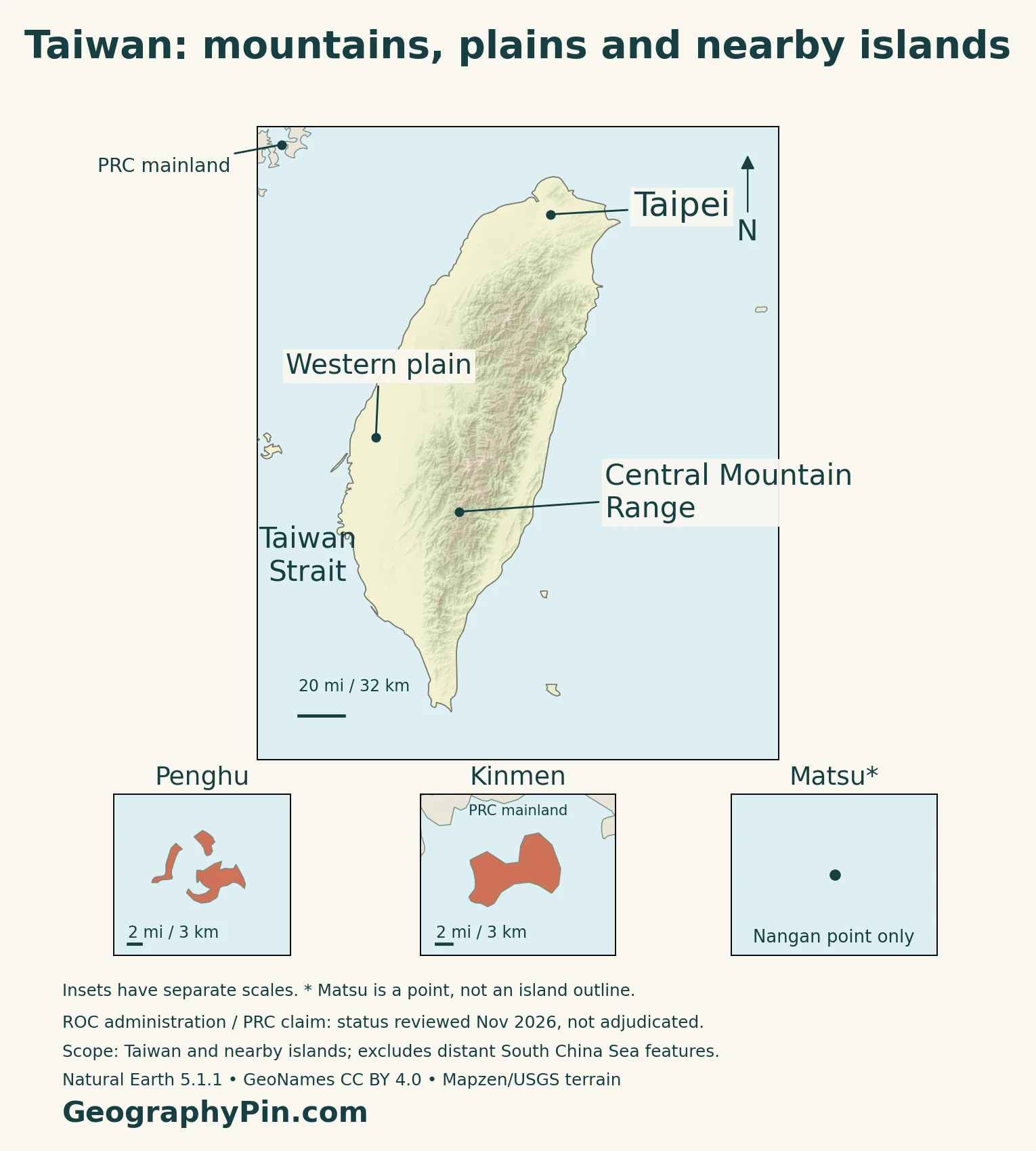
The Central Mountain Range forms a major north–south spine and separates drainage toward opposite sides of Taiwan island. Hills, plateaus, basins and coastal plains add variety around the high terrain.
| Feature | Setting | Geographic distinction |
|---|---|---|
| Central Mountain Range | Interior mountain spine | Separates major eastern and western drainage directions |
| Western plain | Western side of Taiwan island | Lower terrain used by farms, cities and transport |
| Taipei Basin | Northern Taiwan | A basin rather than an extension of the central highlands |
| Eastern mountain margin | Pacific-facing side | Rugged terrain close to the coast |
| Penghu | Taiwan Strait | Basaltic island landscapes |
| Kinmen and Matsu | Near the mainland Chinese coast | Separate island groups, not parts of Taiwan island |
The relief sits in an active tectonic setting
Taiwan lies near the interaction of the Eurasia and Philippine Sea plates. The magnitude 7.4 earthquake near Hualien on April 3, 2024, local time, resulted from reverse faulting near that plate boundary, according to the USGS.
The event also illustrates two different ground hazards: landslides on steep terrain and liquefaction where loose, wet ground loses strength during shaking. Low elevation does not automatically mean low earthquake risk.
3. How Mountains Change Rainfall and Forests
The windward side changes with the season
Taiwan’s official climate report describes northeast monsoon influence in winter and southwest monsoon influence in summer. Frontal systems, the early-summer plum-rain period and typhoons also contribute precipitation.
Mountains obstruct and redirect these airflows. Conditions on an exposed slope can differ from those behind a ridge, and the contrast changes with wind direction and the weather system involved. It is therefore misleading to label one entire side of the island permanently wet and the other permanently dry.
Nearby northern lowlands can receive different rain
A 2024 study by Pei-Di Jeng and Jou-Ping Hou examined the northeast monsoon over the Taipei Basin and Lanyang Plain, including a November 26, 2021 case. Their modeling and observations showed that local terrain altered airflow and the placement of precipitation.
In the case studied, rain in the Taipei Basin setting was concentrated mainly on windward mountain areas, whereas the Lanyang Plain also received substantial rain over the plain. This is a useful example of terrain effects, not a rule that predicts every storm.
Elevation alone does not explain mountain vegetation
A separate study mapped Taiwan’s montane cloud forests using vegetation plots, terrain data and satellite-derived fog observations from 2003–2014. It found frequent fog on northern and eastern mountain slopes, particularly during the northeast monsoon.
Adding fog information helped identify cloud-forest conditions at elevations where a simple altitude band was inadequate. The result connects the landscape to moisture exposure: two slopes at similar heights can have different conditions for vegetation.
4. Farms, Cities and the Western Transport Corridor
Yunlin shows what a lowland agricultural landscape looks like
NASA’s March 2026 satellite view of Yunlin County shows a patchwork of small fields organized around roads and irrigation canals. The county’s floodplain setting along the Zhoushui and Beigang rivers combines relatively flat land, fertile soils and irrigation access.
Rice, vegetables and other crops occupy the mosaic, with some larger plots reflecting a different history of landholding and sugar production. The western plain is therefore not simply a continuous urban strip; farming remains a visible part of the same lowland landscape.
Rail geography connects the western cities
Taiwan High Speed Rail’s operating corridor runs along the western side, linking stations from Nangang in Taipei to Zuoying in Kaohsiung. Its published network includes stops serving Hsinchu, Taichung and Tainan.
This route provides a clear example of the connections between western urban areas.
Industrial concentration also depends on institutions
Hsinchu Science Park was established in 1980. The county’s industrial-development account links its semiconductor and other technology industries with infrastructure investment, universities and the Industrial Technology Research Institute.
Those relationships add an economic explanation to the physical map. Available lowland space matters, but research organizations, skilled workers and planned infrastructure also influence where firms gather. Mountains alone cannot explain the geography of an industrial cluster.
5. Reference Facts with Dates and Territorial Scope
Taiwan: reference facts and coverage
| Item | Reference |
|---|---|
| Government seat | Taipei, seat of the Republic of China government |
| Usual-resident population | 23.710 million; preliminary estimate for January 1, 2026 |
| Reported land area | About 13,976 square miles (36,197 square kilometers); July 2026, including outlying islands |
| Languages | Mandarin, Taiwanese Hokkien, Hakka and Indigenous languages; plural national-language status |
| Currency | New Taiwan dollar (NT$) |
| Government and status | Self-governing multiparty democracy under ROC institutions; claimed by the PRC |
| Local administration | 6 special municipalities, 13 counties and 3 cities: 22 units |
Usual residents differ from household registration
The Directorate-General of Budget, Accounting and Statistics published the January 2026 usual-resident estimate in February 2026 and marked it preliminary. It includes nationals and non-nationals and covers the county/city units, including Penghu, Kinmen and Lienchiang, which administers Matsu.
This is an estimate, not a new census count. It should not be substituted for, or directly compared with, a household-registration total without accounting for their different population coverage. Nor is the national total a population figure for Taiwan island alone.
National-language law is broader than Mandarin alone
The Development of National Languages Act recognizes the natural and sign languages used by Taiwan’s different ethnic groups and gives national languages equal status. Listing Mandarin as the only legally recognized language would therefore misrepresent the law.
The languages named in the table are examples, not an exhaustive list. The legal framework also provides for national-language use in public procedures, with interpretation where needed.
The administrative total includes offshore communities
The government’s current local-administration description lists 22 self-governing county/city-level units. The six special municipalities are Taipei, New Taipei, Taoyuan, Taichung, Tainan and Kaohsiung. Counties include Penghu, Kinmen and Lienchiang.
Taipei is the working government seat and is described as the capital in official reference publications. For a wider comparison, see the Asia capitals guide.
What Did We Learn Today?
Taiwan’s mountains influence drainage, monsoon exposure and cloud forests, while its western lowlands combine farms, cities and transport corridors. Those physical contrasts do not define political status. Taiwan island, the wider area administered from Taipei, population-statistical coverage and territorial claims must be kept distinct rather than compressed into one unqualified outline or number.
Sources & Data Notes
Population is a preliminary usual-resident estimate for January 1, 2026, not a census or household-registration total. The July 2026 land-area reference includes outlying islands and is not Taiwan island alone. Political descriptions distinguish administration, claims and diplomatic recognition; status was reviewed November 2026. Rainfall research includes a dated northern-Taiwan case study, not a forecast. The cloud-forest study uses 2003–2014 satellite observations. The 2024 earthquake is historical context, not a current warning.
- Tourism Administration: main-island geography
- Tourism Administration: offshore-island geography
- Climate Change Administration: 2024 Biennial Transparency Report, published July 2025, section 2.1.4
- Jeng and Hou (2024): northeast monsoon, Taipei Basin and Lanyang Plain
- Schulz and colleagues (2017): cloud forests and satellite-derived fog
- USGS: April 3, 2024 Hualien earthquake and ground hazards
- NASA Earth Observatory: Yunlin agricultural mosaic, March 2026 imagery
- Taiwan High Speed Rail: operating corridor and stations
- Hsinchu County industrial-development committee: science-park setting
- DGBAS: preliminary January 1, 2026 usual-resident estimate
- Original resident-estimate tables, including preliminary-data footnote
- Executive Yuan: statistical summary, July 2026 land area
- Kinmen County Government: official Taiwan at a Glance coverage and Taipei reference
- Office of the President: local administration
- Ministry of Culture: Development of National Languages Act, Articles 3–4 and 11
- Central Bank: New Taiwan dollar issuance regulation
- PRC Foreign Ministry: September 8, 2026 Taiwan position
- ROC Foreign Ministry: May 21, 2026 Taiwan position
- Australian DFAT: Taiwan relationship and diplomatic context
- UK House of Commons Library: Taiwan, recognition and UN representation
Map method: Original GeographyPin maps use public-domain Natural Earth country geometry v5.1.1, real Mapzen/USGS elevation data and GeoNames points under CC BY 4.0. All eight components in the selected source record are retained across the map coverage; many smaller islands are generalized out. Matsu is absent from that geometry and is represented only by a sourced Nangan point, not an invented outline. Penghu and Kinmen insets have their own scales. Landform markers are reference locations, not region boundaries. The maps show selected administered geography, not sovereignty adjudication or maritime claims; distant South China Sea features are outside scope. Status notes were reviewed November 2026. The cover depicts Taiwan island only with the ROC flag, not every administered island.