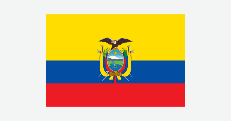
Ecuador’s geography cannot be read from its position on the Equator alone. The Andes separate Pacific-facing landscapes from Amazonian drainage, while the Galápagos occupy a distant volcanic island setting. Together, these four broad environments explain the country’s sharp contrasts in climate, settlement and connections with water.
Ecuador is a South American country with Quito as its capital and territory on both the mainland and the Galápagos Islands. Its four broad settings are the Pacific Costa, Andean Sierra, eastern Amazonía and oceanic Galápagos. Elevation, drainage and ocean conditions explain their contrasts better than equatorial latitude alone.
How to use this article: Compare the mountains and islands, see why elevation changes climate, or follow the Amazon drainage connection.
1. Locate Ecuador on the mainland and in the Pacific
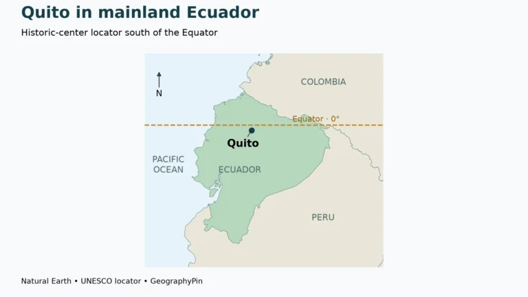
Ecuador lies on South America’s Pacific side, with Colombia to the north and Peru to the east and south. The Equator crosses both its mainland territory and the Galápagos archipelago. The country’s name refers to that line, but Ecuador is a country, not another name for the entire equatorial zone.
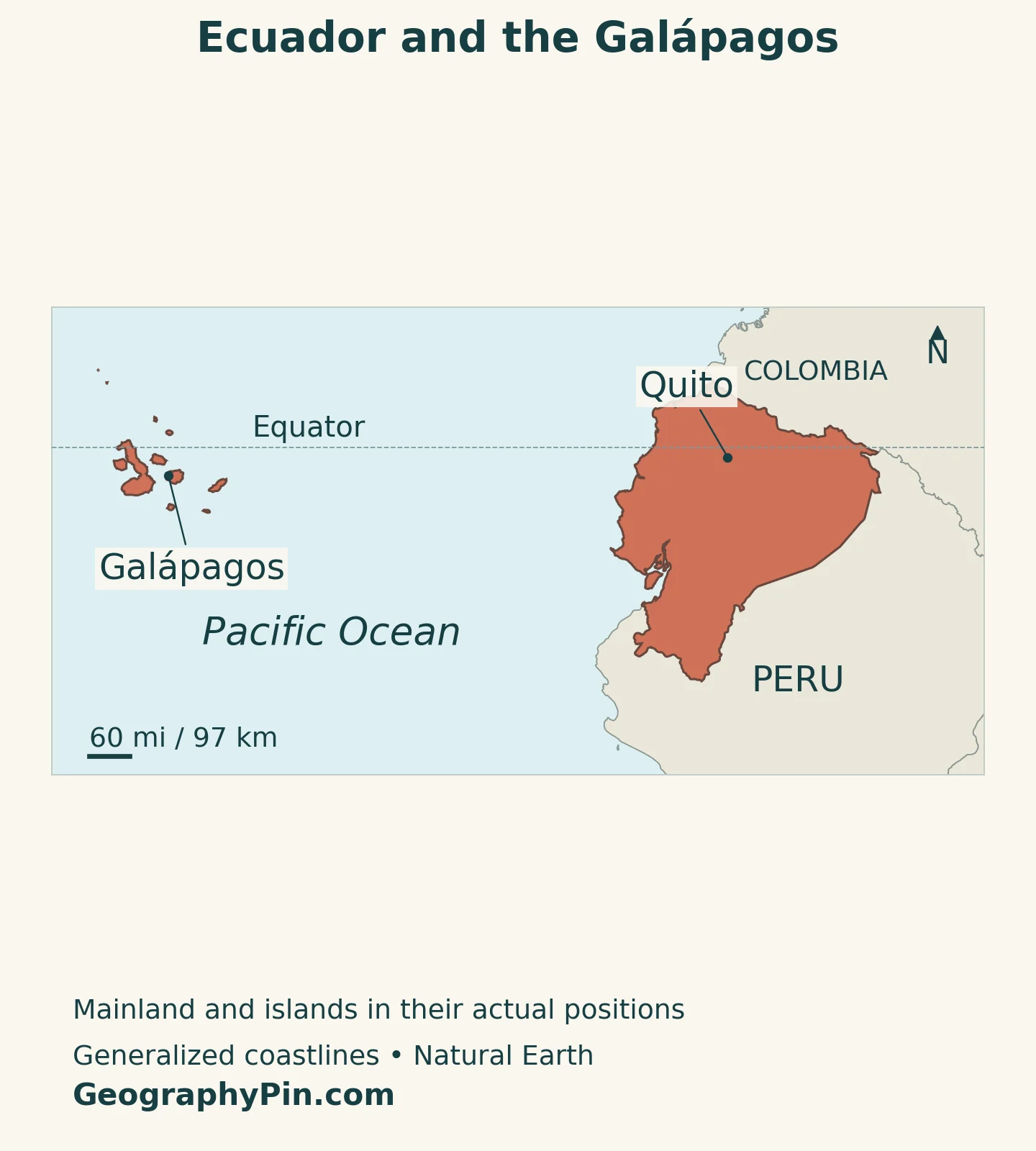
The Galápagos Islands lie roughly 620 miles (1,000 kilometers) west of the South American mainland. They are part of Ecuador, not a separate sovereign country. A map needs to show both the continental territory and the islands to represent the country adequately.
Quito, the capital, is in the Andes. Guayaquil is farther south and west, in the coastal lowlands. These two cities provide useful orientation points: Quito helps locate the highland corridor, while Guayaquil anchors the country’s Pacific-facing urban and port geography.
The South American countries and capitals list places Ecuador among its continental neighbors. The national map adds a distinction that a country list cannot show: the offshore islands and the mainland belong to one state while occupying very different physical environments.
2. Country facts and what the figures describe
| Fact | Reference |
|---|---|
| Official name | Republic of Ecuador. |
| Capital | Quito, designated by Article 4 of the Constitution. |
| Population projection | 18,243,816 people on June 30, 2026, INEC’s 2024 revision. |
| Census population | 16,938,986 usual residents counted in the 2022 census. |
| Surface area | About 99,312 square miles (257,217 square kilometers), UNData reference year 2023. |
| Currency | United States dollar (USD). |
| Language framework | Spanish is the official language; Spanish, Kichwa and Shuar are official languages for intercultural relations. Other ancestral languages have official use for Indigenous peoples in their areas, under the law. |
| Administrative structure | 24 provinces, including Galápagos with its special constitutional regime. |
| Geographic settings | Costa, Sierra, Amazonía and Galápagos. |
The census total is a dated count of usual residents, not today’s population. INEC’s demographic estimates and projections adjust the population base using additional demographic evidence and assumptions. A projected total and the number actually counted in a census therefore measure different things.
The area shown is national surface area, not the size of the mainland alone or of Ecuador’s surrounding ocean jurisdictions. Land-only series exclude inland water, while maritime zones use a different legal and geographic definition. A Galápagos inset is part of the national picture even though it is separated from the mainland on the page.
3. Four settings, not four identical regions
The familiar four-part division is a practical way to read Ecuador: the Costa west of the Andes, the Sierra through the mountain interior, the Amazonía to the east, and the Galápagos in the Pacific. These are broad geographic settings rather than four uniform landscapes with perfectly sharp edges.
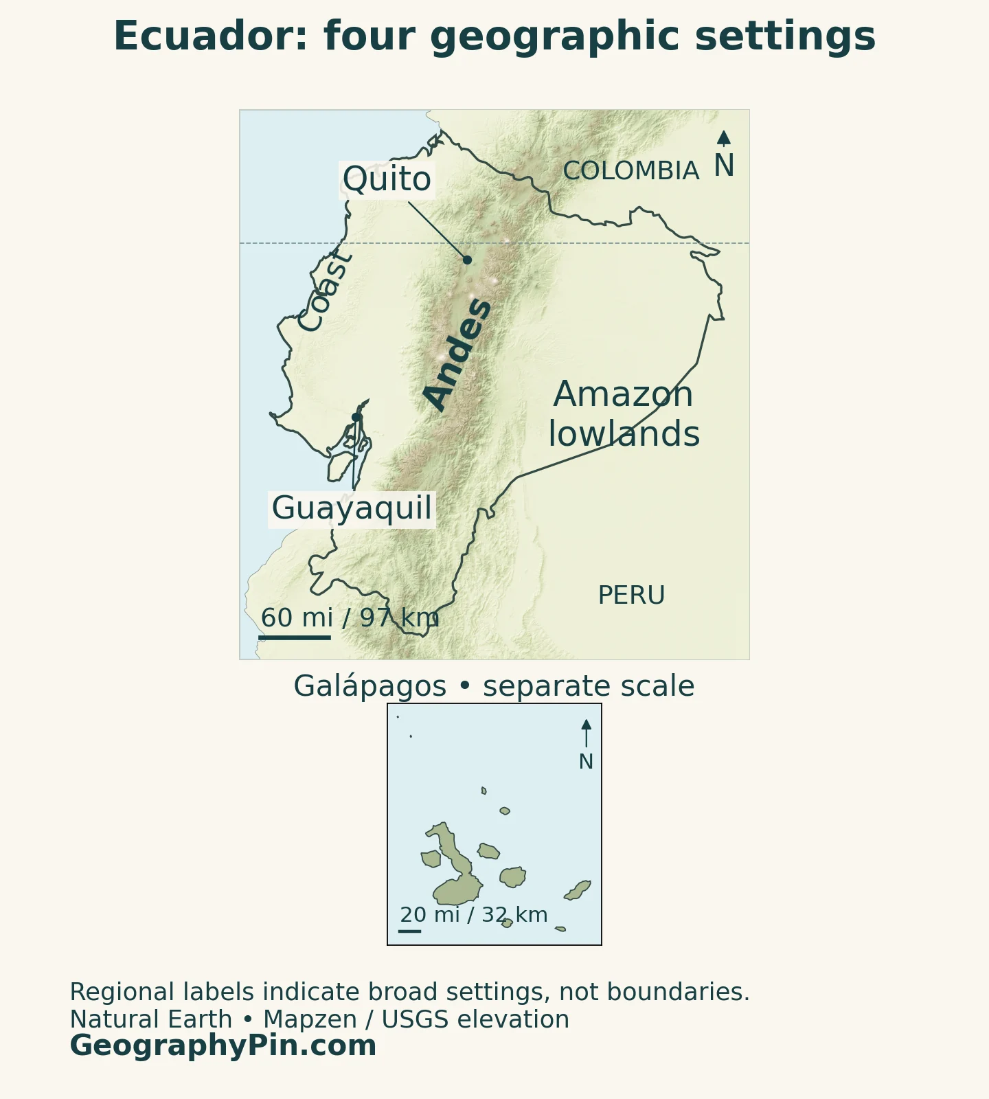
| Setting | Physical character | Connection with people and water |
|---|---|---|
| Costa | Pacific lowlands, river plains and coastal hills west of the Andes | Guayaquil and port infrastructure link the country with Pacific shipping. |
| Sierra | Andean ranges, high valleys, plateaus and volcanoes | Quito and other settlements occupy highland terrain with cooler conditions than the lowlands. |
| Amazonía or Oriente | Eastern Andean foothills and Amazon-basin lowlands | Rivers connect mountain catchments with rainforest lowlands and Peru. |
| Galápagos | Volcanic oceanic islands separated from the mainland | Isolation, ocean conditions and conservation shape island environments and settlement. |
Why the Andes and Galápagos belong in different panels
The Andes are a continental mountain system. Ecuador’s Geophysical Institute explains that interaction between the Nazca and South American plates produces earthquakes, while subduction has supported volcanism in the continental territory. Subduction means that one tectonic plate descends beneath another.
The Galápagos are volcanic islands in the ocean, not simply the exposed tips of the continental Andes. UNESCO identifies ongoing volcanic processes as fundamental to their formation. Their separate position, oceanic setting and isolation distinguish them from the mainland mountain corridor.
Even within the Sierra, mountains are not interchangeable. The Geophysical Institute notes that the southern Ecuadorian Andes do not have the same pattern of active volcanoes as the north. A mountain range can continue through an area without every summit being an active volcano.
The two map panels therefore answer different questions. The mainland panel shows how the coast, highlands and eastern lowlands fit together. The island inset makes the Galápagos legible without pretending that they sit immediately beside Guayaquil or share the mainland panel’s scale.
4. Climate changes with height and ocean conditions
Crossing the Equator does not make Ecuador uniformly hot or wet. The coastal and Amazonian lowlands are generally warm, but high Andean environments are cooler. Local relief also matters: a sheltered valley, an exposed mountain slope and a humid eastern foothill can have different conditions at similar latitudes.
Quito and the lowlands do not share one equatorial climate
Quito stands roughly 9,350 feet (2,850 meters) above sea level in the Andes. Its highland setting explains why its temperatures differ from those of the coastal lowlands even though both are close to the Equator. The city’s terrain also varies, so one quoted elevation is a reference rather than the height of every neighborhood.
In the eastern Amazonian setting, warmth and moisture support rainforest environments. The Sierra’s high valleys and slopes have more pronounced changes in temperature over the day. A countrywide temperature average would conceal much of the contrast that residents experience between these settings.
The Galápagos have their own seasonal rhythm. The national park’s scientific-visitors manual describes a warmer season broadly from January to May and a cooler garúa season from June to December. Garúa is the mist or fine drizzle associated with cloudy conditions, especially in the higher parts of the islands.
Ocean conditions can alter these broad patterns. NOAA identifies a tendency toward wetter-than-normal December–February conditions along coastal Ecuador during El Niño episodes. That is a recurring climate relationship, not a forecast that every El Niño brings identical rainfall to every province.
For reading the map, three questions work better than simply asking how close a place is to the Equator: How high is it? Which side of the Andes is it on? Is it on the continent or in the oceanic islands?
5. Water links the mountains with two continental margins
Ecuador’s mainland rivers drain toward both the Pacific and the Amazon system. The Andes create the major contrast between these drainage directions, while the eastern foothills connect high mountain catchments with much lower terrain.
Ecuador’s Amazon region is not the whole Amazon Basin
The Napo provides a clear eastern example. Napo Province’s development plan traces its basin from the eastern Andean slopes toward Peru and places it within the Amazon drainage system. The provincial name, the river basin and Ecuador’s wider Amazon region describe different areas; they should not be treated as synonyms.
A river basin is the land area from which water drains into a river and its tributaries. Water, sediment and changes in land use can therefore connect places that are far apart and governed by different local authorities. The Napo planning document also identifies hydropower as an important use within this eastern drainage setting.
On the Pacific side, Guayaquil’s port geography is tied to estuarine waters. The transport ministry’s 2025 port bulletin locates the maritime port on Estero Salado, with a navigation channel connecting the facilities to the sea. Calling it a Pacific port is accurate, but does not mean that all its terminals stand on an exposed ocean beach.
The Galápagos are outside these continental drainage systems. Their water environments, volcanic terrain and surrounding sea need to be understood on their own terms rather than as another downstream part of the mainland’s rivers.
6. Quito, Guayaquil and the geography of livelihoods
Quito’s geography offers a closer look at the capital’s mountain setting. Its role as the national capital is established in the Constitution. Its historic center also shows how an urban settlement adapted to an Andean setting: UNESCO describes a city along the slopes of Pichincha, framed by neighboring hills. Mountain terrain is part of the city’s working geography, not just a distant backdrop.
Guayaquil provides a different connection. Its maritime facilities serve international trade through estuarine navigation channels, linking shipping with the mainland economy. Capital functions and port functions are separate: Guayaquil’s commercial importance does not make it Ecuador’s capital.
The Central Bank’s report on 2025 merchandise trade includes petroleum alongside major non-oil exports such as shrimp, cocoa, bananas and plantains. This is a more useful picture than describing Ecuador as dependent on a single product. Export earnings, however, are not the same as the structure of all employment or domestic economic activity.
Physical geography shapes infrastructure costs as well as opportunities. The bank’s 2025 trade review describes landslides, an earthquake and erosion along the Coca River among disruptions affecting oil transport. Routes linking production areas with processing or export facilities can be vulnerable to processes occurring along their path.
These examples connect the regions without reducing them to stereotypes. The coast is more than beaches, the Andes are more than volcanoes, the Amazonía is more than an empty forest, and the Galápagos are more than a visitor destination. Each contains inhabited places, livelihoods and environmental constraints.
7. One republic, with distinct language and island arrangements
The Constitution describes Ecuador as a republic and as an intercultural and plurinational state. Article 2 distinguishes the national official language from official uses for intercultural relations: Spanish is official, while Spanish, Kichwa and Shuar hold the specified intercultural role. Other ancestral languages have official use for Indigenous peoples in the areas where they live, as provided by law.
This is more specific than saying that every language has an identical nationwide administrative role.
Galápagos has a special constitutional regime under Article 258, with planning and development organized around conservation. That special arrangement does not make the islands a separate country. It recognizes that oceanic isolation and ecological vulnerability require a different approach to managing settlement and activity.
UNESCO highlights the islands’ unusual animal life and the evolutionary importance of their isolation, including giant tortoises, land iguanas and finches. Conservation also involves preventing organisms from being moved unintentionally between islands. The national park’s field guidance emphasizes that equipment and supplies can carry seeds or small animals.
The four geographic settings are therefore a starting point, not four separate political units or four complete descriptions of everyday life. Country boundaries, provincial administration, river basins and ecological regions each divide space for a different purpose.
What Did We Learn Today?
Ecuador’s four settings connect one country across very different environments. The Andes influence climate and continental drainage, Quito and Guayaquil occupy contrasting urban settings, and the Galápagos require a separate geographic scale and conservation approach. Equatorial latitude alone cannot explain those differences, just as a physical region is not the same thing as an administrative unit.
Sources & Data Notes
The 2026 population is INEC’s June 30 projection from the 2024 revision, not a census count. The separate 2022 figure refers to enumerated usual residents. Surface area follows UNData’s 2023 reference. Geographic descriptions distinguish mainland and island settings; the four regions are not four equivalent administrative units. Trade examples refer to 2025. Climate patterns are general, not a current weather forecast. Sources checked November 16, 2026.
- INEC: February 2024 demographic reconciliation presentation, census count and methodology
- INEC: 2024 revision tables (Excel ZIP), national population at June 30, 2026
- UNData: national surface area and currency
- Constitution of Ecuador: Articles 1, 2, 4 and 258
- FAO: geographic profile, four natural regions
- David A. Neill, Missouri Botanical Garden: Ecuador’s name and physical regional framework
- Ecuador Geophysical Institute: tectonics, earthquakes and continental volcanism
- UNESCO: Galápagos Islands, location, volcanic origin and evolutionary importance
- UNESCO: Quito’s Andean setting and historic urban landscape
- UNHCR Ecuador: broad regional climate contrasts
- Galápagos National Park: scientific-visitors manual, seasonal climate and field biosecurity
- NOAA Climate Prediction Center: El Niño rainfall patterns
- Napo provincial government: 2020–2023 development plan, drainage and water uses
- Ecuador transport ministry: 2025 port statistical bulletin, Guayaquil general description
- Central Bank of Ecuador: 2025 merchandise trade, February 2026 bulletin
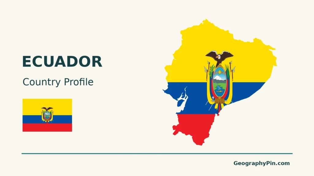
Map method: Original GeographyPin maps use public-domain Natural Earth country geometry and city locations. The locator shows mainland and islands in their actual relative positions; the physical map uses a separately scaled Galápagos inset. Borders and shorelines are generalized, and no maritime claims are drawn. Mainland relief uses Mapzen Terrain Tiles with USGS SRTM/GMTED2010 elevation and is qualitative. Terrain colors are not vegetation or administrative boundaries. The Galápagos inset uses flat land shading. The flag-and-outline cover depicts the mainland only.