Italy’s boot-shaped outline is familiar, but the shape alone misses the country’s strongest geographic contrasts. A mountain arc and broad plain organize the north, another mountain belt runs along the peninsula, and two large islands add distinct Mediterranean landscapes. Reading those relationships makes both the map and the regional differences easier to understand.
Italy is a southern European country comprising a peninsula, Sicily, Sardinia and smaller islands. Its main physical pattern is the Alps in the north, the Po Plain below them, and the Apennines along the peninsula. Mountain, lowland and coastal settings create strong regional contrasts in climate, drainage and land use.
How to use this article: Locate the peninsula and islands, compare the Alps and Po Plain, or explore the Apennines and regional climates.
1. Where is Italy?
The boot is only part of Italy
Italy occupies a peninsula in southern Europe, but its territory also includes Sicily, Sardinia and smaller islands. France, Switzerland, Austria and Slovenia border its northern mainland. San Marino and Vatican City are separate countries surrounded by Italian territory; Vatican City lies within Rome. Corsica, immediately north of Sardinia, belongs to France.
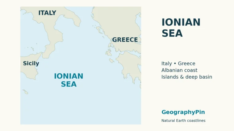
The Mediterranean surrounds much of the country. The Adriatic lies along the peninsula’s eastern side, the Ionian to the southeast, and the Tyrrhenian between the western peninsula, Sicily and Sardinia. The Ligurian Sea meets the northwest coast. These names identify different parts of the wider Mediterranean, not separate oceans.
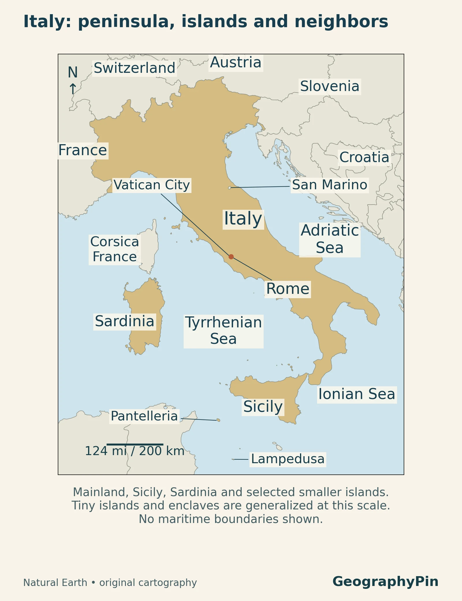
A useful first reading is north to south: locate the Alpine arc, the broad lowland below it, and then the long peninsula. Next identify the two large islands separately. Sicily sits near the peninsula’s toe; Sardinia lies farther west. Lampedusa and Pantelleria show why Italy’s southern geography extends beyond Sicily itself.
2. Country facts and regional structure
The population figure counts residents at a specified date, rather than Italian citizens worldwide. The area figure covers the country, including its islands.
| Topic | Reference |
|---|---|
| Capital | Rome |
| Location | Southern Europe and the central Mediterranean |
| Resident population | About 58.95 million at July 31, 2026; preliminary ISTAT estimate |
| Geographic area | About 116,600 square miles (302,000 km²); rounded from the EU’s 2026 figure of 302,073 km² |
| Major islands in this overview | Sicily, Sardinia and selected smaller islands |
| Political system | Parliamentary republic |
| Regional structure | 20 regions, five with special status |
| Language and currency | Italian; euro |
ISTAT’s July 2026 release reports 58,949,500 residents. The EU country overview supplies the area and institutional summary. For the full administrative map and regional capitals, use our Italy regions guide; physical regions such as the Po Plain are not additional administrative regions.
3. The Alps, Po Plain and northern lakes
Mountains frame a broad northern lowland
The Alps form an arc across northern Italy. Immediately south, the Po Plain creates a broad lowland between those mountains and the northern Apennines. This contrast is the clearest organizing feature on the relief map: a mountain rim, a relatively low basin, and another mountain belt beyond it.
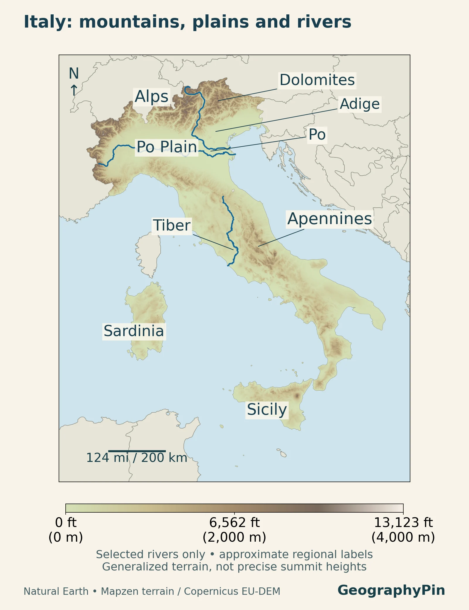
The Po basin authority describes a catchment framed by the Alps to the north and west and the Apennines to the south and southeast. Its physical drainage basin also extends into parts of France and Switzerland. A river basin follows the land draining toward a river, so it need not stop at a national border.
The authority’s administrative district is broader than the Po catchment alone and includes other river systems. Those two areas should not be confused. Across the plain, rivers, artificial canals and groundwater form an interconnected water landscape, rather than one isolated channel surrounded by dry land.
The Dolomites and Alpine lakes reveal different mountain histories
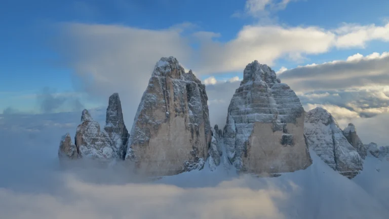
The Dolomites are part of the Italian Alps, not another name for the entire Alpine arc. UNESCO’s description connects their carbonate rocks with ancient marine environments and identifies both glacial and karst landforms. Their cliffs and towers preserve evidence of ancient seas, later uplift and erosion.
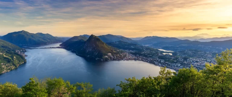
Farther west, Lake Como illustrates the lake-and-valley landscape of the southern Alpine foothills. Its three arms and the Adda’s outlet at Lecco are easier to understand on a detailed local map. On the national map, the important relationship is between the mountain valleys and the lower country to their south.
4. The Apennines and the peninsula
A long mountain belt, not one continuous ridge
The Apennines run along the peninsula, giving Italy a mountainous interior even far from the Alps. They are a system of ranges, uplands and intervening valleys, not a single narrow ridge traced down the middle of the boot. Coastal lowlands and hill country vary considerably from one part of the peninsula to another.
Central Italy provides a useful example of this variety. The Gran Sasso and Monti della Laga National Park describes limestone and dolostone in the Gran Sasso, compared with sandstone and marl in the Laga Mountains. Different rocks help produce different slopes, water pathways and landforms within the same broad mountain system.
The park also contains forests and high grasslands, showing why an Apennine landscape cannot be reduced to bare peaks. Elevation, rock type and exposure create local contrasts. Forested slopes and open uplands form part of the same mountain landscape.
The Po is not the outlet for every Italian river
The relief map marks the Tiber, called Tevere in Italian, flowing through central Italy toward the western coast. The Adige is another separate river system in the northeast. Compare these lines with the Po rather than assuming that all the country’s rivers belong to one national drainage basin.
The three highlighted rivers are a selection: smaller streams and catchments drain the land between them.
5. Sicily, Sardinia and the island landscape
Sicily and Sardinia have distinct physical identities
Sicily and Sardinia are Italy’s two largest islands, but they should not be treated as matching pieces of the mainland. Sicily faces the peninsula across the Strait of Messina. Sardinia lies farther west, separated from Corsica by the Strait of Bonifacio. Their positions place them in different parts of the Mediterranean setting.
On eastern Sicily, Mount Etna adds an active volcanic landscape of craters, lava flows and cones. Repeated eruptions reshape parts of the mountain, adding new material to a landscape built by volcanic activity.
Sardinia has a different and complex geological history. ISPRA’s geological guide describes sedimentary, igneous and metamorphic rocks rather than a single uniform island foundation. In the interior, the Gennargentu massif forms a substantial mountain landscape with valleys and gorges. Sardinia is therefore not simply a flat beach destination on the western edge of the map.
The smaller islands matter for national orientation too. The locator shows Lampedusa and Pantelleria in their geographic positions. Their positions help distinguish the Italian state’s territory from the outline of the peninsula and its two largest islands.
6. Regional climates
“Mediterranean” does not describe every Italian climate
Latitude, altitude and proximity to the sea combine to produce marked climatic differences. Many western and southern coastal areas, along with much of Sicily and Sardinia, have Mediterranean conditions with a pronounced summer-dry tendency. High mountains are colder, while the Po Plain has a different seasonal setting from the southern coast.
A 2026 study of Italian climate patterns uses reanalysis and station information for 1981–2024 to examine this diversity. Its regional framework distinguishes the humid-subtropical Po Plain from Mediterranean areas and colder high-elevation environments. A national average cannot describe all three equally well.
The Alpine foothills and parts of the Apennines also have cooler, wetter conditions than many Mediterranean coasts. Elevation can therefore produce substantial climate differences over a short distance.
7. Cities, countryside and human-shaped landscapes
Some famous scenery is a cultural landscape
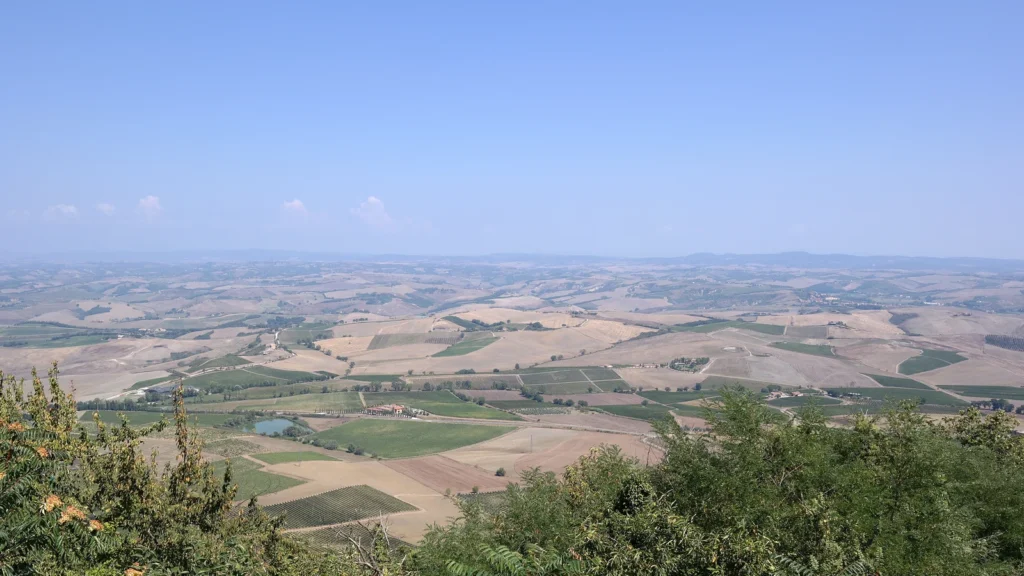
The featured photograph shows Val d’Orcia in Tuscany, seen from Montalcino. Its fields and rolling hills are not untouched wilderness. UNESCO identifies Val d’Orcia as a cultural landscape shaped by agriculture, settlement and the historical influence of Siena. The visual appeal of the countryside and its long history of human management belong to the same story.
This example adds a useful layer to a relief map. Elevation helps explain the shape of the hills, but it does not explain every field boundary, farm building or road. Physical terrain and land use should be read together rather than treating countryside as the opposite of human geography.
The lower Po offers a different example. UNESCO’s account of Ferrara and its Po Delta describes extensive drainage, new waterways and agricultural development under the Este rulers. Parts of the landscape associated with the delta were deliberately reorganized over centuries. A modern pattern of fields and canals can therefore preserve historical decisions about water and land, not just the river’s natural deposits.
8. The economy in its geographic setting
Economic contrasts do not follow a simple mountain–plain rule
Italy’s economic geography is regional as well as national. ISTAT’s preliminary 2024 territorial accounts show substantially higher output per person in the northwest than in the Mezzogiorno, the southern part of the country including the islands. This is a dated comparison of economic output, not a ranking of every household’s income or every community’s opportunities.
The same release reports economic growth in both the northwest and the Mezzogiorno during 2024. A difference in the level of output is not the same as a difference in its direction of change. Nor does a national or regional total tell us which industries dominate a particular town.
Read those economic patterns alongside, rather than instead of, the physical map. Mountain belts, plains, coasts and islands establish the geographic setting; cities, infrastructure, institutions and historical development add further layers. Italy’s geography becomes much clearer when those layers are compared instead of forcing the whole country into one landscape or one economic label.
What Did We Learn Today?
Italy is more than its peninsula. The Alps, Po Plain, Apennines, Sicily and Sardinia form a connected but varied national landscape. Rivers do not all belong to one basin, Mediterranean conditions do not describe every region, and cultivated countryside records human decisions as well as natural processes. Dated national statistics and detailed local maps add different kinds of information to that physical framework.
Sources & Data Notes
Population: preliminary resident total at July 31, 2026. Area: rounded from the EU’s 2026 geographic figure. Economic comparisons refer to preliminary 2024 territorial accounts, not current household income. Older geological and geographic references support stable landscape descriptions, not current population, volcanic summit heights or wildlife counts.
- Italian Ministry of Environment: geographic setting, 2009 national report
- European Union: Italy country overview and 2026 geographic area
- ISTAT: preliminary resident population at July 31, 2026
- Po River Basin District Authority: territory and river-basin setting
- UNESCO: Dolomites geology and protected components
- Gran Sasso and Monti della Laga National Park: terrain and habitats
- UNESCO: Mount Etna
- ISPRA: Sardinia geology, 2012
- Sardegna Turismo: Gennargentu massif
- Vavassori, Žgela and Brovelli, 2026: Italian climate patterns and changes, 1981–2024
- UNESCO: Ferrara and the Po Delta cultural landscape
- UNESCO: Val d’Orcia cultural landscape
- ISTAT: territorial economic accounts, preliminary 2024 estimates
Maps: original GeographyPin cartography using Natural Earth public-domain geometry. Generalized relief uses 35 actual Mapzen Terrarium elevation tiles; European terrain includes Copernicus EU-DEM. Terrain source attribution also documents the global mosaic’s component datasets. Colors depict approximate elevation, not a new survey. River geometry is limited to the Po, Adige and Tevere, labeled Tiber. Small landforms and enclaves are generalized, and no maritime boundaries are shown.
Featured photograph: Val d’Orcia from Montalcino, September 1, 2016, Luca Aless / Wikimedia Commons, CC BY-SA 4.0. Cropped and resized; the derivative retains the same license.