Malta can mean a country or its largest island, while Valletta is a much smaller capital city within that island. A useful country profile starts by separating those scales, then connects the archipelago’s limestone landscape, limited freshwater resources and harbors with its population and economy.
Malta is a sovereign island country in the central Mediterranean, south of Sicily. Its main islands are Malta, Gozo and Comino, and its capital is Valletta on the largest island. The country covers about 122 square miles (316 square kilometers), combining limestone terrain, densely settled areas and maritime connections rather than forming one continuous mainland territory.
How to use this article: Separate country, island and capital, locate island connections, or understand freshwater beneath the limestone.
1. Where is Malta?
Malta is an island country in the central Mediterranean, south of Sicily and north of the North African coast. It has no land border with another country. Italy lies to its north, while Tunisia and Libya provide the wider North African context; proximity does not make Malta part of any of them.
The national territory includes the main island of Malta, Gozo, Comino and smaller islets. A regional map often reduces this compact archipelago to one dot. A closer map is necessary to see that the country is not a single island and that its capital, Valletta, occupies only one small part of the largest island.
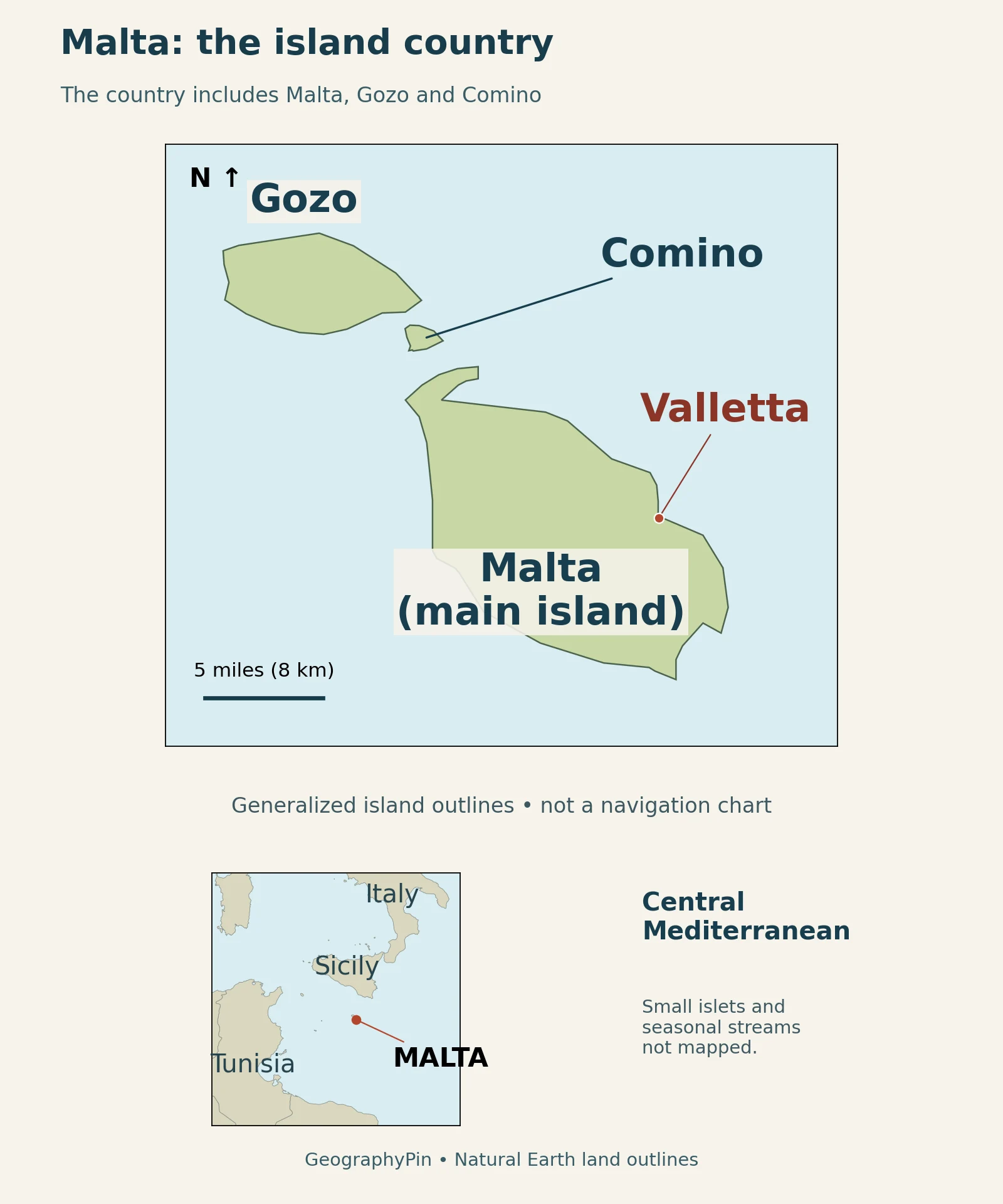
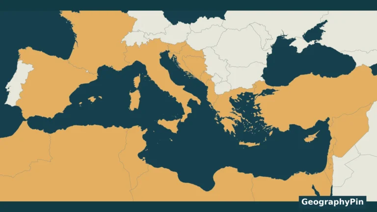
The main map and Mediterranean inset use different scales. The point on the inset locates the archipelago; it is not the size of Malta’s territory. Neither panel draws territorial seas or maritime jurisdiction. For the broader coastal setting, see the Mediterranean countries map.
2. Country facts with clear dates and scope
The country’s small land area makes precise labels especially important. A national population total includes residents across the archipelago, not just Valletta or the main island. It is also different from the number of Maltese citizens living in Malta or abroad.
| Topic | National fact | Scope or reference |
|---|---|---|
| Capital | Valletta | On the island of Malta |
| Land area | About 122 sq mi (316 km²) | Whole country; EU/Eurostat country overview |
| Population | 588,254 residents | End of 2025 estimate; NSO |
| Official languages | Maltese and English | EU country overview |
| Political system | Parliamentary republic | Prime minister heads the government |
| Currency | Euro | Euro-area member since January 1, 2008 |
| European Union | Member state | Since May 1, 2004 |
The European Union: Malta country overview provides the institutional facts and area. The population figure comes from the NSO Malta: World Population Day 2026, end-2025 estimates, released in July 2026 but referring to the end of 2025.
Country, main island and capital are different units
In a country table, “Malta” means the republic. In a ferry comparison between Malta and Gozo, it usually means the main island. Valletta is the capital city, not a third name for the entire republic. Keep those units separate before comparing population, land area or economic output.
3. Malta, Gozo and Comino on the same map
The largest island, Malta, occupies the southeastern part of the main group. Gozo lies to the northwest. Much smaller Comino sits between them. The water separating these islands is a practical part of national geography: places can belong to the same state without being connected by continuous land.
Comino’s small size also explains why it disappears on some country-scale maps. Enlarging a point symbol may help locate it, but it should not be mistaken for an accurate island outline. Here the close map uses Natural Earth’s land polygons, including Comino, rather than treating every island as a dot.
Island connections and harbor functions
Transport Malta: ports in the Maltese Islands identifies Mġarr as Gozo’s main port. On Malta, the northern ferry gateway at Ċirkewwa serves a different geographic role from the capital’s Grand Harbour and the industrial port of Marsaxlokk. These are not interchangeable places simply because all handle boats.
4. Limestone terrain and the water beneath it
The islands’ landscapes are not uniform flat rock. The Environment and Resources Authority: Maltese landscapes and geomorphology describes contrasts created by rock hardness, geological structure and weathering. Softer Globigerina Limestone supports gentler terrain in parts of eastern and southeastern Malta, while northern and northwestern areas include Upper Coralline Limestone cliffs and Blue Clay slopes. Gozo has a more varied pattern of exposed formations.
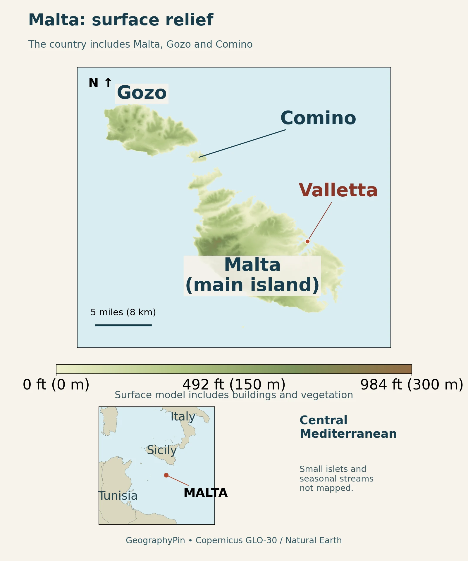
The Geological Survey of Malta: geological map and bedrock formations explains that the principal bedrock formations began as marine sediments roughly 30 to 5 million years ago. Later emergence, deformation and erosion produced the present land surface. “Limestone islands” is a useful shorthand, but it does not mean every exposed layer has identical properties: Blue Clay and Greensand are also part of the sequence.
Why a country without large rivers still has freshwater
The Energy and Water Agency campaign: freshwater and groundwater questions distinguishes the absence of large permanent river systems from the presence of smaller streams, ponds and valley-linked surface waters. Groundwater is especially important. Rain infiltrates pores and fractures in rock rather than remaining entirely at the surface.
Two settings help explain the supply. Perched groundwater can accumulate in Upper Coralline Limestone above less-permeable Blue Clay. Near sea level, freshwater occurs above saltwater within the Lower Coralline Limestone.
Drinking-water production combines groundwater and desalinated seawater. Reclaimed water and rainwater runoff also serve uses such as agriculture. A lack of large permanent rivers does not mean a lack of natural freshwater.
5. Valletta, settlement and population
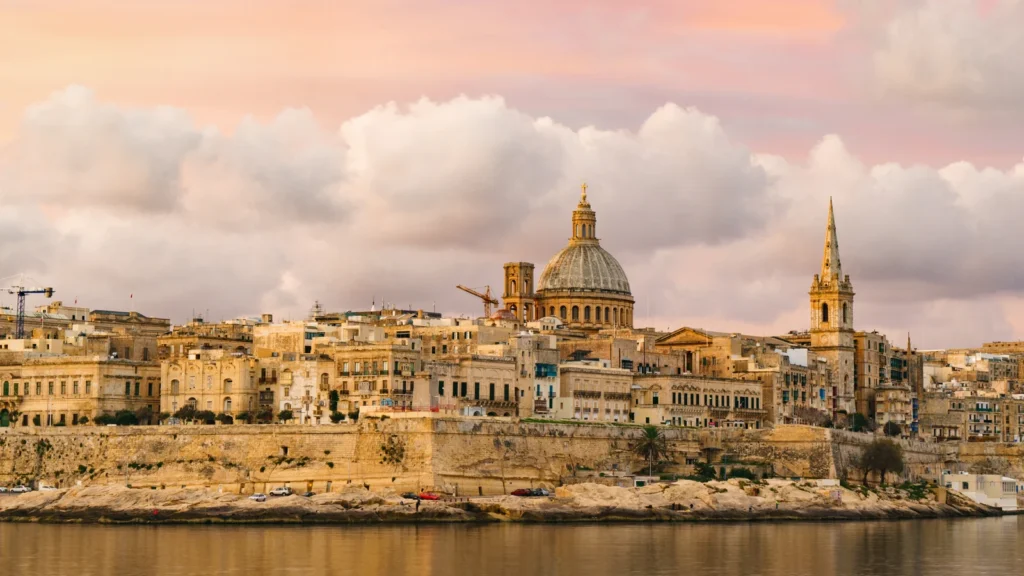
Valletta stands on a hilly peninsula between two harbors. UNESCO: City of Valletta describes the fortified city founded in 1566 after the siege of the previous year, with a planned street grid fitted within defensive walls. That peninsula setting helps explain its compact shape; it should not be confused with the much wider pattern of neighboring settlements.
The national capital is one point in a larger inhabited landscape. A map labeled “Valletta” does not establish the boundary of an urban area, and a national statistic cannot be assigned to the city. Our world capital cities reference separates country names from their capitals.
Residents, citizens and visitors are different counts
NSO’s end-2025 estimate includes Maltese and non-Maltese residents. It reports that 68.9% were Maltese citizens and 31.1% were non-Maltese citizens; these are citizenship categories, not ethnic or language classifications. Net migration was the main contributor to population growth during 2025.
Visitors are another category. A resident total does not measure every person present on the islands on a particular summer day. Nor does a country-wide average describe each locality: a small capital, neighboring built-up areas and less densely developed countryside can all sit within the same national figure.
Maltese and English are the official languages. That institutional fact does not mean every resident has the same language background or speaks both with equal fluency. As with the word “Malta” itself, a useful profile keeps the category being described explicit.
6. A maritime economy with regional contrasts
The two principal ports illustrate different uses of the coastline. Grand Harbour at Valletta handles varied maritime activity, including cruise traffic. Marsaxlokk contains Malta Freeport’s container facilities and industrial storage. A postcard of Valletta’s waterfront is therefore not a picture of the country’s entire port economy.
Malta Freeport Terminals: transhipment role and 2025 throughput describes its business as a transhipment hub. Containers are transferred between shipping services, so the volume passing through the terminal is not simply a measure of goods consumed in Malta. The operator reports 2.87 million twenty-foot-equivalent units, or TEUs, handled in 2025. TEUs measure container capacity, not individual ships or tonnes of cargo.
NSO Malta: regional gross domestic product, 2024 shows the scale difference between the main-island region and Gozo and Comino. In its provisional 2024 figures, the Malta region accounted for about 95.6% of national GDP at market prices, compared with 4.3% for Gozo and Comino. A small extra-regio category covers economic territory that cannot be assigned directly to either region; the regional shares therefore need not total 100%.
Regional GDP measures production, not household income or personal prosperity. It helps locate economic activity, but cannot by itself explain a resident’s wages, housing costs or access to services. Treat the reference year and regional definition as part of the number, not a footnote to discard.
Water demand also varies across the islands and through the year. NSO Malta: regional water statistics, 2024 reports stronger summer peaks in the Gozo and Comino region in 2024. This connects the physical and human geography: supplying a compact island country requires infrastructure that responds to where and when water is needed, not just an annual national population total.
What Did We Learn Today?
Malta’s geography becomes clearer when the country, the main island and Valletta are treated as different places. The archipelago’s rock layers and groundwater systems explain more than a simple “small island” label, while harbors connect it to a much wider maritime economy. Population and GDP figures become useful only when their dates, territorial coverage and measurement categories stay attached.
Sources & Data Notes
Population refers to the end of 2025; regional economic and water figures refer to 2024. Area is rounded from 316 square kilometers. The original GeographyPin locator uses public-domain Natural Earth land geometry, with a separate regional inset. Small islets are omitted, and the maps do not show maritime boundaries or a drainage network.
The relief graphic uses Copernicus GLO-30 Public, 2021 release, a surface model that includes vegetation and buildings. Two tiles were reprojected and bilinearly resampled for illustration; colors are not a field survey or precise peak measurement. It was produced using Copernicus WorldDEM-30 © DLR e.V. 2010-2014 and © Airbus Defence and Space GmbH 2014-2018 provided under COPERNICUS by the European Union and ESA; all rights reserved. See the data description and reuse terms.
Featured photograph: Valletta in November 2017, Olga Prystai, CC BY-SA 4.0. Resized, slightly cropped and converted to WebP; this derivative remains under the same license. It is a historical photograph, not a current conditions report.
- European Union: Malta country overview
- NSO Malta: World Population Day 2026, end-2025 estimates
- Environment and Resources Authority: Maltese landscapes and geomorphology
- Geological Survey of Malta: geological map and bedrock formations
- Energy and Water Agency campaign: freshwater and groundwater questions
- NSO Malta: regional water statistics, 2024
- UNESCO: City of Valletta
- Transport Malta: ports in the Maltese Islands
- Malta Freeport Terminals: transhipment role and 2025 throughput
- NSO Malta: regional gross domestic product, 2024