Stone Mountain’s rounded outline makes it one of the Atlanta area’s most recognizable landforms. Understanding it means separating three things: rock that formed underground, a dome exposed by landscape change, and a much later memorial carved into its surface.
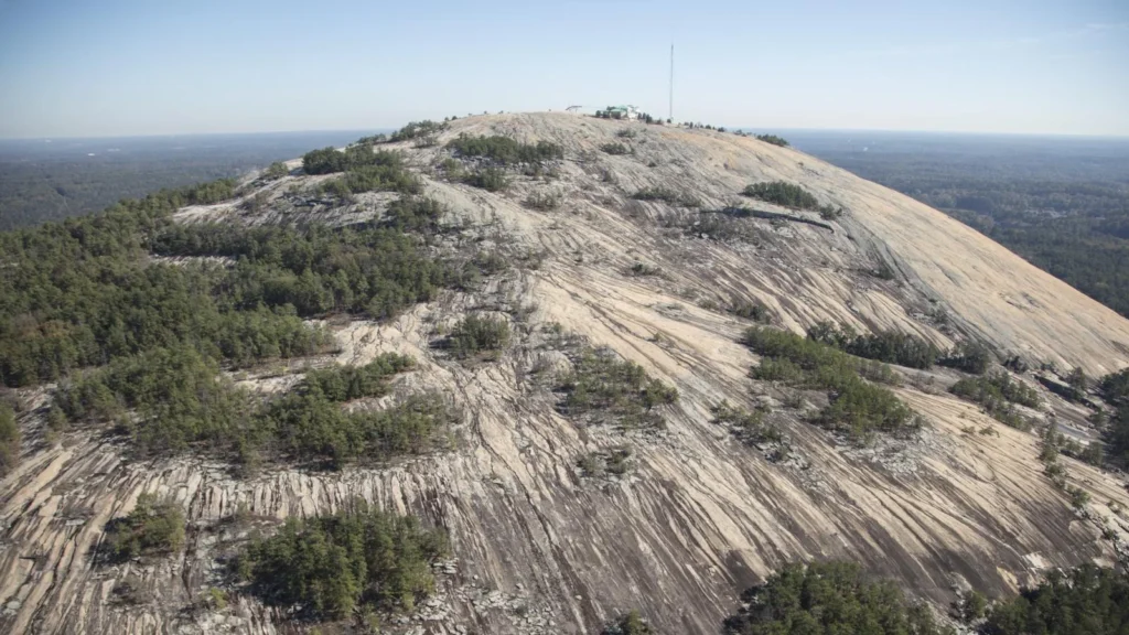
Stone Mountain is an exposed granitic dome east of Atlanta, Georgia. Its summit reaches 1,686 feet (about 514 meters) above sea level. The rock solidified underground before erosion exposed it; the mountain is not an old volcanic cone. The surrounding park and the Confederate memorial have distinct human histories.
Explore the mountain: Start with its location, follow the rock-to-landform process, or read the memorial’s historical context.
1. Where is Stone Mountain in Georgia?
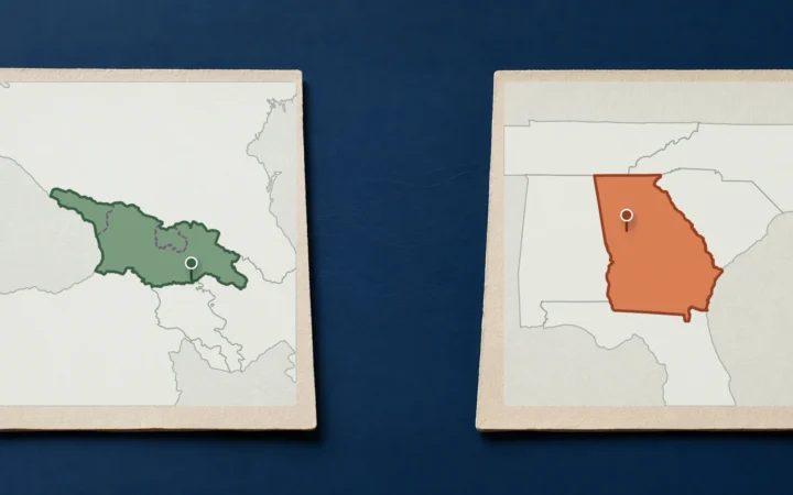
Stone Mountain stands east of Atlanta in DeKalb County, Georgia. It is a prominent exposed-rock landform in the Piedmont, not a volcanic cone. The name can refer to the physical mountain, the surrounding recreational park, or the nearby municipality, so a useful locator needs to distinguish the feature from an entrance or street address.
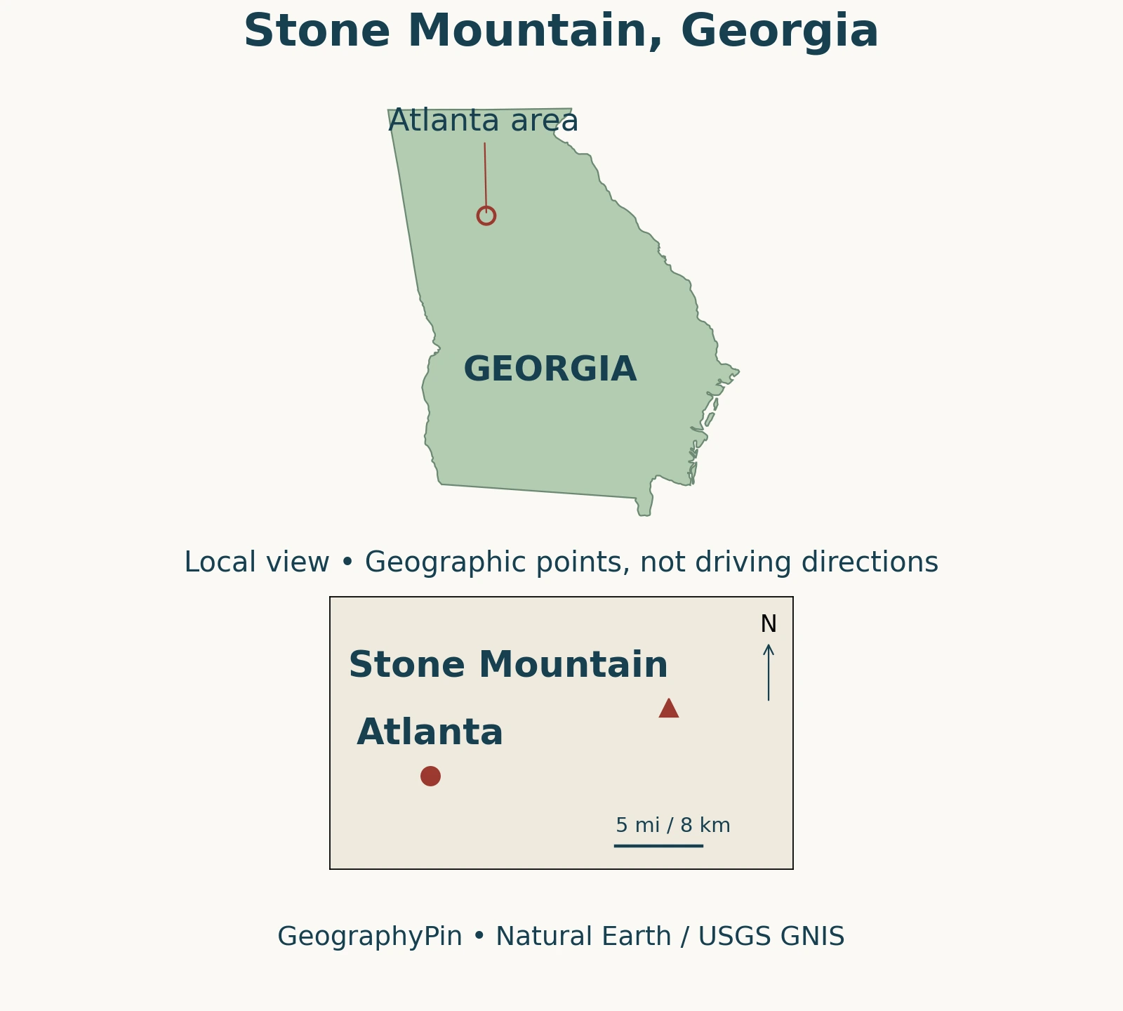
The City of Stone Mountain: 2021 Comprehensive Plan, page 10 treats the city and park as distinct places and notes that part of the park lies within the city limits. They should not be described as identical areas, but neither should they be assumed to be completely separate on the ground.
For a visit, use an official park entrance or facility address rather than a summit coordinate. The position of a landform tells you where it is; it does not tell you how roads, access arrangements, or visitor facilities connect to it.
2. Granite formed underground, not in a volcanic cone
The Georgia Geologic Survey: Geologic Guide to Stone Mountain Park (1980) describes an intrusion: molten rock solidified underground and erosion later exposed it. That differs from a volcanic cone built by surface eruptions.
The familiar word granite describes the rock in visitor guides and in the name Stone Mountain Granite. The Stone Mountain Memorial Association: environment and geology identifies quartz, mica, and feldspar among its minerals. A mountain-sized exposure is not a single mineral crystal, and its pale appearance does not mean that every grain has the same composition.
The older Geological Survey guide dates the granite to approximately 300 million years ago. This is a rock-formation age, not the age of today’s exposed surface or skyline.
Separating rock formation from landform development is useful well beyond this mountain. A rock can form deep underground, become fractured, and eventually reach the surface as the surrounding landscape changes. Those are different stages of the same geological history, not competing descriptions of one moment.
3. How erosion and exfoliation shape the dome
A simplified sequence begins with rock crystallizing below the surface. Erosion removes material above it, while weathering alters and breaks down rock exposed near the surface. The remaining landform can stand above its surroundings as less resistant or more fractured material is removed.
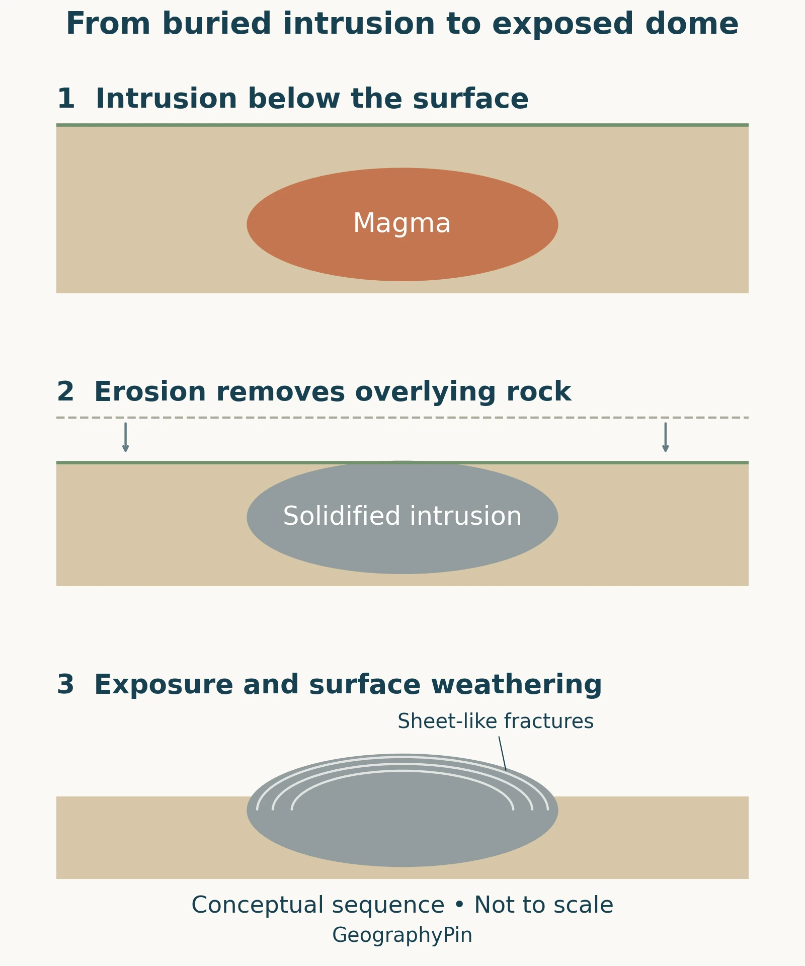
USGS: how exfoliating granitic domes develop describes the development of fractures roughly parallel to the surface as buried granitic rock is exposed. Weathering and removal of material along these fractures can produce curved sheets and rounded surfaces. This process is called exfoliation; the name refers to layers separating, not to lava flowing over the outside of the mountain.
That USGS explanation concerns granitic domes in California and is used here for the general process, not as evidence of Stone Mountain’s particular dimensions or geological dates. The local Georgia guide independently describes exfoliation at Stone Mountain.
For a broader explanation of how rocks, relief, and surface processes fit together, see what physical geography studies. A conceptual diagram can clarify the sequence, but it cannot replace geological mapping or reveal an exact underground shape merely from the outline of the hill.
4. Summit elevation is not the height above nearby land
The Stone Mountain Park: summit elevation and visitor information gives the summit elevation as 1,686 feet, approximately 514 meters, above sea level. This is not the amount of climbing required from every starting point, nor is it the dome’s height above every part of the surrounding landscape.
| Measure | Meaning | How to use it |
|---|---|---|
| Summit elevation | Height above sea level | The park publishes 1,686 feet (514 meters). |
| Local relief | Height difference between the summit and surrounding terrain | Depends on the lower point used for comparison. |
| Route ascent | Climbing along a particular route | Requires the actual starting point and route profile. |
These distinctions explain why different descriptions can give different-looking height figures without referring to different mountains. A summit measurement has a sea-level reference; a statement that a dome “rises above” nearby ground uses a local reference. Neither number alone tells you whether a path is steep, exposed, or suitable for a particular visitor.
5. Bare rock can contain specialized habitats
A distant view can make Stone Mountain’s exposed rock look almost lifeless. At a much smaller scale, shallow depressions collect water and support specialized plants. A U.S. Fish and Wildlife Service: restoring granite outcrop pools (2022) describes work with black-spored quillwort and pool sprite in these granite outcrop pools.
The agency describes shallow pools supplied by rain and seepage, generally wet during winter and early spring and dry during summer and fall. The timing and persistence of water matter: a depression must hold suitable conditions long enough for the plants’ life cycles. Its value is not determined simply by whether it looks like a large pond.
The 2022 account also describes conservation work to improve some pools. It is a dated account of a restoration project, not a current census of plants or a promise that every pool will contain water when someone visits. Avoid treating apparently empty depressions as disposable patches of ground.
The Memorial Association describes both outcrop communities and surrounding woodland within the park. These habitats help explain why the mountain, its bare-rock surface, and the wider park should not be treated as one uniform environment.
6. The memorial is a separate, contested human history
The north-face carving depicts Confederate president Jefferson Davis and generals Robert E. Lee and Thomas “Stonewall” Jackson. Its presence is part of the mountain’s cultural landscape, not an explanation of how the dome formed.
Atlanta History Center: Monument, the history of the carving places the start of the memorial effort in the 1910s and its completion in 1972. The long interval matters: this was not a carving created during the Civil War. Its development involved later choices about how the Confederacy would be commemorated.
The museum’s Atlanta History Center: Carving Fact from Fiction connects the early campaign to the United Daughters of the Confederacy and the Ku Klux Klan’s 1915 revival at the mountain. It also explains the renewed effort in the 1950s within resistance to racial integration. That context is central to understanding why the memorial remains contested rather than treating it only as an engineering or artistic achievement.
The Stone Mountain Memorial Association: institutional history records its establishment in 1958, the carving’s dedication in 1970, and completion in 1972. Dedication and completion are different milestones, so those two years need not contradict each other.
Visitors can study the natural landform while recognizing that the monument represents a particular commemorative project with a disputed legacy. The museum’s documentation provides historical context; the park and Memorial Association provide current visitor and institutional information. The distinction between human and physical geography helps separate these questions without pretending that they concern unrelated places. Neither the geological story nor the memorial story should erase the other.
Frequently Asked Questions
Is Stone Mountain the world’s largest granite outcrop?
No. The Georgia Geologic Survey rejects this claim and notes larger granite domes elsewhere. An exposed dome and the full underground rock body are also different things.
What Did We Learn Today?
Stone Mountain is best understood by separating the rock, the landform, and the memorial. Underground crystallization explains the material; exposure, weathering and erosion explain the dome. Summit elevation is not route ascent, small pools can be important habitats, and the carving belongs to a later, contested history of commemoration.
Sources & Data Notes
The park’s published summit elevation is converted from feet to meters using 0.3048, then rounded. The 1980 Georgia guide is used for established geological distinctions, not current access instructions. The cross-section is conceptual and does not specify an emplacement depth or a precise exposure date. Habitat restoration details are attributed to the Fish and Wildlife Service’s 2022 account. Historical interpretation follows the Atlanta History Center alongside the Memorial Association’s institutional chronology.
- Georgia Geologic Survey: Geologic Guide to Stone Mountain Park (1980)
- USGS: how exfoliating granitic domes develop
- Stone Mountain Memorial Association: environment and geology
- Stone Mountain Park: summit elevation and visitor information
- U.S. Fish and Wildlife Service: restoring granite outcrop pools (2022)
- City of Stone Mountain: 2021 Comprehensive Plan, page 10
- Atlanta History Center: Monument, the history of the carving
- Atlanta History Center: Carving Fact from Fiction
- Stone Mountain Memorial Association: institutional history
Map and image credits: The locator combines Natural Earth state outlines (public-domain terms) with USGS National Map GNIS points: Stone Mountain, ID 326088, and Atlanta, ID 351615. Atlanta is a location point, not its municipal boundary. The state view and local inset use separate equirectangular views centered at 33°N and 33.78°N respectively; the scale applies only to the inset. No park boundaries or roads are shown. The original GeographyPin process drawing is conceptual, based on the Georgia guide and the general USGS explanation.
The featured photograph shows Stone Mountain on October 31, 2017: Carol M. Highsmith, Library of Congress, Prints and Photographs Division, LC-DIG-highsm-46753. Photographs in Carol M. Highsmith’s America Project in the Carol M. Highsmith Archive. The catalogue rights advisory is “No known restrictions on publication.” Cropped to a wide format and converted to WebP; it is a historical photograph, not a view of current conditions.