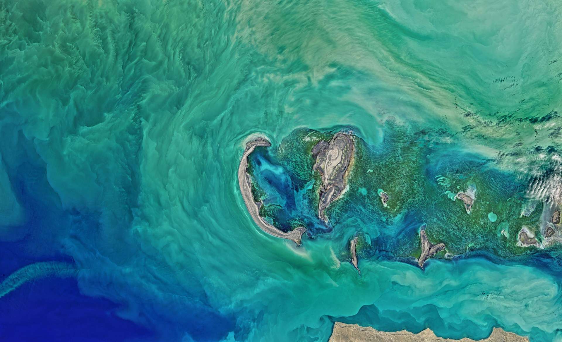
Lake Salda is a closed-basin, alkaline lake in Burdur Province, southwestern Türkiye, known for its white mineral shoreline. Its magnesium-rich waters support unusual carbonate deposits associated with microbial activity. Scientists study Salda to understand comparable geological processes, including possible interpretations of ancient lake deposits on Mars, not because the two places are identical.
- Finding the lake? See its regional setting.
- Checking a depth claim? Read why published measurements disagree.
- Planning a visit? Start with protected-shore restrictions, not an old beach photograph.
1. Where Is Lake Salda?
An inland lake in southwestern Anatolia
Lake Salda lies in Yeşilova district, Burdur Province, within the lake country of southwestern Anatolia. In Turkish, its name is Salda Gölü; English sources also use Salda Lake. These names refer to the same lake, not separate destinations.

The locator places it east of Denizli, west of Burdur city and northwest of Antalya. Antalya is on the Mediterranean coast; Salda is inland. A photograph of turquoise water and a pale shore should not be mistaken for a coastal lagoon or a connection to the sea.
The red dot identifies the lake’s position at regional scale. It is not a lake outline, parking location or approved entrance. Use the map for orientation and local access information for the last part of a journey. For the broader setting, see our Türkiye country profile.
2. Lake Salda Facts and Measurement Limits
Lake measurements need a source and a reference context. A surface area is not the area of the surrounding protected landscape. Elevation describes the water surface above sea level; depth measures downward from that surface. Neither should be treated as an unchanging number.
| Feature | Reported description | Source and limitation |
|---|---|---|
| Location | Yeşilova district, Burdur Province, Türkiye | Official Salda information page |
| Surface area | About 17 sq mi (44 km²) | Official information page; no measurement year stated, not a current satellite measurement |
| Maximum depth | About 382.5 ft (116.58 m) in the cited survey | DSİ 2015 bathymetry, reported in the 2025–2029 management plan, section 1.2.2.3 |
| Surface elevation | About 3,740 ft (1,140 m) | Same management-plan section; reference description, not today’s gauge reading |
| Water setting | Alkaline and magnesium-rich; no surface outlet | Geochemical and hydrological studies; not an ocean-water classification |
Why you may see a different depth
The official public information page gives 604 ft (184 m). However, the ministry’s 2025–2029 management plan explicitly contrasts widely repeated depths around 591 ft (180 m) with the 2015 DSİ survey result in the table. The underlying survey is being cited through that plan, not presented as a new independent measurement.
These figures should not be averaged, silently substituted for one another, or explained away as ordinary seasonal change. They are conflicting source claims. For that reason, Salda is described here without a national depth ranking, and the survey-based figure is labeled with its provenance.
3. How the Basin Holds Water
Salda occupies a tectonic depression: its basin belongs to a landscape shaped by crustal extension. That is different from saying the lake is an impact crater. The Mars comparison concerns particular deposits and processes, not an identical origin for the two basins.
A closed basin has no surface river outlet. Water still moves through the system. Rainfall, streams and groundwater supply Salda, while evaporation removes water. A 2023 hydrological study by Davraz and Aksever examined these inputs and lake-level changes, including groundwater moving toward the lake.
That study reported a fall of about 10.4 ft (3.17 m) between September 2015 and January 2022. This is a historical interval, not a measurement of the lake’s change this year. It also does not establish that one influence explains every period of falling water.
Water management matters alongside weather. The management plan discusses altered stream inflows and groundwater pressures. A useful explanation therefore asks both how much water arrives and how much leaves, rather than attributing the entire change to a single dry summer.
For the general distinction between a lake’s basin, its catchment and its water balance, see what makes a lake a lake. At Salda, that distinction also helps explain why protecting the visible shore alone cannot protect the whole water system.
4. Why the Shoreline Is White
Rock chemistry, microbes and reworked deposits
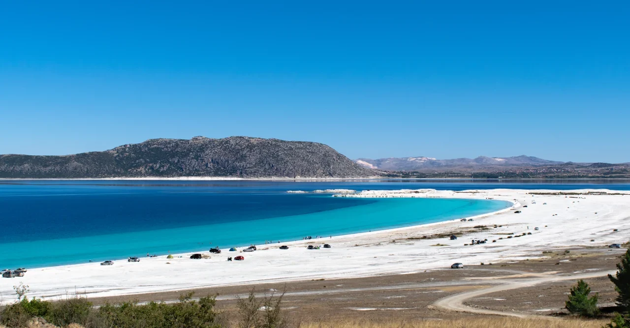
The white shore is not simply ordinary quartz sand painted by blue water. NASA’s description identifies pale sands and gravels dominated by hydromagnesite, a hydrated magnesium carbonate. “Sand” describes grain size, so saying the material cannot be sand because it contains an unusual mineral is misleading.

Surrounding magnesium-rich rocks help supply dissolved magnesium. In the lake, mineral formation interacts with microbial communities. A microbialite is a sedimentary buildup associated with microbial activity; a stromatolite is a layered form. It is a rock structure, not the name of one animal or plant.
The process diagram separates mineral supply, precipitation and subsequent reworking. These are connected stages, not three mapped zones around the lake. A 2016 sediment study describes living microbial buildups in shallow, sheltered water and discusses sediment derived from older carbonate formations.
A 2026 study in Journal of Geophysical Research: Planets found strong microbial involvement in hydromagnesite formation, while also identifying an abiotic pathway for aragonite. In plain terms, biology can help minerals grow, but not every carbonate grain is evidence of life. The lake’s chemistry remains part of the explanation.
That distinction makes the shore scientifically valuable. Looking only at its color misses the relationships between water, mineral surfaces, microorganisms and physical sediment movement. Nor can a photograph establish a deposit’s composition: identifying minerals requires evidence beyond appearance.
5. What the Mars Comparison Means
NASA researchers have used Salda as an Earth-based comparison for the ancient lake environment at Jezero Crater on Mars. The useful parallels include carbonate-bearing deposits and features associated with water delivering sediment into a lake. Salda provides a place where scientists can investigate processes directly.
An analog is a comparison for a particular question, not a duplicate world. Researchers can ask what mineral textures might preserve a record of an environment and how biological and nonbiological formation pathways could be distinguished. An Earth example helps frame those questions; it cannot answer them for Mars by itself.
Three limits keep the analogy honest:
- Salda is a living Earth ecosystem, while Jezero’s lake deposits record a very different planetary past.
- A similar mineral does not necessarily mean the same formation mechanism.
- The comparison does not demonstrate that life existed on Mars.
Descriptions such as “Mars on Earth” may be memorable, but the more informative story is specific: scientists study how water, rock chemistry and possible biological influences leave evidence in sediments.
6. Protected Access and Visiting Context
A scenic shoreline is not permission to enter it
Salda and its surroundings were designated a Special Environmental Protection Area in March 2019. At Beyaz Adalar, an official provincial notice prohibited entering the lake, swimming and using the shore as a beach from October 15, 2020. That notice concerns the named shoreline; it should not be rewritten as a blanket statement about every part of the lake.
Before visiting, check current official notices and follow signs, barriers and staff instructions at the actual access point. An old photograph showing people or vehicles on white sediment does not establish what is permitted now. The featured photograph dates to 2014 and is a landscape illustration, not current access advice.
For a low-impact visit, keep to permitted routes and viewpoints, leave mineral material where it is, and do not enter a restricted shore for a closer photograph. Avoid treating the pale sediment as a souvenir or cosmetic product. Its scientific interest is a reason to leave it undisturbed, not a reason to collect it.
Plan around the place you are actually visiting: an inland protected lake, not a resort beach. Confirm opening arrangements, transport and any charges locally rather than relying on undated travel summaries. A regional locator cannot show temporary closures or prove that a road ends at an authorized entrance.
Frequently Asked Questions
Is Lake Salda a volcanic crater lake?
Its setting is described as a tectonic depression, not a volcanic crater. Comparing its deposits with Jezero Crater does not give the two basins the same origin.
Does alkaline mean the same thing as salty?
No. Alkaline describes acid–base chemistry; salinity concerns dissolved salts. Salda’s unusual magnesium-rich chemistry should not be reduced to a comparison with seawater, and blue water alone tells you neither measurement.
What Did We Learn Today?
Lake Salda is an inland alkaline lake whose white shore connects geology, water chemistry and microbial processes. Its Mars analogy is scientifically useful only when those specific parallels and limits remain clear. Source-labeled measurements, a regional locator and respect for protected access make the lake easier to understand without turning uncertain figures or old photographs into misleading facts.
Sources & Data Notes
- Official Salda information: location, general area figure and protection designation.
- Salda 2025–2029 management plan: bathymetry section 1.2.2.3, printed page 47, and discussion of water-management pressures. The 2015 survey result is reported through this plan.
- Davraz and Aksever, 2023: hydrological inputs and the explicitly dated 2015–2022 lake-level change.
- Kaiser and colleagues, 2016: microbialites and the sedimentary setting.
- Słowakiewicz and colleagues, 2026: mineral formation pathways and geological setting.
- NASA Earth Observatory, 2020 and NASA, 2021: white shoreline material and the scope of the Jezero comparison.
- Burdur provincial notice, September 29, 2020: Beyaz Adalar restrictions effective October 15, 2020.
Map and diagram: original GeographyPin artwork. Locator basemap and city points use public-domain Natural Earth data; the lake reference point follows IUGS’s Salda location. The dot is not a shoreline survey. The mineral diagram is conceptual and not to scale.
Featured photograph: Ahmet Emre Öz, SaldaLake2, May 15, 2014, CC BY-SA 4.0. Resized and converted to WebP, with cropped display thumbnails; the adapted image remains under the same license. Historical scene, not a statement of present-day access.