Getting from Yerevan to Dilijan is only the first part of a national-park visit. A ride into town can work well for a walk and lunch, but Lake Parz, Haghartsin and the forest trailheads are different destinations. Decide which version of the day you want before choosing your departure.
Travel from Yerevan to Dilijan by road, choosing a minibus, app-booked shared shuttle or private transfer with a confirmed arrival point. For a town visit, finish in central Dilijan. For the national park, choose a specific walking route or arrange a separate transfer rather than asking for a generic park entrance.
Quick links: the three trip types, Yerevan pickup points, and the town-to-trail commitment.
Choose the journey around your final destination
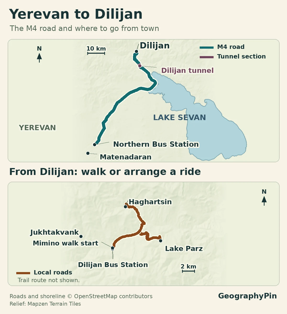
The usual road corridor runs northeast from Yerevan toward Sevan on the M4, then through the Dilijan tunnel and down toward Dilijan. Armenia’s Road Department identifies the tunnel as part of the M4 Yerevan–Sevan–Ijevan road. A map of that corridor explains the journey, but it is not evidence that a particular departure is running or that the road is clear on your date.
Pick the kind of day before the vehicle
Transport information checked November 19, 2026. The ministry’s route record names Northern Bus Station and Dilijan. Check your date, fare and pickup with the operator, and confirm the return separately.
| Choice | Departure and arrival to confirm | Final local leg |
|---|---|---|
| Intercity minibus | Yerevan Northern Bus Station to Dilijan bus station; confirm the operating departure | Walk to your town destination or arrange onward transport |
| ggShuttle | The pickup and drop-off pins for the actual app booking | A shared town-to-town seat is not a trailhead transfer |
| Private driver | Your agreed Yerevan address and named Dilijan destination | Can include a trailhead or return pickup if explicitly arranged |
For a town-only day, public or shared transport avoids paying a driver to wait. For a short visit focused on an outlying monastery or lake, a prearranged driver can be the more useful choice because it solves the last leg and the pickup afterward. Compare the whole arrangement, not just the Yerevan–Dilijan seat price.
Find the right departure point in Yerevan
Northern Bus Station and Matenadaran are not interchangeable
The ministry-hosted Dilijan–Yerevan route document labels route 651 between Dilijan bus station and Yerevan’s Northern Bus Station. The public Transport for Armenia listing corroborates those endpoints. Use that terminal name when checking the intercity minibus, rather than assuming every Yerevan bus leaves from the central Kilikia terminal.
The Transcaucasian Trail’s practical information describes gg shared-minivan departures near the top of Mashtots Avenue below the Matenadaran. Treat that as orientation, not a substitute for the current booking pin: confirm the pickup point, departure, destination and available seat in the gg app before traveling there.
ggShuttle and a private gg ride are different products. Make sure you are looking at a shared intercity departure if that is what you want, rather than ordering a whole vehicle. If booking for more than one traveler, verify the number of seats and any luggage arrangements together.
Public sources give differing schedules and journey estimates, and the ministry annex has an internally inconsistent time table. It is not sensible to turn those entries into an exact departure promise. Ask for the departure and expected arrival for your date, then add your journey from the hotel to the pickup point and the local leg in Dilijan.
Arrive in Dilijan town before choosing the next leg
For a first visit, central Dilijan is a useful place to arrive, orient yourself and decide how much of the day remains. The bus station, your accommodation and the beginning of a walking route are not necessarily the same spot. Keep the destination address or map pin available rather than relying only on the town name.
A town visit and a national-park hike also have different time requirements. You can have a worthwhile day built around streets, a meal and a short walk without committing to a forest route. If hiking is the priority, arriving late and adding a trail simply because it appears nearby on a map is a poor substitute for planning the route first.
Before leaving the arrival area, establish the return meeting point and how the return journey is arranged. For a minibus, check the departure with the station or service staff. For a reserved shuttle, use the pickup point on the return booking, which need not be the place where you were dropped off.
Reach a trail from town or arrange a separate transfer
The walk to Jukhtakvank is one way, not a short loop
Yes, you can begin a documented route from Dilijan town without a car. The Transcaucasian Trail describes a 4.4-mile (7.1-kilometer) section from the center near the Mimino statue to Jukhtakvank. It follows town streets and roads before reaching the monastery approach; it is not continuous forest walking from the first step.
Retracing a 7.1-kilometer route makes about 8.8 miles (14.2 kilometers) in total, before side trips. That simple doubling changes the decision: walking out and returning on foot is a substantially larger commitment than the one-way distance suggests. If you want a shorter outing, plan a shorter route or a confirmed vehicle pickup rather than assuming one will be waiting at the end.
HIKEArmenia also presents the town-to-Jukhtakvank route as a walk through the settled area toward the twin churches. Use its route material and the TCT notes to understand the surfaces and route, then check local conditions. A difficulty label is not an assurance of suitability in rain, snow or ice.
Lake Parz and Haghartsin need separate access planning. They are not roadside equivalents of the central Dilijan stop, and their road approaches lead to different places. A sightseeing driver can combine destinations, but the itinerary must specify the stops, waiting time and return. A town-to-town transport ticket does not include that circuit.
For a walking trip, name the trailhead rather than just the monastery or lake. Tell a driver whether you need a drop-off only, an out-and-back visit with waiting, or a pickup at a different endpoint. Those are different services, even when the same place names appear in the itinerary.
Plan the return before committing to a hike
Choose the return arrangement before setting out on the longer local leg. An onward forest walk can take longer than expected, and returning to Dilijan town still leaves the intercity journey to Yerevan. Avoid linking a hike to the last possible departure with no alternative.
For a day trip, I would choose one main activity: the town, one hike, or a road-based visit to selected outlying sights. Combining a substantial walk with Lake Parz and Haghartsin can turn the day into a chain of transfers. Staying overnight is the more flexible option when you want both the town and a longer park outing.
The TCT’s seasonal guidance notes spring mud, possible lingering higher-elevation snow and cold conditions late in the year. Check the forecast and current trail advice for the actual route, not just Yerevan’s weather. Conditions in town do not establish that a forest trail or higher section is suitable.
For a private pickup, agree the meeting point, time and way to contact the driver before losing reliable service. Carry the route information offline and leave a realistic margin for returning. On the road, consult current official notices rather than treating an old report of a closure, or an old report that a road was open, as today’s status.
Frequently Asked Questions
Can I stop at Lake Sevan on the way and keep the same booking?
Do not assume so. A shared intercity seat is a journey between its agreed stops, not a sightseeing reservation. Ask the operator whether a break and later continuation are possible, or arrange the Sevan stop explicitly with a private driver. Passing the Sevan area on the M4 does not mean the vehicle visits the peninsula or waits there.
Are Jukhtakvank and Jukhtak Monastery different destinations?
They are names used for the same twin-church complex. TCT uses Jukhtakvank, while HIKEArmenia also calls it Jukhtak Monastery. Share the exact trailhead or pickup pin with a driver, because the monument and the accessible vehicle meeting point need not coincide.
Can I reach a park trail from Dilijan town without a car?
Yes. The Transcaucasian Trail describes a 7.1 km (4.4 mi) walk from the Mimino statue area to Jukhtakvank. If you walk back the same way, allow 14.2 km (8.8 mi) before detours, plus time to reach your booked return transport. The map marks the endpoints, not the route.
What Did We Learn Today?
Yerevan to Dilijan is a road journey with several possible departure arrangements, but the most useful choice depends on where you want to finish. Confirm the terminal or app pickup, separate a town visit from a trailhead transfer, and count the return distance when walking from Dilijan. One clearly planned activity works better than treating the whole national park as a single stop.
Sources & Data Notes
Transport information checked November 19, 2026. Published route records identify endpoints, not current departures or seats. The out-and-back walking distance doubles the published one-way length.
- Armenian transport ministry: route 651 endpoints
- Transport for Armenia: route 651 stop listing
- ggShuttle: operator and app
- Transcaucasian Trail: transport and seasonal conditions
- Transcaucasian Trail: Dilijan to Jukhtakvank
- HIKEArmenia: town-to-twin-churches walk
- Visit Dilijan: private car-and-driver terms
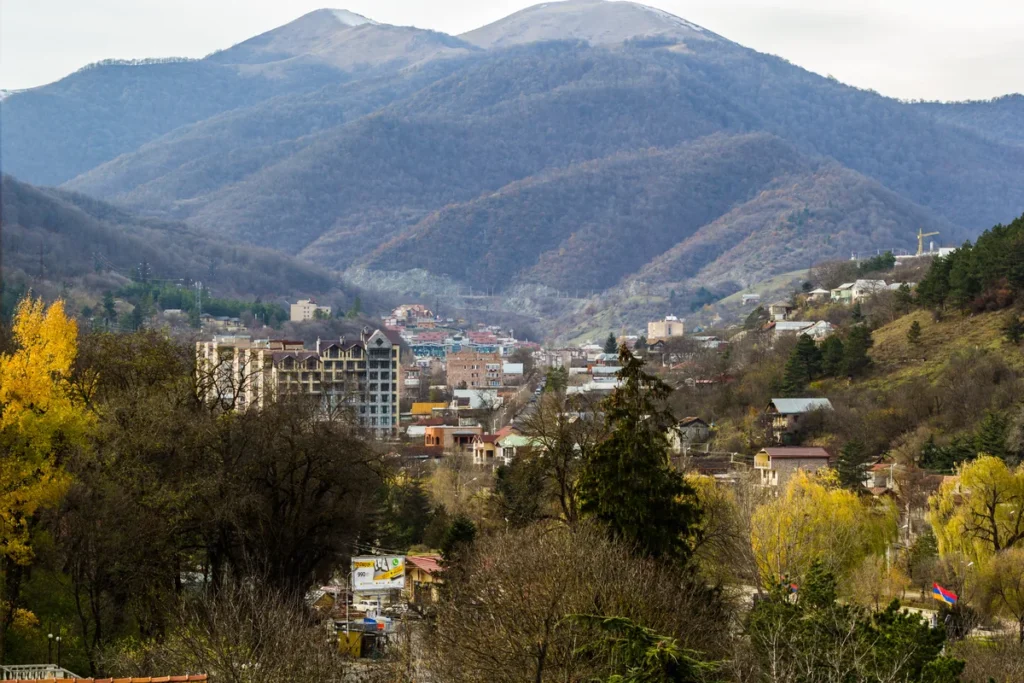
Photograph: Downtown Dilijan, Serouj Ourishian, November 15, 2015, Wikimedia Commons, CC BY-SA 4.0. Resized and converted without cropping. The derivative image remains under CC BY-SA 4.0.
Map: GeographyPin. OpenStreetMap contributors (ODbL), Geofabrik Armenia snapshot, November 18, 2026; relief from AWS Terrain Tiles. The map shows geography, not a tracked vehicle, service guarantee or live access conditions.