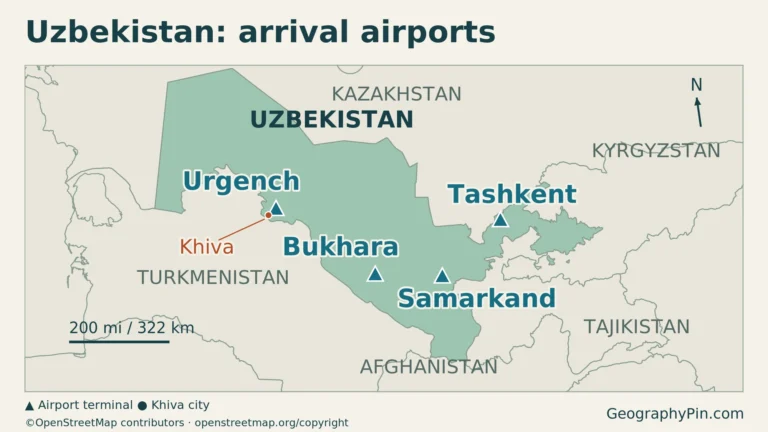
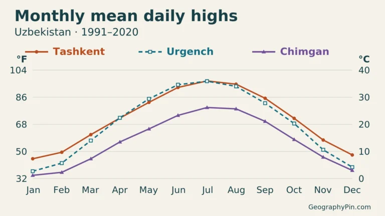
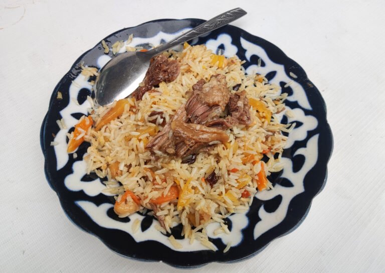
Uzbekistan’s green valleys and historic cities stand in sharp contrast to the dry landscapes surrounding them. Water arriving from distant mountains supports irrigated farmland, while desert plains stretch across much of the center and west. This contrast explains more about the country than a map showing only its borders.
Desert country, mountain-fed valleys
Uzbekistan is a doubly landlocked country in Central Asia, with Tashkent as its capital. All five neighboring countries are also landlocked. Desert plains contrast with irrigated valleys and eastern mountains, while the Amu Darya, Syr Darya and shrinking Aral Sea connect its geography with regional water management.
How to use this article: Understand double landlocking, compare the main landscapes, or examine the changing Aral Sea.
Planning a visit? The Uzbekistan travel guide compares city routes, trip lengths and the practical checks to make before departure.
1. Locate Uzbekistan and understand double landlocking
Uzbekistan occupies an inland position in Central Asia. Kazakhstan lies to its north and northwest, Kyrgyzstan to the northeast, Tajikistan to the southeast, Afghanistan along a short southern frontier and Turkmenistan to the southwest. The country’s shape extends from the Aral Sea region in the northwest toward the mountainous margins of the Fergana Valley in the east.
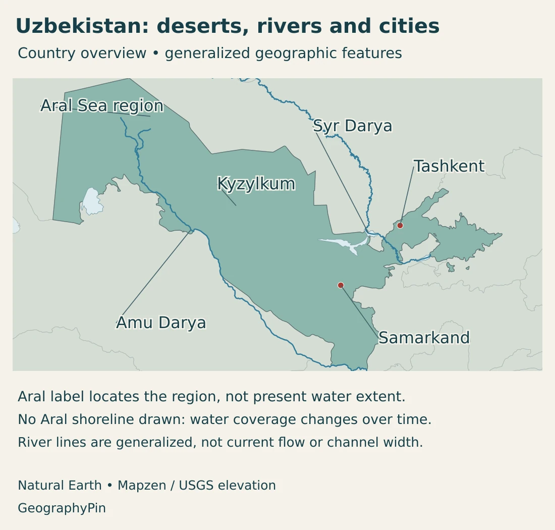
These neighbors connect Uzbekistan to different landscapes and transport corridors. The broad northern and western plains contrast with the more confined eastern valleys. For the regional setting, see our Central Asia countries map.
Why one landlocked neighbor is not enough
A landlocked country has no coastline on the open ocean or an ocean-connected sea. Uzbekistan is doubly landlocked because every country sharing its land borders is also landlocked. Reaching an ocean coastline overland therefore requires passing through at least two other countries.
The Caspian and Aral Seas do not change that classification: despite their names, they are inland water bodies without a natural outlet to the ocean. Uzbekistan itself has no Caspian coastline. Its connection with the Aral Sea is a different geographic relationship from access to an ocean port.
Double landlocking does not mean there is no international trade. It means that cross-border transport, transit arrangements and access to ports in other countries matter especially strongly. Our double-landlocked countries explainer examines the definition in more detail.
2. Country facts with dates and scope
| Measure | Value | Date or scope |
|---|---|---|
| Capital | Tashkent | Capital specified in the Constitution. |
| Population | About 39.54 million | Provisional permanent-population estimate at October 1, 2026, incorporating preliminary census results; not a raw census-day count. |
| Territorial area | About 173,300 sq mi (448,900 km²) | Rounded government territorial figure; the source does not separately define dry land and inland water. |
| State language | Uzbek | Constitutional status; other languages and cultural traditions are also protected. |
| Currency | Uzbek soum | National monetary unit under the Constitution. |
| Top-level administration | 12 regions, Karakalpakstan and Tashkent city | Tashkent city is separate from Tashkent region. |
| Government | Republic | President as head of state; Cabinet of Ministers exercises executive authority. |
Population figures need both a reference date and a description of how they were produced. A census-based revision to a statistical series is not the same as an equivalent number of births or new arrivals. Comparisons should use figures from the same revised series.
The national area is a territorial reference figure, not a measurement of today’s open-water surface in the Aral Sea. Changing lake levels should be described with separately dated observations rather than inferred from an unchanged country-area table.
3. Deserts, river valleys and eastern mountains
Three broad landscapes, many local differences
| Setting | Landscape | Why it matters |
|---|---|---|
| Central and western drylands | Kyzylkum desert, plains and plateau landscapes. | Large distances, sparse water and localized resource development contrast with irrigated settlements. |
| River valleys and oases | Fergana, Zarafshan and other cultivated valley settings. | Mountain-fed rivers and irrigation support concentrated farming and long-established cities. |
| Eastern and southeastern uplands | Western Tien Shan and Gissar-Alay ranges and foothills. | Elevation changes climate, water supply and the routes connecting neighboring valleys. |
| Lower Amu Darya and Aral region | Delta, irrigated land, remnant water bodies and exposed former lakebed. | Water diversions and changing lake extent create a landscape that cannot be represented by an undated historic shoreline. |
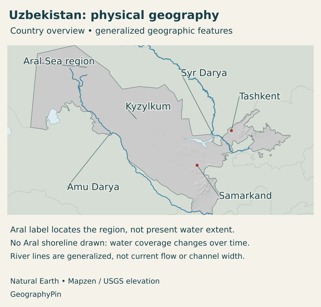
The Kyzylkum occupies a large part of the central and northern drylands, broadly between the Amu Darya and Syr Darya systems. It is not a single continuous dune field: desert landscapes include varied surfaces and relief, and cultivated areas occur where water is available.
In the east, the land rises into the Western Tien Shan and Gissar-Alay systems. Mountain ridges and foothills enclose valleys and influence connections between them. The country is therefore not uniformly flat, even though plains account for much of its territory.
The Fergana Valley is a large intermontane depression, surrounded by mountains on three sides and opening toward the west. Its cultivated landscape is not created by rainfall alone. Rivers, canals and pumping infrastructure distribute water across farmland.
Samarkand illustrates another valley setting. It developed in an oasis in the Zarafshan River valley, where a dependable water source and regional routes helped sustain a major urban center. Its monuments are part of that settlement history, not a separate story detached from the surrounding landscape.
These physical regions do not correspond neatly to administrative borders. A mountain system can continue into a neighboring country, while an irrigation network may connect several districts. The comparison table describes landscape patterns, not a proposed set of political subdivisions.
4. Continental climate, irrigation and the Aral Sea
Uzbekistan has a strongly continental climate, with large seasonal temperature contrasts. Summers are generally hot and dry in the lowlands, while winters can be cold. Higher elevations are cooler and can receive more precipitation than the desert plains.
Much of the precipitation falls in the cooler part of the year, whereas crop demand is high during the growing season. This mismatch makes stored water, river flows and irrigation important. A green agricultural valley can exist inside an otherwise arid region because its water comes from a larger catchment.
The Amu Darya and Syr Darya are regional systems
The Amu Darya and Syr Darya are the major river systems associated with Uzbekistan. They carry water from mountain catchments across national borders toward the Aral basin. Smaller rivers, including the Zarafshan and Chirchik, also support cultivated and urban areas.
In Fergana, the Syr Darya and its tributaries connect farming with snow and glacier melt in the mountains farther east. Reservoir operations, canals and pumping determine how much of that water reaches particular fields. Sharing a river basin makes upstream and downstream decisions relevant to one another.
In its 2025 irrigation-project assessment, the World Bank identified agriculture as Uzbekistan’s dominant water user and emphasized losses in aging distribution systems. Canal rehabilitation and improved measurement address delivery problems; they do not create an unlimited water supply.
Why a dated shoreline matters
The Aral Sea is an inland, closed-basin lake system shared by Kazakhstan and Uzbekistan. Large-scale diversion of its inflowing rivers for irrigation drove a dramatic contraction from the 1960s onward. The former lake separated into different water bodies rather than shrinking evenly toward a single center.
A Sentinel-2 image dated March 18, 2025, described by the European Space Agency, showed a much-reduced western lobe of the Large Aral and a virtually dry eastern lobe. That is a dated observation, not a claim that the shoreline remains fixed in 2026. Water levels and seasonal inflows can change what a later image shows.
The exposed bed has become part of the Aralkum desert landscape. Salt-bearing dust and sand can be carried away by wind, so the consequences extend beyond the remaining water’s edge. The northern lake in Kazakhstan and southern remnants should not be treated as a single reservoir with a uniform recovery trend.
Any map using older lake polygons needs a clear limitation. Here, the Aral label is for geographic orientation; present-day water extent requires dated satellite observations rather than an undated blue outline.
5. Cities, settlement and languages
Tashkent is the national capital and a major urban center in the northeast. Samarkand lies farther southwest in the Zarafshan valley. Their contrasting positions help explain why Uzbekistan’s cities do not form one continuous urban belt across the desert.
The Fergana Valley is another major settlement and farming concentration. Its towns and villages are linked to an agricultural landscape maintained by water infrastructure. In a 2026 field report, the World Bank described how improved supply in the Ferghana district supported orchards, berry production and mulberry-based silkworm breeding. These examples show why the valley’s economy cannot be reduced to cotton alone.
Samarkand’s UNESCO-listed historic area reflects centuries of exchange and urban development. The city’s oasis setting provides the physical context for that history. A World Heritage property, however, covers selected historic areas rather than the entire modern city or surrounding region. The Samarkand city profile explains its map location, historical neighborhoods and dated city facts.
For a different oasis-city story, the Bukhara city profile explores the relationship between water, trading buildings and the inhabited historic center. Farther northwest, the Khiva city profile distinguishes the modern oasis city from its walled inner town, Itchan Kala.
The top-level administrative units comprise 12 regions, the Republic of Karakalpakstan and the separately administered city of Tashkent. Tashkent city and Tashkent region are different statistical units. Karakalpakstan forms part of Uzbekistan and has its own constitution within the national constitutional framework; its republican status does not make it a separate foreign country.
Language and regional identity
Uzbek is the state language under the national Constitution. The same framework requires respect for the languages, customs and traditions of the country’s nationalities and ethnic groups. State-language status is therefore not a claim that everyone speaks only one language.
The Uzbek people explainer distinguishes ethnic identity from citizenship, residence and language use, with examples of communities beyond Uzbekistan.
City and region names can appear in several transliterations, including Tashkent/Toshkent, Fergana/Ferghana and Zarafshan/Zeravshan. Different English spellings do not necessarily identify different places. Comparing the geographic setting is often more useful than assuming that every spelling change means a new location.
6. Government and economic geography
Uzbekistan’s Constitution provides for a president as head of state and a Cabinet of Ministers exercising executive authority, led by a prime minister. The Oliy Majlis has a Legislative Chamber and a Senate. These national institutions should be distinguished from regional and local administration.
Uzbekistan’s economic geography combines irrigated farming, mineral production, manufacturing and urban services. Water availability and transport connections help explain where activities cluster, but no single crop or commodity represents the entire economy.
Gold and copper provide concrete examples of the mineral sector. The U.S. Geological Survey’s account of 2024 production identifies the Navoi and Almalyk mining and metallurgical complexes as major enterprises. Mineral extraction and processing create economic centers outside the best-known historic tourist cities.
Farming has a different spatial logic. Cultivated valleys depend on moving water to crops, sometimes using electricity-intensive pumps. This links agricultural production with energy supply and infrastructure maintenance. Better delivery can improve reliability, while choices about crops and total irrigated demand still influence water pressure.
Historic cities add another dimension. Samarkand’s architectural heritage attracts attention because it preserves evidence of exchange across Central Asia. Its significance is not that Uzbekistan was isolated from the world, but that inland routes connected its settlements to wider networks.
That remains the central geographic lesson: deserts do not prevent connections, but they make routes and water sources especially consequential. Uzbekistan’s valleys, cities and industrial centers make sense when read together with its mountains, rivers and position among other landlocked states.
Frequently Asked Questions
Why is Uzbekistan doubly landlocked?
It has no ocean coastline, and every neighboring country is also landlocked. An overland journey to an ocean coast must therefore pass through at least two other countries. Inland seas such as the Caspian and Aral do not count as ocean access.
Is Uzbekistan entirely desert?
No. Deserts and dry plains cover much of the country, but eastern mountains, foothills, irrigated valleys and oases create very different landscapes. Fergana and the Zarafshan valley are important examples.
Does the Aral Sea still have one continuous shoreline?
No. Its contraction separated it into different water bodies and exposed large areas of former lakebed. Any statement about its current area or shoreline needs a dated observation; a historical outline is not a present-day water map.
What Did We Learn Today?
Uzbekistan combines broad drylands with mountain-fed valleys and long-established cities. Its double-landlocked position makes regional transport connections important, while irrigation links farming to shared river systems. The changing Aral Sea shows why water extent must be dated separately from national territory. Tashkent, Samarkand and the Fergana Valley illustrate different parts of this connected landscape.
Sources & Data Notes
Reviewed in November 2026. Population estimates and census results are distinct measures; revisions can change an entire historical series. Aral water extent requires its own observation date.
- National Statistics Committee, January–September 2026 demographic release: Published October 27, 2026: provisional October 1 population of 39,535.2 thousand, based on preliminary January 15 census results. Methodology notes that estimates may be refined after final census results.
- Urgench city government, National Statistics Committee population announcement: Published October 19, 2026: permanent population of 39,535,225 at October 1, 2026, incorporating census results. Rounded to 39.54 million in the facts table.
- National Statistics Committee, SIAT permanent-population series: Permanent-resident definition and census-based estimation method. Updated November 12, 2026; beginning-of-year values are a different reference date from the October figure.
- Government of Uzbekistan, territory: Rounded territorial area of 448.9 thousand km² and neighboring countries. No separate dry-land or inland-water accounting is stated.
- Constitution of Uzbekistan, 2023 revision: Capital and language, Karakalpakstan, national institutions and currency. Official legal database; English text is a translation.
- National tourism portal, regions of Uzbekistan: Twelve regions, Karakalpakstan and Tashkent city as distinct units.
- Government of Uzbekistan, geographical location: Plains, mountain systems and Fergana Valley setting.
- Uzbekistan Ministry of Foreign Affairs, territory and climate: Continental seasonality, dry lowlands and mountain contrasts.
- International Commission on Irrigation and Drainage, Uzbekistan national committee profile: Double-landlocked setting and broad physical regions.
- FAO, Uzbekistan water-resource country profile: Historical reference for river systems, irrigation geography and cooler-season rainfall; numerical 1990s economic and population tables are not current statistics.
- World Bank, irrigation modernization project: May 21, 2025: water delivery, irrigation infrastructure and pumping-energy connections.
- World Bank, Ferghana Valley irrigation field report: September 2, 2026: mountain-fed water, irrigation and local horticulture and silk-related livelihoods.
- NASA Earth Observatory, dunes and desert at the Aral Sea: Published June 2, 2024, with an October 17, 2023 photograph; lake contraction, exposed bed and dust.
- European Space Agency, the shrinking Aral Sea: April 4, 2025 account of a March 18, 2025 Sentinel-2 image; a dated observation, not a 2026 shoreline survey.
- UNESCO World Heritage Centre, Samarkand: Zarafshan oasis setting and historic urban development.
- U.S. Geological Survey, Uzbekistan minerals: 2024 production account, including Navoi and Almalyk enterprises; used for qualitative industrial geography.
Map sources and scope: Original GeographyPin maps use public-domain Natural Earth country outlines, city coordinate attributes, river lines and lake polygons. All Uzbekistan source components are retained, including source exclaves, but these generalized outlines are not a complete contemporary enclave inventory, official boundary survey or record of recent demarcation changes.
The Aral Sea is shown only as a geographic region label. No Aral water-extent polygon is drawn. NASA’s dated 2000–2018 image series demonstrates major changes and annual fluctuations; it is not interpreted as a 2026 shoreline. Other lake polygons and river segments are generalized reference features, not measurements of present water levels, channel width or flow. Kyzylkum is a broad desert label rather than a mapped boundary.
Hillshade uses real elevations accessed through Mapzen Terrain Tiles. Global elevation data courtesy of the U.S. Geological Survey. Elevation-source attribution and terms apply. Terrain shading has no vertical exaggeration and is not a set of numerical elevation bands or a local navigation surface.
The cover combines the national outline with Uzbekistan flag artwork by Farhod Yoʻldoshev and Commons contributors. A complete flag appears separately to preserve symbols clipped by the decorative outline motif.