Tioga Road climbs into Yosemite’s high country instead of following the valley floor. Its western end branches off at Crane Flat, and its eastern end reaches the Sierra crossing at Tioga Pass. When snow closes that crossing, a route that connects both sides of the Sierra in summer stops being a through-drive.
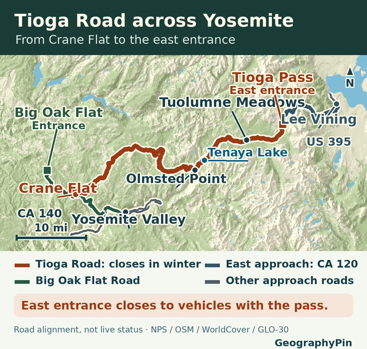
Tioga Road follows Highway 120 for about 47 miles (76 km) one way from Crane Flat to Tioga Pass, past Olmsted Point, Tenaya Lake and Tuolumne Meadows. From the west, reach it via Big Oak Flat Road. From the east, take Highway 120 from US 395 near Lee Vining when it is open. Winter closure blocks vehicle entry at Tioga Pass; it does not by itself close Yosemite Valley’s other approaches.
1. Which Yosemite Approach Fits Your Trip?
Start with your destination instead of searching only for “Yosemite.” A Valley visit, a high-country out-and-back and a crossing to the eastern Sierra use different roads or turnarounds.
| Your trip | How to approach | If Tioga Road is closed |
|---|---|---|
| Yosemite Valley from the west | Use a Valley approach such as Highway 140 through El Portal, or Big Oak Flat Road if open. Do not turn onto the high-country road at Crane Flat. | The Tioga closure does not automatically close these approaches. Check them separately. |
| High-country viewpoints and short hikes | From the west, turn at Crane Flat for Olmsted Point, the Tenaya shoreline and Tuolumne Meadows. | Do not plan on driving up Tioga Road to the meadows. A Valley day is a different itinerary. |
| Yosemite Valley from Lee Vining or US 395 | From US 395 near Lee Vining, climb CA 120 to Tioga Pass. Check the state highway and park road separately. | Do not drive toward Tioga Pass for the Valley. Use the NPS winter driving directions to choose an approach to an open western or southern gate. Check the route and any chain controls separately; there is no single detour time. |
2. Crane Flat: Choose the High Road or the Valley
Big Oak Flat Entrance is a park entrance; Crane Flat is a junction farther inside the park. Coming in on Highway 120 from the west, use Big Oak Flat Road to reach that junction. From there Tioga Road turns away toward the high country; Big Oak Flat Road leads toward the Valley. The park places Crane Flat about 16 road miles (26 km) from Yosemite Valley.
If you plan to return to the Valley after exploring the high country, count the return leg separately. The whole 47-mile figure describes Crane Flat to the pass, not a round trip, not a distance from Yosemite Village, and not a walk from a parking area.
3. Olmsted Point, Tenaya Lake and Tuolumne Meadows
Olmsted Point is a roadside overlook. Its parking area is already above the Valley, and the view toward Half Dome is from the east. It does not lead you down to the Valley floor by car. Tenaya Lake is just to the east, and its named access points matter. The park map distinguishes, for example, the Sunrise Lakes Trailhead at the west end from lake access farther east. Do not use one parking point for every lake stop or hike.
Tuolumne Meadows is a high-country destination with several trailheads, not a single overlook. For a gentle walk once the road and trails allow, the park lists Parsons Lodge and Soda Springs as a 1.4 mi (2.3 km) round trip from Lembert Dome parking or the Tuolumne Meadows Visitor Center. Pothole Dome is a different 1 mi (1.6 km) round trip from its own parking area, with about 200 ft (60 m) of gain and a scramble. Those are walking distances; they do not include driving to the meadow.
4. Tioga Pass and the Road Down to US 395
Tioga Pass is the high crossing at Yosemite’s east edge. On an open-road day, Highway 120 continues outside the park toward US 395 near Lee Vining. The 47-mile scenic-road figure ends at the pass, so the descent toward Lee Vining is a separate leg. Coming the other way, an open stretch of CA 120 below the pass does not prove that the park entrance or the full crossing is open.
The Gaylor Lakes Trail also starts at the Tioga Pass entrance. This is a separate on-foot excursion: the park lists it at 2.6 mi (4.2 km) round trip, with a short steep climb. A trailhead at the entrance is not an alternate road around a closed gate.
5. What the Winter Closure Changes
Status checked November 21, 2026: the National Park Service listed Tioga Road closed for the season due to snow. Caltrans reported a winter closure effective November 20 at 10:50 a.m. local time, from Crane Flat to a point 5 miles west of the US 395 junction. That eastern limit is outside the park. This is why the park’s Crane Flat–Tioga Pass description and the broader Caltrans closure are both useful: the two agencies are describing different road extents.
The park typically closes the high-country road around November and reopens it in late May or June, but the date depends on conditions. The 2026 spring opening came on May 15; that does not set a date for the next year. A pass closure rules out a drive to Tuolumne Meadows and east-gate entry. It does not turn the Valley itself into a closed road.
Check the NPS road-status table for the park segment and Caltrans for CA 120 outside the park before driving. Check your western approach separately, including any chain controls. A route line on a map is not evidence that a gate or road segment is open.
Frequently Asked Questions
Does a Tioga Pass closure also close Yosemite Valley?
No. A closed Tioga Pass blocks the east entrance for vehicles. Yosemite Valley has separate roads from the west and south; check that your chosen entrance and connecting highways are open.
Does an open stretch of CA 120 from Lee Vining mean I can drive over Tioga Pass?
No. Caltrans may list a lower stretch of the state highway as open while the park gate is closed. Check the state highway and the park’s own road report separately.
How can I tell a viewpoint from a trailhead?
Use the park’s map and trail start names together. Olmsted Point is a roadside overlook; Lembert Dome parking serves named hikes. Read each listed walk from its own start rather than using the highway mileage.
What Did We Learn Today?
Tioga Road connects Crane Flat to the east entrance high above Yosemite Valley. The two ends are distinct from the lower approaches to the Valley, and winter closes the through-drive. Use the named trailhead for walking mileage and check both agencies for the day’s road status.
Sources & Data Notes
- National Park Service, current road-status table, winter road closures and Tioga Road plowing and reopening. Caltrans SR 120, checked November 21, 2026, states the extent and effective date of the separate broader winter closure. See Caltrans QuickMap for current approaches.
- NPS Tuolumne Meadows and Tioga Road uses a rounded 47 road miles; a separate NPS auto-touring page rounds to 46 miles, so the guide uses “about” and converts the 47-mile figure independently. Crane Flat supports the junction and Valley mileage, and NPS directions distinguishes western and eastern approaches.
- Official Yosemite maps, Tuolumne Meadows day hikes and park map and stop descriptions for the overlook, trail starts and walking distances. No shuttle service is implied.
- Original GeographyPin relief map in UTM 11N; precise park road alignments from NPS Public Roads, selected external CA 120 and US 395 segments from © OpenStreetMap contributors, ODbL. Land and water from ESA WorldCover 2021 v200 (CC BY 4.0), clipped, reprojected and styled. The map is not a navigation chart; it does not show active winter gates on the state approach.
- Produced using Copernicus WorldDEM-30 © DLR e.V. 2010-2014 and © Airbus Defence and Space GmbH 2014-2018 provided under COPERNICUS by the European Union and ESA; all rights reserved. Copernicus GLO-30 terms. The organisations in charge of the Copernicus programme by law or by delegation do not incur any liability for any use of the WorldDEM-30.
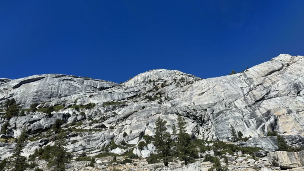
- Photograph: Ben1152000, granite domes along Tioga Road near Tenaya Lake, September 13, 2026, Wikimedia Commons, CC BY-SA 4.0; cropped, resized and converted to WebP under the same license. Not evidence of current road access.