Tajikistan’s map is easier to understand by following its valleys than by imagining a single mountain block. The high eastern Pamirs contrast with western farming valleys and the northern Fergana margin. Rivers connect these landscapes to neighboring countries, while steep slopes make roads vulnerable to disruption.
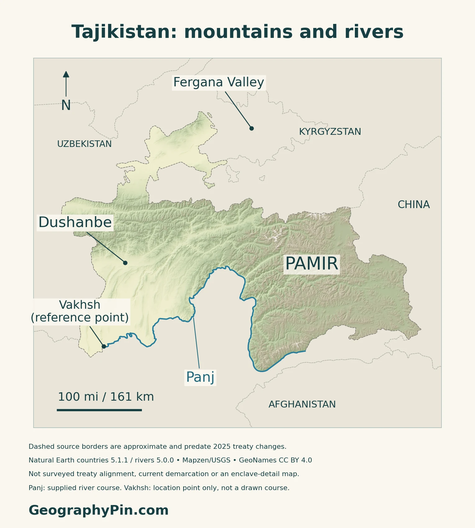
Tajikistan is a landlocked country in Central Asia, with Dushanbe as its capital. The Pamirs dominate its eastern highlands, while lower valleys provide important space for farming and settlement. The Panj and Vakhsh join to form the Amu Darya. Mountain relief shapes local climates, water supplies and the routes connecting different parts of the country.
How to use this article: Locate the country on the map, read the physical map, explore regional climates, or check the population reference.
1. Locate Tajikistan and Its Main Cities
A landlocked country between Central and South Asia
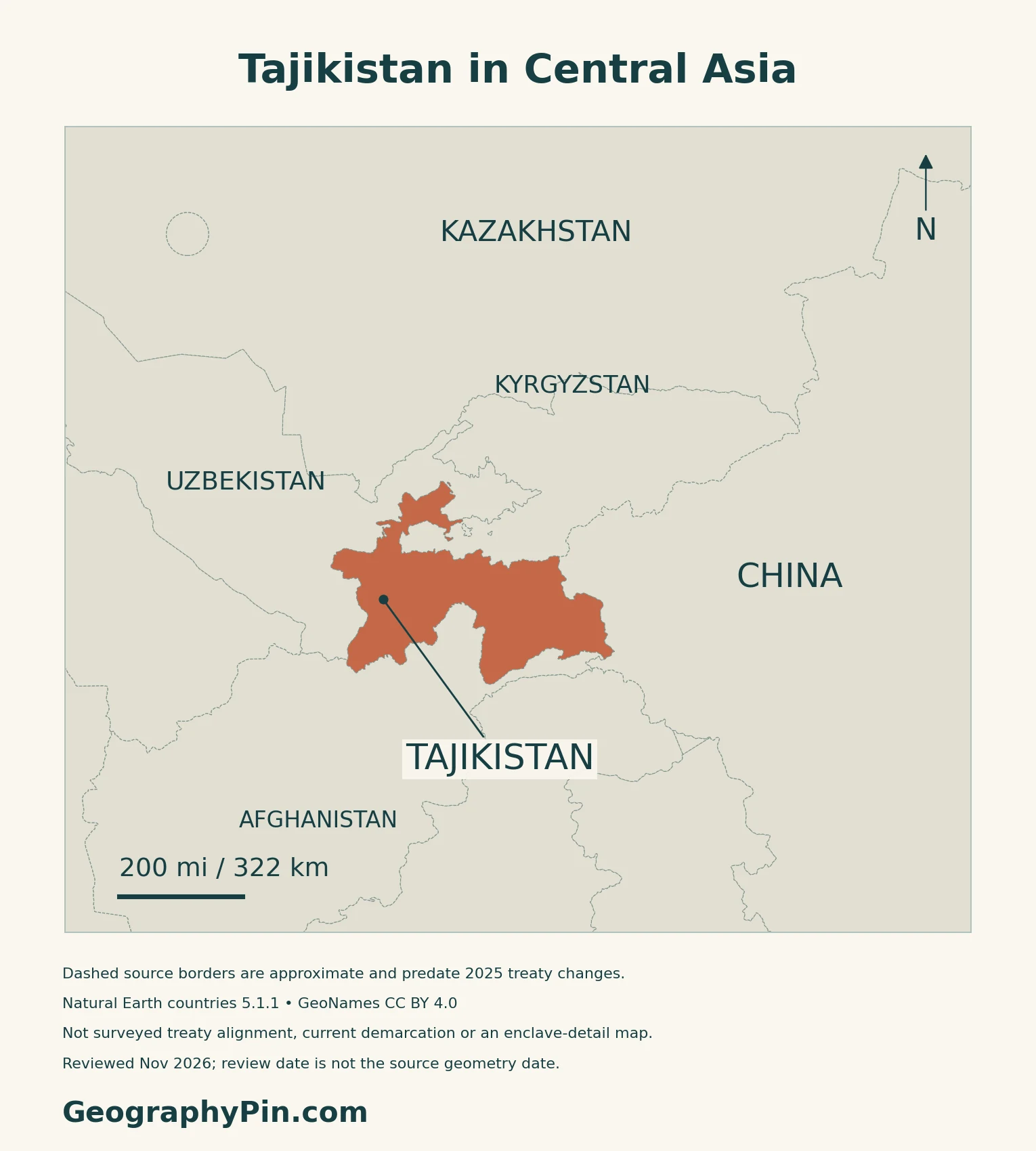
Tajikistan is a landlocked country in Central Asia. It borders Uzbekistan to the west and northwest, Kyrgyzstan to the north, China to the east and Afghanistan to the south. The northern part reaches into the Fergana Valley, while the eastern mountains form part of the wider Pamir region.
Dushanbe is the national capital
Dushanbe lies in the country’s western valley region. Article 4 of the Constitution names it as the capital. The capital city is reported separately from the surrounding districts under central government jurisdiction.
The Kyrgyz border treaty and its implementation
Tajikistan and Kyrgyzstan signed their state-border treaty on March 13, 2025, and exchanged ratification instruments on March 31. A July 2026 official report described the installation of the first border pillars: agreement on the boundary and marking it on the ground are separate stages. The maps use older generalized source lines, not surveyed treaty alignments or a current inventory of enclave arrangements.
2. Read the Pamirs and Western Valleys
Four settings explain the relief map
| Setting | Landscape | Geographic role |
|---|---|---|
| Eastern Pamirs | High plateaux, cold desert and glaciated ranges | Large elevation contrasts and sparse settlement |
| Western mountain valleys | Ridges and deeply cut valleys | Routes and communities follow limited corridors |
| Southwestern valleys | Lower Vakhsh and Hisor valley landscapes | Irrigation, agriculture and the capital’s setting |
| Northern Fergana margin | Lower valley ground around Khujand | Part of a wider cross-border valley and Syr Darya system |
The Pamirs include plateaux as well as peaks
The eastern highlands are not simply a wall of summits. UNESCO’s Tajik National Park description contrasts high plateaux with alpine-desert conditions in the east and rugged, heavily glaciated peaks and gorges farther west. The park protects a large part of the Tajik Pamirs, but its boundary is not the definition of the whole mountain region.
Lake Sarez illustrates how rapidly mountain landscapes can change. An earthquake-triggered landslide blocked a valley and formed the lake in the early twentieth century.
Lower ground is divided among separate valleys
FAO’s historical physical-geography account identifies the Fergana Valley in the north as an important farming area, separated from other parts of Tajikistan by mountain ranges. Western valleys likewise do not combine into one continuous lowland.
3. Climate and Access Across Mountain Relief
A high plateau and a lower valley have different climates
The World Bank–ADB 2021 climate profile describes strong seasonal and regional contrasts. Its 1991–2020 reference shows much warmer southern lowlands and colder Pamir terrain. Northern lowland deserts and the eastern Pamirs are especially dry, while parts of the central mountains receive substantially more precipitation.
Summer is generally the dry season, but elevation and exposure prevent a single national average from describing every valley. Snow accumulation, melting and intense rain matter differently on a high slope, a river terrace and an irrigated field.
Why short distances can require difficult journeys
Mountain roads must negotiate steep slopes and confined valleys. GFDRR’s work with Tajikistan’s Ministry of Transport documents road disruption from mudflows, landslides and glacial-lake outburst floods, including along the route through Lakhsh toward Kyrgyzstan. Damage at one constrained section can interrupt access for communities farther along the corridor.
Infrastructure can reduce those barriers without removing the terrain. ADB’s account of the Ayni–Uzbekistan border road describes rehabilitation completed in 2017, including bridges and feeder roads serving the Zarafshan Valley. The project improved connections between valley settlements, markets and border routes.
4. Rivers, Irrigation and Hydropower
The Panj and Vakhsh form the Amu Darya
The Panj follows much of Tajikistan’s boundary with Afghanistan. The Vakhsh drains mountain country to its north; its upper system extends into Kyrgyzstan. Their confluence forms the Amu Darya, linking Tajikistan’s mountain water with downstream countries. The Syr Darya serves a separate northern drainage system, so the national border does not define one river basin.
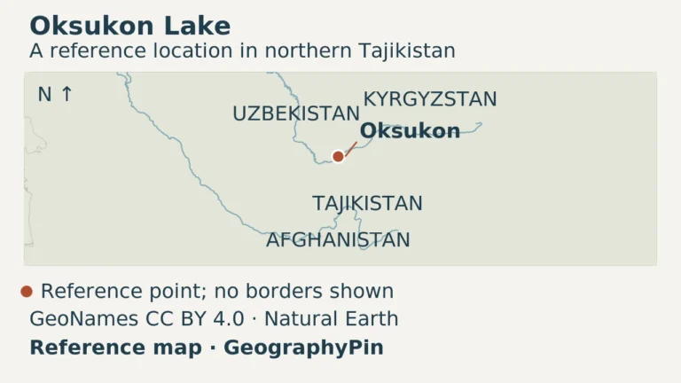
Not every local water body belongs to these outward-flowing channels. For a distinct northern saline landscape, the Oksukon Lake guide explains seasonal water and salt deposits without treating a lake outline as a permanent shoreline.
Water supply matters where usable land is limited
FAO identifies agriculture as a major rural livelihood, with both crops and livestock important. Mountain water supports production, but reliable access depends on infrastructure as well as the presence of rivers. The World Bank’s 2024 climate-and-development assessment calls for improved irrigation and water storage alongside restoration of degraded land.
UNEP’s 2025 environmental atlas highlights shrinking glaciers and growing pressure on shared water resources. Changes in runoff matter to both farming and power generation.
Rogun is an expanding project, not a completed promise
The Vakhsh supports a hydropower cascade including Nurek. Rogun, upstream, remains under development. The World Bank’s June 2026 financing announcement supports further construction, equipment and environmental and social measures, including resettlement and livelihood restoration.
Projected full-project generation and export benefits should not be read as present output.
5. Dated Country Facts and Institutions
| Item | Reference | Date or scope |
|---|---|---|
| Capital | Dushanbe | Constitution, Article 4 |
| Population | About 10.867 million | Preliminary national estimate at October 1, 2026 |
| Surface area | About 54,595 sq mi (141,400 km²) | UN reference, 2023; not land-only |
| Language status | Tajik is the state language | Russian has a constitutional role in interethnic communication |
| Currency | Somoni (TJS) | 100 dirams |
| Government | Unitary presidential republic | Constitution, Article 1 |
| Administration | Sughd, Khatlon, Gorno-Badakhshan Autonomous Region, Dushanbe and districts under central government jurisdiction | National statistical reporting units |
A preliminary estimate based on population accounting
The Statistics Agency reports a preliminary population of 10.867 million for October 1, 2026. This is an estimate, not a new census count. Its 2026 population publication explains that resident estimates build on the 2020 census with subsequent births, deaths, migration and administrative changes.
Legal language roles and regional names
Article 2 distinguishes Tajik’s state-language status from Russian’s role in communication between ethnic groups. It also protects the use of communities’ native languages.
Gorno-Badakhshan, often abbreviated GBAO, is an autonomous administrative region within Tajikistan. “Pamir” is a mountain-region name, not an interchangeable administrative label. Sughd and Khatlon are separate regions; the centrally administered districts do not together constitute another province.
What Did We Learn Today?
Tajikistan combines high Pamir landscapes with western and northern valleys that serve different settlement, farming and transport roles. The Panj–Vakhsh connection explains the Amu Darya’s headwaters, while the Syr Darya belongs to a separate northern system. Relief creates sharp climate contrasts and makes road connections as important as straight-line distance.
Sources & Data Notes
Population references retain their date and resident estimate or census scope. The historical FAO survey is used for stable physical and drainage relationships, not its old statistics or construction status. Climate patterns use the 2021 profile’s 1991–2020 reference. ADB’s road example is a completed 2017 project, not a current route-condition report. UNESCO’s park is not the whole Pamir region. Rogun’s full-project benefits remain projections; the June 2026 financing announcement does not establish project completion.
- Statistics Agency: preliminary population at October 1, 2026
- Statistics Agency: Population 2026, resident-estimate methodology and regional units
- UNData: Tajikistan surface area, 2023
- Ministry of Labour Migration Service: Constitution, amended through 2016
- National Bank of Tajikistan: somoni and diram
- Kabar / presidential press service: exchange of border-treaty ratification instruments, March 31, 2025
- Kabar / Cabinet: border demarcation, July 14, 2026
- FAO: Irrigation in Central Asia, AQUASTAT Survey 2012, Tajikistan chapter (physical setting and drainage only)
- UNESCO: Tajik National Park (Mountains of the Pamirs)
- World Bank–ADB: Climate Risk Country Profile, Tajikistan (2021), 1991–2020 baseline
- GFDRR: Road geohazard screening with Tajikistan’s Ministry of Transport
- ADB: Ayni–Uzbekistan border road, project completed in 2017
- Ministry of Energy and Water Resources, Syr Darya basin authority: river systems (2021)
- FAO: Tajikistan’s agricultural setting
- World Bank: Tajikistan climate-and-development assessment (2024)
- UNEP: Tajikistan Atlas of Environmental Change, September 2025
- World Bank: Rogun project and downstream Vakhsh cascade
- World Bank: Rogun second-phase financing, June 30, 2026
Map method: Original GeographyPin maps use public-domain Natural Earth countries 5.1.1 and rivers 5.0.0. All three source country components are retained, but generalized outlines predate the 2025 treaty changes and are not surveyed treaty alignment, current demarcation or a current enclave inventory. Dashed lines indicate approximation, not unresolved status everywhere. The supplied Panj line is trimmed near the Vakhsh-mouth reference to avoid labeling a downstream Amu Darya segment as Panj. Vakhsh itself is a point only: no channel, connector or basin boundary is invented. GeoNames coordinates are credited under CC BY 4.0; Pamir and Fergana Valley labels are geographic references, not administrative boundaries. Real Mapzen Terrain Tiles supply relief with Mapzen/USGS and upstream credits; invalid negative artifacts are transparent rather than replaced with invented heights. WGS84 scales apply at their displayed latitude. The cover uses the Commons Tajikistan flag rendition under its public-domain/CC0 terms, with a separate complete flag for editorial identification.