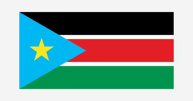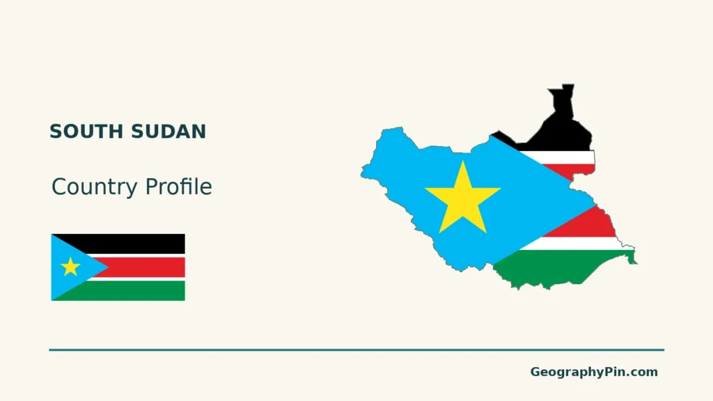
South Sudan is landlocked, but water is central to its geography. The White Nile crosses broad lowlands, spreading through the Sudd wetland system, while higher ground and different farming environments occupy much of the south and west.
South Sudan is an independent country south of Sudan, with Juba as its capital. The White Nile links its southern border region with the Sudd, a changing mosaic of channels, marshes and floodplains. Savannas, western uplands and the Imatong Mountains add important contrasts. A large inland wetland does not require a coast: upstream river flow and local rainfall supply its water.
How to use this article: Locate the country on the map, read the physical map, explore rainfall seasons, or check the population reference.
1. Locate South Sudan and Its Neighbors
A separate country south of Sudan
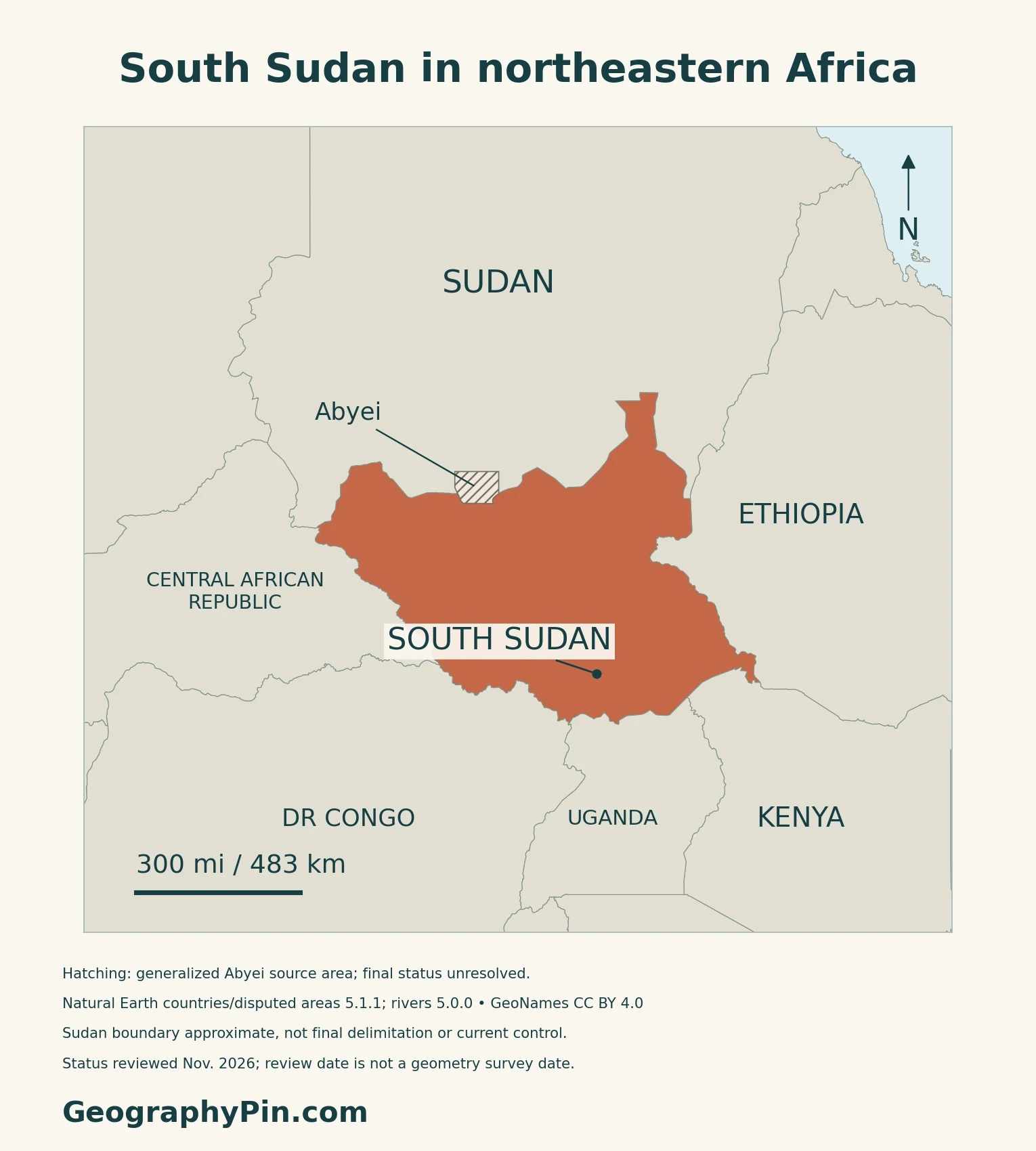
South Sudan is a landlocked country in East Africa, independent from Sudan since July 9, 2011. It borders Sudan, Ethiopia, Kenya, Uganda, the Democratic Republic of the Congo and the Central African Republic.
Juba is the capital; Ramciel is a relocation proposal
Juba is the national capital and government seat. Article 50 of the Transitional Constitution names Juba while allowing a future relocation. The government’s 2021–2024 development strategy discussed a proposed capital at Ramciel; that proposal should not replace Juba on a current capital map.
Abyei requires a separate status qualification. South Sudan includes it in its administrative framework, but its final status remains unresolved between Sudan and South Sudan. Diplomatic statements at the UN Security Council in November 2026 still addressed outstanding governance arrangements and a negotiated settlement.
2. Read the White Nile and Sudd Landscape
Wetlands are one part of a varied country
| Setting | Physical character | Useful distinction |
|---|---|---|
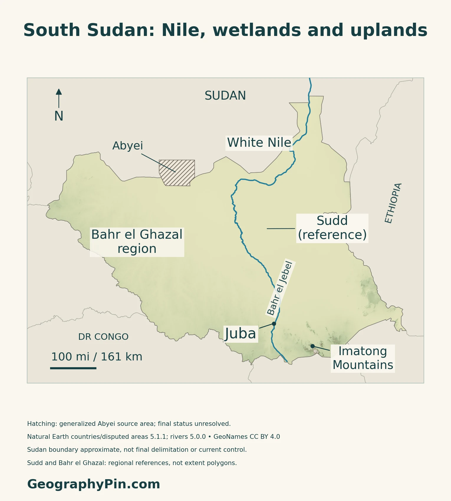
| White Nile–Sudd corridor | Channels, marshes and floodplains | Not one permanent lake |
| Bahr el Ghazal region | Western drainage and savanna landscapes | Regional label, not a single mapped river |
| Southern and western uplands | Higher ground and mixed vegetation | Different from the low floodplains |
| Imatong Mountains | Mountain country near Uganda | Relief and montane habitats |
Why a landlocked country has a vast wetland
The government’s 2017 Sudd submission to UNESCO describes water spreading north of Juba across a shallow depression. The White Nile, known along this reach as Bahr el Jebel, supplies water from upstream, supplemented by local rainfall and runoff.
Wetland extent changes between seasons and years.
The submission is on UNESCO’s Tentative List, not evidence of inscription on the World Heritage List.
The southern mountains support different habitats
South Sudan’s 2018 national climate communication identifies montane forests in the Imatong, Didinga and Dongotono mountains. Vegetation changes with altitude, contrasting with the lower savannas and floodplains.
3. Understand Seasonal Rain and Water Security
Rainfall varies across the country
The 2018 national climate communication describes a broad wet season from April to October and a drier period from November to March. Southern locations can have two rainfall peaks, while the southwest generally receives more rain than the northeast and parts of the southeast.
Abundant surface water does not guarantee safe supplies
The World Bank’s 2023 water-security assessment treats flooding, drought and access to safe water as connected but different problems. Floodwater can support fishing and flood-recession farming while also damaging settlements and infrastructure. Drought is particularly important in parts of the northeast and southeast.
The assessment emphasizes reliable water services, early warning, wetland restoration and attention to the social and environmental effects of infrastructure.
4. Connect Savannas, Farming and Settlement
Different activities follow different water levels
FEWS NET’s 2018 livelihood study distinguishes crop-growing zones, pastoral areas and riverine fishing and agro-pastoral systems. In parts of the northwestern floodplain, cattle move toward low-lying grazing during the dry season. Along the Nile, fishing continues through the year, but the places used change as river and swamp water levels vary.
These are descriptions of livelihood systems, not a current count of residents or a guarantee that movement remains possible. The study explicitly warns that conflict and displacement can change how households obtain food and income.
Potential crops differ by ecological setting
The agriculture ministry distinguishes a greenbelt, ironstone plateau, floodplains, Nile–Sobat corridor, hills and mountains, and an arid zone. Its agricultural guidance associates sorghum and groundnuts with plateau settings and a wider range of crops with wetter areas.
Returning to cultivation depends on local conditions
FAO’s November 2025 account from Rubkona County describes farmers cultivating land that had previously been submerged. Participants received maize or vegetable seeds and practical training after floods and displacement had interrupted cultivation.
For the separate question of national income measures and oil dependence, see the South Sudan economy and poverty comparison.
5. Dated Country Facts and Institutions
| Item | Reference | Date or scope |
|---|---|---|
| Capital | Juba | National capital and government seat |
| Population | About 16.43 million | NBS projection for June 30, 2026; with net migration |
| Area | About 248,777 sq mi (644,330 km²) | NBS September 2026 report labels this land area |
| Languages | English: official working language; indigenous languages: national languages | Transitional Constitution, Article 6 |
| Currency | South Sudanese pound (SSP) | National currency |
| Government | Presidential republic | Structural description, not a claim of completed political transition |
A projection is not a new census
The September 2026 NBS report projects populations for ten states using a 2020 base, fertility, mortality and migration assumptions. It treats Abyei as external to that ten-state model. The figure is not a new nationwide enumeration.
UNData separately reports a 2025 medium-fertility projection of about 12.189 million. These are different statistical series, not successive census counts or a measured one-year population increase.
Language roles and administrative scope
English’s constitutional working-language role does not make it the country’s only language. Article 6 also recognizes indigenous languages as national languages and provides for their promotion.
The administrative framework lists ten states and three areas: Greater Pibor, Ruweng and Abyei. Including Abyei in that list does not resolve its international status. The area figure above follows the NBS report’s own label; it is not presented as a separate measurement of land plus water.
What Did We Learn Today?
South Sudan’s landscape is shaped by the White Nile, the changing Sudd wetlands, savannas and southern high ground. Seasonal water levels connect farming, fishing and livestock movements, but access to safe water and productive land also depends on infrastructure and local conditions.
Sources & Data Notes
Dated population, legal and territorial references are identified below. The Sudd’s 2017 government submission is a UNESCO Tentative List entry, not World Heritage inscription or a current inundation survey. Climate and livelihood patterns use 2018 reports and should not be mistaken for current conditions at every locality. The World Bank water assessment dates to 2023, and the Rubkona recovery example to November 2025. Agriculture ministry crop descriptions indicate ecological suitability rather than measured present-day production. Map and disputed-area scope are explained below.
- National Bureau of Statistics: Population Situation Analysis, September 2026; projection methods and reference area
- UNData: separate 2025 medium-fertility population projection
- 2011 Transitional Constitution: Articles 6 and 50, official embassy copy
- South Sudan embassy: independence, capital, currency and presidential republic
- Government and UNDP: Revised National Development Strategy 2021–2024, proposed Ramciel relocation
- Chinese embassy: South Sudan administrative framework, July 17, 2026
- UK statement to the UN Security Council: unresolved Abyei governance and final status, November 5, 2026
- Russian UN mission: unresolved Abyei status, November 5, 2026
- South Sudan government: Sudd Tentative List submission, 2017; not World Heritage inscription
- Government of South Sudan: Initial National Communication, 2018; historical climate and montane habitats
- World Bank: Rising from the Depths water-security assessment, 2023
- FEWS NET: original livelihood-zone study, August 2018
- Ministry of Agriculture and Food Security: ecological settings and crop suitability
- FAO: Rubkona farming recovery account, November 11, 2025
Map method: Original GeographyPin maps use public-domain Natural Earth countries and disputed areas 5.1.1, with rivers 5.0.0. Abyei is a separate, neutrally hatched source polygon, not assigned to either state; its final status remains unresolved. The Sudan boundary is approximate, not final delimitation or current control. November 2026 is the status-review date, not a survey date. Actual Bahr el Jebel and White Nile source courses are retained. Sudd and Bahr el Ghazal are reference labels, not wetland, basin or administrative boundaries. GeoNames coordinates are credited under CC BY 4.0. Real Mapzen Terrain Tiles supply relief with Mapzen/USGS and upstream credits. WGS84 scales apply locally. The cover uses the country source outline excluding the separate Abyei area, without adjudicating borders, and the public-domain Commons flag rendition, with a complete separate flag.