Patagonia contains rain-soaked mountain forests as well as dry plateaus. To find the Patagonian Desert on a map, start east of the Andes and look for where the steppe gives way to a different landscape.
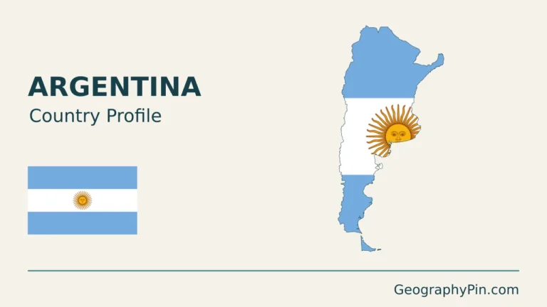
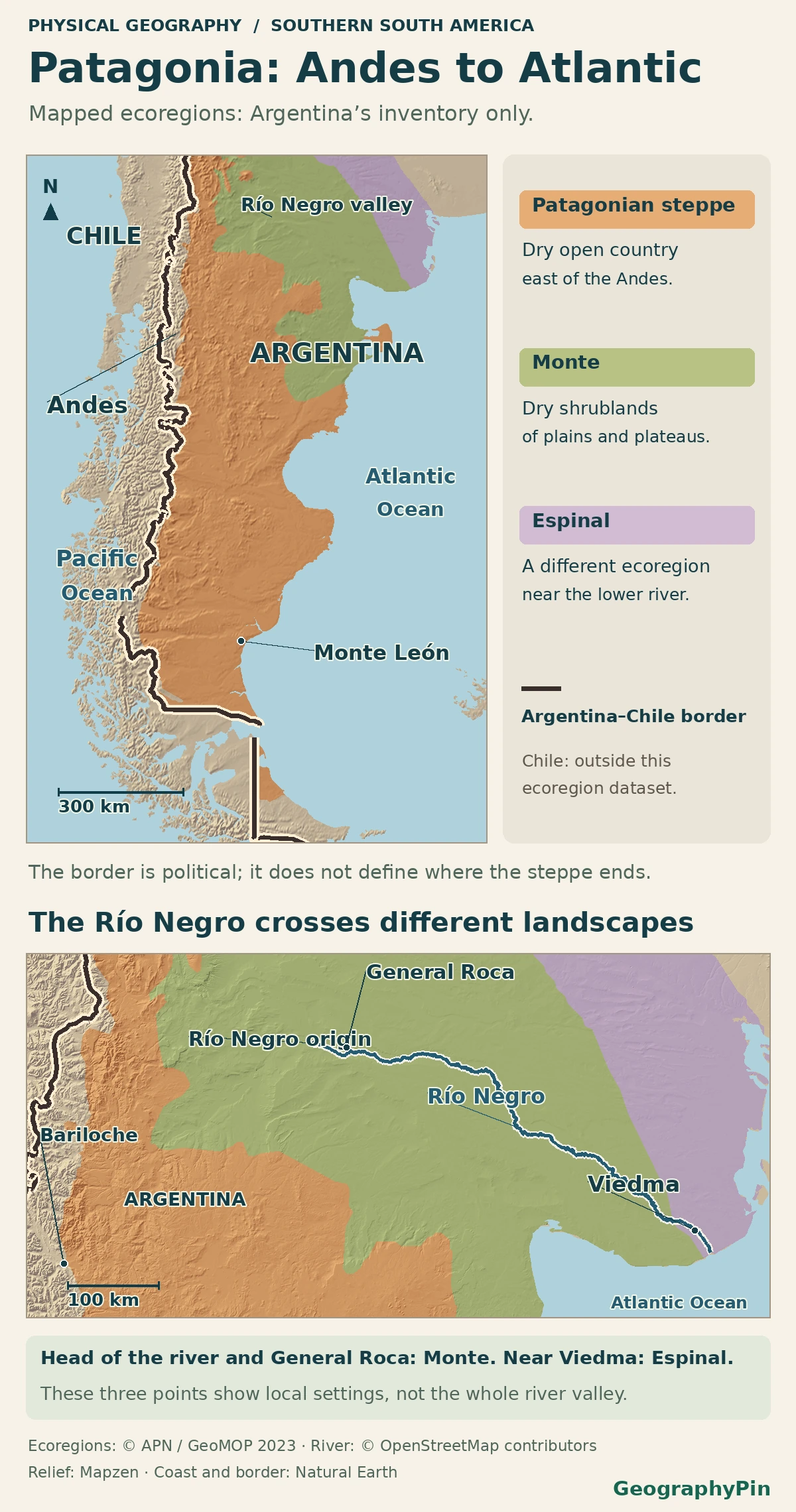
The Patagonian Desert occupies dry country east of the southern Andes, mostly in Argentina, where plateaus and steppe extend toward the Atlantic. The mountains create a rain shadow, but the desert is not all of Patagonia. The map colors ecoregions in Argentina only. The unshaded area in Chile is outside the dataset, not proof that the steppe stops at the border.
How to use this article: Read the measured rain-shadow contrast, trace Río Negro through other ecoregions or locate where the steppe reaches the ocean.
The Patagonian Desert on a map of southern South America
Look for the drier plateaus and basins east of the southern Andes rather than coloring all of Patagonia as desert. In Argentina, the national ecoregion layer gives the Estepa Patagónica, or Patagonian Steppe, a mapped outline. It is an ecological grouping, not the whole of Patagonia or the result of imposing one annual rainfall threshold. Argentina’s national parks agency describes it as spanning much of the country’s southern interior to the Atlantic, with smaller grasslands as far south as northern Tierra del Fuego.
Why the Andean side is wetter than the eastern plateau
Measure the contrast instead of treating it as a hard edge
Research on the southern Andes describes how moist air carried by prevailing westerly winds from the Pacific rises over the mountains. It cools and loses moisture on the windward slopes. Once across the mountains, descending air favors much drier conditions. This is the rain shadow; it is not a rule that no rain falls east of the Andes.
In a 1987–2016 comparison using rain gauges, observed mean annual precipitation in northern Patagonia ran from more than 700 mm (about 28 in) at high elevations around the divide between 37° and 40° S to less than 300 mm (about 12 in) to the east. Those are approximate observed ranges in that band, not averages for two entire sides of Patagonia. The forest-to-steppe transition that Nahuel Huapi National Park describes shows how this gradient can appear locally in vegetation.
The Río Negro is a river and a province, not the desert boundary
Trace the valley independently of the steppe
A dated Landsat view from Argentina’s space agency shows the Neuquén and Limay joining to form the Río Negro. The river then passes through the province of the same name and reaches the Atlantic beyond Viedma, as the regional planning atlas describes. The river and its valley are useful orientation features, but neither outlines an ecological region.
Sample the official ecoregion polygons at General Roca and Viedma. The first point falls in the Monte de Llanuras y Mesetas, the Monte of plains and plateaus; the other is in the Espinal. Neither sample is in the mapped Patagonian Steppe, though both towns are in Río Negro province. A productive valley or a familiar province name is not enough to identify the land around it.
| Map reference | What it demonstrates |
|---|---|
| Nahuel Huapi | Mountain forests grade toward drier steppe to the east. |
| General Roca, Río Negro | The valley goes through a different mapped dryland, the Monte of plains and plateaus. |
| Viedma, Río Negro | Close to the Atlantic, a sample from the same river province lies in the mapped Espinal instead. |
| Monte León, Santa Cruz | Farther south, the Patagonian Steppe actually meets the Atlantic coast. |
Where the steppe reaches the Atlantic
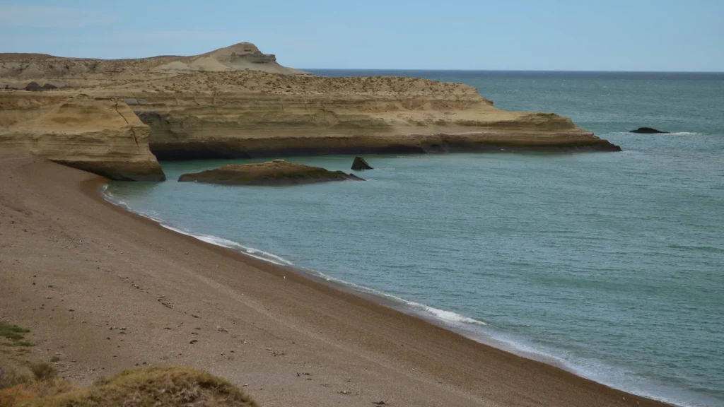
Find the steppe–sea contact at Monte León
The national parks agency identifies Monte León in Santa Cruz as a meeting point between the Patagonian Steppe and the Argentine Sea. Its landscape description places open land above cliffs and beaches. Inland, dryland shrubs and grasses characterize the steppe; along the shore, beaches, rock and marine life belong to a different environmental setting. A coastline visible beside arid land does not make the whole coast one desert.
That is a useful contrast with the mouth of the Río Negro much farther north. Both face the Atlantic. They do not have the same mapped ecological setting, and a label drawn along the entire shoreline would obscure the difference.
Why a climate map and an ecoregion map draw different edges
A rainfall map follows precipitation values. An ecoregion groups features such as climate, landforms and vegetation. Argentina’s published steppe layer is a repeatable way to locate its dry eastern landscapes, not a surveyed line where dry ground ends all at once. The fill also follows the national dataset’s coverage; it tells you where that particular map stops, not where a habitat must stop.
For example, Chile’s forest agency describes wet and dry types of Patagonian steppe at Pali Aike in Magallanes. The vegetation occurs there in a patchwork rather than one precise line. When using the atlas, check what its ecological shading covers and read the national border as a separate layer.
Frequently Asked Questions
Can the Patagonian Steppe get snow?
Yes. Argentina’s Laguna Blanca biodiversity account describes steppe plants adapted to snow as well as strong winds and seasonal water scarcity. Dryness does not mean the landscape cannot have snowy or freezing periods.
Does the Petrified Forest at Jaramillo mean the steppe is a forest today?
No. At Bosques Petrificados de Jaramillo, the preserved trunks come from a former environment. The national parks agency classifies the current setting as Patagonian Steppe, with drought-adapted vegetation around the fossils.
Why might a satellite rainfall map show higher totals than local rain gauges?
By design, a gridded rainfall product estimates weather across areas rather than measuring at each point. In northern Patagonia, the validation study by Rivera and colleagues found that its CHIRPS inputs overestimated the cold-season amounts there. The rain-shadow comparison here uses the study’s station observations, not its gridded values.
What Did We Learn Today?
The Patagonian Desert lies east of the southern Andes, where the rain shadow favors dry plateaus and open steppe. The vegetation map does not follow the Río Negro or a province line. Monte León shows the steppe meeting the Atlantic, while other places on the same ocean face belong to different ecological settings.
Sources & Data Notes
The map uses the Argentine national parks ecoregion layer published by GeoMOP in 2023. Río Negro context follows Argentina’s space agency and regional planning, and the northern rain-shadow comparison uses gauges from the 1987–2016 period. Chile’s forest agency supplies an example outside the Argentine data coverage.
Photo: Monte León National Park by Andreacav7, January 26, 2016, CC BY-SA 4.0 (cropped and resized, same terms). Map data: Natural Earth, Mapzen Terrain Tiles, Administración de Parques Nacionales / GeoMOP (ODbL; selected Argentine ecoregions), OpenStreetMap contributors (ODbL).