Moldova’s two best-known rivers provide a useful starting point, but they do not tell the whole story. Much of the country lies between the Prut and Dniester, with rolling uplands, cultivated slopes and wooded areas around the central Codri. Its internationally recognized territory also includes Transnistria, where effective control differs from the constitutional map.
Moldova is a landlocked European country between Romania and Ukraine. Chișinău is its capital. The Prut, Dniester and a short Danube frontage organize its water and transport connections, while rolling uplands and the wooded Codri contrast with river valleys. Transnistria is within Moldova’s internationally recognized borders but outside the central government’s effective control in important areas.
How to use this article: Clarify territory and control, compare the main landscapes, or follow the two major rivers.
1. Locate Moldova between Romania and Ukraine
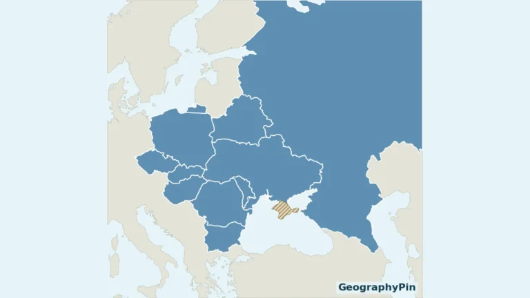
Romania lies to Moldova’s west; Ukraine surrounds it to the north, east and south. Moldova does not have a Black Sea coastline. Its southern access to the Danube nevertheless provides a river route to maritime trade.

The Prut is the main river along the Romanian boundary. The Dniester, also called Nistru, has both cross-border and internal reaches. It is not simply Moldova’s entire eastern international border, and neither river begins within Moldova: both have their headwaters in the Carpathians.
The wider setting is explained in our Eastern European countries guide. The European capitals reference places Chișinău among the region’s other capitals.
International borders and effective control are not identical
Transnistria is part of Moldova within its internationally recognized borders, but the central government does not exercise effective control throughout the region. De facto authorities operate from Tiraspol. The OSCE settlement framework supports Moldova’s sovereignty and territorial integrity with a special status for Transnistria, not recognition of it as a separate sovereign state.
The Dniester is central to the geography of the dispute, but its channel is not an exact dividing line for administration. Local exceptions and the Security Zone involve both banks. A generalized country map is therefore not a guide to checkpoints, current access rules or the control of individual settlements.
2. Country facts and territorial coverage
| Fact | Value | Date or meaning |
|---|---|---|
| Capital | Chișinău | Also written Chisinau. |
| Population | About 2,365,600 | Provisional usual-resident estimate at January 1, 2026; specified territorial exclusions apply. |
| Whole-country area | About 13,069 square miles (33,848 km²) | NBS land-fund table at January 1, 2025, including water-fund land. |
| State language | Romanian | Constitutional Article 13; minority-language protections also apply. |
| Currency | Moldovan leu (MDL) | Constitutional Article 130. |
| Government | Republic with parliamentary government | Government and prime minister exercise executive responsibilities. |
Population coverage is narrower than the national area
The provisional estimate is about 2,365,600 usual residents at January 1, 2026. It is based on the revised 2024 census and excludes specified areas outside the statistical office’s coverage, including left-bank administrative units, Bender and listed settlements on both banks. It is not a population total for every part of Moldova’s internationally recognized territory.
The final 2024 census incorporated a coverage adjustment rather than simply publishing the raw number of people enumerated. The subsequent resident estimate is another statistical measure, updated to a later reference date.
The area figure describes the whole country, while the resident-population estimate has specified territorial exclusions. Combining the two to calculate a single population density would conceal that mismatch.
Usual residence is also different from citizenship. Moldovan citizens living abroad are not automatically part of the resident population, and a person’s registered address does not by itself establish where they usually live.
3. Rolling uplands, wooded Codri and river valleys
Compare four landscape settings
| Setting | Landscape | Geographic distinction |
|---|---|---|
| Central uplands and Codri | Rolling and dissected terrain with wooded landscapes. | The broad Codri landscape is not identical to the boundary of the Codrii reserve. |
| Northern and interior agricultural country | Cultivated land interspersed with settlements, slopes and valleys. | Agricultural land is not one uniformly flat surface. |
| Prut valley | A major river corridor along the Romanian boundary. | The river belongs to the wider Danube drainage system. |
| Dniester valley | An international river basin with reaches in Moldova and Ukraine. | The catchment extends beyond political and administrative divisions. |

Codri is a woodland and upland setting
Codri is associated with Moldova’s central wooded uplands. Within that wider landscape, the Codrii reserve protects a defined natural area. The regional name and the protected-area boundary answer different geographic questions.
Moldova’s yearbook describes deciduous woodland with trees such as oak, beech, elm and hornbeam, alongside steppe vegetation preserved in scattered fragments. This is a varied mosaic rather than an uninterrupted forest covering the whole country.
Slopes and valley floors influence drainage, land use and routes between settlements. Even without high alpine mountains, differences in relief can matter greatly for farming, erosion and local access.
4. Dniester, Prut and climate pressures
The Dniester and Prut follow different routes to the sea
The Dniester crosses an international basin centered on Ukraine and Moldova, with a small headwater tributary area in Poland. Its upper reaches and mouth are in Ukraine, and its middle course has both shared and Moldovan reaches. The river is an important source of water for communities and economic activity.
The Prut belongs to the Danube system. At Moldova’s southern end, the Prut–Danube setting provides the location for Giurgiulești’s port facilities. These connections explain how a landlocked state can participate in river-to-sea transport.
Neither river basin stops at a national border. Upstream rainfall, abstraction, water quality and reservoir operations can affect downstream users. Transboundary cooperation is therefore a practical water-management issue as well as a matter of diplomacy.
Continental influences and changing water conditions
Moldova has a temperate-continental climate influenced by air masses from the Atlantic, Mediterranean and continental interior. Conditions vary by season and location; one national description cannot capture every slope, valley or extreme event.
Drought and flooding are both relevant. A comparatively dry climate does not prevent intense storms, rapid runoff or river floods. The World Bank’s 2026 hydrometeorological assessment identifies drought, extreme heat, heavy rain, hail and strong winds among important hazards.
Forecasting and monitoring support decisions about planting, irrigation, harvest and transport. These are continuing services, not guarantees that every damaging event can be prevented.
5. Chișinău, population and languages
Chișinău is the capital, not the whole urban population
Chișinău is Moldova’s capital and the central institutional reference point. Its municipality and the built-up city are different statistical units. Comparisons with another city need matching boundaries and dates.
Tiraspol is associated with the de facto Transnistrian authorities, rather than being a second constitutional capital of Moldova. That distinction helps separate the location of effective institutions from the internationally recognized state framework.
Romanian is the constitutional state language
The current constitutional wording identifies Romanian as the state language. It also protects the preservation and use of Russian and other languages spoken in the country. Older sources using a different label for the state language should not be read as the current constitutional text.
Place names often appear with or without Romanian diacritics: Chișinău and Chisinau refer to the same capital. The river names Dniester and Nistru likewise refer to the same watercourse, not two parallel rivers.
Language, residence and citizenship describe different aspects of a population. A constitutional language provision is not evidence that every resident uses only that language in daily life.
6. Institutions, farming and transport connections
Moldova is a republic with parliamentary government. Its Government carries out domestic and foreign policy and directs public administration, while the prime minister leads the Government. The Moldovan leu is the national currency. These constitutional arrangements describe the recognized state, while effective administration in the Transnistrian region requires the separate qualification above.
Cultivated landscapes depend on soil and water
Moldova’s statistical yearbook records extensive agricultural land and separate categories for orchards and vineyards. These uses help explain the importance of rural landscapes without reducing the economy to a single crop or product.
Soil conditions, moisture and weather influence farm decisions. Drought can limit yields, while intense rainfall can damage crops and move soil downhill. Upland management and valley water quality are connected rather than independent environmental concerns.
Giurgiulești links inland Moldova to maritime trade
Giurgiulești’s river-to-sea port lies in the Danube–Prut setting at the southern end of the country. Grain handling, fuel movement and connections with road and rail illustrate why a short river frontage can have importance beyond its length on a map.
The EBRD identifies the M3 as the principal road connection between Chișinău and Giurgiulești International Free Port. Its 2026 financing announcement concerns planned rehabilitation and construction, not proof that every upgraded road section is already complete.
A port connection does not give Moldova a seacoast, and commercial ownership does not alter national sovereignty. The physical route, infrastructure operation and political boundary are separate concepts.
Moldova’s geography brings these relationships together: an internationally recognized state with divided effective control, rolling agricultural and wooded landscapes, shared river systems and transport connections that reach beyond its borders.
Frequently Asked Questions
Does Moldova have a Black Sea coast?
No. Moldova is landlocked. Its Danube frontage and port at Giurgiulești provide river-to-sea access rather than a Black Sea coastline.
Is Transnistria a separate internationally recognized country?
No. It lies within Moldova’s internationally recognized borders, although de facto authorities exercise control in the Transnistrian region.
Are the Dniester and Nistru different rivers?
No. Dniester and Nistru are alternative names for the same river, whose basin extends across Moldova, Ukraine and a small part of Poland.
What Did We Learn Today?
Moldova’s rolling uplands, Codri woodlands and river valleys form a varied inland landscape. The Prut and Dniester connect it to larger basins, while Giurgiulești provides Danube access without a seacoast. International borders, effective control and statistical coverage must be distinguished when discussing Transnistria and population figures.
Sources & Data Notes
Population is provisional and refers to usual residents at January 1, 2026. NBS exclusions include left-bank administrative units, Bender with Proteagailovca, Chițcani/Merenești/Zahorna, Cremenciug/Gîsca, Corjova/Mahala and Roghi. This is not a simple exclusion of everything east of the Dniester. The whole-country area has broader coverage and includes water-fund land, so no population density is calculated from the two. Area conversion from thousand hectares and square-mile conversion are rounded.
- National Bureau of Statistics, usual-resident population, January 1, 2026: Provisional 2,365.6 thousand residents, based on the revised 2024 census; territorial exclusions are specified in the release.
- National Bureau of Statistics, final 2024 census results: Census reference April 8, 2024, usual residence and coverage adjustments; not interchangeable with the later annual estimate.
- National Bureau of Statistics, Statistical Yearbook 2025: Table 1.3.1: whole-country land fund, 3,384.8 thousand hectares at January 1, 2025, including water-fund land. Also physical setting, vegetation and agricultural land-use categories.
- Constitutional Court, Constitution of Moldova, 2023 English edition: Articles 13, 14 and 130: Romanian, Chișinău and Moldovan leu; government and prime-minister responsibilities.
- OSCE Mission to Moldova: Internationally recognized borders and territorial integrity, with a special-status settlement envisaged for Transnistria.
- Government of Moldova, useful information on the Transnistrian region: Effective-control distinctions and the Security Zone on both banks; not a live access or checkpoint guide.
- Dniester Commission, basin geography: International basin, river reaches and water-supply importance. Older demographic and industrial quantities are not treated as current.
- Moldsilva, Codrii Natural Reserve: Protection of a characteristic central Moldovan forest landscape; the reserve is a specific protected area, not the entire Codri region.
- World Bank, Moldova hydrometeorological roadmap, 2026: Climate and weather hazards, agricultural decisions and monitoring; historical disaster losses are not presented as current events.
- EBRD, Giurgiulești river-to-sea port: Stable port location and transport functions. The article’s ownership and cargo totals are historical, not current claims.
- EBRD, Moldova road corridors, 2026: M3 connection from Chișinău to Giurgiulești and planned road investment; financing is not completion.
Map sources and scope: Original GeographyPin maps use public-domain Natural Earth country outlines, city coordinates, rivers and lakes. The complete Moldova outline includes Transnistria. This is the internationally recognized territorial extent, not a depiction of effective central-government control. Transnistria has de facto separatist authorities but remains internationally recognized as part of Moldova. No internal line of control or separate territorial polygon is drawn. November 2026 dates this presentation, not a new boundary survey.
Chișinău and Tiraspol use Natural Earth coordinate attributes. The Transnistria label is located near Tiraspol and does not delineate the region. Codri is a broad central-hill locator near the Codrii Natural Reserve, not a reserve boundary or a surveyed physiographic division. Place-name context follows the PCGN Moldova Toponymic Factfile, 2024.
Prut and Dniester lines follow actual generalized source river geometry. Source lakes intersecting the country are retained in full. These are not navigation charts, current shoreline observations or fine-scale border surveys; a river line should not be read as an exact boundary of political control.
Hillshade is calculated from genuine elevations accessed through Mapzen Terrain Tiles, with no vertical exaggeration. Global elevation data courtesy of the U.S. Geological Survey. Produced using Copernicus data and information funded by the European Union – EU-DEM layers. Elevation-source attribution and terms apply. Shading is not bathymetry or numerical elevation bands.
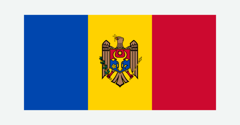
The cover uses Moldova flag artwork by Gheorghe Vrabie and Commons vector contributors. The intact flag preserves its 2:1 proportions and emblem, separate from the decorative flag-color outline motif.