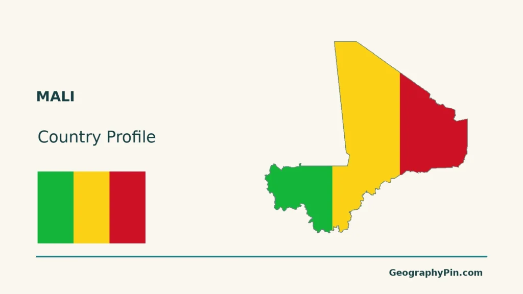
Mali is a landlocked West African country with Bamako as its capital. Its inland delta is a seasonal wetland far from the sea. Reading the country’s borders separately from its river geography helps explain that apparent contrast.
The Niger inland delta matters because seasonal river flooding supplies wetlands, fishing grounds, pasture and rice-growing areas within landlocked Mali. Water arriving from upstream highlands spreads through channels and floodplains far from the sea. The Niger continues beyond the wetland; this is not its coastal delta in Nigeria.
How to use this article: Locate the country, compare the physical settings, or follow the inland delta.
1. Locate Mali, Bamako and Timbuktu
A landlocked country with seven neighbors
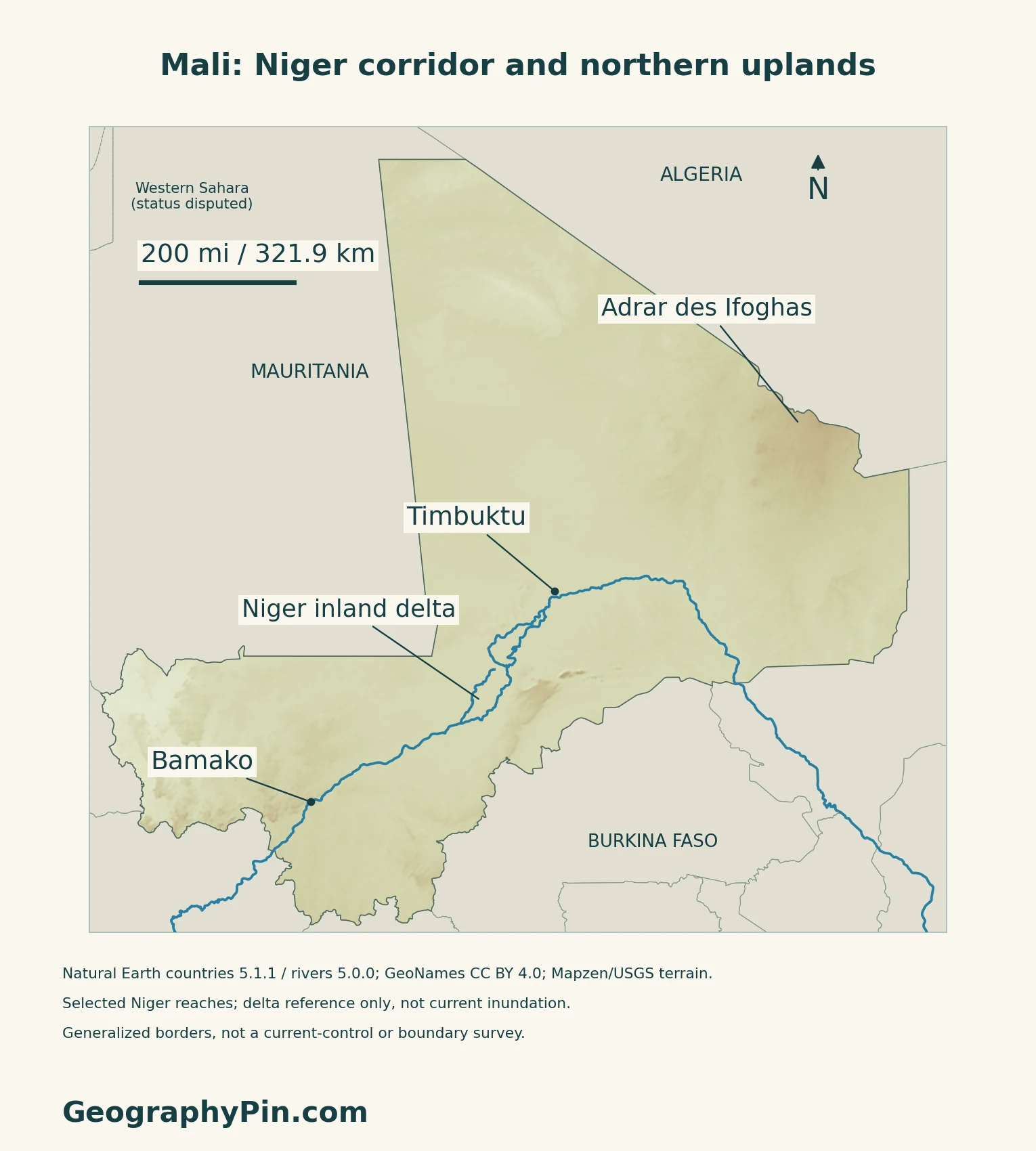
Mali borders Algeria, Niger, Burkina Faso, Côte d’Ivoire, Guinea, Senegal and Mauritania. Bamako, its capital, lies in the southwest beside the Niger River. The country of Niger is a neighbor; the river called Niger crosses several countries.

Timbuktu belongs to a different setting
Timbuktu, also written Tombouctou, is farther north near the Sahara’s southern margin. UNESCO describes its position close to the river as part of a historic trading crossroads connecting northern salt routes with southern cattle and grain. Its importance as a center of Islamic learning during the fifteenth and sixteenth centuries is not the same thing as being Mali’s present capital.
Use the West Africa countries map for the wider regional pattern. The maps here show geographic context, not present military control, road access or travel safety.
2. Compare Desert, Sahel and Southern Landscapes
A north-to-south climatic transition
Mali’s fourth national communication, submitted in December 2025, describes a dry Saharan north, a semiarid Sahelian transition and wetter southern environments.
| Setting | Main contrast |
|---|---|
| Saharan north | Very dry environments with sparse vegetation. |
| Sahelian belt | Semiarid grass and shrub environments between desert and wetter country. |
| Southern Mali | Greater rainfall and more wooded savanna. |
| Niger inland delta | A seasonal floodplain within an otherwise much drier regional setting. |
The northeast is not simply a flat sand plain
The Adrar des Ifoghas, also spelled Iforas, is an upland area in northeastern Mali. The British Geological Survey’s country atlas identifies old crystalline rocks there, including rocks altered by heat, pressure and deformation. Elsewhere, Mali includes sedimentary plateaus and extensive plains.
3. Understand the Inland Delta’s Seasonal Role
A floodplain, not a maritime outlet
USGS describes the inland delta as a network of lakes, marshes and channels supplied by seasonal water arriving from the Guinea Highlands. Its recurring inundation supports fishing, livestock pasture and rice farming.
Upstream rain and local flooding need not coincide
NASA’s November 2021 satellite account shows the delta changing from drier ground to greener flooded environments as water moves through it. Different parts fill and recede at different times.
For the full route and the distinction between Mali’s inland wetland and Nigeria’s coastal outlet, see the Niger River map and two-delta explanation.
4. Read Rainfall and Water Resources Together
Rainfall generally decreases toward the north
The national communication describes moist monsoon winds arriving from the southwest and the dry Harmattan from the northeast. Rainfall varies strongly by place and year.
A dry surface does not mean no underground water
The British Geological Survey distinguishes groundwater moving through cracks in hard rock from groundwater stored between grains in sedimentary deposits. Mali contains both types. In the Adrar des Ifoghas, fractures are particularly important; the inland delta has different, river-associated deposits. These contrasts explain why one borehole’s performance cannot describe groundwater conditions across the country.
5. Check Dated Country Facts
| Item | Reference |
|---|---|
| Capital | Bamako |
| Census reference | 22,395,489 residents; 2022 RGPH5, reported in INSTAT’s December 2024 analysis |
| Surface area | About 478,841 sq mi (1,240,192 km²); UNData’s 2023 reference |
| Currency | West African CFA franc (XOF) |
| Language framework | National languages are official; French is the working language under Article 31 of the 2023 Constitution |
| Administrative reference | 19 regions and the Bamako district; government account dated April 2026 |
What the census total includes
INSTAT’s December 2024 analysis reports the 2022 resident population as people normally resident who were present plus residents temporarily absent, rather than residents present plus visitors. Some localities could not be fully enumerated because of insecurity; statistical and geospatial estimates were used for uncovered or partly covered areas. The total is a dated census reference, not a current headcount or evidence of uniform field coverage.
In that analysis, the Bamako district accounted for 18.9% of national residents. This is a district statistic, not a separately measured city-proper population.
Official languages and the working language
Article 31 of the Constitution promulgated in July 2023 distinguishes national languages’ official status from French’s role as the working language. It provides for an organic law governing the use of official languages and allows the state to adopt another working language. The constitutional wording should not be simplified to “French is the sole official language.”
For a broader comparison, see the African countries and capitals reference.
What Did We Learn Today?
Mali’s boundaries, climatic regions and seasonal floodplain describe different geographic units. The inland delta shows how water arriving from elsewhere can shape livelihoods in a dry region.
Sources & Data Notes
Sources, dates and map conventions
Population and Bamako’s share follow INSTAT’s December 2024 census analysis, including its coverage-estimation caveat; the earlier November 2023 global report was explicitly preliminary. Surface area follows UNData’s 2023 convention. Capital and language statements cite Articles 30–31 of the promulgated 2023 Constitution, not a draft. The administrative count is attributed to an April 2026 government account, not a map of territorial control. The national communication, submitted December 25, 2025, supplies broad climatic contrasts, not current weather or precise zone boundaries. USGS and NASA explain a recurring floodplain process; no present inundation extent or current dependent-population total is inferred. The BGS atlas is used for stable geology and groundwater concepts, not its outdated political or population summaries. UNESCO supports Timbuktu’s historical setting, not present transport or security conditions. The country maps do not show current territorial control, and environmental labels are not administrative boundaries.
- INSTAT: December 2024 RGPH5 population analysis, resident scope and coverage
- Official Gazette: promulgated July 2023 Constitution, Articles 30–31
- UNData: currency and 2023 surface-area reference
- Government: April 24, 2026 administrative reform account
- Government: Fourth National Communication, submitted December 2025
- UNESCO: Timbuktu’s historic river-and-desert setting
- British Geological Survey: Hydrogeology of Mali
- USGS EROS: Niger River Inland Delta, Mali
- NASA: A Seasonal Emerald in the Sahel, November 2021
Original maps and artwork: Natural Earth countries 5.1.1 and rivers 5.0.0 (public domain) provide generalized outlines and selected Niger river/lake-centerline geometry. GeoNames (CC BY 4.0) supplies the city and regional references. No distributary connectors, delta boundaries, current flood extent or military-control areas are invented. Western Sahara appears as disputed peripheral context; source boundaries do not adjudicate sovereignty.
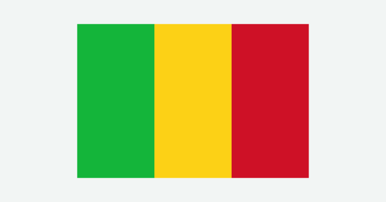
Mapzen/USGS Terrarium elevation provides qualitative relief, not vegetation or inundation. All sampled national land elevations were nonnegative and retained; no exact summit heights are inferred. The cover uses a Flagpedia rendition permitted for free website reuse. Its 3:2 proportions come from that rendition; Article 30 of the 2023 Constitution corroborates the equal vertical green, gold and red bands.