What is Human Geography?
Human geography is the branch of geography that examines people, cultures, economies, and their relationships with places and environments. It asks where and why human activities occur and how they vary across space and time, using tools like GIS, surveys, and statistics to explain patterns such as migration, urban growth, and cultural diffusion.
Human geography at a glance
At its core, human geography explains the “where” and “why” of human life on Earth. It studies settlement patterns, cultural landscapes, economic networks, political borders, and health outcomes. Instead of treating people as numbers alone, it places those numbers on maps to see patterns and to understand the stories behind them. A simple example is a daily commute of 12 miles (19 kilometers): why does it take that route, and how does it change when a new rail line opens?
As of 2025, more than half of humanity lives in cities, and people, goods, and ideas move faster than ever. Human geography helps decision-makers plan new neighborhoods, businesses choose store locations, and public-health teams track disease outbreaks. It also helps communities protect cultural heritage while adapting to climate risks such as heat waves and sea-level rise. For a plain-language overview, see the National Geographic encyclopedia entry on human geography.
Place vs. space
Place is a location with meaning — your street, a sacred site, or a busy market. Space is the larger pattern those places form when mapped together. Human geographers study how people attach meaning to places and how those meanings differ across communities and languages.
Scale and distance
Questions can be asked at many scales: local (a 1-mile/1.6-kilometer neighborhood), regional (a state or province), or global (oceans and continents). Distance can be physical (miles/kilometers) or social (how connected groups feel). A high-speed rail link that cuts a 62-mile (100-kilometer) trip to 30 minutes “shrinks” distance socially and economically.
Diffusion and networks
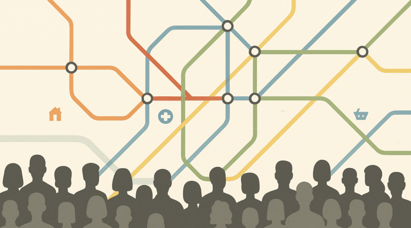
Diffusion describes how ideas, products, or diseases spread. Networks are the routes they follow — roads, fiber-optic lines, airline hubs, and social media ties. Mapping these flows reveals why some places become innovation centers while others specialize in different roles.
| Metric | Value |
|---|---|
| Typical commute distance (local example) | ~12 miles (19 km) |
| Remote-sensing detail often used in cities | ~100 feet (30 m) pixel resolution |
| Regional planning horizon | 10–30 years |
Methods and data in 2025
Human geographers use a blended toolkit. Quantitative methods include statistics, spatial modeling, network analysis, and remote sensing. Qualitative methods include interviews, participant observation, and archival research. The most famous tool is GIS (Geographic Information Systems), which layers different datasets — such as roads, income levels, and clinic locations — to answer “where” questions with maps and numbers. For population trends and urbanization facts, analysts frequently draw from the UN World Urbanization Prospects (regularly updated) and national statistics agencies.
Data quality and ethics matter. As map detail improves, there is a risk of exposing private information (for example, showing a single household’s income). Responsible practice aggregates data to appropriate units (like blocks or tracts), obtains consent where required, and follows guidelines from professional bodies such as the Royal Geographical Society. Many projects also use open data portals and “citizen science” mapping, which help communities document needs like safe crossings or shade along school routes of 0.5–1.2 miles (0.8–2 kilometers).
GIS and remote sensing
GIS integrates map layers to reveal spatial relationships (e.g., asthma rates versus proximity to major roads). Remote-sensing images — from satellites or drones — can detect heat islands down to ~100 feet (30 meters) and track land-use change over 3–5 years. Together, they show both present patterns and trends.
Fieldwork, surveys, and qualitative methods
Talking with people adds context that numbers miss. Interviews with market vendors, classroom observations, or photo-mapping with residents can reveal how a 0.6-mile (1-kilometer) barrier like a highway affects access to jobs, parks, or clinics. Good practice treats communities as partners rather than “subjects.”
Big data, privacy, and ethics
Smartphones and sensors produce huge streams of location data. These can model traffic flows, disaster evacuations, or tourism footprints. But the same data can be misused. Ethical human geography anonymizes records, uses the smallest safe sample sizes, and shares results in ways that help — not harm — vulnerable groups.
| Theme | Typical Questions | Example Metric / Dataset |
|---|---|---|
| Population geography | Where do people live now and in 2050? | Census tracts; density per sq mi (per km²); age structure |
| Urban geography | How does transit change housing costs? | Transit stops within 0.5 miles (0.8 km); rent indices |
| Cultural geography | How do languages and religions shape place? | Language maps; heritage site inventories |
| Economic geography | Why do firms cluster? | Supply-chain networks; travel-time isochrones |
| Political geography | How do borders and districts affect representation? | District compactness; border-crossing counts |
| Health geography | Who can reach a clinic within 3 miles (5 km)? | Accessibility catchments; travel time rasters |
Major subfields with real-world examples
Population geography explores births, deaths, migration, and age structures. For instance, planners track where a city will add 20,000 residents in the next five years — will new schools be within 1 mile (1.6 kilometers) of those homes? Urban geography examines city form, transport, and housing. Bus rapid transit can “shrink” travel times across 8–12 miles (13–19 kilometers), changing where people choose to live.
Cultural geography studies languages, religions, foodways, and identities as they create “sense of place.” Economic geography maps how industries cluster along highways, ports, or data cables; a factory 50 miles (80 kilometers) from a port faces different costs than one 5 miles (8 kilometers) away. Political geography analyzes borders, geopolitics, and voting districts. Health geography links environment and well-being; for example, mapping heat exposure with satellite data to target cooling centers within a 0.3-mile (0.5-kilometer) walk for seniors. For approachable case studies, the National Geographic Society’s education portal offers strong primers.
How human geography is used
Urban planning: Cities use human-geography analysis to place schools, parks, and clinics where they will serve the most people. A walkable grid that puts daily needs within 0.6 miles (1 kilometer) can cut car trips and improve health. Business location: Retail chains study spending patterns and drive-times of 10–15 miles (16–24 kilometers) to choose store sites.
Climate adaptation and hazards: Combining flood maps with household data helps design equitable evacuations — for example, ensuring shelters are within 3 miles (5 kilometers) of neighborhoods without cars. Public health: During outbreaks, health geographers map cases, contact networks, and mobility data to target testing and vaccination. For global urbanization trends that shape all these decisions, see the UN’s World Urbanization Prospects and professional guidance from the Royal Geographical Society’s publications.
Human–environment connections
Human geography works hand-in-hand with physical geography. People build in river valleys for fertile soils, but those same valleys flood. A city’s heat island can raise nighttime temperatures by several degrees Fahrenheit (≈2–4 °C), affecting health and energy demand. Mapping these interactions shows where tree planting or cool roofs will help the most — ideally within a 10-minute, 0.5-mile (0.8-kilometer) walk for vulnerable residents.
This joined-up view is called a social-ecological system. It treats communities and ecosystems as one unit, changing together. Policies work best when they recognize both sides: storm-water parks that store floodwater and provide play space; bus lanes that cut emissions and connect workers to jobs; coastal zoning that protects wetlands while allowing safe development. For definitions and curriculum resources, consult the Royal Geographical Society (Schools).
FAQ
Is human geography the same as social studies?
They overlap but are not identical. Social studies combines history, civics, economics, and geography. Human geography is a branch of geography focused on people–place relationships, patterns, and processes across space and time.
What jobs use human-geography skills?
Urban planning, transportation analysis, market research, GIS and mapping, public health, environmental consulting, emergency management, and international development all rely on human-geography tools and thinking.
How is human geography different from physical geography?
Physical geography studies natural processes like climate, landforms, and water systems. Human geography studies people and societies. In practice, they work together to solve real problems (for example, mapping flood risk and social vulnerability at once).
What Did We Learn Today?
- Human geography explains where and why human activities occur and vary across space.
- Key ideas include place, space, scale, distance, diffusion, and networks.
- Tools like GIS, surveys, and remote sensing connect data to maps responsibly.
- Subfields range from population and urban geography to political and health geography.
- Applied work guides planning, business siting, climate adaptation, and public health.