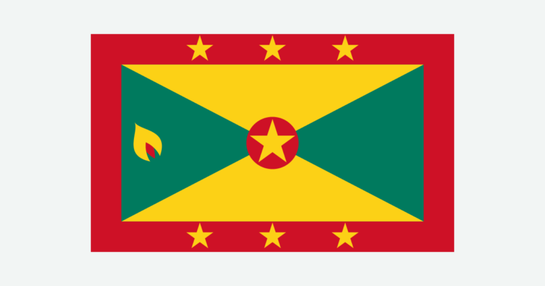
Grenada is both the name of an island and the name of a country extending into the southern Grenadines. That distinction matters when reading maps, population figures or accounts of hurricanes. The mountainous main island and the smaller islands to its north share a government, but not identical landscapes or water systems.
Grenada is a Caribbean island country comprising the main island of Grenada, Carriacou, Petite Martinique and smaller islands. St. George’s is its capital. The main island has a mountainous volcanic interior and Grand Etang crater lake. The country includes part of the Grenadines, not the entire chain, which also extends into Saint Vincent and the Grenadines.
How to use this article: Clarify the Grenadines distinction, read the physical map, compare water systems, or check the population reference.
1. Locate the Islands and Define Grenada
One country, several islands
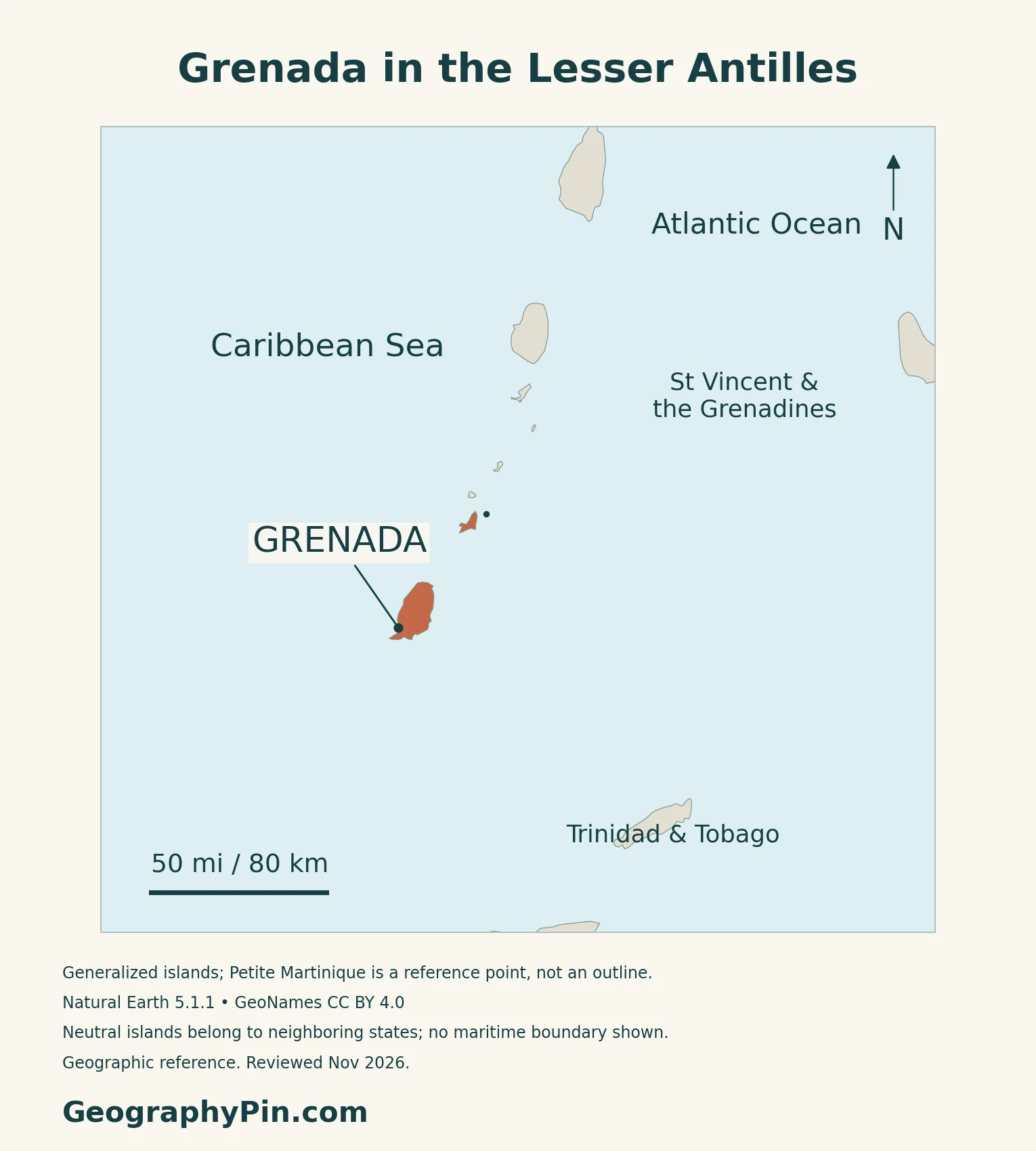
Grenada is an island country in the southeastern Caribbean, south of Saint Vincent and the Grenadines. The country includes the main island of Grenada, Carriacou, Petite Martinique and smaller islands in the southern Grenadines. St. George’s, on Grenada’s southwestern coast, is the capital and seat of national government.
The Grenadines extend beyond Grenada
The name Grenada can mean either the country or its largest island. Carriacou and Petite Martinique belong to the same country, but the wider Grenadines chain is shared with Saint Vincent and the Grenadines. Bequia, Mustique and Union Island, for example, belong to that northern neighbor. The Caribbean countries and territories map places both states in their regional setting.
2. Mountains, Crater Lakes and the Smaller Islands
Compare the main island with its northern neighbors
| Place | Geographic setting | Useful distinction |
|---|---|---|
| Grenada island | Mountainous main island with narrow coastal plains | Contains St. George’s and the Grand Etang highlands |
| Carriacou | Smaller island northeast of Grenada in the Grenadines | Drier setting with more limited freshwater catchment and storage |
| Petite Martinique | Small island near Carriacou in the southern Grenadines | Part of Grenada, not the French island of Martinique |
A mountain spine shapes the main island
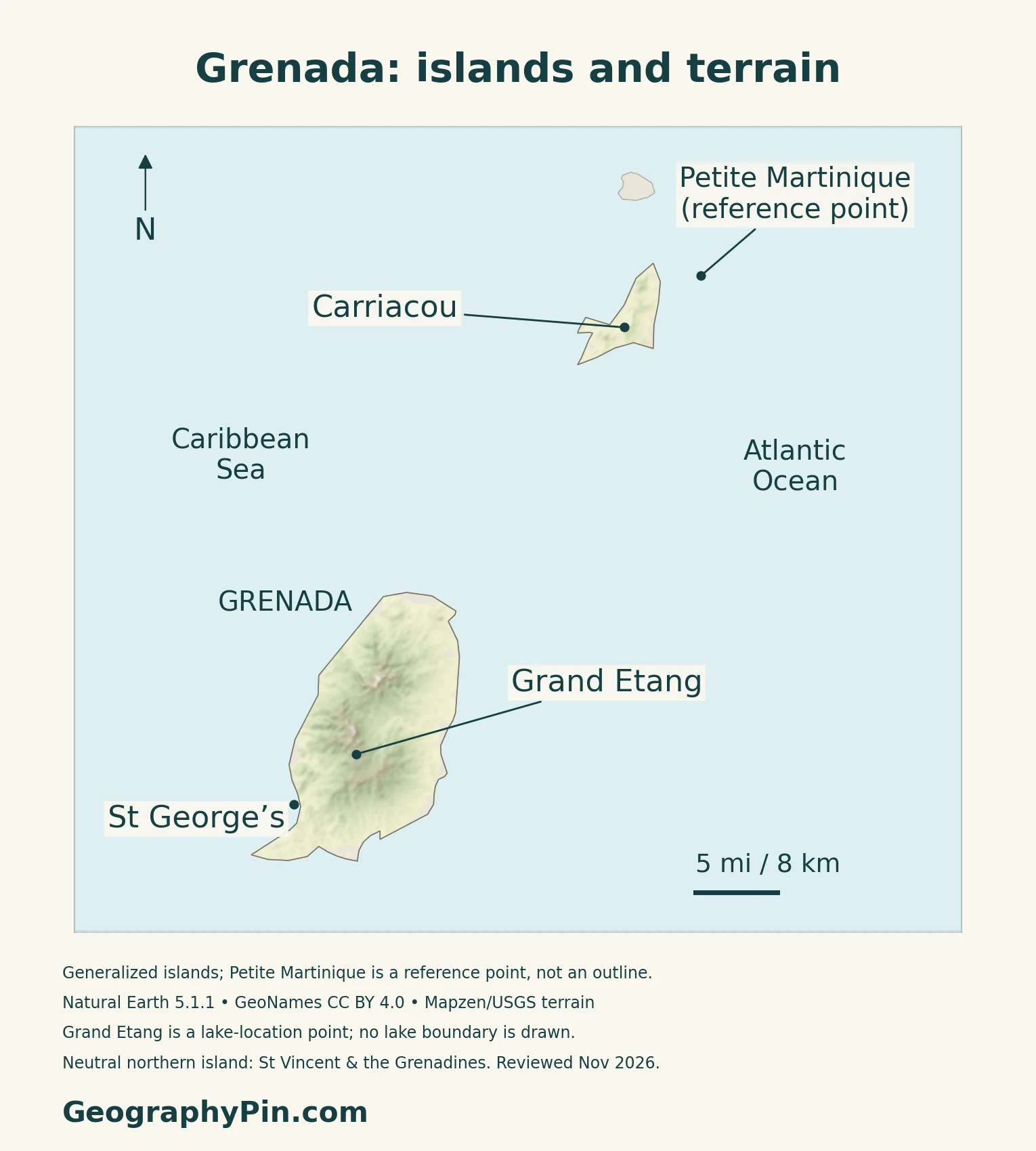
The UWI Seismic Research Centre describes a generally north–south mountain spine descending toward narrow coastal plains. Small rivers drain the volcanic peaks, and Mount St. Catherine forms the island’s highest point. The landscape includes volcanic rocks over older volcanic-sedimentary formations, rather than one uniform rock layer.
Grand Etang connects a crater lake and forested headwaters
Grand Etang Lake occupies a volcanic crater in the main island’s interior. The surrounding reserve includes ridges, steep-sided valleys and headwater catchments. The lake drains toward a tributary of the Great River, connecting this highland feature with the wider drainage system.
The Grenada Tourism Authority’s physical description identifies tropical, cloud and elfin forest environments within the reserve.
Volcanism also extends beneath the sea
Kick-’em-Jenny is an active submarine volcano north of Grenada. It should not be confused with nearby Diamond Rock, which has also carried that name on older charts. Its underwater setting is distinct from Grand Etang’s inland crater lake.
3. Seasonal Rainfall and Different Water Systems
A tropical climate with local and seasonal contrasts
Grenada’s embassy describes a generally drier season from January to May and a rainy season from June to December, with trade winds moderating temperatures. Altitude also affects conditions.
The climate ministry identifies Carriacou and Petite Martinique as drier than the main island, with more limited catchment and storage capacity. Across the country, both dry periods and heavy rainfall can complicate water supply: low yields reduce availability, while sediment-laden runoff can disrupt treatment and distribution.
River intakes on Grenada, desalination and rain capture farther north
NAWASA, the national water utility, says most supply on the main island comes from surface sources such as rivers, dams and intakes, with a smaller contribution from groundwater. Carriacou and Petite Martinique use desalination plants alongside household rainwater harvesting.
This makes water security partly a storage and infrastructure issue. In its October 11, 2026 project update, NAWASA reported completion of additional storage tanks at Belair and Mt. Royal on Carriacou. The same account explains how Hurricane Beryl damaged roofs and storage infrastructure used for rainwater collection. New capacity improves the system’s ability to handle interruptions, but maintenance and management remain necessary.
4. Coastal Habitats, Storms and Economic Geography
The landscape continues from forest to sea
Levera Wetland in Saint Patrick provides a coastal contrast to the Grand Etang highlands. Its Ramsar description includes mangroves, sandy beaches, seagrass beds, coral reefs and an offshore island, with important turtle-nesting habitat.
The site was designated in 2012 and covers roughly 1,280 acres (518 hectares). That is the protected wetland complex, not simply the surface of Levera Pond. The Ramsar ecological description also dates from 2012, so it provides a documented habitat baseline rather than a new survey of present conditions.
Hurricane Beryl showed why island-specific locations matter
Hurricane Beryl made landfall on Carriacou on July 1, 2024 as a Category 4 hurricane, according to the US National Weather Service. Saying that it struck “Grenada” is correct at the country level, but locating the landfall identifies the particular island involved.
Spice cultivation is one part of a wider economy
Nutmeg, mace and cocoa are among Grenada’s agricultural exports, while fish connects livelihoods with the surrounding sea. Agriculture remains visible in the country’s identity, but it is not a complete description of the modern economy.
The Ministry of Finance’s 2026 mid-year review describes a mixed first-quarter crop recovery after Beryl. It notes that some crops recover slowly because of their maturation periods, alongside ongoing replanting efforts.
The IMF’s consultation released in January 2026 emphasizes investment and construction activity, tourism dependence and the costs of imported inputs. These connections make ports, transport and resilient infrastructure important alongside farmland and marine resources. The North American countries and capitals guide places Grenada in its wider regional setting.
5. Country Facts, Census Scope and Administration
| Item | Reference | Date or scope |
|---|---|---|
| Capital | St. George’s | On Grenada island; national government seat |
| Population | 109,021 | Preliminary national census; reference January 14, 2022 |
| Surface area | About 133 sq mi (345 km²) | UN reference, 2023; not maritime jurisdiction |
| Language | English is official | Official diplomatic reference |
| Currency | Eastern Caribbean dollar (XCD) | Shared regional currency |
| Government | Constitutional monarchy with parliamentary government | Monarch represented by a governor-general |
| Administrative geography | Six parishes on Grenada; Carriacou and Petite Martinique | Sister islands distinct from the main-island parishes |
Read the census label and reference date together
The Central Statistical Office publishes this count in its preliminary “2021” census report, while its census information page gives January 14, 2022 as the reference date. The total covers Grenada, Carriacou and Petite Martinique and includes people in private dwellings, institutions and the homeless population. It is not a live 2026 estimate or a count of citizens abroad.
Parishes on the main island
Grenada’s six parishes are Saint Andrew, Saint David, Saint George, Saint John, Saint Mark and Saint Patrick. Carriacou and Petite Martinique are the country’s dependencies, not additional parishes on Grenada island. The parish of Saint George is a wider administrative area than the capital city of St. George’s.
What Did We Learn Today?
Grenada is a multi-island country, not just its mountainous main island. Grand Etang’s forested crater-lake landscape contrasts with the smaller northern islands and coastal wetlands. Differences in rainfall and freshwater supply help explain the need for distinct water systems, while dated census and storm information should always be read at the correct geographic scale.
Sources & Data Notes
Population is the Central Statistical Office’s preliminary census total. Its report is labeled “2021,” while the official census page specifies January 14, 2022 as the reference date; this is not a current-year estimate. Surface area follows the UN’s 2023 reference, not maritime jurisdiction. The 2013 Grenadines submission hosted by UNESCO is a tentative-list document, not a World Heritage inscription. Levera’s Ramsar ecological baseline dates from 2012. Water-source descriptions use NAWASA’s current account, and the storage-project update is dated October 11, 2026. The Finance Ministry’s mid-year report uses first-quarter 2026 crop data; forecasts are not completed outcomes. The Beryl reference describes the July 2024 event, not present conditions.
- Central Statistical Office: preliminary national census results
- Central Statistical Office: census reference date and report status
- UNData: Grenada, dated surface area and currency reference
- Grenada Embassy in China: capital, language and institutions
- Grenada Embassy in the United States: island and parish geography
- Government of Grenada: constitutional governance
- Grenada’s 2013 tentative-list submission: the Grenadines island chain
- Government of Saint Vincent and the Grenadines: northern Grenadine islands
- UWI Seismic Research Centre: Grenada geology and relief
- UWI Seismic Research Centre: Kick-’em-Jenny, submarine setting
- Grenada Tourism Authority: Grand Etang physical landscape
- Grenada Embassy: seasons and trade winds
- Climate Resilience Ministry: water availability and island contrasts
- NAWASA: current water sources across the islands
- NAWASA: Carriacou storage investments, October 11, 2026
- Ramsar Sites Information Service: Levera Wetland, 2012 ecological information
- US National Weather Service: Hurricane Beryl, July 2024
- Government of Grenada: agricultural exports and services
- Ministry of Finance: 2026 mid-year review, crop evidence on page 13
- IMF: 2025 consultation, released January 2026
Map method: Original GeographyPin maps use Natural Earth 1:10m countries version 5.1.1, public domain, for generalized outlines. The source includes Grenada and Carriacou but omits Petite Martinique, shown as a location dot rather than a scaled outline on the maps and cover. Other small islets may be omitted. Locations use GeoNames under CC BY 4.0; Grand Etang is a lake-location point, not a drawn lake or park boundary. Elevation shading uses actual Mapzen Terrain Tiles, with USGS and upstream attribution. Negative coastal artifacts and a small buffer are transparent, not replaced with invented elevations. No terrain is invented for Petite Martinique. Neighboring islands remain distinct; no maritime boundary or current hazard zone is shown. The clean featured outline uses FlagCDN national-symbol artwork, checked against the government flag specification, with a separate intact 5:3 land flag. No endorsement is implied.