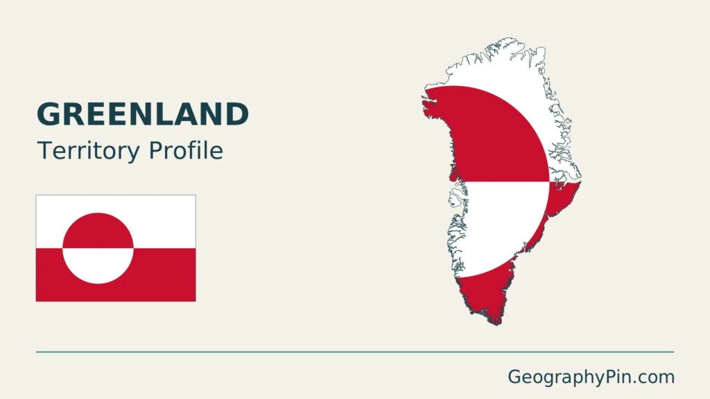
Greenland’s huge ice-covered interior dominates a world map, but its communities occupy a very different landscape around the coast. Its island identity also needs separating from its political relationship with Denmark. A useful overview therefore follows the inhabited coastal margins as well as the ice sheet, rather than treating the whole territory as an empty white shape.
Greenland is a self-governing territory within the Kingdom of Denmark, not an independent sovereign state. Its geography is dominated by a large inland ice sheet and a deeply indented coastal margin. Nuuk, the capital, lies on the southwest coast; Greenland’s geographic identity as an island is distinct from its constitutional status.
How to use this article: Locate Greenland and its neighbours, read the ice sheet, or follow coastal communities.
1. Locate the Island and Its Coastal Communities
Read the Arctic and North Atlantic setting
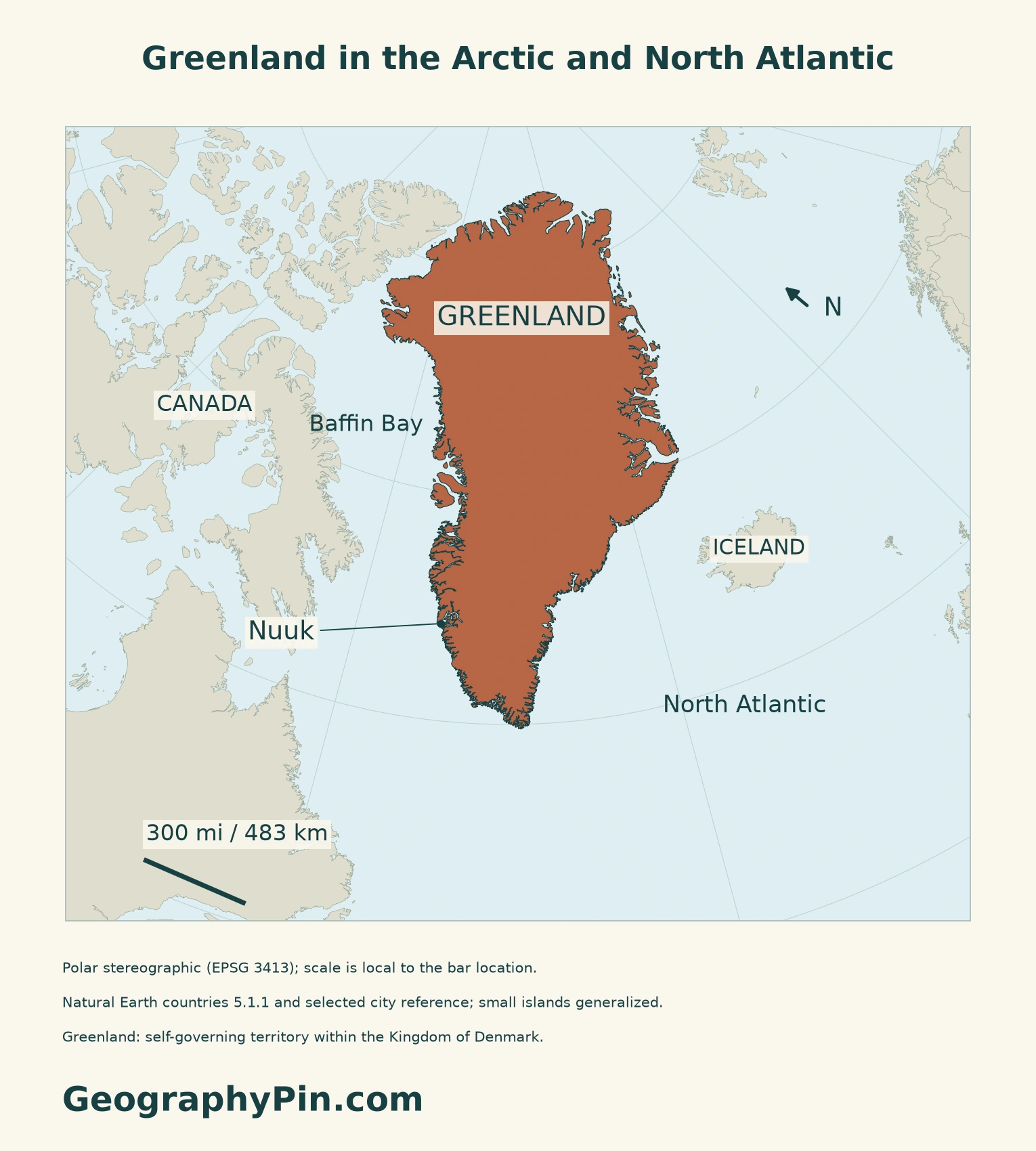
The locator places Greenland beside northeastern Canada, with Baffin Bay on its western side and Iceland across the waters to the southeast. Its northern end faces the Arctic Ocean. Geographic proximity and political affiliation answer different questions: a map of the island’s neighbours should not be mistaken for a map of its constitutional relationships.
Follow the inhabited margins
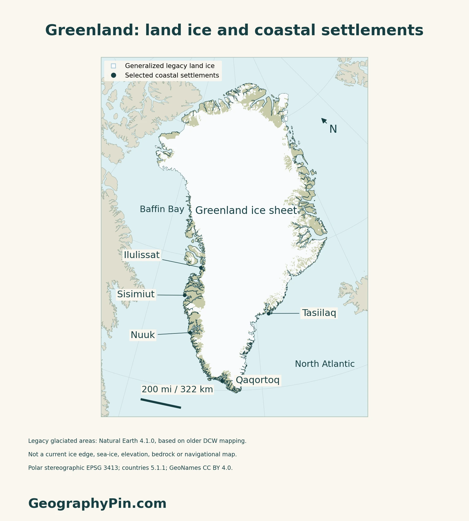
Statistics Greenland’s 2026 overview describes a population concentrated in coastal towns and settlements, especially in the southwest. Sisimiut and Ilulissat help locate the western coastal corridor; Tasiilaq provides an eastern reference point rather than representing the entire east coast.
The original maps use a polar projection to keep the high-latitude setting readable. Settlement dots are selected reference locations, not a complete list or a population-density layer.
2. Distinguish Land Ice From the Coastal Landscape
A moving ice sheet, not a frozen ocean
The National Snow and Ice Data Center describes the Greenland Ice Sheet as about 656,000 square miles (1.7 million square kilometers), covering around four-fifths of the island. An ice sheet is glacial ice on land. It spreads under its own weight, so the interior is not a permanently motionless block.
| Feature | What it means |
|---|---|
| Land outline | The general shape of Greenland and its coastal islands |
| Glaciated area | Land ice, shown here using a generalized legacy dataset rather than today’s ice edge |
| Settlement point | A named inhabited reference location, not a road connection or an administrative boundary |
Seasonal sea ice is a separate feature of the surrounding ocean and is not mapped here. Nor does the physical overview reconstruct rock beneath the ice. The existing Greenland bedrock article addresses that different, subsurface question.
Read a dated ice balance, not a prediction
In its September 2026 assessment, the Geological Survey of Denmark and Greenland estimated a net ice-sheet loss of about 173 billion tonnes for the 2025/26 melt year. This is a mass balance: snowfall adds ice, while meltwater runoff and ice discharged through glaciers remove it.
A loss of mass does not mean the same percentage of mapped ice-covered area disappeared. Thickness, glacier flow and the timing of snow accumulation all matter. The dated assessment should not be read as a forecast for the next year or as the boundary of the legacy ice polygons used in this overview.
3. Compare Coastal and Interior Climate
Latitude is only part of the explanation
The Danish Meteorological Institute’s 1991–2020 climate assessment describes strong differences between the coast, inner fjords and ice sheet. Precipitation is generally greater near the coast than inland, especially in the south and southeast. North Greenland includes very dry Arctic landscapes.
In the southwest, the report describes relatively mild coastal winters influenced by open water, while the inner fjords can have colder winters and warmer summers. Sea fog can affect coastal conditions even when the land farther inside a fjord is warmer. These contrasts explain why a single “Greenland temperature” is a poor description of local conditions.
The assessment is a historical climate reference, not a present weather forecast.
4. Check Status and Dated Facts
| Item | Reference |
|---|---|
| Capital | Nuuk, seat of Inatsisartut and Naalakkersuisut |
| Population reference | 56,853 registered residents on October 1, 2026; Statistics Greenland release dated November 5, 2026 |
| Total area reference | About 836,330 sq mi (2,166,086 km²), including ice-covered areas |
| Ice-free area reference | About 158,475 sq mi (410,449 km²), as tabulated in Greenland in Figures 2026 |
| Official language | Greenlandic, under section 20 of the Self-Government Act |
| Currency | Danish krone (DKK) |
| Administration | Five municipalities, as listed by Statistics Greenland in 2026 |
| Political status | Self-governing territory within the Kingdom of Denmark; not a separate sovereign state |
Residents, not an ethnic population count
Statistics Greenland derives population statistics from the Central Population Register, rather than a new door-to-door census. The count includes people officially registered as residents, not Greenlanders living worldwide. The agency warns that delayed reporting of departures from the Danish Realm can overstate the number of foreign nationals still resident.
Self-government is not separate statehood
The Self-Government Act took effect on June 21, 2009. The Act provides a process for a future decision on independence; it does not itself declare independence.
Greenlandic is the official language. The Danish Prime Minister’s Office explains that Danish may still be used in official matters. Language status should not be confused with the nationality or birthplace of individual residents.
What Did We Learn Today?
Greenland’s island outline, land ice and constitutional status describe different things; its communities are concentrated around the coastal margins.
Sources & Data Notes
Sources, dates and map conventions
Population uses Statistics Greenland’s November 5, 2026 release summary for October 1 and its published register-method explanation. Area figures follow Greenland in Figures 2026 and distinguish total from ice-free area; they are not a new ice-margin measurement or a count of habitable land. Greenland is treated as a self-governing territory, not an additional sovereign country. This overview preserves the separate task of the existing Greenland bedrock article: it maps territory, land ice and selected coastal settlements, not a hypothetical ice-free bedrock landscape. Ice-sheet scale is approximate, following NSIDC. The GEUS mass-balance figure refers specifically to the 2025/26 melt year and its September 2026 assessment; it is not an area-loss percentage. Climate descriptions use DMI Report 21-12 and its 1991–2020 reference period, not current forecasts.
- Statistics Greenland: November 5, 2026 population release summary
- Statistics Greenland: 2026 register-based population methodology
- Statistics Greenland: Greenland in Figures 2026, area, capital and municipalities
- Act on Greenland Self-Government, sections 20–22, official English translation
- Danish Prime Minister’s Office: Greenland self-government and language context
- Nordic cooperation: Greenland currency and constitutional setting
- National Snow and Ice Data Center: ice-sheet definitions and Greenland scale
- GEUS: Greenland ice-sheet mass balance, September 2026
- Danish Meteorological Institute: Greenland climatological normals 1991–2020, Report 21-12
Original maps use Arctic polar stereographic projection EPSG 3413, with local WGS84 scale bars and true-north arrows. Public-domain Natural Earth countries 5.1.1 supplies Greenland’s generalized land outlines and surrounding context; smaller islands and precise frontier details are not resolved. The glaciated-area dataset (downloaded release 4.1.0) is derived from legacy Digital Chart of the World mapping and includes recently deglaciated areas. Its Greenland-intersecting polygons are clipped to the source land outline. This is not a current ice-sheet margin, seasonal sea-ice extent, change comparison, bedrock map or elevation model; no ice-area percentage was calculated from it. The locator uses a Natural Earth Nuuk reference. Settlement coordinates in the unchanged physical map and cover use GeoNames, CC BY 4.0. The local north direction follows NSIDC’s polar-stereographic projection definition. The cover is an original polar-projected composition of Greenland’s generalized land outlines, legacy glaciated-area polygons and a sourced Nuuk reference, not a contemporary ice-edge depiction. Island outlines do not imply independent statehood or a cadastral boundary survey.