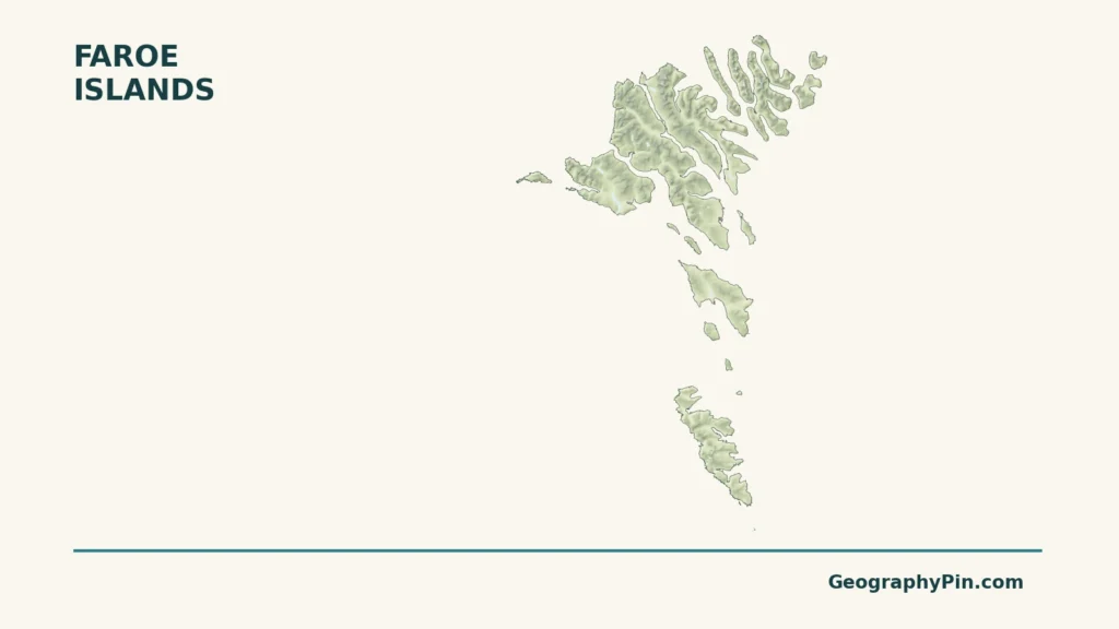
The Faroe Islands’ cliffs and narrow sounds can make neighboring settlements look both close together and sharply separated. Their landscape began as a much larger volcanic plateau, then erosion and ice helped turn it into the island group visible today. Understanding those physical divisions also means separating the Faroes’ North Atlantic geography and self-government from Denmark proper.
The Faroe Islands are a self-governing territory within the Kingdom of Denmark in the North Atlantic, northwest of Scotland. Their mountainous islands are built from ancient basalt layers and shaped by erosion and glaciation. Tórshavn, on Streymoy, is the capital. The Faroes are not an independent sovereign state or part of Denmark proper.
How to use this article: Locate the islands, read the terrain, or explore the climate.
1. Locate the Islands and Their Capital
An island group northwest of Scotland
The Faroe Islands lie near 62° north in the North Atlantic, between Iceland and Norway and northwest of Scotland. The familiar description of 18 islands refers to the principal island group, not every offshore rock that a detailed coastline dataset might contain.
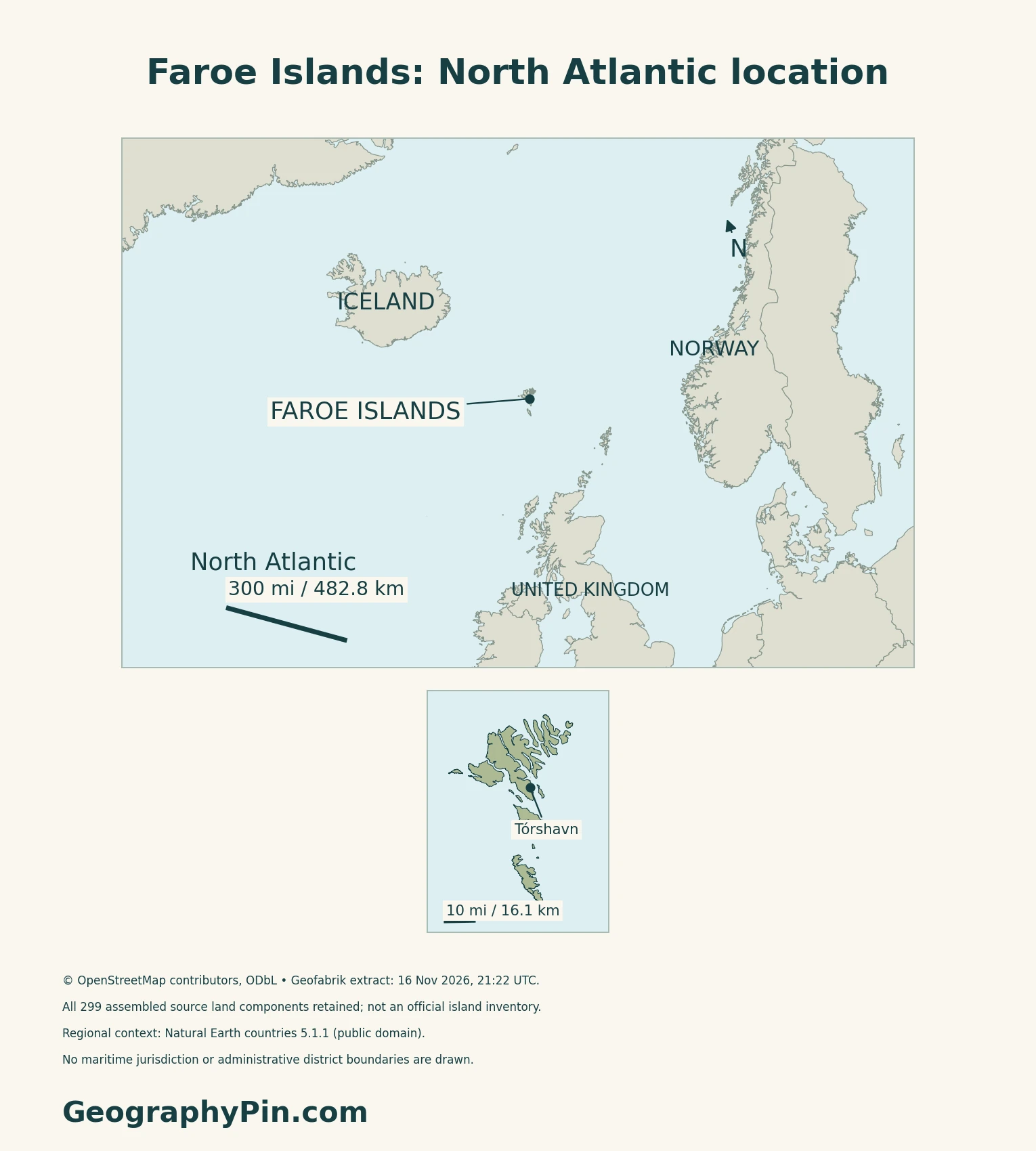
Tórshavn is on Streymoy, not a separate island
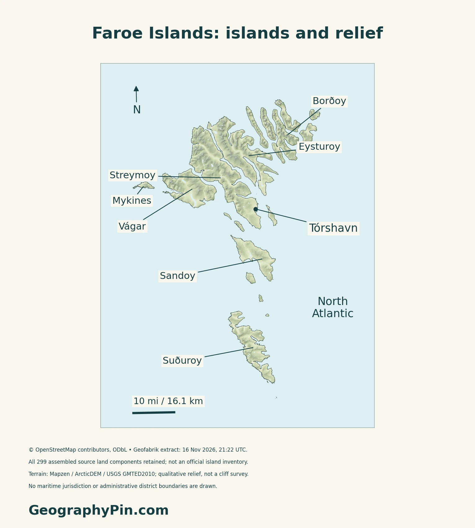
Tórshavn stands on Streymoy’s southeastern coast. Streymoy and neighboring Eysturoy are central reference points for reading the archipelago, while islands farther north and south extend the group beyond the capital’s surroundings. Naming these islands separately matters: a statement about Tórshavn’s population or weather does not automatically describe the whole territory.
For the different geographic scope of Jutland and the Danish islands, see the Denmark profile. Faroese self-government is explained separately in the dated facts below.
2. Understand Basalt, Cliffs and Glacial Valleys
Volcanic origin does not mean an active volcanic island
The basalt layers record repeated eruptions during the early opening of the Northeast Atlantic. The government’s geological account places this volcanic construction roughly 55 million years ago. Lava flows accumulated into a broad plateau, with sediment and volcanic ash between some layers.
The islands subsequently moved away from the active volcanic region. Their modern appearance owes much to the erosion of that older rock pile, including repeated glacial and interglacial periods. A stepped slope or layered cliff is therefore evidence of a long geological history, not proof of present volcanic activity.
Sea-facing cliffs contrast with sheltered shores
The Faroese maritime authority describes a broad contrast between steep western coasts and eastern shores that tend to slope toward the sea. Fjords and sounds create more sheltered settings between the islands, and settlements line many of these shores. This is a regional pattern rather than a rule for every headland: the coast’s orientation and the local relief both matter.
3. Read the Ocean Climate at the Right Scale
Cool summers and relatively mild winters
DMI describes a maritime climate shaped by warm Atlantic influence and frequent weather systems. Its 1991–2020 Tórshavn normals show a mean temperature of about 40°F (4.3°C) in January and 52°F (11.2°C) in August. These are monthly means at one station, not daytime highs or island-wide extremes.
Mountains make rainfall uneven
Annual precipitation in the same Tórshavn reference period averaged about 55 inches (1,399 millimetres). DMI reports substantially wetter conditions in some mountainous interiors, where rising air produces additional precipitation. Wind also varies with terrain and exposure. A capital-city average is useful context, but not a forecast for a mountain ridge or a different island.
4. See How Settlements Connect Across Water
The capital faces the sea
Tórshavn’s harbor setting is part of its geography, not just its history. The Reyni and Tinganes peninsula divides the harbor into eastern and western sides, while the town occupies coastal ground on Streymoy.
Tunnels change connections, not coastlines
The tunnel operator identifies subsea links between Vágar and Streymoy, between the Leirvík and Klaksvík areas, and between the Tórshavn area and Eysturoy. The Faroese government announced the opening of the Streymoy–Sandoy connection in December 2023.
These links explain why an island map alone cannot show how communities are connected by road. An underwater connection crosses a physical separation without removing it: the islands remain separate landforms.
5. Check Status and Dated Facts
| Topic | Reference |
|---|---|
| Status | Self-governing territory within the Kingdom of Denmark, not an independent sovereign state |
| Capital | Tórshavn |
| Population | 55,616 registered residents on October 1, 2026; Hagstova release of November 10, 2026 |
| Land-area convention | About 540 square miles (1,399 square kilometers), as listed by the Faroese Government |
| Language provisions | Faroese is the principal language; Danish may also be used in public affairs under section 11 of the Home Rule Act |
| Currency | Danish krone (DKK), with a Faroese banknote series |
A registered-resident count, not a forecast
Hagstova’s population statistics cover residents in the national register. Publication has a one-month lag to accommodate late registrations, especially address changes. The date belongs to the population count, not the day the webpage was consulted. It is neither a visitor total nor a count of Faroese people living abroad.
Self-government does not mean sovereign independence
The Faroese Government describes the islands as a separate jurisdiction within the Kingdom, with their own legislative and administrative responsibilities. This is not the same geographic or governmental unit as Denmark proper. The land-area figure excludes the much larger maritime area.
Danmarks Nationalbank produces Faroese banknotes, exchangeable at parity with Danish banknotes; the coins are the same as in Denmark. Distinctive banknote designs do not establish a separate sovereign state.
What Did We Learn Today?
The Faroe Islands are an oceanic archipelago with their own self-government within the Kingdom of Denmark. Ancient basalt layers, later erosion and glaciation explain much of the steep terrain. Tórshavn is a useful reference point, but its city statistics and station climate should not be mistaken for measurements of every island.
Sources & Data Notes
Sources, dates and map conventions
Population follows Hagstova’s November 10, 2026 release for October 1 and its national-register definition. Land area follows the government’s 1,399-square-kilometer convention rather than silently substituting another statistical area figure. Language wording follows section 11 of the Home Rule Act, not a claim that Faroese alone may be used officially. Currency design and constitutional status are separate matters. Climate values use DMI’s 1991–2020 Tórshavn station normals, not present weather; the temperature figures are monthly means. Fahrenheit and inch values are rounded conversions. Geological ages are approximate. Transport examples describe established connections, not a live route or toll guide.
- Hagstova: October 1, 2026 population, released November 10
- Hagstova: population coverage and registration lag
- Faroese Government: facts and figures
- Faroese Government: constitutional status
- Home Rule Act: sections 1 and 11, government English text
- Danmarks Nationalbank: Faroese banknotes and coins
- Faroese government: geology
- Faroese maritime authority: geography
- Faroese government: Tórshavn and its harbor setting
- DMI Report 21-13: original 1991–2020 climate normals
- Tunnil: subsea tunnel connections
- Faroese government: Sandoy Tunnel opening, December 2023
Original maps and cover use Geofabrik’s OpenStreetMap extract, timestamped 16 November 2026 at 21:22:36 UTC, retrieved 17 November. © OpenStreetMap contributors, ODbL. All 299 land components assembled from 653 coastline ways are retained in their relative positions; these are source components, not an official island inventory, and tiny skerries may be illegible. Source water polygons are excluded from relief. Tórshavn and island labels use OSM records. The local maps and cover use UTM zone 29N; the regional locator uses a North Atlantic Lambert azimuthal equal-area projection and Natural Earth countries 5.1.1, public domain. No maritime jurisdiction or district boundaries are depicted.
Relief uses Mapzen Terrain Tiles, zoom 11, bilinearly reprojected to a grid of about 213 feet (65 metres). Tile metadata identifies ArcticDEM v2.0, USGS GMTED2010 and NOAA ETOPO1 inputs; this is a legacy composite, not a contemporary elevation survey. Of 327,776 dry-land samples, 286 negative samples are omitted transparently rather than flattened; coast/model mismatch and source errors can produce gaps. This does not establish the absence of below-sea-level ground. No peak heights, cliff edges, geological units or current vegetation are inferred. Scale bars use WGS84 geodesic distances; these are explanatory maps, not navigation charts.
Terrain credits and source terms: ArcticDEM was produced from DigitalGlobe imagery with National Science Foundation funding under awards 1043681, 1559691 and 1542736. GMTED2010 is courtesy of the U.S. Geological Survey; ETOPO1 is from NOAA. The cover is an original terrain-and-island composition using these same sources, not a photograph.