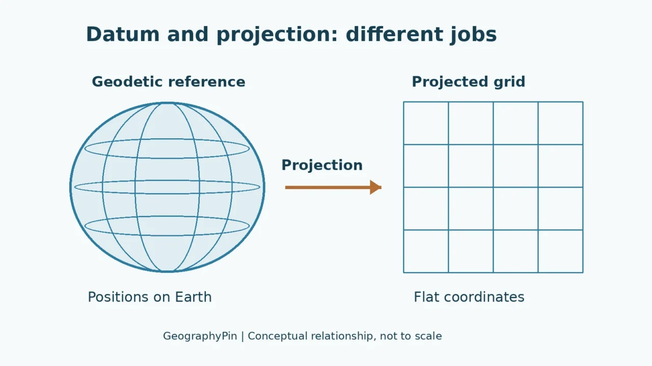
A geodetic datum provides the reference framework for locating points on Earth. A map projection converts positions on a curved reference surface into a flat grid. They work together but are not interchangeable: knowing the projection alone does not fully identify a coordinate reference system or guarantee that map layers align.
How to use this article: Start with the basic distinction, compare the worked coordinate example, or examine assigning versus transforming a CRS.
1. Datum and projection answer different questions
Where is the coordinate anchored?
A coordinate is not just a pair of numbers. To interpret it, we need to know the reference framework, the units and how the numbers are arranged. Two datasets can use familiar-looking coordinates yet refer to different locations if those details differ.
A geodetic datum establishes the reference for positions on Earth. A map projection supplies a mathematical relationship between a curved reference surface and a flat map. A coordinate reference system, usually shortened to CRS, brings the necessary reference and coordinate-system information together.
The National Geodetic Survey explains datums and reference frames as the foundation for known positions used in surveying and mapping. This article concentrates on the distinction between horizontal positioning and projection, with a separate caution about heights. It is a conceptual guide, not a survey specification.
| Term | Main role | What it does not establish by itself |
|---|---|---|
| Reference ellipsoid | A smooth mathematical model of Earth’s size and shape | The complete reference frame tying coordinates to Earth |
| Geodetic datum or reference frame | The reference for locating positions | Which flat-map projection will be used |
| Map projection | Converts curved-surface positions to a plane | The complete datum, units and coordinate-system definition |
| Coordinate reference system | Combines the reference with coordinate-system information | The accuracy of the original observations |
An ellipsoid is not the whole datum
Earth is not a perfect sphere. A reference ellipsoid is a deliberately smooth model, useful for describing positions mathematically. It does not attempt to reproduce every mountain, valley or irregularity in the gravity field.
Choosing the ellipsoid’s size and shape is not the same as specifying the entire reference framework. Origin, orientation, scale and the way the frame is realized also matter. Two systems using very similar ellipsoids should not automatically be treated as identical. In precise work, the particular realization and the time associated with coordinates may matter too.
2. What a map projection changes
From curved-surface coordinates to a flat grid
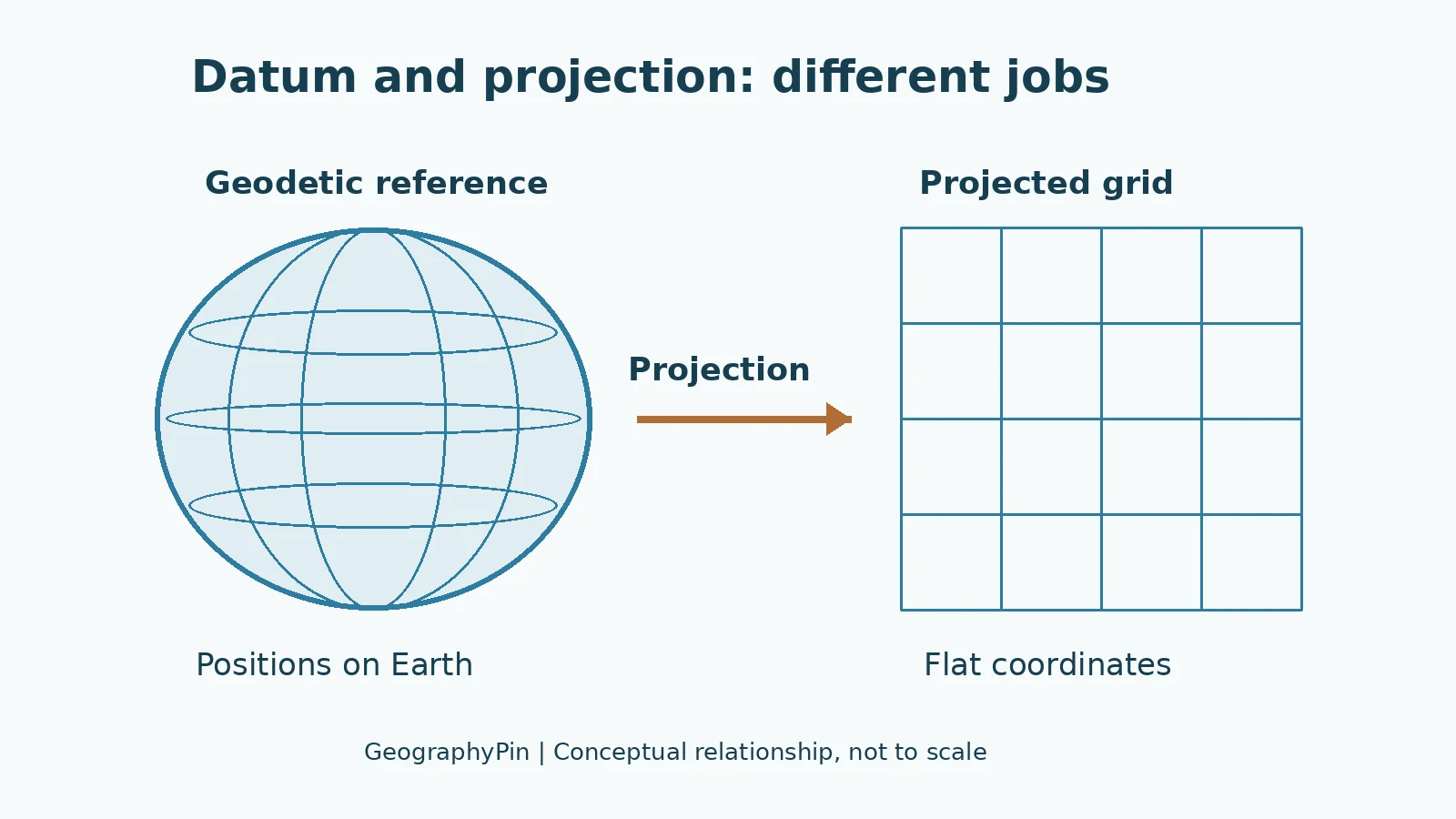
Latitude and longitude describe angular positions in a geographic coordinate reference system. A projected system expresses positions on a plane, commonly using eastings and northings in meters or feet. The projection is the mathematical part that connects these representations.
No flat world map preserves every geometric property of the curved Earth. Different projections serve different purposes, such as preserving area or local angles, and their distortions vary with location. Changing the projection changes the map representation; it does not physically move the mountain, city or coastline being represented.
The projection name is not the complete definition
“Transverse Mercator” or “Lambert Conformal Conic” names a projection method, not every setting needed to interpret coordinates. A projected CRS also identifies its underlying geographic reference and parameters such as an origin or central meridian, together with units and axes.
Two projected systems can use the same mathematical method while differing in their parameters or underlying datum. Conversely, a single geographic reference can support several projections. It is therefore better to preserve the complete CRS definition than to record a short projection name and assume the rest is obvious.
Esri’s spatial-reference documentation illustrates this relationship: a projected system includes a geographic reference as well as the projection and its settings. A label such as “WGS 84 / UTM zone 32N” contains more information than “UTM” alone.
Latitude and longitude still need a reference
Coordinates written in degrees are not free of datum assumptions. A latitude and longitude pair must be interpreted within a specified geographic reference. It also matters whether software expects latitude first or longitude first.
This is separate from changing between decimal degrees and degrees, minutes and seconds. For example, 45.5° equals 45°30′00″. Reformatting that angle does not change the datum, project it onto a flat grid or improve the accuracy of the original observation.
3. Is WGS 84 a datum or a projection?
WGS 84 is not itself a map projection
WGS 84 is a geodetic reference system widely associated with GPS. The name is also used in related datum, reference-frame and ellipsoid terminology. It does not, by itself, name the mathematical operation that flattens Earth onto a map.
Two commonly encountered identifiers help show the difference. EPSG:4326 identifies a WGS 84 geographic CRS using latitude and longitude. EPSG:3857 identifies WGS 84 / Pseudo-Mercator, the projected system commonly called Web Mercator. The first uses angular coordinates; the second uses a projected grid in meters.
They are not two interchangeable labels for the same stored numbers. A geographic point can be converted to the projected representation, but its numeric coordinates must be calculated appropriately. The PROJ Web Mercator documentation describes the projection and its forward and inverse operations.
One point, two coordinate representations
Consider a point at longitude 0° and latitude 45°N, interpreted in WGS 84. In Web Mercator, its coordinates are approximately x = 0 meters and y = 5,621,521 meters. We explicitly name longitude and latitude here rather than relying on an ambiguous pair of numbers.
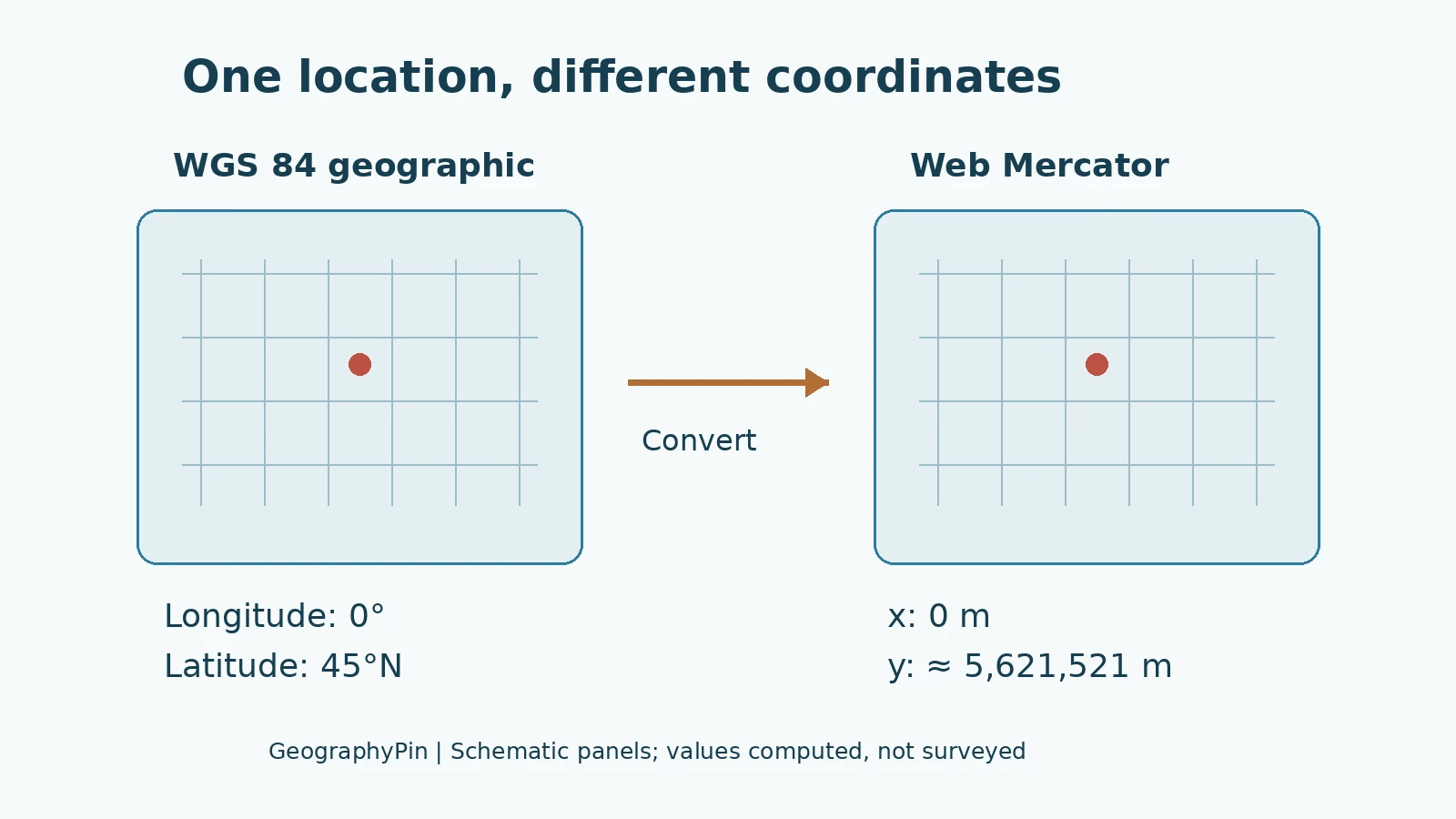
The example was calculated using a coordinate conversion and independently checked with the Web Mercator formula. It is not a measured survey point. The rounded result demonstrates how the representation changes while the intended location stays the same.
The projected y-value is not a statement that the point lies that many ground meters from the equator. Web Mercator’s grid scale differs from ground scale away from the equator. Merely changing units from degrees to meters does not make every map measurement a true surface distance.
A code does not guarantee accuracy
A CRS identifier helps software retrieve a definition. It does not certify the quality of the data, fix an incorrectly assigned reference or turn a rough location into a survey-grade measurement. More decimal places likewise do not create information that was never observed.
For ordinary web mapping, common CRS names may be sufficient to understand the display. Precise surveying, engineering and scientific comparisons need more detailed attention to reference-frame realization, coordinate epoch, transformation choice and the accuracy required.
4. Defining a CRS is not the same as reprojecting data
Correct the label only when the label is wrong
Suppose a dataset already contains correctly calculated coordinates, but its reference information is missing. Once the true reference has been established from reliable metadata or the data producer, assigning that CRS tells software how to interpret the existing numbers.
That operation should not be confused with converting the coordinates. Esri’s Define Projection documentation explicitly says the tool updates coordinate-system information without changing geometry. Giving unknown data the same label as a basemap is not a sound way to discover its original reference.
Imagine labeling the degree coordinates in the previous example as if they were already Web Mercator meters. The software would interpret the numbers under the wrong system. The operation would not magically calculate the correct projected values shown in the diagram.
Reprojection calculates a new representation
Once the source CRS is correctly known, a projection or reprojection operation calculates coordinates in the desired target system. If the source and target reference frames differ, the process may also need an appropriate datum transformation.
That transformation is not necessarily one fixed shift applied everywhere. Different operations have different areas of use, accuracy and data requirements. PROJ’s transformation guide describes pipelines that can combine several operations rather than treating every change as one simple translation.
The distinction is practical: assign the correct meaning to existing coordinates; transform coordinates when changing their reference or representation. A workflow can require both steps, but they should not be substituted for one another.
Keep the source and check the result
Before converting important geographic data, preserve the original file and its metadata. Record the source CRS, target CRS and transformation used. Check known control locations or suitable reference data rather than judging alignment from one convenient-looking point.
A successful software operation only means a calculation ran. It does not prove the input was correctly identified or the selected transformation was appropriate. Esri’s Project tool documentation distinguishes projection from required geographic transformations and notes that default choices may not suit precise work.
5. Heights and map alignment need their own checks
Height is not just a third interchangeable number
Horizontal position and height are related but distinct referencing problems. An ellipsoidal height is measured relative to an ellipsoid. A gravity-related elevation uses a different reference, commonly associated with a geoid model or a defined vertical datum. A height described casually as “above sea level” needs clarification when accuracy matters.
Do not assume that changing a map’s horizontal projection also converts its heights. A vertical transformation requires suitable source and target vertical references and, where applicable, supporting models or grids. There is no universal fixed offset that converts every GPS height into every elevation datum.
NOAA’s datum overview distinguishes geometric and vertical referencing. The distinction matters when combining terrain, survey points, water levels or infrastructure data, even if their horizontal positions seem to line up.
A useful checklist for mismatched layers
If two layers do not align, start by checking their documentation rather than dragging one into place:
- Source reference: Is each dataset’s actual CRS known and correctly assigned?
- Units and axes: Are degrees, meters or feet being interpreted correctly, and is coordinate order explicit?
- Projection settings: Are zones, origins and other parameters included in the definition?
- Transformation: Is an appropriate operation available for the source and target references?
- Height and time: Do vertical references or coordinate epochs matter for the intended precision?
Misalignment can also come from observation errors, poor georeferencing or outdated geometry. A datum mismatch is one possible cause, not the explanation for every discrepancy. Good metadata helps separate these possibilities.
Projection choices can affect other geographic calculations too. Our guide to calculating a country’s geographic center explains why a flat-map result needs a stated method rather than an unexplained point on a map.
Frequently Asked Questions
Can two maps use the same projection but different datums?
Yes. A projection method does not uniquely specify the underlying geodetic reference. Compare the full coordinate reference systems, including their parameters and units, before treating coordinates as equivalent.
Does changing the CRS label fix misplaced data?
Only if the label was wrong and you replace it with the dataset’s actual reference. Assigning a convenient target CRS does not convert the coordinates. Establish the true source CRS first, then transform the data if a different representation is needed.
Are latitude and longitude always WGS 84?
No. Latitude and longitude can be expressed in different geographic reference systems. WGS 84 is common, especially in GPS-related contexts, but it should not be assumed when a dataset’s documentation specifies something else or the reference is unknown.
What Did We Learn Today?
A datum establishes the reference for positions, while a projection converts curved-surface coordinates to a flat representation. A complete CRS connects these ideas with the coordinate system, units and relevant settings. WGS 84 is not itself a map projection, assigning a CRS is not the same as transforming coordinates, and height references require separate attention. Reliable mapping begins with knowing what the numbers mean, not simply making two layers look aligned.
Sources & Data Notes
Both illustrations are original conceptual teaching graphics, not survey diagrams or maps of measured datum shifts. The numeric example was checked using PROJ through pyproj and an independent Web Mercator formula. The rounded output does not imply meter-accurate source observations. This article explains stable concepts rather than the implementation timetable of national datum modernization programs.
- NOAA National Geodetic Survey: Datums and reference frames
- Esri: Spatial references and geographic/projected coordinate systems
- PROJ: Web Mercator definition and formulas
- PROJ: Geodetic transformation pipelines
- Esri: Define Projection, metadata rather than geometry changes
- Esri: Project, geographic and vertical transformations