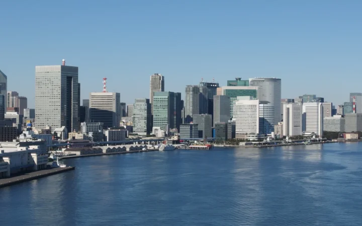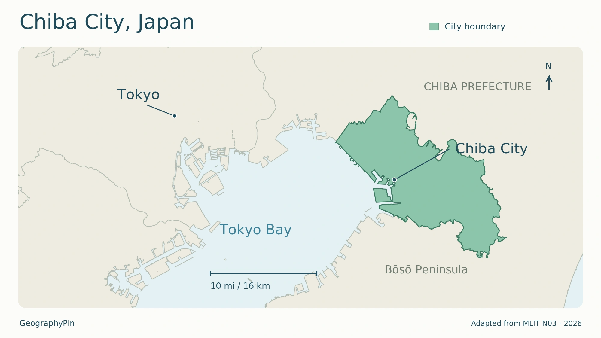
The map highlights the municipality, not the whole prefecture. Enlarge map.
Chiba can mean a city, a prefecture or a much broader travel destination. The city itself has a distinct shape and history: a prefectural capital with an industrial waterfront, planned coastal districts and inland neighborhoods where farms and woodland remain part of the landscape.
Chiba city is not the whole prefecture
Chiba is the capital of Chiba Prefecture, Japan, on the eastern side of Tokyo Bay. Its municipality contains six wards and had an estimated 998,638 residents on November 1, 2026. The city is distinct from the larger prefecture and the Bōsō Peninsula, despite sharing their regional identity.
How to use this article: Separate the city from the prefecture, understand the rebuilt coastline, or check what the population figure counts.
1. A prefectural capital on Tokyo Bay
Chiba lies in Japan’s Kantō region on Honshu, east of Tokyo. The municipal government places it approximately 25 miles (40 kilometers) from the national capital. This is a broad location reference, not a road distance or a promised train journey.
City, prefecture and peninsula describe different places
Chiba city, written 千葉市, is the municipality described here. Chiba Prefecture is the larger administrative region containing it and other municipalities, including Narita. The Bōsō Peninsula is a landform, not another name for the municipal government’s territory.
The prefecture extends far beyond the city, toward the Pacific coast and the southern peninsula. A story about a beach, an airport or a town “in Chiba” therefore needs one more check: does it mean the city or the prefecture? Narita city is not a district of Chiba city.
For the broader national setting, the world country locator map places Japan in East Asia. At the city scale, Tokyo Bay and the municipal boundary are more useful than a label covering the entire prefecture.
2. Six wards, not six separate cities
Chiba’s six administrative wards are Chuo, Hanamigawa, Inage, Wakaba, Midori and Mihama. They are subdivisions of one city, not six independent neighboring municipalities. Ward names appear in addresses and local statistics, so they help distinguish locations that share the Chiba name.
The city became a government-ordinance-designated city on April 1, 1992. This large-city status gives it responsibilities that would otherwise be handled by the prefecture. It does not turn Chiba into a separate prefecture.
| Measure | Value and reference date |
|---|---|
| Prefectural role | Capital of Chiba Prefecture |
| Administrative wards | Six |
| Municipal area | About 104.9 square miles (271.76 square kilometers), October 1, 2025 (Pocket Data CHIBA2026) |
| Estimated population | 998,638 on November 1, 2026 |
| City incorporation | January 1, 1921 |
| Designated-city status | April 1, 1992 |
A municipal boundary encloses more than continuous streets and buildings. It can include industrial land, parks, farmland and woodland as well as housing. That is why a map of the built-up area and a map of Chiba’s jurisdiction answer different questions.
3. From coastal flats to inland neighborhoods
The city’s own geographic description places Chiba across the Shimosa Plateau and the Tokyo Bay shore. Its landscape is not a single flat waterfront: the coastal and inland parts have different development patterns.
Much of the modern waterfront was created, not inherited
Postwar land reclamation changed the relationship between the city and the bay. The municipal history describes coastal development as part of the move toward industry, housing estates and an enlarged city. Present-day shoreline districts should not be read as an unchanged outline of the medieval town.
Makuhari offers a particularly clear example. The city’s planning history traces its transformation from shallow coastal waters and tidal flats into a planned urban district. Business and research buildings, homes, educational facilities, parks and the convention complex were developed as parts of a wider plan rather than as an extension of one old shopping street.
In the southeast, Midori Ward presents another side of Chiba. Its municipal description identifies woodland, cultivated fields and rice land, alongside residential development around the JR Sotobō Line. The combination explains how a city close to Tokyo can contain both heavily built districts and an agricultural landscape.
4. The city took shape in several different eras
Chiba’s historical identity is older than its modern city government. The municipal anniversary history connects the beginning of the town’s development to 1126, when Chiba Tsuneshige moved his base to the area around present-day Inohana. This is not a claim that people first settled the area then: archaeological remains, including the Kasori shell mounds in Wakaba, reach much further back.
During the Edo period, coastal shipping and land routes helped the town develop as a junction. The city’s historical account also describes a religious center around the predecessor of today’s Chiba Shrine. These older networks preceded the railways and the reclaimed industrial coast.
| Date | What changed |
|---|---|
| 1873 | Chiba became the seat of the newly formed prefecture |
| 1921 | The town was incorporated as Chiba city |
| 1945 | Air raids devastated much of the central urban area |
| 1953 | The Chiba steelworks began operation, a major step in postwar industrialization |
| 1992 | Chiba acquired designated-city status |
Reconstruction, industrial investment, mergers with surrounding municipalities and reclamation all contributed to the city that exists today. The old town, the twentieth-century municipal boundary and the modern waterfront are related layers, but they are not identical.
5. Nearly a million residents, counted within city limits
The estimate belongs to the municipality
The city statistics office reported 998,638 people and 489,124 households on November 1, 2026. Its monthly population estimate starts with census results and adds or subtracts registered changes such as births, deaths and moves. The release states that the current series uses the 2025 census.
This is not the population of Chiba Prefecture or Greater Tokyo. It is also not a count of everyone who works in, studies in or visits Chiba during a day. Those are different questions with different statistical definitions.
The six wards are uneven in size and population. In the same November estimate, Chuo had the largest population, 229,465, while Midori had 128,014. The 2026 pocket-data area table lists Wakaba as the largest ward by area. Population rank and land-area rank therefore do not describe the same urban pattern.
6. Government, industry and a second center at Makuhari
Chiba is more than a residential extension of Tokyo. Its prefectural-capital role brings government and associated services, while its postwar development added substantial industrial functions along the bay. The city’s history specifically identifies the steelworks and port development as a shift toward production.
Makuhari gives the city another concentration of activity. Its planned mix of offices, research, education, housing and events differs from the older central district. Makuhari Messe opened in 1989 and became a central facility in that development. A visitor who sees only the convention area is seeing one important part of Chiba, not the whole city.
Railways connect these urban functions at different scales. The city is a junction for JR and private rail lines, while the Chiba Urban Monorail network links Chibaminato, central Chiba and inland stations toward Chishirodai. Its map helps explain local connections, but a railway diagram is not a municipal-boundary map.
For a visit, choose the district that matches the purpose: the central city, the bayfront, Makuhari or an inland destination. Travel times, admission arrangements and hotel choices need their own current check; they are separate from the geographic and historical profile above. The Chiba travel guide compares the shrine-and-museum day, the port extension and a Makuhari-focused stay.
What Did We Learn Today?
Chiba is a distinct city within a much larger prefecture, with six wards and a landscape extending beyond its built-up waterfront. Its older town, prefectural-capital role, industrial coast and planned Makuhari district explain different stages of its development. Keeping municipal boundaries and statistical dates clear makes the city easier to understand without confusing it with the wider peninsula.
Sources & Data Notes
View city sources and statistical definitions
Sources checked November 18, 2026. Population uses the municipal estimate for November 1, not a prefectural or metropolitan total. Area is dated October 1, 2025, in the 2026 municipal pocket-data publication; older introductory pages report different area figures. No physical land loss is inferred from those differences. Historical dates distinguish the medieval town’s origin from modern incorporation and designated-city status. Japanese municipal sources were used where the English overview was older or incomplete.
- Chiba city: geographic location and regional connections
- Chiba Prefecture: physical setting and peninsula context
- Chiba Prefecture: municipality directory
- Chiba city: designated-city system
- Pocket Data CHIBA2026: municipal and ward areas; historical dates
- Midori Ward: landscape and rail-linked development
- Chiba city: historical development and postwar industry
- Chiba city: modern chronology
- Chiba city: November 1, 2026 estimated population and method
- Chiba city: Makuhari New City planning and history
- Chiba Urban Monorail: network map and station names
Map by GeographyPin, adapted from Japan MLIT National Land Numerical Information (N03 administrative areas, January 1, 2026), CC BY 4.0; Tokyo reference point: Natural Earth. City ward polygons were dissolved and styled for this map. Dots mark representative city locations, not stations; this is a dated geographic reference, not a cadastral survey.