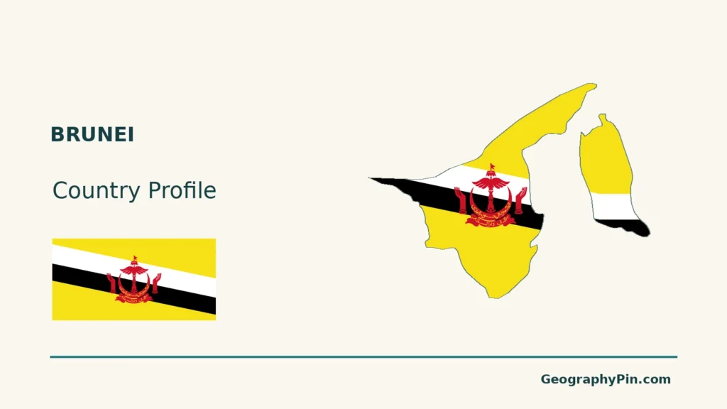
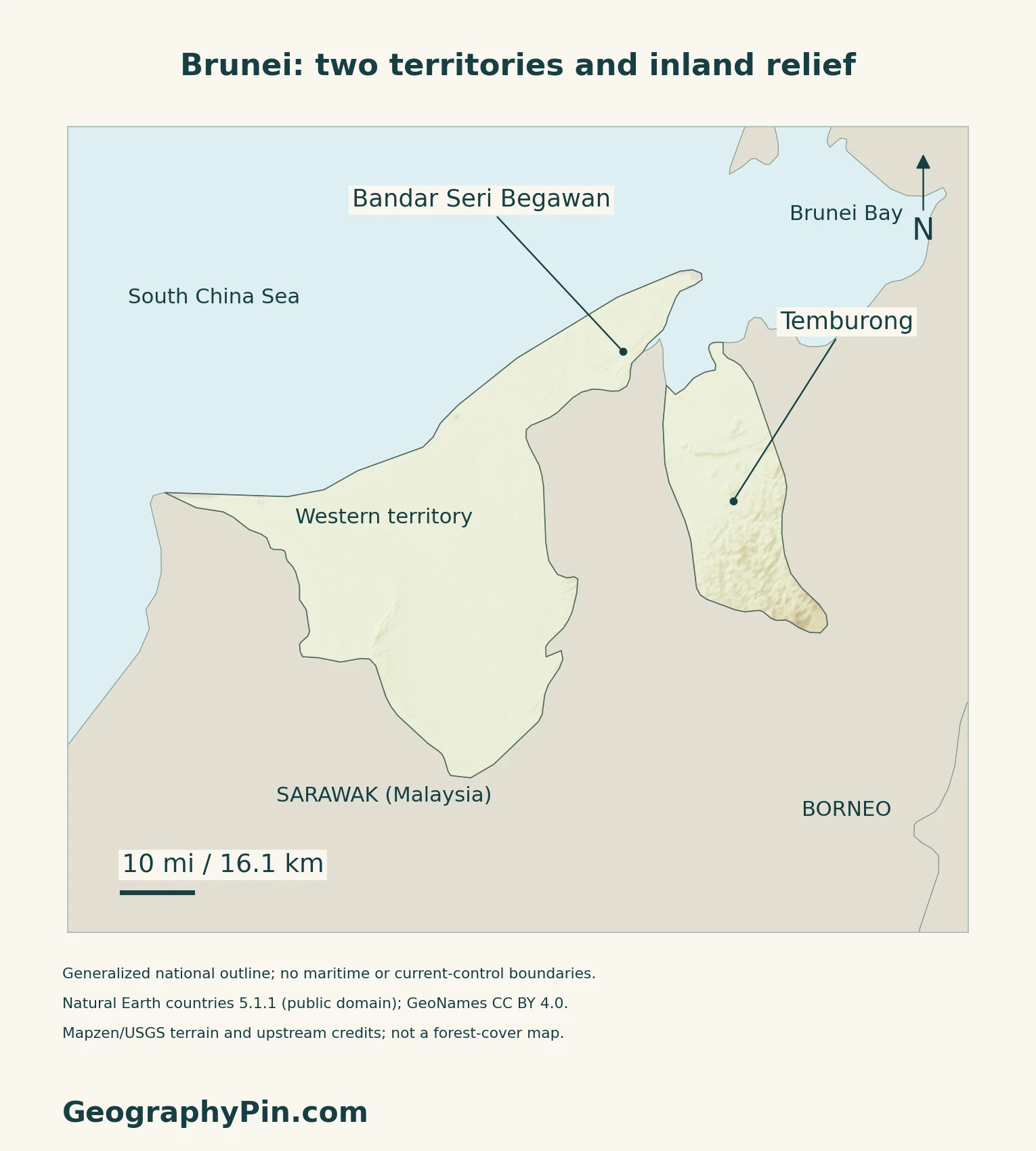
Brunei’s map has an immediately noticeable gap: Sarawak separates its western territory from Temburong. That political shape is only the starting point. Coastal settlements, inland hills, tidal forests and offshore energy activity each reveal a different part of the country.
Brunei is a Southeast Asian country on Borneo’s northwestern coast, with Bandar Seri Begawan as its capital. Its western territory and eastern Temburong district are separated by Malaysian Sarawak. Coastal plains, inland hills and more rugged eastern terrain accompany varied tropical forests, while oil and gas activity connects the land with offshore waters.
How to use this article: Locate the two separated areas, compare physical settings, or examine rainfall patterns.
1. Locate Brunei’s Two Separated Areas
Brunei is a country; Borneo is an island
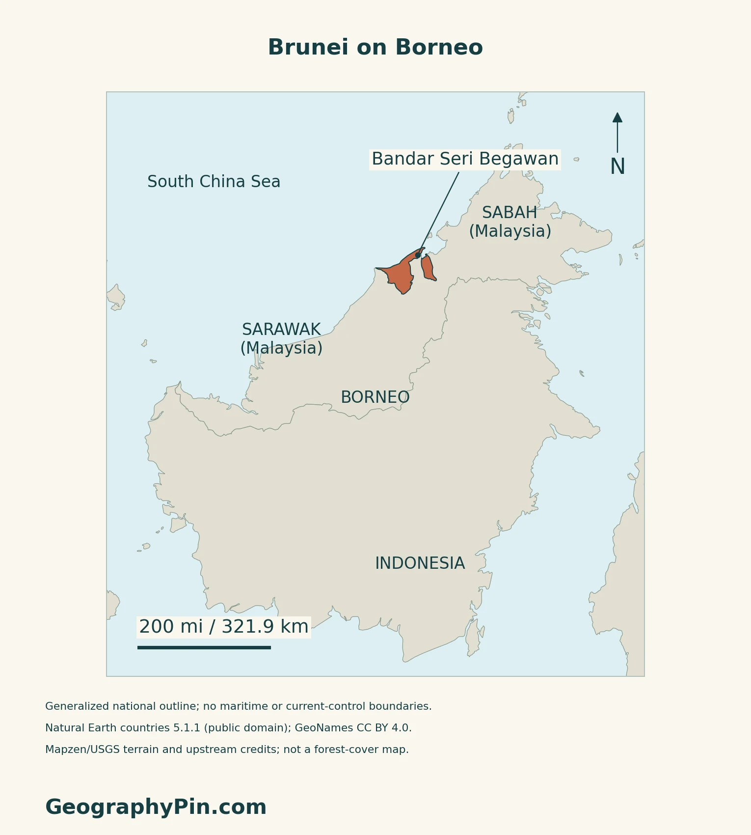
Brunei occupies part of Borneo’s northwestern coast, facing the South China Sea. It is not another name for Borneo, and it is not a Malaysian state. Sarawak, which belongs to Malaysia, separates Brunei’s larger western territory from Temburong in the east.
Bandar Seri Begawan, the national capital, lies in the western portion. Temburong is part of the same country despite the interruption in the land outline. The Southeast Asia regional map places Brunei in its wider island setting.
A bridge connects travel, not the land outline
In March 2020, the Temburong Bridge opened a connection between Brunei-Muara and Temburong that avoided the previous overland route through Malaysia. The BIMP-EAGA announcement describes a bridge-and-causeway link across the intervening waters.
2. Compare Coastal Plains and Inland Relief
Low coastal land gives way to a more rugged interior
| Place | Physical character |
|---|---|
| Western interior | Predominantly hilly lowland, rising toward the Sarawak border. |
| Temburong interior | More rugged mountain terrain in the eastern component. |
| Coastal margins | Tidal and swampy plains contrast with inland slopes. |
| River valleys | Alluvial corridors cut into the broader ridge-and-valley landscape. |
FAO’s historical forest assessment describes this broad physical framework. Its old population, forest-area and economic statistics are not used as current measurements.
Rainforest is not a single uniform habitat
The Forestry Department distinguishes mangroves on saline, tidally influenced coastal and river soils from peat-swamp forests. Mangroves are especially associated with inner Brunei Bay, while the department describes extensive peat-swamp forest along the Belait drainage.
Mixed dipterocarp forests occur in both lowland and hill settings, including Temburong. “Dipterocarp” refers to a tree family prominent in these forests. These habitat descriptions are not a claim that every shaded mountain or lowland on the map has intact forest cover today.
3. Read the Climate Without Assuming a Dry Season
Monsoons modify an equatorial climate
Brunei’s Meteorological Department describes generally hot, wet conditions throughout the year. The northeast and southwest monsoons, with transitional periods between them, influence rainfall together with the shifting Intertropical Convergence Zone.
Rainfall has seasonal peaks rather than a clean division into a completely wet and completely dry half-year. The department identifies the main maximum around late October to early January, with December generally wettest, and a smaller maximum around May to July.
El Niño is normally associated with prolonged drier conditions, whereas La Niña tends to bring wetter conditions.
Rivers link hills, lowlands and the coast
Rainfall and erosion move sediment from slopes toward lower river reaches. The older FAO assessment describes redistribution by rivers and floods into coastal alluvial plains.
4. Understand the Coastal Energy Economy
Onshore and offshore production are connected
The Petroleum Authority traces the Seria field’s discovery in Belait to 1929. Brunei Shell Petroleum describes its present business as exploration and production from both onshore and offshore fields for domestic use and exports. The energy geography therefore extends beyond the land shown in a national outline.
The authority’s overview reports the energy sector at 46.7% of GDP in 2024. This is a dated national economic measure, not the share of land occupied by industry or a 2026 production estimate. The same overview describes expansion into downstream activities, which process hydrocarbons rather than simply extracting them.
5. Check Dated Country Facts
| Item | Reference |
|---|---|
| Capital | Bandar Seri Begawan |
| Population | 458,600; DEPS estimate for 2025 |
| Surface area | About 2,226 sq mi (5,765 km²); UNData’s 2023 reference |
| Official language | Malay, under Constitution Article 82 |
| Currency | Brunei dollar (BND) |
| Government | Sultanate; executive authority vested in the Sultan and Yang Di-Pertuan |
| Districts | Brunei-Muara, Belait, Tutong and Temburong |
An estimate based on the census
DEPS builds its 2025 estimate from the 2021 Population and Housing Census, accounting for births, deaths and net migration. The total includes Brunei citizens, permanent residents and temporary residents; it is not a citizens-only count or a new census.
Malay and official English texts
Article 82 names Malay as the official language and also provides for authentic English versions of specified official written material. Where the two texts conflict, Malay prevails.
What Did We Learn Today?
Brunei’s separated territory, contrasting forests and coastal economy are connected parts of its geography, but no single landscape represents the whole country.
Sources & Data Notes
Sources, dates and map conventions
Population follows the original DEPS Population Estimates 2025 report, not a UN projection or the 2021 census total. Area is UNData’s surface-area convention, referenced to 2023. Legal statements follow Articles 4 and 82 of the official 2022 revised Constitution, checked against the AGC-listed 2024 amendment, which changes other articles. Sources checked in November 2026. The historical FAO assessment supports broad landforms and sediment processes, not current forest extent or economic conditions. Undated Forestry Department descriptions support habitat distinctions; their area totals are not used. The bridge account describes its 2020 opening, and the energy-sector GDP figure retains its 2024 reference year. Climate patterns are not a current weather warning.
- DEPS: Population Estimates 2025, original report
- UNData: Brunei capital, currency and 2023 surface-area reference
- Attorney General’s Chambers: Constitution, 2022 revised edition, Articles 4 and 82
- Constitution Amendment Order 2024, S42/2024
- Brunei Ministry of Foreign Affairs: location, capital and districts
- Brunei Tourism: separated Temburong district
- BIMP-EAGA: Temburong bridge opening, March 17, 2020
- FAO: historical Brunei forest and terrain assessment
- Forestry Department: mangrove forests
- Forestry Department: peat-swamp forests
- Forestry Department: mixed dipterocarp forests
- Brunei Meteorological Department: climate
- Petroleum Authority: industry overview with 2024 GDP reference
- Brunei Shell Petroleum: onshore and offshore operations
Map method: Original maps use public-domain Natural Earth countries 5.1.1, showing both parts of Brunei; small islands absent from the source are omitted. Generalized boundaries are not a cadastral or maritime survey. GeoNames supplies capital and Temburong reference coordinates under CC BY 4.0. Mapzen terrain retains Mapzen/USGS upstream credits. Some elevation values, including inland values, are omitted; blank areas do not represent flat ground. Shading is qualitative relief, not forest cover; no river, bridge or park boundary is invented. Scales use local WGS84 distances. The Commons flag rendition, credited to Nightstallion/Open Clip Art and marked public domain, supplies the complete flag and continuous decorative outline fill. Its motif is corroborated by Brunei’s Department of Adat Istiadat Negara; the 1:2 ratio is taken from the rendition.