Afghanistan is a landlocked Asian country of 251,830 sq mi (652,230 km²) with Kabul as its capital, a 2024 UN-estimated population of ~42.6 million (≈43.8 million in 2025), and two official languages, Dari and Pashto. It has a half-hour time zone (UTC+4:30) and the highest point at Mount Noshaq (24,580 ft / 7,492 m).
Where Is Afghanistan and Why It Matters
Afghanistan sits where Central and South Asia meet, linking the Iranian plateau to the Indus and the steppes beyond the Amu Darya. This geography has long made it a corridor for merchants and empires—from the Silk Roads to modern pipelines and highways. Its rugged terrain largely defines settlement patterns, with major cities (Kabul, Herat, Mazar-i-Sharif, Kandahar) tied together by a circular trunk road known as the Ring Road.
Being landlocked, Afghanistan depends on neighbors for seaports and external trade. The capital, Kabul, lies in a high valley, while the Hindu Kush divides the country and influences climate and transport. The narrow Wakhan Corridor connects Afghanistan to China, giving it a tiny eastern border and outsized geopolitical significance for trans-Asian connectivity.
Geography & Environment
Afghanistan’s area is commonly cited as 652,230 km² (251,830 sq mi), a figure used by the CIA World Factbook; some UN tables list the surface area slightly higher due to differing measurement bases (e.g., 652,864 km²). Most of the country is arid to semi-arid, with cold winters and hot summers. The highest summit is Mount Noshaq at 24,580 feet (7,492 meters).
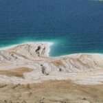
Major rivers include the Helmand (about 1,150 kilometers / 715 miles) flowing southwest towards the Sistan basin, and the Kabul River (about 700 kilometers / 435 miles), a tributary of the Indus that links eastern Afghanistan to Pakistan’s plains. These rivers are vital for irrigation and power but are vulnerable to droughts and floods that are becoming more frequent.
Mountains, Rivers & Climate
The Hindu Kush system bisects the country, creating steep relief and high passes that historically controlled movement. Climate varies by altitude: alpine conditions in the northeast; continental, dry climates in basins; and harsh deserts in the southwest. Water security is a growing concern due to variable snowfall feeding rivers and the compounding effects of climate change on drought and flash flooding.
Borders and the Wakhan Corridor
Afghanistan borders Pakistan, Iran, Turkmenistan, Uzbekistan, Tajikistan, and touches China at the far northeast via the sparsely populated Wakhan Corridor. The Chinese frontier is short and high-altitude; there are no major roads crossing it. This bottleneck corridor historically linked Central and East Asia but remains remote today.
| Metric | Value (latest reliable) |
|---|---|
| Area | 251,830 sq mi (652,230 km²) — CIA; UN listing 652,864 km² |
| Highest point | Noshaq — 24,580 ft (7,492 m) |
| Major rivers | Helmand (~1,150 km / 715 mi); Kabul (~700 km / 435 mi) |
| Time zone | AFT (UTC+4:30), no daylight saving |
Sources: CIA World Factbook; UNdata; Britannica; timeanddate.
People, Languages & Religion
Afghanistan’s population is growing. UN data show ~42.65 million people in 2024 and ~43.8 million in 2025 (UNFPA dashboard), with a youthful age structure and relatively low urbanization compared to global averages. Life expectancy has recovered to roughly 66.0 years in 2023, up from a pandemic-era dip.
Literacy remains among the lowest worldwide: UNESCO reports an adult literacy rate of 37.3% in 2022 (≈52% men, ≈23% women), reflecting long-term education challenges—especially acute for girls since the 2021 political shift. Ongoing humanitarian constraints and disaster shocks (floods, drought) have also affected schooling and nutrition outcomes.
Languages and Ethnic Mosaic
The 2004 Constitution recognizes Dari (Afghan Persian) and Pashto as official state languages; Uzbeki, Turkmeni, Baluchi, Pashai, Nuristani and others have official status in the areas where they are spoken. Afghanistan is ethnically diverse (Pashtun, Tajik, Hazara, Uzbek, Turkmen, Baluch, and many smaller communities), but reliable post-2021 nationwide statistics are scarce.
Religion
Afghanistan is overwhelmingly Muslim. The CIA reports 99.7% Muslim, with Sunnis around 85–90% and Shi‘a roughly 10–15%. Non-Muslim communities are very small after decades of conflict and emigration.
Government, Recognition & International Status (since 2021)
The Taliban returned to power in August 2021, establishing the “Islamic Emirate of Afghanistan.” Governance is centralized under the Amir, with acting ministers and no elected legislature. As of 2025, Russia announced it had recognized the Taliban government (July 3, 2025), while most countries maintain de facto engagement without formal recognition. China appointed an ambassador in 2023, but Beijing stated this did not automatically constitute formal recognition.
At the UN, Afghanistan’s seat remains accredited to a representative appointed under the former republic; the UN General Assembly’s credentials committee has repeatedly deferred changes (e.g., 2024), reflecting the international community’s cautious stance even as agencies continue large-scale humanitarian operations inside the country.
Rights and Social Policies
Since 2021, secondary and tertiary education for most girls and women has been restricted, alongside limits on many forms of paid work and public participation, drawing criticism from UN bodies and rights groups. Humanitarian agencies note high rates of food insecurity and malnutrition, driven by economic contraction, droughts, and funding shortfalls.
Economy, Trade & Infrastructure
Afghanistan is a low-income, aid-dependent economy where agriculture (wheat, fruits, nuts, livestock) and small-scale manufacturing (carpets, textiles, food processing) dominate jobs. UN national accounts show nominal GDP at about US$14.2 billion in 2024—implying GDP per capita of roughly US$330 when set against UN population estimates. Human development metrics reflect these challenges: the country’s 2023 HDI is 0.496 (rank 181/193), and UNDP’s 2024 MPI estimates 64.9% of people are multidimensionally poor.
Trade flows are highly regional, relying on corridor agreements with neighbors for access to ports. The Ring Road (NH-01) ties most major cities in a ~2,200-kilometer (≈1,370-mile) loop and links to the Asian Highway Network, though security, maintenance, and weather all affect reliability. Kabul–Kandahar alone spans ~483 km (300 mi).
Output, livelihoods and development
Agriculture depends on snowmelt and river systems; drought cycles and floods can devastate harvests, while rural finance is limited. Remittances, informal trade, and humanitarian programs provide many households with cash and in-kind support. Development indicators have seen fragile improvements in life expectancy since the 2000s but remain vulnerable to shocks and policy restrictions affecting education and labor force participation.
Roads, the Ring Road & connectivity
The Ring Road forms a national spine connecting Kabul, Kandahar, Herat, and Mazar-i-Sharif, with feeder highways to Jalalabad and the northern provinces. As part of AH1 (the trans-Asian highway), it situates Afghanistan within wider Eurasian logistics—though financing, security, and upkeep determine how much of that potential can be realized.
History in Brief — A Timeline
Afghanistan’s history features recurring external interventions and state-building attempts: the Durrani Empire formed in 1747; modern independence came in 1919 after the Third Anglo-Afghan War; a republic (1973), communist coup (1978), Soviet invasion (1979), civil war (1990s), Taliban rule (1996–2001), U.S.-led intervention (2001) and republic era (2001–2021), then the Taliban’s 2021 return.
| Year | Event |
|---|---|
| 1747 | Ahmad Shah Durrani founds the Durrani Empire, often seen as the origin of the modern Afghan state. |
| 1919 | Independence affirmed after the Third Anglo-Afghan War; Treaty of Rawalpindi concludes hostilities. |
| 1979–1989 | Soviet intervention and war; withdrawal completed in 1989. |
| 1996–2001 | First Taliban emirate; international isolation and internal conflict. |
| 2001 | U.S.-led coalition ousts Taliban; Bonn process begins republic era. |
| 2014 | ISAF combat mission ends; Afghan forces take lead. |
| 2021 | Taliban retake Kabul; Islamic Emirate announced (Aug. 15–Sept. 7). |
| 2025 | Russia recognizes the Taliban government (July 3, 2025); UN seat remains unchanged as of 2024. |
Key Facts Table (At-a-Glance)
| Metric | Latest value & note |
|---|---|
| Capital | Kabul |
| Official names (endonyms) | افغانستان (Dari); افغانستان (Pashto) |
| Area | 251,830 sq mi (652,230 km²); UN listing 652,864 km² |
| Population | ~42.65 million (2024, UN); ~43.8 million (2025, UNFPA) |
| Time zone | AFT (UTC+4:30), no DST |
| Official languages | Dari Persian and Pashto (Constitution, Art. 16) |
| Religion | ~99.7% Muslim; Sunni ~85–90%, Shi‘a ~10–15% |
| Highest point | Noshaq — 24,580 ft (7,492 m) |
| Major rivers | Helmand (~1,150 km / 715 mi); Kabul (~700 km / 435 mi) |
| GDP (nominal) | ~US$14.2 billion (2024, UN) |
| HDI (2023) | 0.496 (rank 181/193) |
| Adult literacy (2022) | ~37.3% (men ~52%, women ~22.6%) |
| Dial code / ccTLD | +93 / .af |
Sources: CIA; UNdata; UNFPA; timeanddate; UNDP; UNESCO; Britannica.
FAQ
Is Afghanistan in Central Asia or South Asia?
Geographically and culturally, it straddles both. Many frameworks place Afghanistan in South Asia, but its northern provinces and historical trade links tie it strongly to Central Asia. International datasets sometimes classify it under “Southern Asia.”
What time zone does Afghanistan use?
Afghanistan observes AFT (UTC+4:30) year-round with no daylight saving time—one of the world’s few half-hour offsets.
What are the official languages of Afghanistan?
Dari (Afghan Persian) and Pashto are official per Article 16 of the 2004 Constitution; several other languages have official status in areas where they are spoken.
What Did We Learn Today?
- Afghanistan covers 251,830 sq mi (652,230 km²), with the Hindu Kush shaping climate, settlement and transport.
- The population is ~42.6–43.8 million (2024–2025), with life expectancy ≈66 years in 2023.
- Dari and Pashto are official; Islam is practiced by ~99.7% of the population.
- Nominal GDP was ~US$14.2B (2024), and human development indicators remain low (HDI 0.496, 2023).
- Since 2021 the Taliban govern de facto; in 2025 Russia recognized them, while the UN seat remains with the prior government’s envoy as of 2024.