Choose Sequoia National Park for General Sherman and the Giant Forest. Choose Kings Canyon’s Grant Grove for a shorter drive to big trees from the Fresno side, or Cedar Grove for the canyon floor when its road is open. Grant Grove and Cedar Grove are in the same park, but a winter closure can leave the sequoias reachable and the canyon floor out of reach by car.
Choose Sequoia’s Giant Forest for General Sherman, or Kings Canyon’s Grant Grove for giant sequoias closer to the CA 180 entrance. Cedar Grove is a separate seasonal drive into the canyon. In winter, check both the Generals Highway link between the parks and CA 180 east of Hume Lake Road; either can close independently.
How to use this article: Pick your entrance and first stop, see where the canyon road closes, or check which winter routes were interrupted.
Sequoia and Kings Canyon map and route choices
Start from the west at the right entrance
From Visalia and Three Rivers, CA 198 reaches Sequoia’s Ash Mountain entrance and continues as the Generals Highway. From Fresno, CA 180 reaches Big Stump, the entrance for Grant Grove in Kings Canyon. The park’s driving directions make an important distinction: the two west-side approaches can connect, but no park road crosses the Sierra Nevada to its east side.
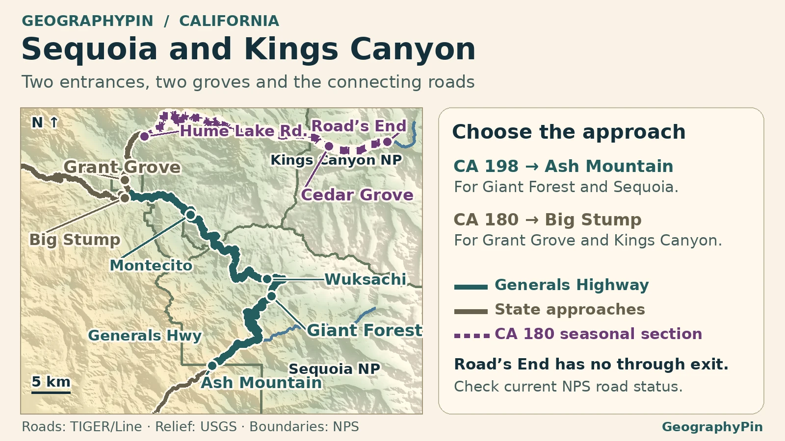
Road status checked November 21, 2026: NPS listed the Wuksachi–Montecito connector temporarily closed after a storm, separate from the seasonal CA 180 closure farther east toward Cedar Grove. Check the current road status before following either route.
If the mountain connector is closed, pick one grove and approach it directly. From Fresno, check CA 180 through Big Stump for Grant Grove: the usual winter closure farther east affects Cedar Grove, not the whole approach to Grant Grove. From Three Rivers, check CA 198 and the Generals Highway from Ash Mountain for Giant Forest. Check parking and chain controls separately rather than assuming an open entrance means you can visit both groves.
| Goal | Main way in | What might change the plan |
|---|---|---|
| General Sherman and the Giant Forest | Ash Mountain → Generals Highway | Snow can change which Sherman parking lot you use even if the highway is open. |
| Giant sequoias from the Fresno side | Big Stump → Grant Grove on CA 180 | Check chain controls and individual trail closures. |
| Canyon floor and river corridor | CA 180 east of Grant Grove → Cedar Grove | Winter closure beyond Hume Lake Road can prevent car access to the canyon floor. |
Giant Forest or Grant Grove for big trees
In Sequoia, the Giant Forest Museum is an orientation stop, not the General Sherman trailhead. The usual main parking area off Wolverton Road puts you about half a mile downhill on foot to the tree and uphill on the way back. On the November 21 check, NPS listed that lot and its access road closed to vehicles because of snow and directed drivers to the Sherman Tree Accessible Parking Area along Generals Highway instead. Check parking and the walking surface separately.
In Kings Canyon, Grant Grove Village is about three miles past Big Stump and has the Kings Canyon Visitor Center. The General Grant Tree trailhead is a separate stop from the village, normally serving a paved half-mile loop. When checked November 21, NPS still warned of post-burn trail closures near the tree. Do not assume the loop is available because CA 180 is open. Check the park’s closure map or ask at the visitor center.
Driving into Kings Canyon to Cedar Grove
The canyon closure begins beyond Hume Lake Road
From Giant Forest, the usual connection goes north on Generals Highway to CA 180, then past Grant Grove toward the canyon. The Kings Canyon Scenic Byway follows CA 180. About six miles northeast of Grant Grove Village, Hume Lake Road branches off. The winter closure begins just beyond that junction, not at Big Stump or Grant Grove. NPS describes these road sections separately.
When open, the paved road descends toward Cedar Grove Village, about 30 road miles from Grant Grove Village, and ends farther east at Road’s End. It is an out-and-back drive, not a way over the Sierra. Road’s End is a trail access and turnaround, not another road entrance.
The two winter closures to check
November 21, 2026: two separate breaks in the road network
The NPS road table, updated November 19 and checked November 21, listed Wuksachi Lodge to Montecito Sequoia Lodge on Generals Highway temporarily closed after a winter storm. That interrupted the direct drive between Giant Forest and Grant Grove. Separate approaches from Ash Mountain and Big Stump were listed open, with traction advisories on the higher sections.
NPS separately listed Hume Lake Road to Road’s End on CA 180 closed for winter, with the seasonal shutdown starting November 13. Reopening typically falls in late April or early May, but there is no guaranteed day. Reopening the Generals Highway connector would not reopen Cedar Grove.
If you want both groves while the mountain connector is closed, return west to the foothills and verify both approaches independently. NPS identifies CA 245 as one possible outside connection, and the November 21 Caltrans report still showed chain controls near its CA 180 end. Check actual conditions rather than treating an alternate line on a map as a confirmed detour.
Frequently Asked Questions
Which entrance is less awkward for a long vehicle?
For the grove areas, NPS generally points long vehicles toward Big Stump on CA 180. The southern Generals Highway has tight bends and a length advisory for vehicles over 22 feet on part of the climb. This does not make Big Stump a way around a closure farther along the highway.
Is the Sherman Tree’s accessible trail the same as the main trail?
No. NPS describes a separate paved accessible route from parking along Generals Highway, about 0.2 miles one way. Snow and ice can affect how usable it is; confirm conditions rather than assuming it has been cleared.
Do the two national parks need separate entrance passes?
No. The NPS entrance pass covers both parks. Check the separate nonresident-fee rules if they apply to you; a valid pass does not override closures or chain controls.
What Did We Learn Today?
General Sherman and General Grant sit in different groves reached from different entrances. Cedar Grove needs a second stretch of road beyond Grant Grove. Check that canyon road and the mountain connector separately before trying to fit all three stops into one trip.
Sources & Data Notes
Open the road checks, distance sources, map and photo credit
- NPS road-status table and area conditions checked November 21, 2026. The dated table controls over older map copies and general tour text. For state-road approaches, also see Caltrans CA 180, CA 198, and CA 245. A report for the state highway does not verify the roads inside the parks.
- NPS site descriptions and road distances, Fall 2026 trip planner and Grant Grove temporary closure order. Walking and driving lengths start at different places.
- Map: GeographyPin using 2025 U.S. Census TIGER/Line road geometry for Fresno and Tulare counties, NPS administrative boundaries, USGS hydrography and USGS 3DEP elevation. Seasonal CA 180 is marked for orientation. Temporary closures are maintained in the dated HTML road notes, not drawn in the map. No through detour is shown.
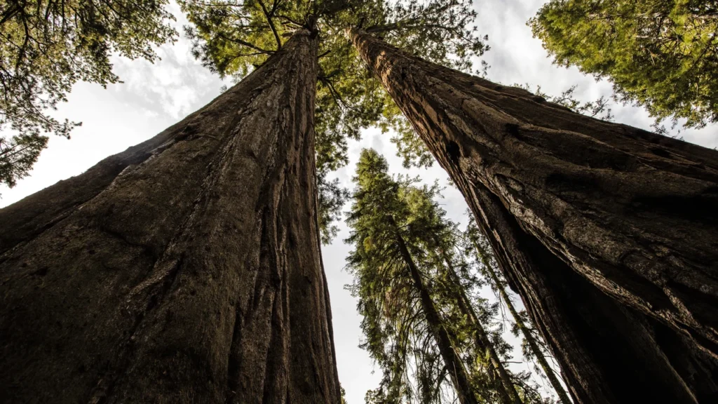
- Photograph: Looking up between giant sequoias in the Giant Forest, Daniel G. Rego, October 26, 2015, CC0 1.0. Cropped, resized and converted to WebP.