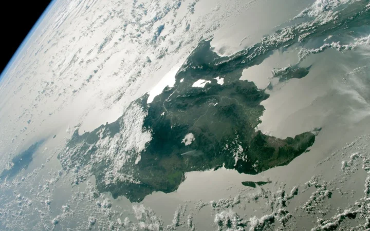
The Cayman Islands are not a single island, and their low shorelines conceal a much larger underwater landscape. Grand Cayman’s lagoon, Cayman Brac’s limestone Bluff and Little Cayman’s low terrain give the three islands different physical identities. The surrounding reefs and deep sea are part of their setting, not extra dry land.
The Cayman Islands are a British Overseas Territory in the western Caribbean, comprising Grand Cayman, Cayman Brac and Little Cayman. George Town, on Grand Cayman, is the capital. Their limestone landscapes include low coastal terrain, Cayman Brac’s Bluff and surrounding reef shelves above much deeper water. They are not a sovereign country.
How to use this article: Find the three islands, compare their landscapes, or understand the underwater setting.
1. Locate the Three Islands
Grand Cayman and the two northeastern islands
The group lies in the western Caribbean Sea, south of Cuba and northwest of Jamaica. Cayman Brac lies northeast of Grand Cayman, with Little Cayman west of Cayman Brac. George Town is on Grand Cayman, not on a separate capital island.
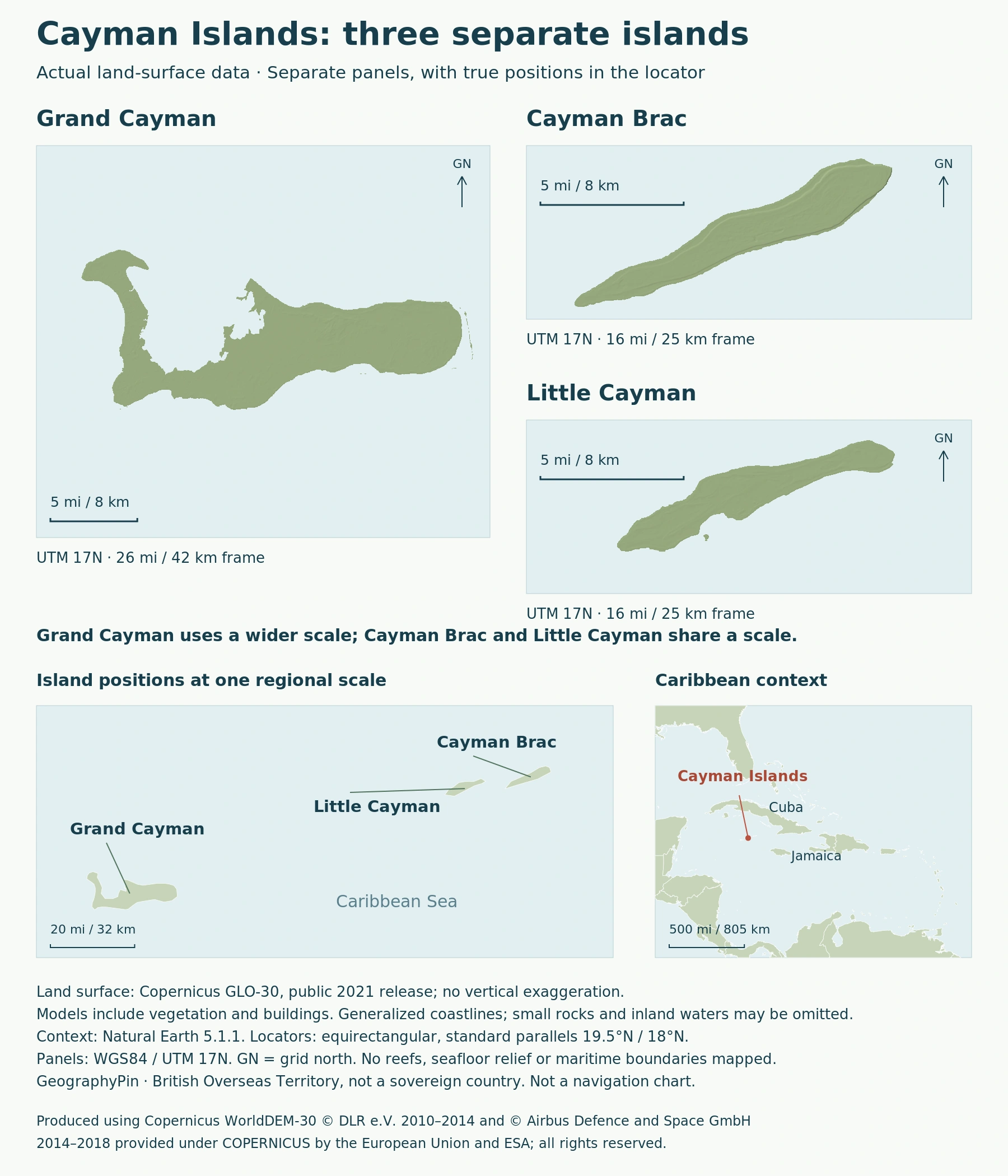
The regional locator preserves those positions, while the individual panels enlarge the islands. Their scales are labeled separately. Compare the scale bars before comparing apparent island sizes: an enlarged small island can occupy as much page space as a larger one.
Use the whole group to understand the territory and an individual panel to examine its coastline. The open water between the islands is real separation, not a missing piece of an otherwise continuous island.
2. Compare the Island Landscapes
The Bluff is a contrast, not a description of every island
| Island | Landscape to recognize |
|---|---|
| Grand Cayman | The largest island; generally low terrain and the broad North Sound lagoon. |
| Cayman Brac | A central limestone Bluff rising toward the eastern end. |
| Little Cayman | The smallest island; predominantly low-lying land. |
The government’s environmental overview places the eastern end of Cayman Brac’s Bluff at about 140 feet (43 meters) above the sea. The Bluff distinguishes Brac from its lower neighbors.
North Sound is a shallow, reef-protected marine lagoon on Grand Cayman. Its water is not part of the island’s dry-land surface. A coastline enclosing much of a blue area does not turn that water into land, nor does the lagoon become a freshwater lake simply because it is sheltered.
3. Low Islands Above a Much Deeper Seabed
The Cayman Ridge and the trench to the south
The Department of Environment places the islands on the Cayman Ridge, an underwater structure extending from southeastern Cuba toward Honduras. The Cayman Trench lies to their south. The low islands are therefore not evidence that the surrounding sea is uniformly shallow.
Narrow island shelves support coral reefs. Coral colonies build calcium-carbonate skeletons that contribute to the limestone reef framework. A living reef is not the same habitat as an exposed island.
This produces three distinct surfaces to keep in mind: dry land, the shallow coastal shelf and the deeper seabed beyond. The map shows land, not a depth model. Its blue background must not be read as a contour map of the trench or as a continuous reef surrounding every shore.
4. Look Beyond Beaches to Wetlands and Ironshore
The Department of Environment distinguishes forests, shrublands, beaches, rocky ironshore and wetlands across the islands. Ironshore is the rocky coastal environment, rather than a sandy beach. Its low woody vegetation is adapted to persistent salt spray.
Mangrove forests are extensive on Grand Cayman and Little Cayman. Other wetland communities occur inland, while dry shrublands occupy exposed areas, including the edges of Cayman Brac’s Bluff. These contrasts show why a green patch on a map is not a complete habitat classification.
Reef location also differs from reef condition. The Department of Environment confirmed stony coral tissue loss disease in Little Cayman in August 2025. Clear water in a photograph does not establish reef health.
5. Territorial Status and a Dated Population
The Cayman Islands are a British Overseas Territory, not an independent sovereign state. Local government operates through a parliamentary system with a governor, Cabinet and Parliament. The governor represents the monarch; local institutions do not make the islands three separate countries.
The government identifies the 2009 Constitution as its governing constitutional framework, with later amendments. The legislature’s name changed from Legislative Assembly to Parliament in 2020. These institutions describe how the territory is governed, whereas Grand Cayman, Cayman Brac and Little Cayman are the physical islands.
A government release published May 8, 2026 gives an estimated population of 90,577 for December 2025, derived primarily from administrative data. It covers the territory, not George Town alone, and should not be presented as a 2025 census or an exact population today.
What Did We Learn Today?
The Caymans combine low limestone landscapes with a distinctive raised Bluff, a shallow lagoon and narrow reef shelves beside deeper sea. The three island panels explain contrasts on land; the regional locator explains their separation. Keeping land, coastal water and territorial status distinct makes both the physical map and the population reference easier to interpret.
Sources & Data Notes
Sources, dates and map conventions
Population is the government’s administrative-data-based estimate for December 2025, released in May 2026, not a census or a live count. The Bluff height is an approximate government reference. Physical descriptions use local environmental sources; the terrain map does not depict reef condition, marine boundaries or water depth.
- Cayman Islands Government: Our Islands
- Cayman Islands Government archive: physical environment
- Department of Environment: coral reefs and submarine setting
- Department of Environment: terrestrial habitats
- Cayman Islands Government: governing institutions
- Cayman Islands Government: December 2025 population estimate, released May 2026
Map: Copernicus GLO-30, public 2021 release, and Natural Earth 5.1.1. Surface models include vegetation and buildings. WGS84 UTM17N panels have independent scales; Brac and Little Cayman share one scale. Generalized coastlines do not inventory inland waters, intertidal habitats or tiny rocks. North Sound remains water. No reefs, marine boundaries or bathymetry are inferred from land data. Not a navigation chart.
Produced using Copernicus WorldDEM-30 © DLR e.V. 2010-2014 and © Airbus Defence and Space GmbH 2014-2018 provided under COPERNICUS by the European Union and ESA; all rights reserved.
The organisations in charge of the Copernicus programme by law or by delegation do not incur any liability for any use of the Copernicus WorldDEM-30. Copernicus licence.
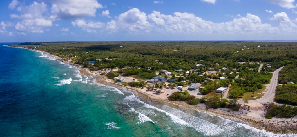
Coast and settlement near Watering Place Road on Cayman Brac, February 2022. Photo: FreezingWorld, via Wikimedia Commons, CC BY-SA 4.0; resized and converted to WebP. The adapted photograph retains that licence.