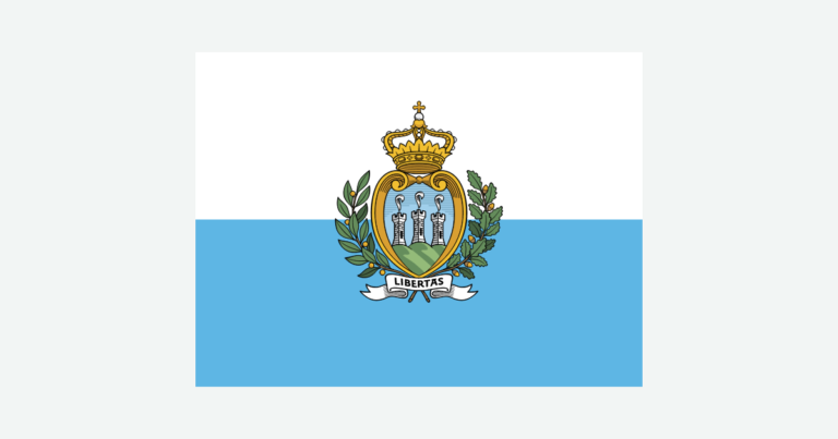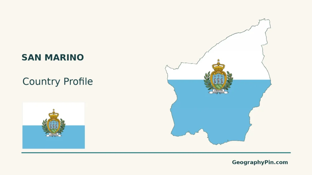
San Marino’s small size creates a common map-reading problem: the republic, its capital and its famous ridge can look like the same place. They are not interchangeable. An enlarged boundary map and a terrain view reveal the difference.
Yes. San Marino is an independent republic entirely surrounded by Italy, not an Italian town or province. Its capital, Città di San Marino, occupies a historic setting on Monte Titano, but the state also includes other settlements and lower hills. Distinguishing the country, the capital and the UNESCO property makes its geography much clearer.
How to use this article: Clarify the independent enclave, read the ridge and hills, or distinguish the capital and heritage site.
1. Locate an Independent Country Inside Italy
An enclave is not an Italian municipality
San Marino is an independent republic completely surrounded by Italy. Its foreign ministry describes this geographical position as an enclave.
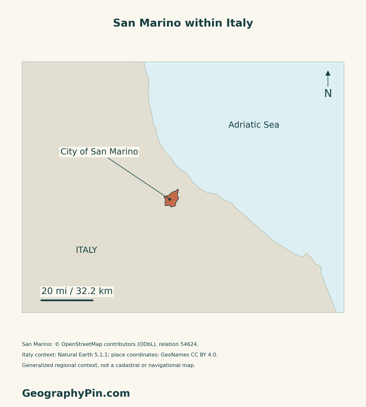
The republic has no coastline. The nearby Adriatic belongs to the surrounding regional setting, not to San Marino’s own territory.
San Marino joined the United Nations on March 2, 1992, according to its foreign ministry’s membership register. That date is an international-membership reference, not the date the country was founded.
For the wider continental setting, see the Europe country maps.
2. Read Monte Titano and the Surrounding Hills
The famous ridge is not the whole country
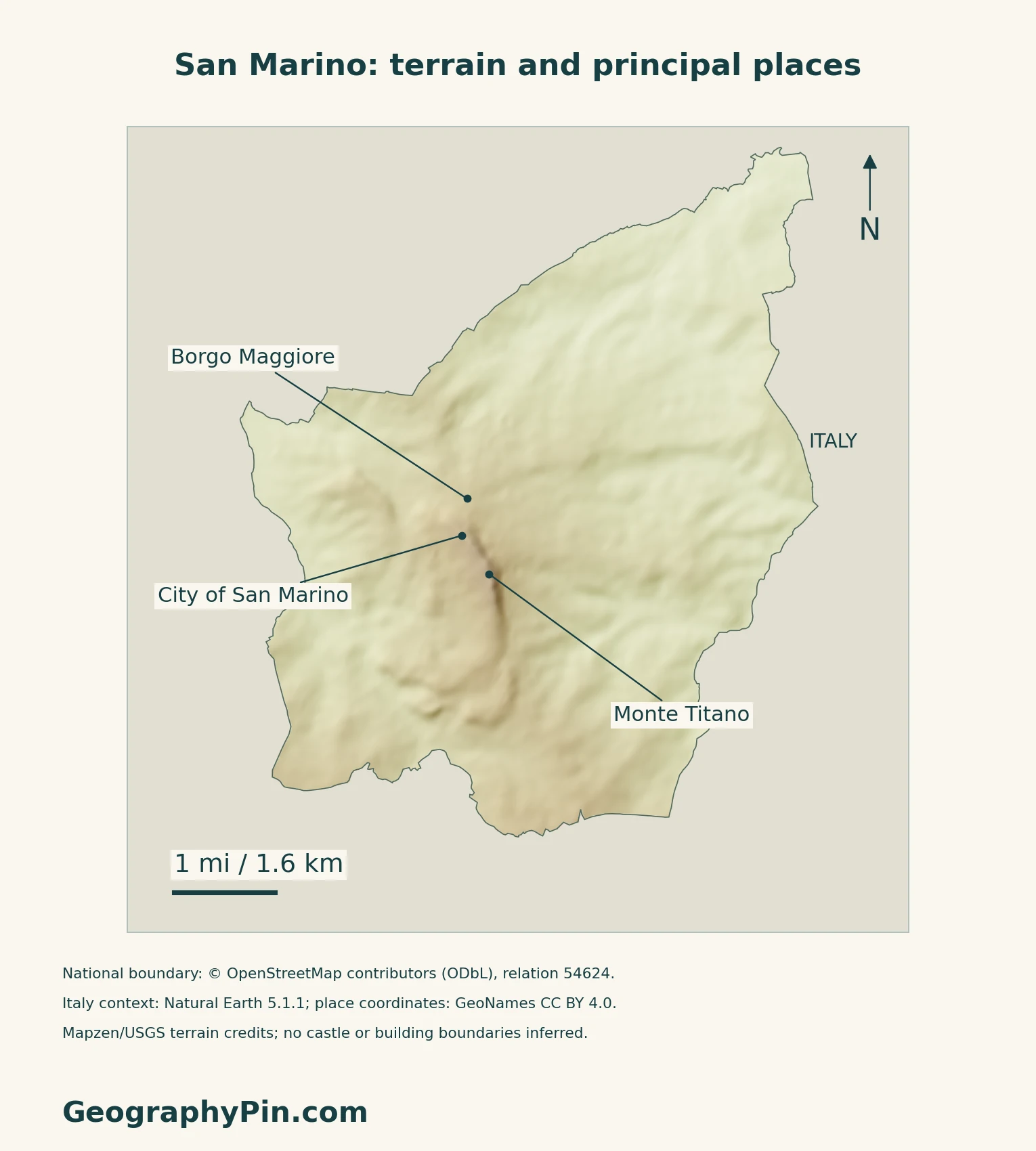
Monte Titano is the conspicuous ridge associated with the capital and its towers. The wider national landscape also includes lower ridges, rolling hills and small valleys.
San Marino’s second national climate communication distinguishes calcareous rock formations in the southwest from gentler clay-and-sand hills toward the northeast. This is a stable physical description from an older report, not a present-day land-cover survey.
Separate landforms from administrative areas
| Setting | Map-reading distinction |
|---|---|
| Monte Titano | A prominent ridge and historic urban setting, not the outline of the republic. |
| Lower western ridges | A sequence of lower calcarenitic ridges described by archaeological landscape research. |
| Northeastern hills | Gentler terrain toward the Adriatic side of the regional landscape. |
A University of Bologna research summary, coauthored by a San Marino State Museums archaeologist, places the country’s landscape among routes connecting the coast, nearby valleys and trans-Apennine passes.
3. Follow Drainage and Seasonal Contrasts
Small valleys connect to larger drainage systems
The second national climate communication identifies the Ausa and Marano as streams flowing toward the Adriatic near Rimini. The San Marino stream belongs to the Marecchia system. The country’s border therefore does not enclose complete, self-contained river basins.
The same report describes a temperate subcoastal climate with hot summers, rainy autumns and cold winters, sometimes with snow at low elevations. Its historical weather series should not be mistaken for a current climate normal or a forecast.
4. Distinguish a Living Capital From a Heritage Site
World Heritage boundaries are not state borders
UNESCO inscribed San Marino Historic Centre and Mount Titano in 2008. The property occupies about 136 acres (55 hectares), far less than the whole republic. The international heritage designation and the sovereign state therefore describe different areas.
The ICOMOS evaluation places the historic city on the ridge and the market area of Borgo Maggiore lower down to the north. It also describes the capital as a place where institutional functions continue, not simply an abandoned monument.
UNESCO’s account emphasizes continuity of republican institutions from the Middle Ages. That documented heritage is more useful here than treating a traditional foundation story as proof of an unqualified “oldest country” ranking.
Borgo Maggiore and the capital occupy different levels
The official tourism office describes the cable car as a connection between Borgo Maggiore and the capital’s old town, used by local people as well as visitors. The connection makes the vertical relationship between these settlements easy to understand without implying that the whole country is built on the ridge.
The same office’s Rupe nature-trail description identifies cliffs, woodland and natural terraces along Monte Titano between the two historic centres.
5. Check Dated Country Facts
| Item | Reference |
|---|---|
| Capital | Città di San Marino |
| Registered resident population | 34,167 at June 30, 2026; National Statistics Office |
| Surface area | About 24 sq mi (61 km²); UNData’s 2023 reference |
| Official language | Italian, as identified by the official tourism office |
| Currency | Euro (EUR), under the monetary agreement with the European Union |
| Local divisions | Nine castelli |
| Government | Republic; two Captains Regent jointly serve as heads of state |
Residents are not the same as citizens or visitors
The June 2026 figure comes from the continuously updated resident register, not a new census. It includes residents of different citizenships. The bulletin separately reports a larger “present population,” adding people classified as soggiornanti to registered residents. Neither measure should be read as the number of tourists visiting the country.
The capital is only part of the republic
Città di San Marino is both the capital’s name and one of the nine castelli, the country’s local territorial institutions. A capital or castello population therefore does not describe the whole state. The two Captains Regent hold their joint office for six months, with terms beginning in April and October.
For a broader reference, see European countries and their capitals.
What Did We Learn Today?
San Marino is a sovereign enclave, while its capital and World Heritage property cover only parts of the country. The ridge, lower hills and cross-border drainage explain its landscape; dated resident statistics describe a different question from citizenship or visitor numbers.
Sources & Data Notes
Sources, dates and map conventions
Population follows the national resident register at June 30, 2026; it is not a census or citizenship count. Area uses UNData’s rounded 2023 surface figure. Italian’s official status is attributed to the national tourism office, not to an unverified constitutional language clause. The older second national climate communication is used only for stable physical and broad seasonal context, not current weather normals, population or land-use shares. Heritage inscription dates follow UNESCO rather than an inconsistent date on a tourism page. No current transport schedule or trail condition is asserted.
- National Statistics Office: second-quarter 2026 bulletin, tables 1.7–1.8 and population glossary
- UNData: San Marino surface area, 2023 reference
- Official tourism office: capital and language
- Secretariat for Internal Affairs: nine castelli and their local functions
- Regency: joint heads of state and six-month terms
- Foreign Ministry: monetary agreement and official use of the euro
- Foreign ministry: European geographical and institutional setting
- Foreign ministry: international organization membership register
- San Marino: second national climate communication, physical and climatic baseline
- University of Bologna: State Museums coauthored landscape research summary
- UNESCO: San Marino Historic Centre and Mount Titano
- ICOMOS: 2008 evaluation of the heritage property
- Official tourism office: cable-car connection
- Official tourism office: Rupe landscape description
Map method: Original maps use the national boundary from OpenStreetMap relation 54624, retrieved 17 November 2026, with © OpenStreetMap contributors, ODbL attribution. Regional context uses public-domain Natural Earth countries 5.1.1; its older San Marino outline is replaced, not overlaid. Place coordinates come from GeoNames under CC BY 4.0. Mapzen terrain retains Mapzen/USGS source credits. Heights are unaltered; no negative samples occur inside the boundary. Shading is qualitative, not an exact summit-height or building survey. Scales use local WGS84 distances. The flag is reproduced from statutory Annex A to Constitutional Law 1/2011, using its standard 3:4 proportions. The cover applies decorative flag fill to the boundary beside the intact flag. This uses the official-act reproduction provision in Article 98(f) of Law 8/1991 for editorial identification, not a claim of unrestricted rights in the national arms or flag.