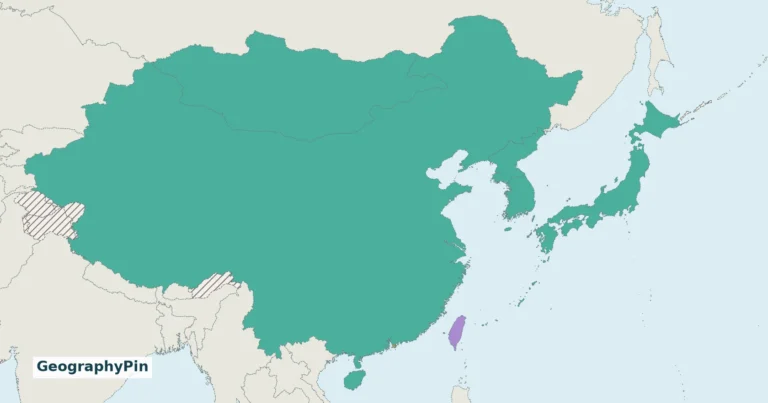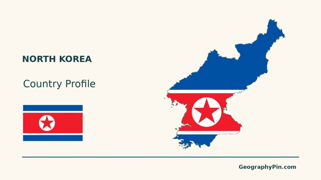
North Korea’s mountain interior and western lowlands give the northern Korean Peninsula a strongly uneven physical geography.
North Korea, officially the Democratic People’s Republic of Korea, occupies the northern Korean Peninsula, with Pyongyang as its capital. Mountainous country contrasts with western plains and coastal lowlands. China and Russia lie to the north, while the armistice demarcation and Demilitarized Zone separate it from South Korea.
How to use this article: Locate the country on the map, read the physical map, explore rainfall seasons, or check the population reference.
1. Locate North Korea on the Peninsula
The northern part of the Korean peninsula
North Korea, formally the Democratic People’s Republic of Korea (DPRK), occupies the northern part of the Korean peninsula in East Asia. China and Russia lie across its northern borders, while South Korea lies to the south. The Yellow Sea is to the west and the Sea of Japan, called the East Sea of Korea by the DPRK, is to the east.
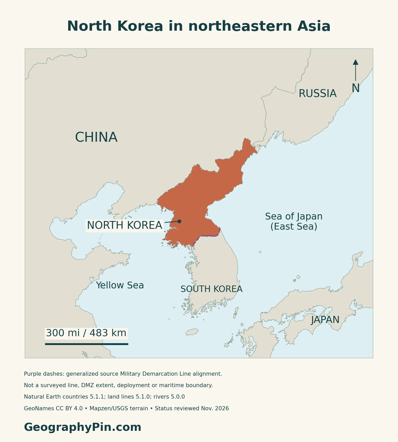
Pyongyang is the national capital
Pyongyang is the capital.
2. Read the Mountains and Western Lowlands
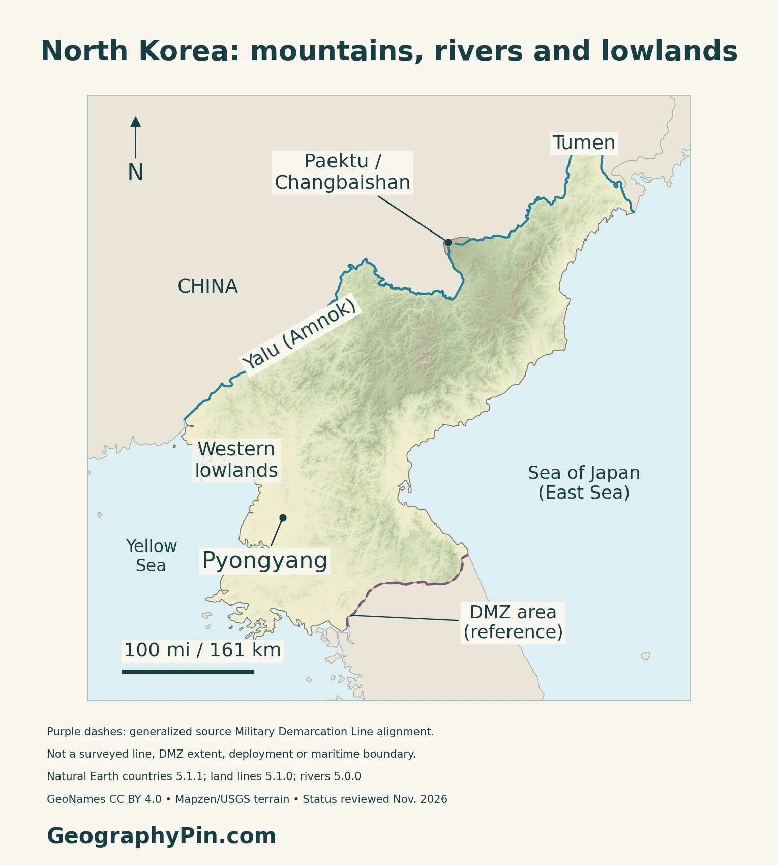
Relief varies across a relatively compact territory
| Setting | Geographic role | What the label means |
|---|---|---|
| Northern and eastern uplands | Mountainous interior with narrow valleys | Relief, not a provincial boundary |
| Western lowlands | Lower country toward the Yellow Sea | Broad reference, not a measured lowland polygon |
| Eastern coast | Coastal land beside the mountain interior | Not a continuous broad western-style plain |
| Paektu / Changbaishan | Volcanic complex on the China border | A shared mountain setting, not a border survey |
Paektu and Changbaishan name the same volcanic complex
The Smithsonian Global Volcanism Program identifies Changbaishan, also called Paektu, as a stratovolcano on the China–North Korea border. A lake occupies its summit caldera.
UNESCO designated Mt Paektu as a Global Geopark in 2025. That geopark is listed within the DPRK and is not a transnational designation, even though the volcanic complex straddles the international boundary. A Global Geopark designation is also different from World Heritage inscription.
3. Distinguish River Borders, the MDL and the DMZ
The northern rivers have more than one familiar name
Amnok is the Korean name commonly paired with Yalu; Tuman or Tumen identifies the northeastern border river. The selected channels on the map help locate the country against China and Russia, but they are not a complete drainage network.
A demarcation line and a buffer zone are different things
The July 27, 1953 armistice provided for a Military Demarcation Line, or MDL, and withdrawal of opposing forces by about 1.2 miles (2 kilometers) on each side. This established the Demilitarized Zone, or DMZ, as a buffer roughly 2.5 miles (4 kilometers) wide.
The agreement distinguishes the line from the northern and southern limits of the zone. A generalized line on a country map cannot resolve those separate boundaries or current conditions on the ground. This profile does not map maritime claims or provide border-access guidance.
4. Connect Settlement, Farming and Seasonal Weather
The western plains matter beyond their share of the map
A historical DPRK-authored land-and-water paper hosted by FAO describes population as concentrated mainly on the western plains. This is historical background, not a current population-density measurement.
Growing conditions depend on timing as well as terrain
The Ministry of Land and Environment Protection’s 2015–2024 agroforestry strategy describes cold continental winters, humid summers and concentrated summer rainfall. Its planning approach combines trees with crops or other farm activities to address land management and soil protection.
A vegetation assessment is not a final harvest count
FAO’s September 4, 2026 GIEWS brief described the main season’s crops as mainly rice and maize, with smaller quantities of soybeans, potatoes, millet and sorghum. It reported generally favorable growing conditions but also localized July flooding in some western lowlands.
The assessment used mid-August remote-sensing observations to discuss production prospects before harvest completion. It should not be read as a final 2026 harvest total or a direct measure of household food access.
5. Dated Country Facts and Statistical Limits
| Item | Reference | Date or scope |
|---|---|---|
| Capital | Pyongyang | National capital |
| Population | About 26.57 million | UN 2025 medium-fertility projection |
| Surface area | About 46,540 sq mi (120,538 km²) | UNData reference year 2023; not land-only |
| Language | Korean | Official language identified by PCGN |
| Currency | North Korean won (KPW) | UNData national-currency reference |
| Government | Republic | DPRK; constitutional revisions recorded in 2026 |
| Administration | Provinces and separately administered cities | Dated reference sources differ over city status |
A projection and an older census measure different reference years
The UN figure is a projection for 2025, not a new enumeration. The Central Bureau of Statistics’ 2008 census reported 24,052,231 people at October 1, 2008. Its method generally counted people at their usual residence and included institutional quarters and military camps. The report describes its coverage as Korean citizens living in the DPRK, including naturalised citizens.
A dated constitutional reference
China’s Foreign Ministry country profile, updated in June 2026, records a constitutional revision that year. This overview does not treat an older constitutional edition as a current description of every institution.
What Did We Learn Today?
North Korea combines a mountainous interior with western lowlands and smaller coastal settings. River names help orient its northern borders, while the MDL and DMZ require separate meanings. Population projections and dated agricultural observations also need to be read according to their methods.
Sources & Data Notes
Population references retain their distinct dates and methods. Historical settlement and agroforestry sources describe broad geographic patterns and planning approaches, not current population density or verified implementation totals. The September 2026 FAO brief assesses crop prospects rather than a final harvest. The original armistice defines a demarcation line and a separate zone; generalized maps do not resolve its surveyed boundaries or maritime claims. Mt Paektu Global Geopark is distinct from World Heritage inscription.
- UNData: DPR Korea, 2025 projected population and 2023 surface area
- DPRK Central Bureau of Statistics: 2008 Population Census National Report, published 2009
- UK PCGN: North Korea toponymic factfile, April 2024; language, names and qualified administrative account
- Chinese Ministry of Foreign Affairs: DPRK country profile, updated June 2026
- DPRK Ministry of Land and Environment Protection: National Agroforestry Strategy and Action Plan, 2015–2024; historical physical/climate context and proposed management
- Mun Jong Nam: historical DPRK land-and-water paper hosted by FAO; western settlement background, not current demographic measurement
- Smithsonian Global Volcanism Program: Changbaishan / Paektu volcanic complex
- UNESCO: Mt Paektu Global Geopark, designated 2025; distinct from World Heritage status
- U.S. National Archives: original July 27, 1953 armistice transcript, Article I line and zone definitions
- FAO GIEWS: September 4, 2026 country brief; crop prospects and remote-sensing observation, not final harvest
Map method: Original GeographyPin maps use public-domain Natural Earth countries 5.1.1, land-boundary lines 5.1.0 and rivers 5.0.0. Purple dashes retain the source’s generalized Military Demarcation Line alignment, not a surveyed line, DMZ polygon or current deployment. No maritime allocation is drawn. The DMZ reference uses Panmunjeom’s location, not the zone’s extent. GeoNames coordinates are credited under CC BY 4.0; Paektu uses the Smithsonian volcano reference, not a surveyed national highpoint. Real Mapzen Terrain Tiles provide relief with Mapzen/USGS and upstream credits; isolated negative artifacts are transparent, not assigned invented heights. WGS84 scales apply locally. The cover uses a CC0 flag rendition reflecting the 1:1.65 height-to-width ratio reported by Yonhap on November 13, 2026. The underlying official page was inaccessible during this review. This rendition relies on the report and Commons, not independent verification of the official specification.