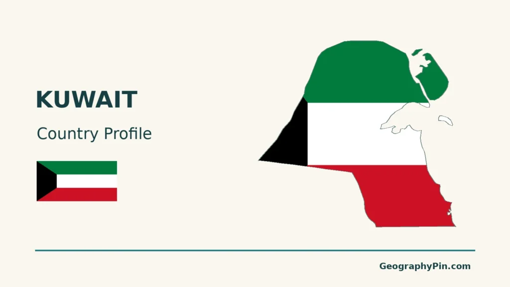
Kuwait’s outline brings together a broad desert interior, an indented Gulf coast and low islands threaded by tidal channels. The capital and major ports occupy only part of that landscape: Kuwait Bay and the northern wetlands have a different character from the industrial coast farther south.
Kuwait lies at the northwestern end of the Gulf, between Iraq and Saudi Arabia. Its geography is dominated by low desert plains, Kuwait Bay and offshore islands, including Bubiyan and Failaka. Kuwait City is the capital on the bay’s southern side, while commercial and industrial ports connect the coastal urban area to maritime trade.
How to use this article: Compare coastal settings, locate Bubiyan, distinguish port functions, or check population scope.
1. Kuwait’s Location, Bay and Desert Plain
Two land neighbors at the head of the Gulf
Kuwait is in Western Asia on the northeastern side of the Arabian Peninsula. Iraq borders it to the north and west, and Saudi Arabia lies to the south. The Persian Gulf, also called the Arabian Gulf in regional usage, forms its eastern maritime setting.
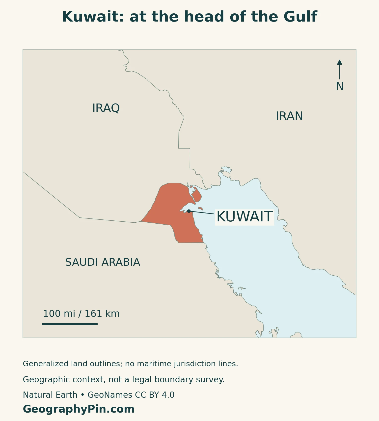
Kuwait City and Kuwait Bay are different geographic entities: one is the national capital, the other an inlet of the Gulf. The city’s position on the southern side of the bay helps orient the national map, but the capital is not the whole country.
Low relief does not mean an identical surface
The mainland generally slopes toward the sea from the west and southwest. Low hills and shallow depressions interrupt the plain; the Jal Al-Zor ridge overlooks the northern side of Kuwait Bay. This is a landscape of modest relief, not a mountain barrier separating the coast from the interior.
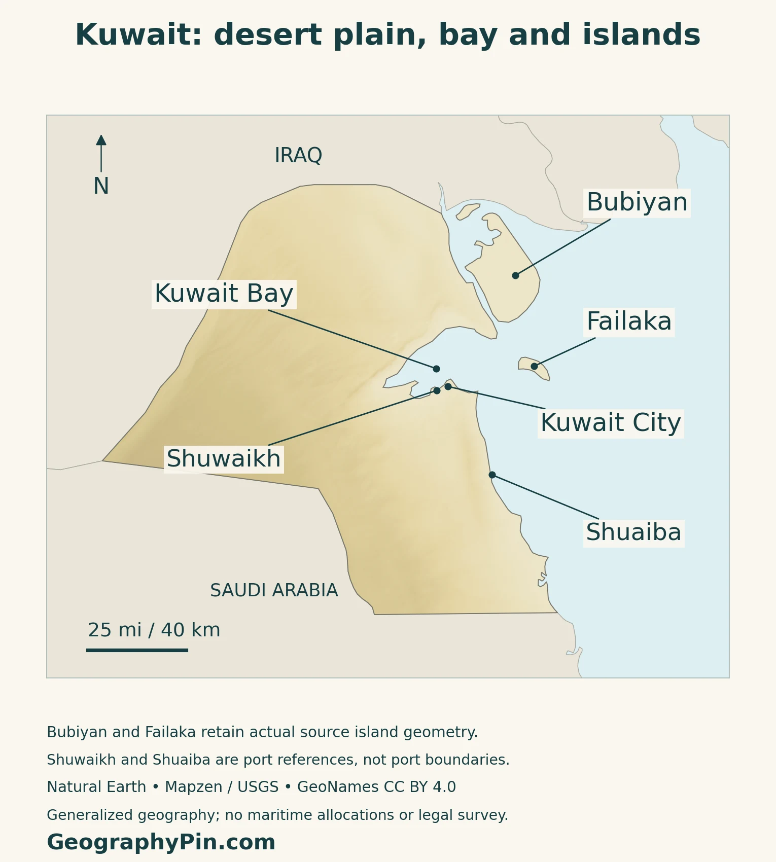
Read the shaded terrain separately from the place markers. Elevation shading does not show population density or vegetation, and a port marker identifies a location rather than its complete operational footprint. The island shapes and bay outline explain the coastal setting without drawing maritime jurisdiction lines.
2. Mudflats, Islands and Contrasting Shores
The northern coast differs from the southern shore
The Environment Public Authority’s coastal guide distinguishes extensive northern mudflats from the sandier central and southern shores, with rocky sections in some places. Fine sediment, wave exposure and tidal processes help produce these different shore types. Kuwait’s coast is therefore not one continuous sandy beach.
| Setting | Characteristic | Map-reading distinction |
|---|---|---|
| Interior plain | Low desert relief with local hills and depressions | Separate from the built-up coastal area |
| Kuwait Bay and northern shore | Mudflats and sheltered coastal environments | Bay water is not an inland freshwater lake |
| Bubiyan and northern islands | Low land, creeks and tidal margins | Narrow channels are part of the marine setting |
| Central and southern shore | Sandier stretches with local rocky sections | Different from the northern mudflat coast |
Bubiyan and the northern tidal landscape
Bubiyan is Kuwait’s largest island. ESA’s radar-image account describes its low, flat terrain and the channels separating it from neighboring land. Parts of the northern island landscape are affected by high tides, so a simple land outline cannot describe every intertidal surface.
The Environment Public Authority identifies northern Bubiyan and Warba Island within the Mubarak Al-Kabeer Natural Reserve. Mudflats, salt flats and marine creeks provide habitat for seabirds, including birds using the area during migration. A dry national climate can coexist with these coastal wetlands because seawater and tides shape their water supply.
Failaka adds a settlement-history layer
Failaka lies offshore near the entrance to Kuwait Bay. Kuwait’s 2025 UNESCO Tentative List submission describes a low island landscape containing archaeological layers from the Bronze Age through later periods. The island preserves evidence of settlement and maritime connections that is different from the modern capital’s urban form.
Failaka’s proposed cultural landscape is on the Tentative List, not an inscribed World Heritage property.
3. Coastal Settlement and Working Ports
The built-up coast is not the national boundary
Satellite descriptions by ESA and NASA show the contrast between Kuwait City’s concentrated urban area and the much more sparsely settled desert. NASA’s 2012 night photograph also records radial roads and ring roads organized around the capital, illustrating how urban growth extended beyond the original center.
That older image is useful for understanding the pattern, not for measuring today’s city edge. A capital-city population, a metropolitan total and a governorate population require different boundaries; none should be silently substituted for the national figure.
Shuwaikh and Shuaiba serve different coastal roles
The Kuwait Ports Authority describes Shuwaikh, near Kuwait City, as the country’s main commercial port. Its storage and distribution functions connect imported goods with the urban and commercial area.
Shuaiba is farther south in Ahmadi Governorate. The authority identifies it as an industrial port handling commercial cargo, heavy equipment, raw materials and chemicals. These descriptions explain why ports occupy different positions along the coast rather than one interchangeable point beside the capital.
Port location and function do not by themselves establish current cargo volumes or sailing conditions. The maps are geographic references, not navigation charts.
Some coastal development brings seawater inland
USGS imagery of Sabah Al Ahmad Sea City in southeastern Kuwait illustrates a different form of coastal change. Its account describes canals excavated into salty coastal ground, with excavated material used in developing adjacent land. This is not simply a chain of artificial islands added offshore.
The example also shows why coastline measurements need a date and a method. Whether a measurement follows engineered channels, includes islands or uses a generalized national outline affects what it represents.
4. Desert Climate and Supplied Water
Hot summers, cooler winters and variable winds
Kuwait’s Meteorological Center describes a strong seasonal contrast. Summers are very hot; winter brings cooler conditions and periods of rain. Spring can include thunderstorms, while strong winds may raise dust.
The agency distinguishes dry northwesterly summer winds from more humid episodes associated with air arriving across the Gulf from the east or southeast. Desert climate does not mean every summer day has low humidity.
Water supply depends on treatment and distribution
The Ministry of Electricity, Water and Renewable Energy describes a system that receives distilled water from power plants and desalinated water from reverse-osmosis units. Storage, pumping and distribution networks then supply residential, commercial, industrial and agricultural areas.
This infrastructure links the dry landscape with concentrated settlement. Seawater can be a source for treatment, but it is not directly equivalent to potable water delivered at a tap: production, storage and transport are separate stages.
The ministry also develops groundwater fields and lower-salinity wells. A national water account must distinguish those resources from desalinated supply rather than describe every source as rainfall or every well as fresh drinking water.
5. Population and Dated Country Facts
Capital, administration and a dated population total
Kuwait City is the national capital. The country has six governorates, and Arabic is the official language. The Capital Governorate is an administrative unit, not a synonym for the entire connected urban area.
| Item | Reference |
|---|---|
| Capital | Kuwait City |
| Population | About 5.279 million at the end of March 2026, PACI series reported by the Central Bank |
| Total area | About 6,880 square miles (17,818 square kilometers) |
| Official language | Arabic |
| Currency | Kuwaiti dinar (KWD), divided into 1,000 fils |
| Government | Hereditary emirate; see the constitutional note below |
| Administrative divisions | Six governorates |
The total includes more than Kuwaiti citizens
The Central Bank’s first-quarter 2026 table reports the Public Authority for Civil Information population series in thousands. Its end-period value is 5,279 thousand, so about 5.279 million preserves the source’s precision. It is not a new census count or a total of citizens alone.
Kuwait also publishes population estimates through the Central Statistical Bureau using a different statistical process. A nationality count from that series should not be divided by the PACI total to manufacture a citizen share.
The parliamentary description needs a dated qualification
An Amiri order of May 10, 2024 dissolved the National Assembly and suspended specified constitutional provisions for up to four years. The order assigned the Assembly’s powers to the Amir and Council of Ministers.
For broader reference, use the Middle East countries guide and the Asia countries and capitals list.
What Did We Learn Today?
Kuwait combines a low desert mainland with a varied marine edge: Kuwait Bay, northern mudflats, tidal islands and sandier southern shores. The coastal urban concentration and the different roles of Shuwaikh and Shuaiba connect settlement with trade, while treated-water networks support life in an arid climate. Population figures and shoreline measurements become useful only when their dates, coverage and definitions are clear.
Sources & Data Notes
Population uses the PACI series reported in the Central Bank’s first-quarter 2026 table, rounded to thousands; it is not labeled the latest release. Total area follows the embassy’s square-kilometer figure, independently converted to square miles. The 2024 Amiri order qualifies the government description. Older imagery supports geographic interpretation, not current urban boundaries or project completion. Climate and port descriptions are not forecasts or navigation guidance.
- Kuwait Embassy in Sweden: broad mainland relief and Jal Al-Zor; outdated statistics not used
- Environment Public Authority: coastal zonation in its macroalgae guide
- ESA (2010): Bubiyan and neighboring channels; historical image interpretation
- Environment Public Authority: Mubarak Al-Kabeer reserve habitats
- Kuwait’s UNESCO Tentative List submission (2025): Failaka cultural landscape
- ESA (2020): Kuwait’s regional and urban setting in 2019 imagery
- NASA (2012): Kuwait City’s historical road and urban pattern
- Kuwait Ports Authority: Shuwaikh commercial port
- Kuwait Ports Authority: Shuaiba industrial port
- USGS EROS: excavated waterways at Sabah Al Ahmad Sea City; plans distinguished from completion
- Kuwait Meteorological Center: broad seasonal weather patterns
- Water Ministry: water production, storage and distribution functions
- Central Bank: Q1 2026 population indicator attributed to PACI
- Central Statistical Bureau: population estimate methodology and separate series
- Kuwait Direct Investment Promotion Authority: capital, language and governorates; old political and population text not used
- Kuwait Embassy in Japan: total area in square kilometers; conversion independently calculated
- Central Bank Law, Article 1: dinar and fils
- National Assembly: full Amiri order of May 10, 2024
Map method: Original GeographyPin maps use public-domain Natural Earth country geometry and GeoNames locations under CC BY 4.0. Relief comes from Mapzen Terrain Tiles and USGS elevation data. All four source components are retained: mainland, Bubiyan, Failaka and Warba. This generalized source omits smaller islands and does not fully depict modern reclamation or tidal margins; four mapped components are not a national island count. Port markers are references, not facility boundaries. No maritime allocations or navigation limits are drawn. The feature uses a decorative flag-filled outline and a separate intact national flag.
