Bulgaria’s Black Sea coast is only one part of its geography. Inland, a mountain range crosses the country, while plains, basins and higher southern ranges create a more varied landscape than a simple coastal or “Balkan” label suggests. Rivers reveal another contrast: some water reaches the Black Sea, while other rivers flow toward the Aegean.
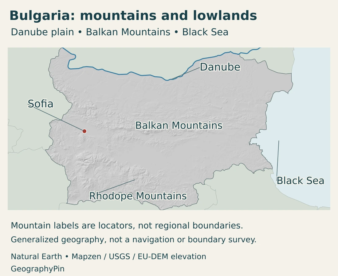
Bulgaria is a southeastern European country on the Balkan Peninsula, with Sofia as its capital and an eastern coastline on the Black Sea. The Balkan Mountains, also called Stara Planina, form an important east–west landscape divide. North lie the Danubian Plain and Danube; south lie valleys, lowlands and other mountain systems. The mountains influence drainage and climate, but do not create a perfect boundary for every river.
How to use this article: Compare the main landscapes, follow the two-sea drainage, or explore the Iskar’s crossing of the mountains.
1. Locate Bulgaria on the Balkan Peninsula
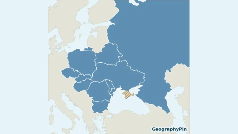
Bulgaria borders Romania to the north, Serbia and North Macedonia to the west, and Greece and Türkiye to the south. Its eastern margin reaches the Black Sea. Much of the Romanian boundary follows the Danube, but the two countries also share a land boundary in the northeast.
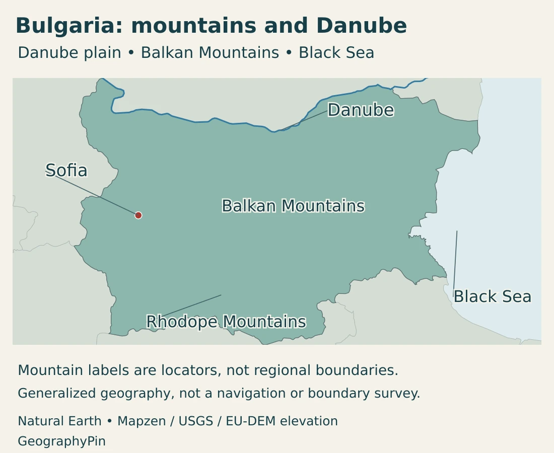
Sofia lies in western inland Bulgaria, not on the Danube or the Black Sea. The capital’s location makes it a different geographic setting from the river towns of the north or the ports and resorts along the eastern coast.
The Balkan Mountains are not the whole Balkan Peninsula
The Balkan Mountains are a particular mountain chain. The Balkan Peninsula is a much larger geographic region containing Bulgaria and several other countries. A reference to “the Balkans” may therefore describe a broad region rather than this one range.
Our Balkan countries map explains the wider regional usage. Here, Stara Planina refers specifically to the range that helps organize Bulgaria’s landscape.
2. Country facts and the change to the euro
| Fact | Value | Date or meaning |
|---|---|---|
| Capital | Sofia | Western inland Bulgaria. |
| Population | 6,423,207 | Final annual estimate at December 31, 2025; released in April 2026. |
| Territorial area | About 42,856 square miles (110,996.80 km²) | NSI cadastral territorial balance at December 31, 2025. |
| Official language | Bulgarian | Constitutional mother-tongue rights also apply. |
| Currency | Euro (EUR) | Adopted January 1, 2026. |
| Administrative structure | 28 regions (oblasts) | Separate from physical mountain and drainage regions. |
| Government | Unitary parliamentary republic | Prime minister leads government; president is head of state. |
The population figure is an annual demographic estimate for the end of 2025, released in 2026. It is not a 2025 census enumeration. Annual estimates update the population using births, deaths and migration, so the reference date and statistical definition matter when comparing figures.
The area follows the national statistical office’s cadastral territorial accounting. It should not be silently replaced with a differently defined figure from an older atlas. A rounded square-mile conversion is useful for orientation without implying that the underlying boundaries were measured to that same precision.
Bulgaria now uses the euro
Bulgaria adopted the euro on January 1, 2026. Older descriptions listing the Bulgarian lev as the current national currency are therefore out of date. The currency change does not alter the physical country, but it is an important dated fact in a current profile.
3. Plains, Balkan Mountains and southern highlands
Compare the northern plain with the southern ranges
| Setting | Position and terrain | Geographic significance |
|---|---|---|
| Danubian Plain | Northern lower country between the Danube and the rising Balkan foothills. | Links agricultural landscapes, tributary valleys and the international river boundary. |
| Balkan Mountains / Stara Planina | An east–west mountain chain through the country. | Influences climate, drainage and routes between northern and southern areas. |
| Southern valleys and Thracian lowlands | Lower terrain between and beyond mountain systems, including the Maritsa setting. | Provides a contrasting environment to the higher ranges. |
| Rila, Pirin and Rhodope Mountains | Distinct southern and southwestern mountain systems. | Contains some of Bulgaria’s highest terrain and varied upland environments. |
| Black Sea margin | Eastern coast with maritime settlements and ports. | Connects inland Bulgaria to shipping and coastal economic activity. |
The country’s highest mountain is not in Stara Planina
Musala rises in Rila, not in the Balkan Mountains. At about 9,596 feet (2,925 meters), it is Bulgaria’s highest peak and the highest on the Balkan Peninsula. This is a useful example of why the peninsula’s name and the mountain range’s name should not be treated as interchangeable.
Rila is also a headwater region. The Iskar, Maritsa and Mesta have their origins in this mountain setting, yet their downstream routes do not all lead to the same sea. High terrain can connect several drainage systems through nearby headwaters.
Pirin provides another distinct landscape. UNESCO describes its protected mountain environments as including glacial lakes, rocky summits, alpine meadows and forests. These are not the same landforms as a coastal plain, and the World Heritage property is not a label for every part of southern Bulgaria.
More than one kind of mountain country
The Rhodope Mountains occupy an extensive southern setting east of Rila and Pirin. Together, the southern ranges make it clear that crossing Stara Planina does not mean leaving all mountains behind. Bulgaria’s relief is a sequence of uplands and lower corridors rather than a single ridge followed by an uninterrupted plain.
Names on the map identify broad landscapes, not administrative divisions. A mountain region can span several local jurisdictions, and a valley can link places on different sides of a regional label.
4. Climate and rivers flowing toward two seas
Bulgaria lies between continental and Mediterranean climatic influences. Mountains and valleys can block or channel air, creating contrasts over relatively short distances. The Black Sea adds a coastal influence, while altitude changes conditions within the uplands.
Rainfall also varies across the country. Research by Bulgaria’s National Institute of Meteorology and Hydrology links this diversity to regional circulation patterns as well as local terrain. A national average cannot describe the same conditions on a mountain slope, in an inland basin and beside the sea.
Black Sea and Aegean drainage
The Danube carries water toward the Black Sea. Northern Bulgarian tributaries, including the Iskar and Yantra, belong to that international system. Other coastal catchments drain directly toward the Black Sea rather than first joining the Danube.
Southern drainage includes the Maritsa system and the Struma and Mesta systems, which lead toward the Aegean. Bulgaria’s basin administration reflects this distinction through Danube, Black Sea, East Aegean and West Aegean management areas.
These are water-management and drainage divisions, not four provinces. The fact that Bulgaria has a Black Sea coastline does not mean every Bulgarian river flows there. The Danube River map follows the wider northern system beyond Bulgaria.
The Iskar crosses the mountain barrier
The Iskar begins in Rila, continues through the Sofia region and cuts through the Balkan Mountains before joining the Danube. Its route is an important exception to a map that treats the mountain crest as an unbroken division between all northern and southern waters.
The gorge is also a transport corridor. Bulgaria’s railway operator describes the railway following the river valley between Novi Iskar and Cherven Bryag. Here, the same landform organizes a river route and a connection through difficult terrain.
Upstream water uses include supply and hydropower, while the lower valley also serves irrigation. A river is therefore more than a blue line: its catchment connects mountain headwaters, reservoirs, settlements and farmland.
5. Sofia, coastal cities and languages
Sofia is the national capital and a center of institutions and services. Its western inland setting differs from the Danube-facing north and the Black Sea margin. The city is also closely associated with nearby mountain landscapes, rather than standing on an open coastal plain.
Varna illustrates the coastal contrast. Its eastern port terminal lies in the Bay of Varna and connects maritime activity with land transport. The port, the city and the wider administrative district are different geographic units; a statistic for one should not automatically describe the others.
Bulgarian and other mother tongues
Bulgarian is the official language. The Constitution also states that citizens whose mother tongue is not Bulgarian may study and use their own language alongside the compulsory study of Bulgarian. This distinction recognizes language rights without declaring every language nationally co-official.
The national population total is not a count of just one ethnic or linguistic community. Administrative residence, citizenship, mother tongue and ethnic identity answer different questions and should not be substituted for one another.
6. Government, work and transport connections
Bulgaria is a unitary parliamentary republic. The prime minister leads the government, while the president is head of state. The country has twenty-eight administrative regions, commonly called oblasts, with municipalities at the local level.
Physical names such as the Danubian Plain or Rhodope Mountains do not create separate political jurisdictions. They help explain terrain and settlement, while administrative boundaries organize government responsibilities.
Technology and services in Sofia
Sofia’s municipal investment agency identifies software development, IT consulting, data processing and related digital activities among the capital’s business sectors. These activities show an urban economy that is not explained simply by nearby mountains or distance from the coast.
Skills, institutions and connections to clients influence the location of such work. The capital’s technology and business functions coexist with manufacturing and other activities, rather than replacing every older part of its economy.
A port connects inland production with the sea
At Varna East, the operator describes grain-handling facilities, storage and access to national rail and road networks. This is a concrete connection between inland production, freight movement and maritime trade.
The contrast with Sofia is useful: one location concentrates national institutions and a range of urban services, while another provides a coastal transport interface. Neither city represents the whole economy or the whole physical landscape.
Bulgaria’s geography is best understood through these connections. The Danube, mountain crossings, southern catchments and Black Sea coast form overlapping systems, not isolated strips on a map.
Frequently Asked Questions
Are the Balkan Mountains and the Balkan Peninsula the same thing?
No. The mountains are a particular range, also called Stara Planina. The peninsula is a wider European region containing several countries and many mountain systems.
Do all Bulgarian rivers flow into the Black Sea?
No. The Danube and direct coastal catchments lead to the Black Sea, but the Maritsa, Struma and Mesta systems drain toward the Aegean.
Is Musala in the Balkan Mountains?
No. Musala is in Rila. Its status as the highest peak of the Balkan Peninsula does not place it in the mountain range named the Balkans.
What Did We Learn Today?
Stara Planina is an important divide, but Bulgaria also has southern mountain systems and rivers that cross or bypass a simple north–south pattern. Rila’s headwaters feed different seas, while Sofia and Varna show contrasting inland and coastal roles. The country’s current currency is the euro, adopted in January 2026.
Sources & Data Notes
Population and cadastral territorial area refer to December 31, 2025. The population is an annual estimate, not a new census. The area is reported under NSI’s cadastral accounting; a separate land–water split is not supplied here. Square-mile and elevation conversions are rounded. Climate research describes regional patterns rather than a weather forecast.
- National Statistical Institute, population and demographic processes, 2025: Final annual population estimate for December 31, 2025, released April 29, 2026; demographic updating rather than a new census.
- National Statistical Institute, territorial balance, 2025: 110,996.80 km² at December 31, 2025, calculated from digital cadastral map models. No separate dry-land or inland-water measure is inferred.
- European Central Bank, Bulgaria adopts the euro: Adoption and euro cash circulation from January 1, 2026.
- Constitutional Court, Constitution of Bulgaria: Parliamentary and unitary institutions, official language and minority mother-tongue rights, capital and national flag.
- European Union, Bulgaria country profile: Capital, government roles and twenty-eight administrative regions. Statistical figures follow the dated national sources above.
- Ministry of Environment and Water, First Biennial Transparency Report, 2024: Physical-region framework and regional climatic influences. Historical statistics in this report are not current population or area measurements.
- Malcheva and colleagues, precipitation research, 2026: Original National Institute of Meteorology and Hydrology research using 1991–2020 rainfall observations; regional diversity and atmospheric circulation.
- Bulgarian Tourist Union, Musala and Rila: Musala’s location and 2,925-meter elevation, and the Rila headwaters of the Iskar, Maritsa and Mesta.
- UNESCO, Pirin National Park: Glacial lakes, alpine meadows, rocky terrain and forest environments in the World Heritage property.
- West Aegean River Basin Directorate: Four basin-management districts and the rivers draining toward the Black Sea and Aegean.
- Bulgarian State Railways, Iskar: River route, gorge railway corridor, water supply, hydropower and irrigation uses.
- Port of Varna, Varna East terminal: Bay location, grain handling and connections with rail and road networks.
- Sofia Municipal Investment Agency, information technology: Qualitative examples of software development, consulting, data processing and related urban business activities.
Map sources and scope: Original GeographyPin maps use public-domain Natural Earth country boundaries, populated-place coordinate attributes, rivers and lakes. The complete source outline of Bulgaria is retained. Boundaries are generalized, not an official boundary survey.
Sofia uses the source city coordinates. Balkan Mountains and Rhodope Mountains labels mark broad landscape locations, not administrative or surveyed physical-region boundaries. The Balkan Mountains are distinct from the wider Balkan Peninsula. Danube lines and lake shapes follow source geometry; they do not depict current water levels or navigation channels.
Hillshade is calculated from genuine elevations accessed through Mapzen Terrain Tiles, with no vertical exaggeration. Global elevation data courtesy of the U.S. Geological Survey. Produced using Copernicus data and information funded by the European Union – EU-DEM layers. Elevation-source attribution and terms apply. Shading is not bathymetry or a set of numerical elevation bands.
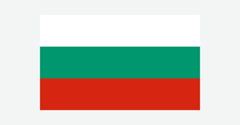
The cover uses Bulgaria’s flag artwork from Commons. The intact flag retains its 5:3 proportions and appears separately from the decorative outline motif.