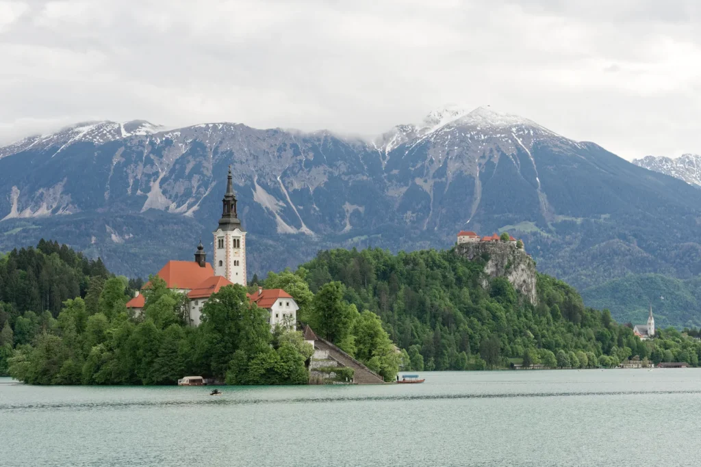
The island church and cliff-top castle make Lake Bled instantly recognizable. Looking beyond that familiar view reveals a small lake whose basin, landmarks and managed water connections tell different parts of its story.
Lake Bled is a freshwater lake in northwestern Slovenia. Its glacially shaped basin surrounds a natural island, while Bled Castle stands separately on a mainland cliff. Natural streams and engineered water connections both influence the lake today, making its geography more than a picture of an island church and mountains.
How to use this article: Locate Bled on the Slovenia map, understand its glacial landscape, distinguish island and castle, or follow the water connections.
1. Where is Lake Bled?
Lake Bled lies in northwestern Slovenia, in a subalpine setting. The Slovenian name is Blejsko jezero. Bled can also mean the town beside the lake, so a place name on a regional map does not necessarily identify a waterfront entrance or boat landing.
Finding Bled within Slovenia
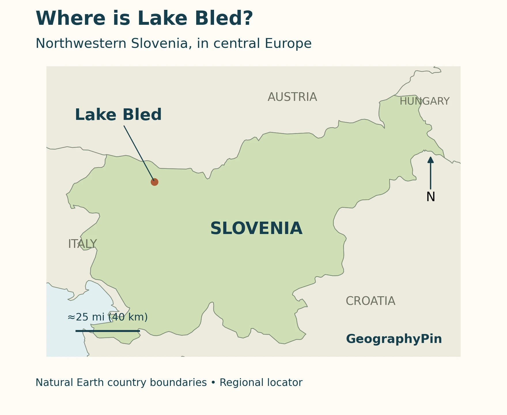
The regional locator places the lake south of Austria and east of Italy. It shows a location marker rather than enlarging the actual lake outline to fill the country map. The close-up plan below answers a different question: where the island, castle and town lie in relation to the water.
The mountain setting is important, but this is not a remote tarn high above the settled valleys. Tourism Bled lists the lake’s reference elevation as about 1,558 feet (475 meters). The surrounding landscape includes the Julian Alps and Karawanks, with the wooded plateaus of Pokljuka and Jelovica forming part of the regional backdrop.
2. Lake dimensions and what they describe
Tourism Bled’s official reference gives the following dimensions. These belong to the lake, not the municipality, town center or hill carrying the castle. Converted values are rounded: converting units does not make the original measurements more precise.
| Measure | Reference value |
|---|---|
| Surface area | About 356 acres (144 ha; 1.44 km²) |
| Length | About 1.32 mi (2.12 km) |
| Width | About 0.86 mi (1.38 km) |
| Maximum depth | About 100 ft (30.6 m) |
| Lake elevation | About 1,558 ft (475 m) above sea level |
| Water type | Freshwater |
Depth is not the same as water level
A maximum depth describes the vertical distance between the water surface and the deepest measured lakebed. An elevation describes the height of the water surface relative to a reference such as sea level. They answer different questions: a lake can stand hundreds of meters above sea level and still be only a few tens of meters deep.
The Slovenian Environment Agency publishes observations from the Mlino station under the lake’s Slovenian name. Its table reports water level in centimeters and temperature in degrees Celsius. A gauge reading must not be substituted for the lake’s maximum depth or its published elevation. Check the date attached to an observation before treating it as current.
3. How the basin and island formed
Lake Bled occupies a glacially shaped basin. The important distinction is between the natural landform and the buildings that later made its island famous. A church on an island does not mean that the island itself was built for the church.
A resistant ridge within a glacial landscape
The island operator’s account describes the Bohinj Glacier excavating softer material around a more resistant dolomite ridge. After the ice withdrew, water occupied the surrounding basin, leaving the ridge as an island. This explains the contrast between a small piece of exposed land and the larger water-filled depression around it.
That is a geological explanation, unlike the local fairy story also presented in Bled’s visitor literature. The legend has cultural interest, but it is not evidence for how ice, rock and sediment shaped the basin. Nor does a simplified tourism account establish an exact formation date by itself.
It is also worth separating two mechanisms sometimes compressed into the phrase “tectonic-glacial.” Tectonic processes concern movements and structures in Earth’s crust; glacial erosion is the wearing and removal of material by moving ice. They are not synonyms. Here, the defensible explanation centers on glacial shaping rather than claiming that a glacier created a tectonic depression.
For the wider concept, see what a lake is and how lake basins differ. Bled is a useful example of why the origin of the basin should be discussed separately from the water entering it today.
4. Island, castle and town: three different places
Bled Island occupies the western part of the lake. Bled Castle stands on the mainland cliff on its northern side, while Bled town is beside the eastern and northeastern shore. The castle is not the building on the island, even when photographs line the two landmarks up in the same view.
Read the plan before interpreting the photograph
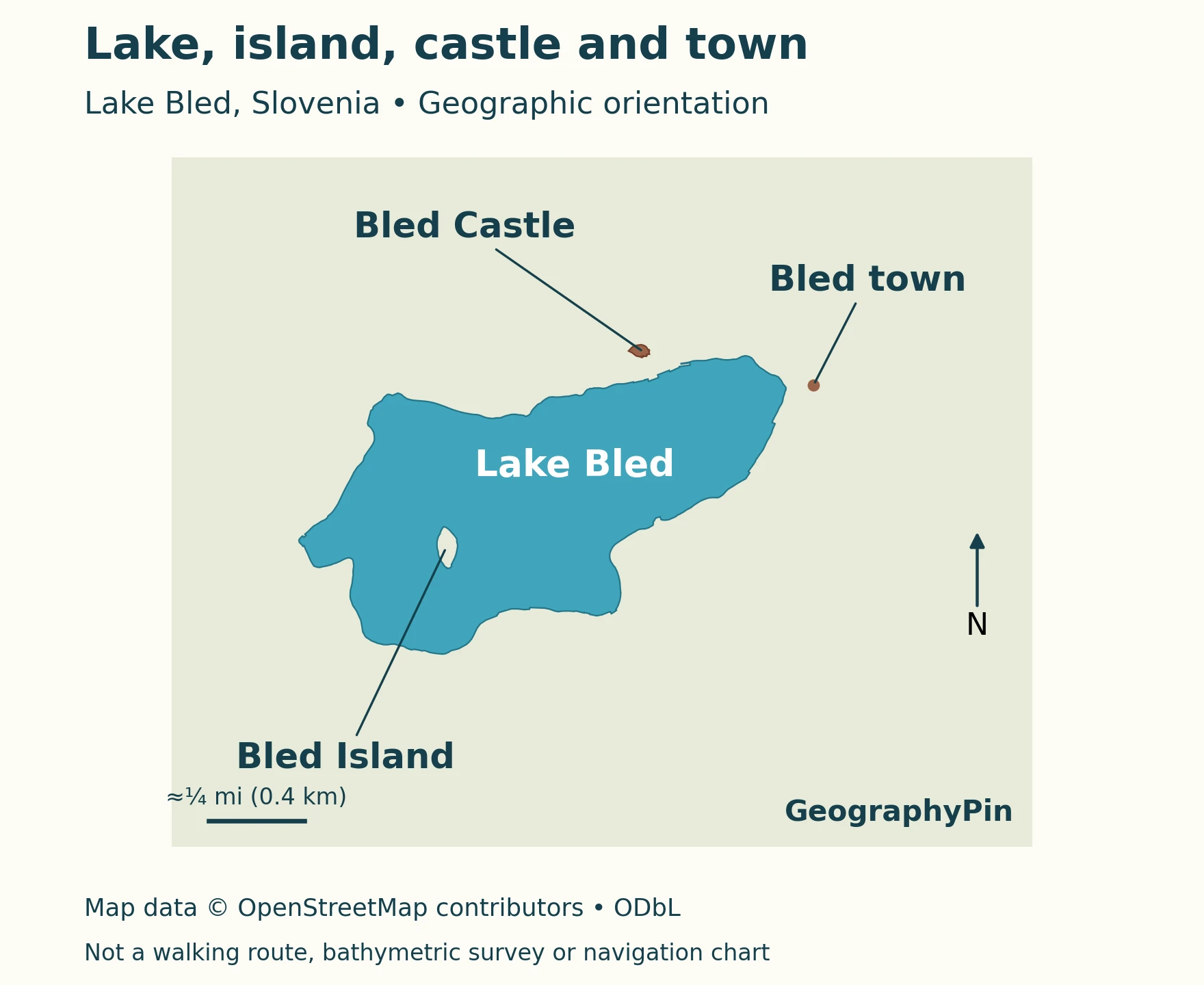
The island’s prominent church is the Church of the Assumption. The mainland castle belongs to a different site on Grad Hill. Tourism Bled describes the cliff on the north side of the lake and access by a marked walking path or road; that elevated mainland position explains the castle’s commanding view across the water.
The map’s leader lines identify landmarks, not bridges, paths or boat routes. The lake is drawn without depth shading, so a uniform blue color does not imply uniform depth. Likewise, the small town marker is a location reference, not a boundary enclosing every building associated with Bled.
5. Where the water comes from, and how it circulates
Lake Bled’s present water system combines natural streams with engineered connections. A LIMNOS report prepared for the municipality and dated April 2024 identifies Mišca as the largest natural tributary. It distinguishes the artificial supply from the Radovna River from natural inflows, and the natural Jezernica outlet from an additional engineered deep-water withdrawal.
Natural drainage and restoration measures
The Radovna supply and deep withdrawal were introduced as restoration measures, changing how water moves through the lake. The report describes a shorter residence time after intervention, but that should not be treated as an exact clock followed by every parcel of lake water. Inflow, outflow and mixing are related but different processes.
A study published in Biogeosciences in 2012 examined water samples collected in 2008. It documented seasonal layering and oxygen-poor deep water during its study context. Surface water and deep water therefore cannot automatically be assumed to share the same conditions merely because they occupy one lake.
In a seasonally layered lake, warmer upper water and colder deeper water can remain separated; periods of mixing redistribute water and dissolved substances. The Bled study describes a lake influenced by this seasonal cycle as well as restoration interventions. Its observations are evidence of lake processes, not a statement of today’s bathing-water quality.
The 2024 report also cautions that restoration measures do not cancel every pressure associated with intensive use around the shore. A scenic surface and a managed water supply are not, by themselves, proof of an undisturbed ecosystem.
6. Seasonal views and responsible access
The same lake can look different from shore level, a hilltop or a boat. A photograph looking toward the island can compress the apparent distance to the mainland castle, whereas the plan separates them. Use the photograph to understand the landscape’s appearance and the map to understand its arrangement.
What to check before a visit
Tourism Bled describes a lakeside circuit of roughly 3.7 miles (6 kilometers), along with boat access to the island. That circuit length is not the lake’s straight-line length, and an island visit is a separate journey. Current operator information is more useful for boat services and attraction access than an evergreen list of fares or departure times.
For swimming, consult Slovenia’s official bathing-water information, including monitored locations, sampling results and warnings. The government distinguishes designated bathing waters and their monitoring from surface waters generally. A lake-wide ecological study and a bathing-water assessment serve different purposes.
Temperature also changes through time. ARSO’s Mlino observations provide dated measurements, not a promise of comfortable water throughout a season. Neither a summer photograph nor a winter photograph establishes safe conditions for a particular activity.
What Did We Learn Today?
Lake Bled’s island, mainland castle and lakeside town are separate geographic features. Glacial shaping helps explain the basin and island, while natural drainage and engineered connections explain the present water system. Reference dimensions, dated scientific observations and current visitor information answer different questions; keeping them separate gives a clearer understanding of the lake.
Sources & Data Notes
Dimensions use Tourism Bled’s reference set, with rounded conversions, not a new survey. Scientific findings retain their observation or report dates. The locator uses generalized Natural Earth boundaries; the lake plan uses OpenStreetMap lake and island geometry and verified landmark positions. Neither map shows bathymetry, walking routes or current water conditions.
- Tourism Bled: About Bled, reference dimensions and setting.
- Tourism Bled: Lake Bled, visitor context and formation account.
- Bled Island: history, island landform and cultural setting.
- Tourism Bled: Grad Hill, mainland castle location.
- Bratkič and colleagues (2012), Biogeosciences, study based on 2008 observations.
- LIMNOS municipal report (April 2024), natural and engineered water connections.
- ARSO: Mlino observations, dated gauge and temperature readings.
- Government of Slovenia: bathing waters, monitoring and current information.
- Map data: Natural Earth, public domain, and © OpenStreetMap contributors, ODbL. Map styling: GeographyPin.
Featured photograph: Jakub Hałun, CC BY 4.0; resized and converted to WebP. The photograph shows the island church in front of the mainland castle.