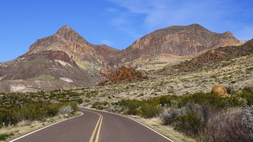
Ross Maxwell Scenic Drive crosses the western side of Big Bend, from the desert overlooks near the Chisos Mountains down toward the Rio Grande. The usual paved trip ends at Santa Elena Canyon, but the last section is a separate road. A drive to Castolon and a drive to the canyon are not the same plan.
The roughly 30-mile paved outing usually runs from the west park road past Sotol Vista, Mule Ears and Castolon to Santa Elena Canyon. The canyon approach is separate from the main scenic drive. Check the road notice below before adding the canyon trailhead, and fill up before heading west.
How to use this article: Compare the western, mountain and eastern drives, find where canyon access changes, or plan fuel and your paved return.
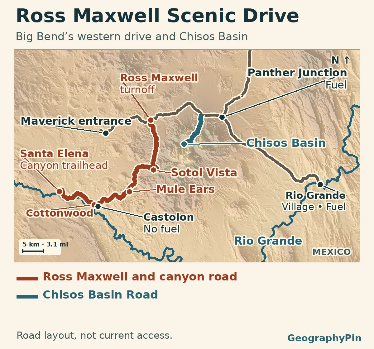
Big Bend driving map and route choices
Choose where you want to turn around
From Terlingua or Study Butte, use Maverick at the west entrance for the Ross Maxwell turnoff. From the north, come through Persimmon Gap toward Panther Junction, then turn west for the scenic drive, take the separate Chisos Basin spur, or continue east to Rio Grande Village. NPS describes these as different paved drives, not a complete paved loop along the river.
| What you want | Where to go | What to check |
|---|---|---|
| Desert overlooks and the western river corridor | Ross Maxwell Scenic Drive toward Castolon | No fuel at Castolon; check the last paved section before adding Santa Elena. |
| Higher ground without committing to the full western drive | Chisos Basin Road, a separate 6-mile spur | Check weather, vehicle length and the particular Basin services you need. |
| The river lowlands with a fuel stop | Rio Grande Village, about 21 paved miles from Panther Junction | It is on the east side of the park, not a continuation of the Castolon drive. |
Ross Maxwell Scenic Drive and Santa Elena Canyon
The drive starts at a signed turnoff west of Panther Junction. At Sotol Vista, about eight road miles from the start, look toward the west for the notch of Santa Elena Canyon in the far mesa. That distant view does not require reaching the canyon road. Farther south, Mule Ears Overlook is down a half-mile paved spur. The two sharp rock towers are visible from the overlook; the spring trail is another outing.
The last paved section is a separate road
NPS calls the whole sight-seeing drive about 30 miles, including the paved continuation beyond Castolon. The federal road inventory separates the named Ross Maxwell road (Route 15) from Santa Elena Canyon Road (Route 16). Check the dated road advisory beside the map before driving this last section.
When the road is open, the canyon’s roadside overlook and trailhead are different stops. The canyon trail is 1.6 miles (2.6 km) round trip from its own lot and starts with a crossing of Terlingua Creek. An open road does not make that crossing safe. Check with a ranger, and skip the walk if the creek is running high or the route is closed.
What changes on the Chisos Basin road
The six-mile Chisos Basin Road climbs from the west park road into the mountains, then drops into the basin. The basin is roughly 5,400 feet (1,650 m) above sea level; Castolon, near the river, is around 2,170 feet (660 m). That is more than 3,200 feet of difference. If you are visiting both, check the separate locations in the park forecast rather than planning river heat and mountain conditions from one reading.
Older NPS pages still describe a May 2026 closure for lodge and facility construction. The park’s April 1, 2026 update canceled the original plan; a separate water-system project was to be rebid, with no closure schedule in that announcement. The alerts checked November 21 listed the Chisos Basin Visitor Center open and the lodge restaurant closed. The November 18 park report also carried a boil-water notice for the basin. Check the current advisory and bring water rather than relying on Basin taps.
Fuel, return miles and day-of checks
The longest fuel gap here is the western outing
For the western drive, fill up before entering from Study Butte or use Panther Junction’s service station while you are still near the main road. There is a store at Castolon but no fuel there. From Panther Junction, the paved approach to the Cottonwood turnoff measures about 36 miles one way, or about 72 miles back to the same junction, before overlook spurs. By contrast, Chisos Basin is roughly 10 miles from Panther Junction, and the longer eastern drive ends at a fuel stop in Rio Grande Village.
Plan to return on pavement rather than treating Old Maverick Road as a shortcut around the closure. It is a separate dirt road; the November 18 report required high clearance and four-wheel drive there. That report does not establish that the canyon lot is reachable by another route. Check NPS alerts and the latest park Daily Report, and follow posted gates. If Santa Elena is the reason for the drive, confirm access with the park before setting out.
Frequently Asked Questions
Is Chisos Basin Road suitable for a long RV or trailer?
NPS does not recommend it for RVs over 24 feet or trailers over 20 feet because of tight curves and steep grades. That guidance is about the road itself, separate from whether a campground has space for your rig.
Is there a wheelchair-accessible viewpoint on Ross Maxwell?
The park identifies a curb ramp and sidewalk at Mule Ears Overlook. This describes the viewing area, not the hiking trail to the spring. Check the park’s alerts for any temporary access restriction.
If the canyon road is closed, can I still see Santa Elena Canyon from Sotol Vista?
Yes, if Sotol Vista itself is accessible and visibility is good. The canyon appears as a small gap in the distant mesa. That is a view from the Ross Maxwell drive, not access to the canyon overlook, trailhead or creek crossing.
What Did We Learn Today?
Big Bend’s most useful road map is one that shows where you can turn around. Ross Maxwell is the western desert drive, Chisos Basin is a separate mountain spur and Rio Grande Village is the eastern river stop. Confirm Santa Elena access and plan fuel before the western drive.
Sources & Data Notes
Open the official road updates, map sources and photo credit
The map shows paved road alignments from the NPS inventory; temporarily closed roads are still mapped. Road status is reported independently above.
- NPS conditions (page updated November 3, checked November 21, 2026), the November 18 park communications report, and the April 1 Chisos project update. The lodge project and the weather-related canyon closure are separate events.
- NPS Ross Maxwell tour, park elevation and distance references and park and gateway fuel locations. The 36-mile approach was measured along NPS road centerlines from Panther Junction to the Cottonwood turnoff, rounded to the nearest mile. It is not a road closure or fuel range estimate.
- Map: GeographyPin. Actual NPS road centerlines, USGS National Hydrography Dataset and USGS 3DEP elevation were accessed November 21, 2026. The dashed line covers the listed road section, not the position of any gate. This is not a navigation map.
- Photograph: Goat Mountain from Ross Maxwell Scenic Drive, Jonathan Cutrer, February 16, 2019, CC BY 2.0. The Commons version was edited by Ron Clausen; this crop was resized and converted to WebP. It does not show current road conditions.
