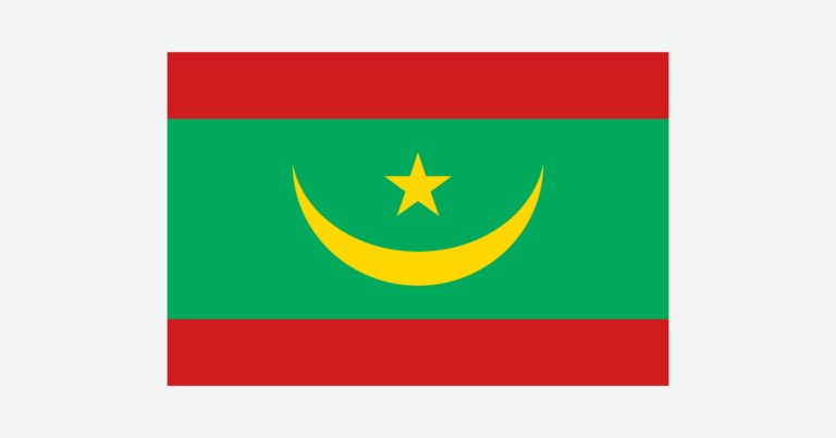
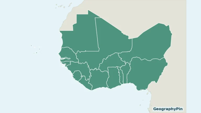
Mauritania is a mainland West African country facing the Atlantic and extending into the Sahara, not the island nation of Mauritius. Its capital, Nouakchott, is coastal, while the Senegal River valley along the southern border offers a different setting from the desert interior.
Mauritania’s desert interior has scarce, irregular rainfall, dunes and rocky uplands. Along the southern boundary, the Senegal River supports irrigated farming and floodplain livelihoods. The Atlantic coast adds a third setting: ports and productive shallow marine habitats. These landscapes should not be treated as one uniform desert environment.
How to use this article: Locate the country, compare the physical settings, or follow the river valley.
1. Locate the Country and Its Coastal Cities
Atlantic frontage and inland borders
Mauritania meets Algeria, Mali and Senegal, as well as the disputed territory of Western Sahara. The Atlantic lies to the west. Nouakchott is the capital; Nouadhibou is a different coastal city farther north.
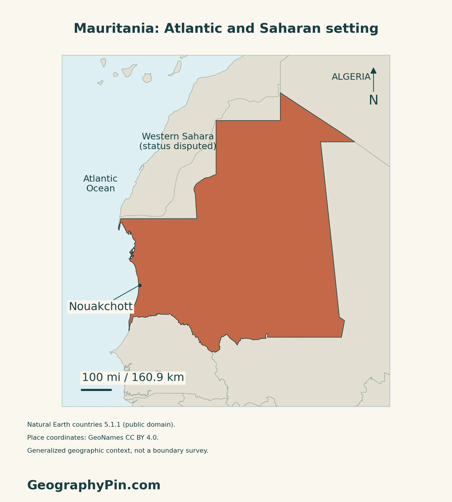
Nouadhibou’s port is not the national capital
The Port Autonome de Nouadhibou describes its location in a naturally sheltered bay and its role in fishing, transport and trade. Its facilities include fish-processing and storage infrastructure.
The West Africa countries map supplies the broader regional context. Western Sahara is shown separately as disputed territory; these maps neither settle sovereignty nor depict current military control.
2. Compare Desert, Uplands and River Valley
Three contrasting settings
| Setting | What to notice |
|---|---|
| Interior Sahara | Dune fields alternate with rocky ground and uplands. |
| Atlantic coast | A low coastal setting includes ports and shallow marine habitats. |
| Senegal River valley | An alluvial corridor marks the far south. |
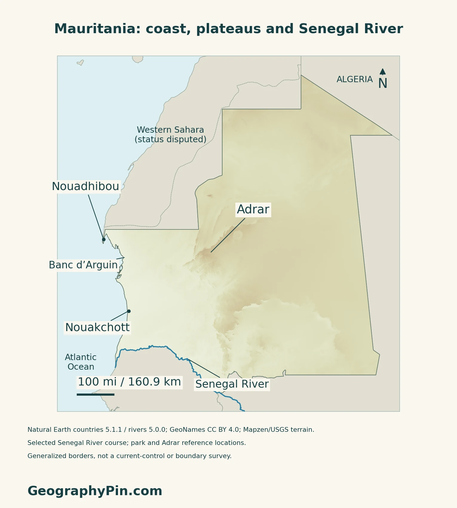
Adrar is more than sand
The Adrar Plateau includes exposed rock, valleys and old drainage channels as well as surrounding dunes. NASA’s April 2026 account highlights the Richat Structure on its eastern side: concentric ridges produced by erosion of an uplifted geological dome, not an accepted meteor-impact crater. Its circular pattern is easier to recognize from satellite imagery than from ground level.
3. Follow Water Through the Southern Valley
A shared river and managed farmland
The Senegal River is a transboundary water system, not a river belonging solely to the country called Senegal. The basin organization, OMVS, brings together Guinea, Mali, Mauritania and Senegal. Its published convention account treats the river and associated basin waters as an international system.
OMVS’s December 2021 account describes irrigation development associated with Diama, Manantali and river embankments. It identifies rice as a major irrigated cereal and also describes horticulture and flood-recession farming. Those activities make the valley distinct from the dry interior.
Water also moves below the surface
A USGS hydrogeological study published in 2008 distinguishes a porous coastal groundwater system from a fractured sedimentary system inland. It also identifies cross-border groundwater movement and coastal saltwater intrusion. These stable geological distinctions help explain why a dry landscape can still contain groundwater, but do not establish that any particular well is safe, fresh or productive today.
4. Understand the Atlantic Coast and Rainfall
Banc d’Arguin joins desert and sea
UNESCO’s Banc d’Arguin National Park description combines dunes, small islands, coastal wetlands and shallow waters. Seagrass beds, marine nutrients and coastal upwelling help sustain fish and other wildlife. Migrating birds use these habitats, making the coastal environment very different from the adjacent desert.
The park’s geographic reference on our map is not its legal boundary. UNESCO also distinguishes the inscribed property from the separate Cap Blanc reserve, whose inclusion was deferred because of the unresolved boundary context. A point label should not be read as including every nearby protected area.
The south is wetter, but rainfall is variable
The British Geological Survey describes a Saharan north and a Sahelian south, with highly irregular rainfall in both time and space. Seasonal rainfall generally increases toward the south.
5. Check Dated Country Facts
| Item | Reference |
|---|---|
| Capital | Nouakchott |
| Census reference | 4,927,532 residents in the 2023 RGPH; final results announced in June 2025 |
| Surface area | About 397,955 sq mi (1,030,700 km²); UNData’s 2023 reference |
| Currency | Ouguiya (MRU) |
| Official language | Arabic; Article 6 also recognizes Poular, Soninké and Wolof as national languages alongside Arabic |
| Administrative reference | 15 wilayas (regions), listed by the territorial administration in November 2026 |
| Constitutional form | Islamic republic |
A resident census, not a current projection
ANSADE’s original census brochure reports residents, including foreigners and refugees. Enumeration ran from December 25, 2023, to January 8, 2024, although the operation is named RGPH 2023. The Ministry’s June 2025 final-results announcement gives the same national total. It should not be presented as a 2026 population estimate.
The census places 29.4% of national residents in Nouakchott. ANSADE’s report catalogue identifies this grouping as the capital’s three wilayas, so it is not a single-wilaya statistic.
Official and national language status
The Constitutional Council’s text, incorporating the 2017 revisions, distinguishes Arabic’s official status from the national-language recognition shared by Arabic, Poular, Soninké and Wolof. Article 7 names Nouakchott as the state capital. These legal labels do not measure how widely each language is spoken.
For a broader comparison, see the African countries and capitals reference.
What Did We Learn Today?
Mauritania combines desert uplands, an Atlantic marine environment and a southern river corridor. Coastal port activity and river-based farming help explain why the country cannot be understood through dunes alone.
Sources & Data Notes
Sources, dates and map conventions
The population figure is the 2023 resident census, supported by ANSADE’s original brochure and the June 23, 2025 final-results announcement, not a current projection. The original brochure was retrieved from ANSADE’s current admin subdomain; the old general-report PDF URL returned non-document HTML. Area follows UNData’s dated surface convention. The wilaya count is a November 2026 website reference, not a new administrative enactment. The BGS atlas is used for terrain and broad climate, not its dated population, economic shares or water-supply totals. NASA’s April 2026 account supports the Adrar and Richat explanation; no satellite image is reused. OMVS’s December 2021 land-use account is not treated as a current cultivated-area inventory. The 2008 USGS study supports groundwater concepts, not present drinking-water safety. UNESCO’s property description is not a current wildlife census or visitor-access assessment. Western Sahara is disputed context, not a depiction of control.
- ANSADE: original RGPH 2023 resident census brochure
- AMI: June 23, 2025 announcement of final census results
- ANSADE catalogue: general census report and three Nouakchott wilayas
- Constitutional Council: Constitution revised in 2017, Articles 1, 6–8
- UNData: currency and 2023 surface-area reference
- Territorial administration: 15 wilayas, accessed November 17, 2026
- British Geological Survey: Hydrogeology of Mauritania
- NASA: Eyeing the Richat Structure, April 2026
- Port Autonome de Nouadhibou: location and economic functions
- OMVS: basic conventions and shared river framework
- OMVS: Senegal valley agriculture, December 2021
- USGS: Hydrogeology of Mauritania, 2008 study abstract
- UNESCO: Banc d’Arguin National Park and property scope
Original maps and artwork: Natural Earth countries 5.1.1 and rivers 5.0.0 (public domain) provide generalized outlines and selected Senegal River geometry. GeoNames (CC BY 4.0) supplies the cities and Adrar/Banc d’Arguin reference locations. No park, maritime or current-control boundary is mapped; Western Sahara is identified as disputed context.
Mapzen/USGS Terrarium elevation supplies qualitative relief. Negative elevations are not automatically removed: low coastal terrain is retained. One isolated −463 m sample inconsistent with its local neighborhood is withheld, without replacing its displayed height. The cover uses a Flagpedia rendition permitted for free website reuse. The Presidency’s flag description and government visual-identity guide corroborate the crescent, star, red bands and 3:2 proportions.