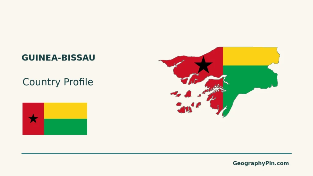
Guinea-Bissau lies on West Africa’s Atlantic coast, with Bissau as its capital and the Bijagós Archipelago offshore. Its estuaries and islands make a mainland-only map incomplete. The relationship between the mainland, tidal waterways and archipelago is central to understanding its geography.
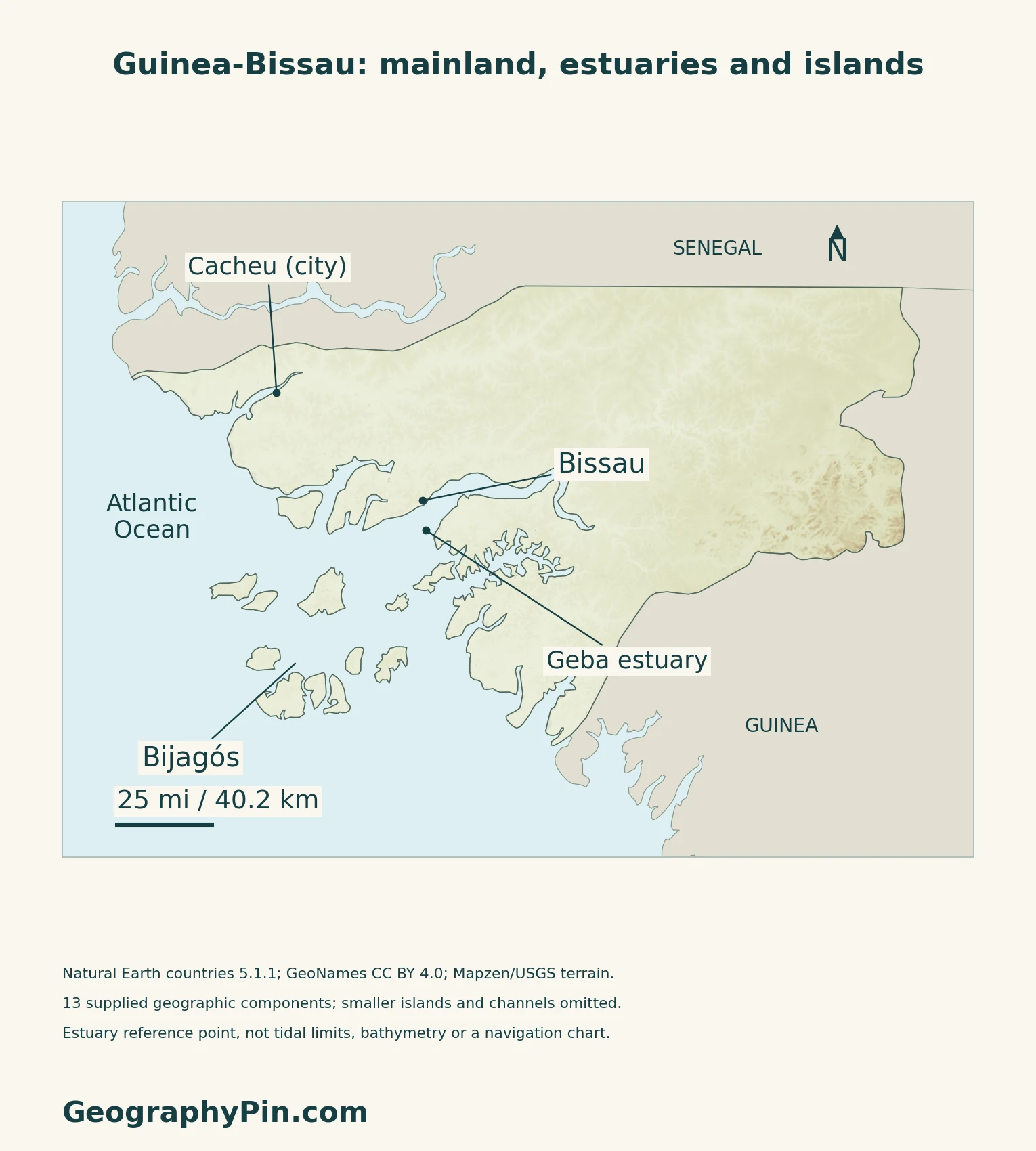
The Bijagós are the offshore archipelago of Guinea-Bissau, part of the same country as the mainland and capital, Bissau. Their channels, banks and mangroves belong to a coastal system shaped by tides, marine processes and river sediment. They are neither a separate country nor a complete substitute for Guinea-Bissau’s mainland geography.
How to use this article: Locate the country, compare the physical settings, or follow coastal connections.
1. Locate the Mainland, Bissau and the Offshore Islands
Two land neighbors and an Atlantic frontage
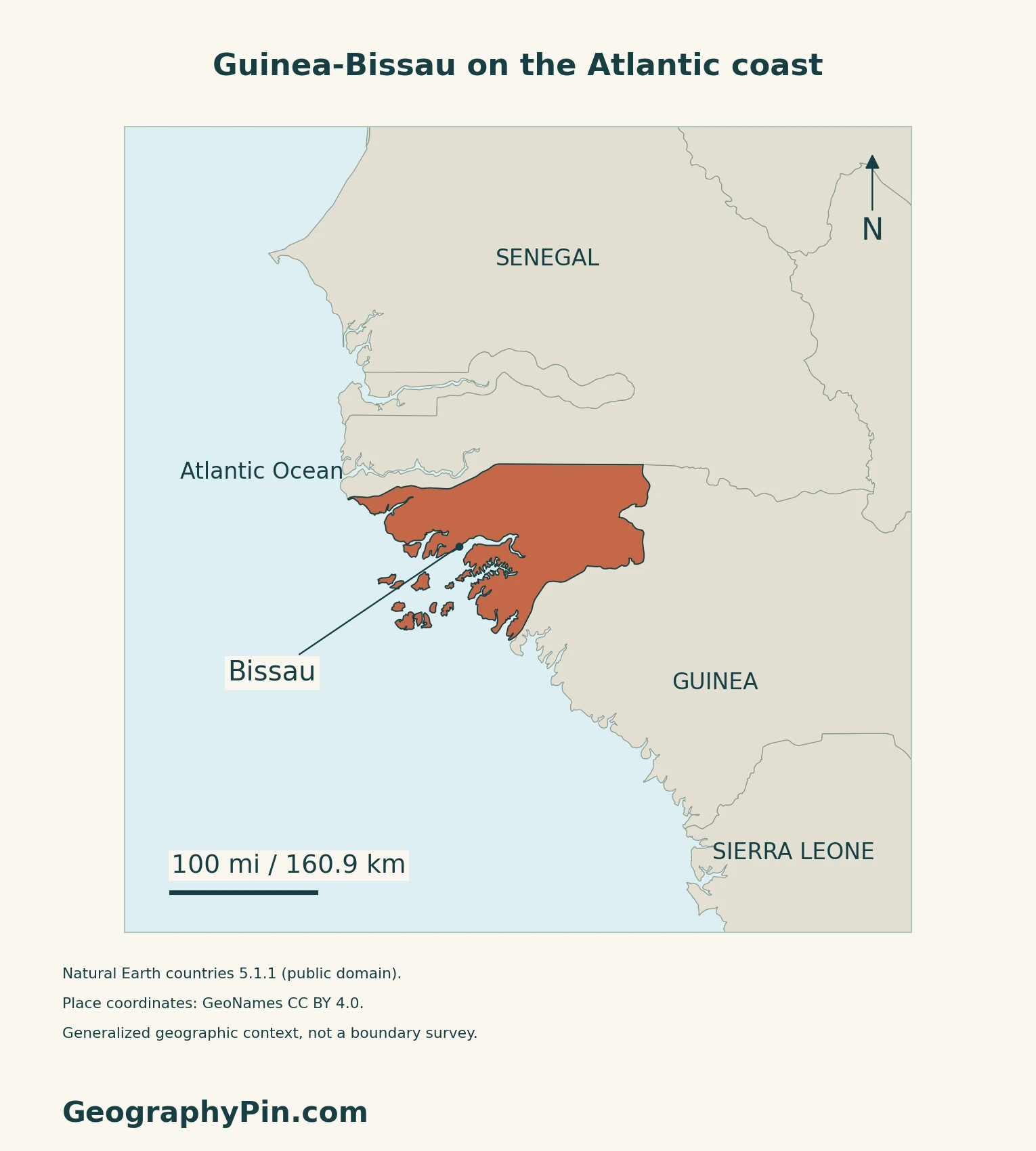
Guinea-Bissau lies on the Atlantic coast of West Africa, south of Senegal and west of Guinea. Its territory includes both a mainland and the offshore Bijagós archipelago. Guinea-Bissau and Guinea are separate countries, with different capitals: Bissau and Conakry.
The capital sits beside an estuary
Bissau’s port is on the northern side of the Geba estuary. The World Bank’s 2015 port study describes the Bijagós islands as sheltering it from Atlantic swell.
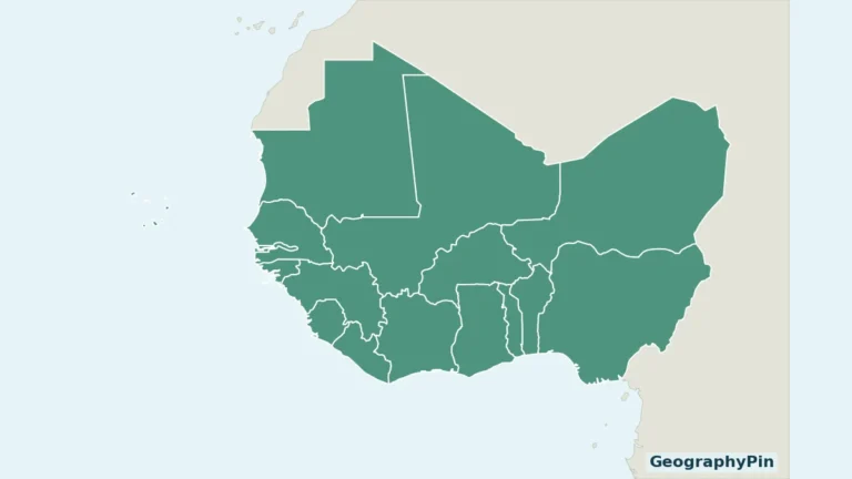
For the surrounding country pattern, see the West Africa countries map.
2. Compare Coastal Lowlands, Inland Plateaus and Islands
Low relief does not mean one uniform landscape
The 2025 national climate communication distinguishes the western coastal zone, gently undulating central plateaus and the hills and plateaus of the eastern Boé area. Offshore islands add a separate insular setting.
| Setting | What to look for |
|---|---|
| Western coast | Low ground cut by estuaries and tidal waterways. |
| Central mainland | Gently undulating plateaus rather than a mountain chain. |
| Eastern interior | The Boé area’s hills and plateaus. |
| Bijagós | Offshore islands separated by marine channels, banks and intertidal areas. |
3. Understand How the Bijagós Connect With the Mainland
An archipelago is more than a few large islands
The government’s October 2021 climate contribution describes 88 islands and islets in the Bijagós archipelago. This is a source-defined count, not a promise that every small feature appears on a generalized country map.
Rivers and tides shape a connected coastal system
UNESCO describes the Bijagós as a deltaic archipelago shaped by tidal and marine processes, with sediment supplied by the Geba and Corubal rivers. Mangroves, sandbanks and mudflats are part of that setting, alongside permanently dry land.
The World Heritage property has its own limits
In 2025, UNESCO inscribed the Coastal and Marine Ecosystems of the Bijagós Archipelago – Omatí Minhô. The listed property covers selected marine and intertidal environments, not every part of the archipelago or the whole country. It includes habitats important to migratory birds and nesting sea turtles.
4. Read Rainfall and Mangroves Together
A wet season and a dry season
The 2025 national communication describes a monsoon-influenced rainy season and a Harmattan-influenced dry season. It reports heavier rainfall in the south and drier conditions toward the north, with much of the annual rain concentrated in July, August and September.
Cacheu provides a mainland wetland example
The Cacheu River Mangroves Natural Park is distinct from the offshore Bijagós. IBAP, the protected-area agency, describes two park areas separated by the river and identifies mangrove protection, fish reproduction and resident livelihoods among its purposes. The country map does not trace the park’s legal boundary.
Wetlands International’s account of its 2015–2018 work with IBAP and communities records ecological mangrove restoration in abandoned rice fields.
5. Check Dated Country Facts
| Item | Reference |
|---|---|
| Capital | Bissau |
| Population reference | About 2.19 million; preliminary 2026 census |
| Surface area | About 13,948 sq mi (36,125 km²); UNData’s 2023 reference |
| Currency | West African CFA franc (XOF) |
| Official language | Portuguese, as identified by CPLP |
| Country name | Republic of Guinea-Bissau |
A preliminary census, not a projection
The fourth population and housing census released preliminary results in July 2026. ANG’s report of the INE presentation describes a resident population after initial checks, but gives conflicting exact totals within the same article. The rounded figure above avoids implying precision that the accessible release does not consistently support. It is not a final census total or a continuously updated population estimate.
Portuguese and everyday linguistic diversity
CPLP identifies Portuguese as the official language and also notes the use of Crioulo, Mandjaco and Mandinga. The government’s 2023–2028 health plan describes Crioulo as the most widely used language of oral communication. Official-language status therefore does not mean that everyday speech is uniform across the country.
Bissau’s national role should also be distinguished from its statistical geography: the census release reports the Autonomous Sector of Bissau separately from the other regions.
For a broader comparison, see the African countries and capitals reference.
What Did We Learn Today?
Guinea-Bissau combines mainland lowlands and inland plateaus with offshore islands. Bissau, the Geba estuary, the Bijagós and Cacheu show different parts of that coastal geography.
Sources & Data Notes
Sources, dates and map conventions
The July 2026 preliminary census is rounded because ANG’s original release gives 2,191,300 and 2,191,202. INE’s new website displays the latter, but an indicator row is marked “demo” and its publication listing supplied no detailed report; no exact final total or reference-night methodology is claimed. Surface area follows UNData’s 2023 convention. Language references are CPLP and the 2023 health plan, not a newly verified constitutional article. Older descriptions of government mechanics are not treated as current law. The 2021 climate contribution is used for the mainland–island distinction and its island-count convention, not current national statistics or policy commitments. The 2025 communication supports broad terrain and climatic contrasts. The World Bank’s 2015 study is used only for the port’s geographic setting, not present capacity or navigation. The 2025 UNESCO property is not equated with the entire archipelago. The Cacheu restoration example concerns 2015–2018, not a current restoration total.
- ANG: July 23, 2026 preliminary census presentation, with inconsistent exact totals
- INE: RGPH-4 preliminary-results homepage
- INE indicators: duplicate population entries and demo-label limitation
- UNData: Bissau, currency and 2023 surface-area reference
- CPLP: country name, capital and language references
- Government: June 2023 national health plan, language context only
- Government: October 2021 climate contribution, mainland and archipelago context
- Government: 2025 Fourth National Communication, terrain and climate
- World Bank: January 2015 Country Economic Memorandum, port setting
- UNESCO: Bijagós – Omatí Minhô, 2025 inscription and property scope
- IBAP: Cacheu River Mangroves Natural Park
- Wetlands International: August 2018 account of Cacheu restoration work
Original maps and cover use Guinea-Bissau land outlines from Natural Earth countries 5.1.1 (public domain). This generalized geometry omits small islands and channels; it is not a complete Bijagós inventory, surveyed shoreline or current tidal boundary. GeoNames coordinates (CC BY 4.0) identify Bissau, Cacheu city, a Geba estuary reference point and the Bijagós group. No river joins, maritime limits or protected-area boundaries are invented.
Mapzen/USGS terrain is qualitative, with some uncertain elevation values omitted in coastal and river lowlands and at isolated locations. Blank areas do not represent flat ground. Colors are not mangrove cover, bathymetry or flood zones. The complete reusable Flagpedia flag uses its source 2:1 ratio. Motifs agree with Article 22 of the Parliament-hosted constitutional text, which does not specify that ratio.