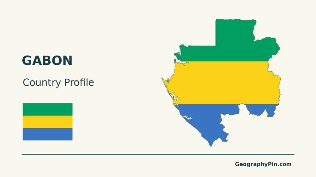
Gabon’s rivers link a forested interior with a low Atlantic coast, but the country is not one uniform rainforest landscape. The Ogooué provides the clearest route through that geography: upland tributaries feed a river that reaches broad floodplains and coastal outlets. Savannah mosaics at Lopé and on the Batéké plateaus add contrasts that a single green country outline can hide.
Gabon is an equatorial country on Central Africa’s Atlantic coast, with Libreville as its capital. The Ogooué is its principal river, connecting much of the interior with the coast. Forested uplands, lower river wetlands and southeastern Batéké savannas are distinct landscapes. Gabon belongs to the wider Congo forest region, but the Ogooué is a separate river system from the Congo.
How to use this article: Locate the country on the map, read the physical map, explore Ogooué drainage, or check the population reference.
1. Locate Gabon and Its Coastal Cities
An Atlantic country in Central Africa
Gabon lies on the Atlantic side of Central Africa. Equatorial Guinea borders it to the northwest, Cameroon to the north, and the Republic of the Congo to the east and south. The Republic of the Congo is the neighboring state here, not the Democratic Republic of the Congo.
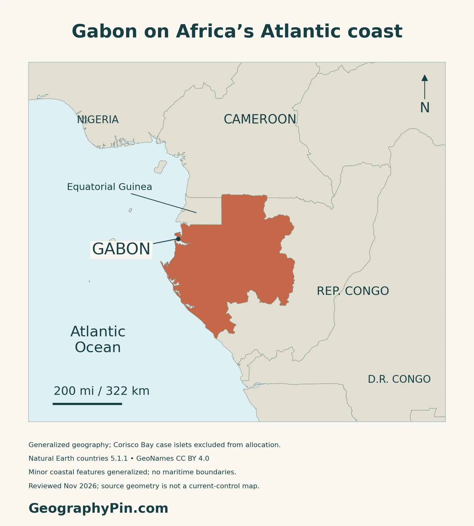
Libreville is the national capital
Libreville is Gabon’s constitutional capital and the center of national government. Article 1 of the December 2024 Constitution names the city and requires a referendum law for any transfer of the capital. National administrative institutions, including the Finance Ministry’s central headquarters, operate from Libreville.
2. Read the Coast, Uplands and Batéké Plateaus
Three useful landscape contrasts

| Setting | Typical features | Geographic significance |
|---|---|---|
| Atlantic coastal lowlands | Estuaries, lagoons and low sedimentary terrain | The river systems meet the ocean here |
| Interior uplands | Plateaus, forested ridges and river valleys | Relief channels the drainage toward lower ground |
| Batéké plateaus | Rolling uplands, sandy ground and savanna–forest mosaics | A distinctive southeastern landscape, not continuous rainforest |
The British Geological Survey’s physical overview distinguishes low coastal plains from higher inland plateaus.
Batéké adds savannas and sandy uplands
Gabon’s 2022 UNESCO Tentative List submission describes the Batéké plateaus in the far southeast, near the Republic of the Congo. Rolling hills are cut by valleys and streams, with grass and shrub savannas interrupted by gallery forests. Sandy surface materials and underlying sandstone help distinguish this landscape from other parts of Gabon.
The national park occupies only part of the broader plateau landscape. Its Tentative List entry is not a World Heritage inscription, and a plateau label is not a mapped park boundary.
Lopé is a forest–savanna meeting place
The World Heritage property of Lopé-Okanda combines rainforest with relict savannas. UNESCO also recognizes archaeological evidence, iron-working remains and rock carvings associated with the Ogooué valley’s long history of human movement.
This landscape makes an important distinction: an open grassland patch is not automatically evidence of recent forest clearance. Lopé’s protected forest–savanna interface reflects a much longer environmental and human history.
3. Follow the Ogooué from Interior to Atlantic
A river basin is not a national boundary
The Ogooué rises in the Republic of the Congo before crossing Gabon toward the Atlantic. Its tributary network includes the Ivindo and Ngounié. FAO’s historical inland-water inventory identifies floodplains and lakes along the lower river system.
The watershed and the country are not identical. Other rivers, including the Nyanga and coastal systems such as the Komo, have their own drainage. The Ogooué should not be confused with the Congo River system simply because both lie within Central Africa’s forest region.
Ivindo shows the upland river landscape
Ivindo National Park, inscribed on the World Heritage List in 2021, protects a forest landscape crossed by blackwater rivers, rapids and waterfalls. UNESCO emphasizes freshwater habitats as well as the surrounding old-growth forest.
The lower Ogooué spreads into channels and wetlands
The 2023 Key Biodiversity Areas assessment describes the lower Ogooué as an alluvial plain with branching channels, lakes, wetlands, savannas and dry-ground forests. Its downstream position also makes it susceptible to pollution and sediment arriving from elsewhere in the watershed.
Farther seaward, the separately assessed Ogooué Delta has multiple outlets to the Atlantic and a mosaic of freshwater, brackish and terrestrial habitats, including mangroves. Port-Gentil lies beside this coastal setting, but the KBA’s conservation boundary explicitly excludes the city. Neither KBA boundary is the outline of the entire Ogooué basin.
4. Rainfall, Forest Value and Resource Connections
Equatorial does not mean equally rainy every month
Gabon has a wet equatorial climate, but rainfall is seasonal and geographically uneven. The British Geological Survey’s climate summary describes a longer dry period around June–September and shorter interruptions between rainy periods. Broadly, the northwest is wetter than the east and southeast.
Forests matter beyond timber production
The World Bank’s 2025 wealth assessment treats Gabon’s forests as natural assets with carbon-retention, soil-retention and other ecosystem services. The same assessment identifies oil, manganese and wood as the main products in the country’s concentrated export economy.
Those two views of resources are different: exports measure traded output, while forest assets also provide benefits that do not pass through a port as cargo.
Resource wealth does not settle the employment question
The World Bank’s 2026 economic update describes a young, largely urban population and a need for more employment beyond the existing resource-led model. It links diversification with education, skills, infrastructure and conditions for private investment.
5. Dated Country Facts and Institutions
| Item | Reference | Date or scope |
|---|---|---|
| Capital | Libreville | Constitutional capital; national administrative center |
| Population | 3,518,621 residents | 2026 census; preliminary results, October 2026 release |
| Surface area | About 103,347 sq mi (267,668 km²) | UN reference, 2023; not a land-only figure |
| Official working language | French | 2024 Constitution, Article 1 |
| Currency | Central African CFA franc (XAF) | Issued by BEAC |
| Government | Republic; unitary decentralized state | 2024 Constitution and current national institutions |
| Provinces | Nine | 2026 census provincial classification |
The 2026 resident census is still preliminary
INSTAT’s October 2026 release labels the national total as preliminary resident-population results. It includes people of Gabonese and foreign nationality, rather than counting only Gabonese citizens. The release reports the country through nine provinces.
Estuaire province accounts for 2,184,908 of the reported residents. That is a provincial total, not the population of Libreville city. The census results should not be interchanged with older national projections or with figures for a differently defined capital-city area.
National languages and the constitutional framework
The Constitution identifies French as the official working language while also providing for the protection, promotion and teaching of national languages. Official status therefore does not mean that French is Gabon’s only language.
The current framework is the Constitution promulgated in December 2024, rather than the earlier transitional charter. Gabon’s official government roster identifies the President as both head of state and head of government. Provinces are territorial divisions within this republic, not separate sovereign states.
What Did We Learn Today?
The Ogooué links Gabon’s interior with lower wetlands and Atlantic outlets, but it is neither the whole country nor part of the Congo River itself. Forested uplands, Lopé’s forest–savanna interface and the Batéké plateaus give Gabon several distinct physical settings. Reading the river, relief and coastal cities together is more useful than treating every green area as the same landscape.
Sources & Data Notes
Population figures retain their stated census or estimate status and reference date. Historical physical and hydrological sources are used for enduring landforms and named river relationships, not current fish production, population or navigation conditions. Rainfall descriptions are climatic patterns, not forecasts. UNESCO distinguishes inscribed Lopé-Okanda and Ivindo from the Batéké Tentative List submission. The 2023 KBA assessments describe conservation sites, not the entire Ogooué basin. The World Bank’s 2025 wealth and 2026 economic assessments have different reference periods. No undated forest-cover percentage or current hazard map is claimed.
- INSTAT Gabon: preliminary 2026 resident census results, October2026 release
- Agence Gabonaise de Presse, 2 September2026: census includes residents of foreign nationality
- UNData: 2023 surface area and XAF currency code
- Official Gazette, 19 December2024: Constitution, capital, languages and institutions
- Government of Gabon: current national executive
- UNHCR RiMAP: geographic location and neighboring countries
- Gabon Finance Ministry: central administrative headquarters in Libreville
- BEAC: Central African CFA franc
- British Geological Survey, 2018: physical geography, climate and drainage
- Gabon UNESCO Tentative List submission, 2022: Batéké plateaus
- UNESCO: Ecosystem and Relict Cultural Landscape of Lopé-Okanda
- FAO historical inland-water inventory: Gabon hydrography
- UNESCO: Ivindo National Park
- Key Biodiversity Areas, 2023 assessment: Lower Ogooué
- Key Biodiversity Areas, 2023 assessment: Ogooué Delta
- World Bank, 2025: Gabon national wealth and forest services
- World Bank, 2026: Gabon employment and diversification
Map method: Original GeographyPin maps use public-domain Natural Earth countries 5.1.1 and rivers 5.0.0. The source’s tiny Mbanié-area component is excluded from Gabon’s highlight, terrain clip and cover; Corisco Bay case islets are not allocated to either country and no maritime boundary is drawn. This scope does not imply a sovereignty or control transfer. Other minor coastal details remain generalized. The Ogooué uses its actual supplied river and lake-centerline records, not a complete tributary network or invented basin boundary. GeoNames city coordinates and a Batéké regional reference are credited under CC BY 4.0; the latter marks neither a park nor a plateau boundary. Relief uses real Mapzen Terrain Tiles with Mapzen/USGS and upstream credits. Coastal raster artifacts are transparent, not replaced with invented heights. WGS84 scales apply at their displayed latitude. The cover uses the public-domain Commons Gabon flag rendition, with a separate complete flag for editorial identification.

